

 Tides and Currents – A Beginner’s Guide to Ocean Movements">

Always check the tide chart and local current forecasts before your planning day at the shore. This quick decision defines your path and helps you choose a safe location. Tides, a stream of coastal water, and the flows respond to wind and rain, and their changes matter for where you can swim, fish, or walk along the beach.
Movements in the sea fall into several types, each with a name and signals that are characterized by their patterns. Tides rise and fall on roughly semi-diurnal cycles; longshore flows push water down the coast; rip currents pull seaward in clear channels; and shelf-edge streams redirect water between inshore zones. Learning these patterns gives you a useful map for planning days at the water’s edge.
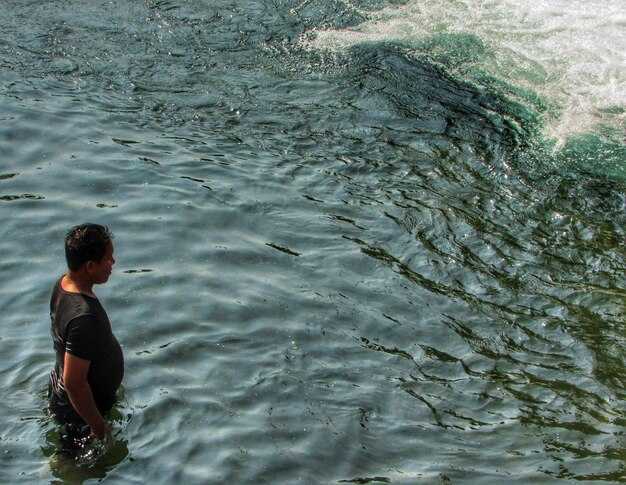
From the shore, stay careful and read the signs. Watch for changes in water color, foam lines, and debris moving along the beach. If you notice a sudden pull toward deeper water, back away to a safe spot and wait for a calmer interval. Always respect lifeguard guidance and keep a buddy with you for added safety.
For planning days near the coast, set a clear location and window based on tide height. Low tide reveals more of the shoreline, which helps you observe stream paths and shoreline changes. Check rain forecasts, carry a waterproof map, and keep a simple safety plan in case you need to retreat.
In this path, you will learn to read the currents, identify significant signals, and use the knowledge to stay safe. The information here is useful for any beginner who wants to learn about how the water moves; with careful planning, your familiarity with the sea will grow, and you will gain confidence in approaching beaches with respect for their power.
Semi-diurnal Tides and Coastal Currents: Quick Guide for Beginners
Start with checking tables of tides and currents for your location and times before any coastal outing.
Semi-diurnal tides produce two high tides and two low tides in roughly a 12-hour cycle; the pattern repeats daily and the mean range varies by season, with autumn often showing distinct shifts on many coasts.
Coastal currents near inlets and bays are distinct from open-ocean stream flows; in many areas they reverse with the tides, so flood moves toward the shore and ebb returns to sea; the difference comes from forces that shape the coastline, depth, and the geometry of the inlet.
This guide offers practical steps: know your location’s mean tide range, read the prediction from local stations or apps, and plan around a seven-day outlook to spot pattern shifts. The app offers a quick view of the two high tides and two low tides per day, and many resources tabulate the times of high and low water for a location, making it easier to decide when to launch or moor–it’s actually practical for weekend trips.
Keeping safety in mind, stay near a mooring or sheltered area during stronger hours and avoid rushing across a surge near an inlet; this involves watching the stream direction and the changing rate of current so you can adjust course smoothly. The difference between calm and hazardous conditions is often a matter of timing and distance from the inlet.
| Event | Approx Time | Height (m) |
|---|---|---|
| High tide 1 | 08:15 | 2.1 |
| Low tide 1 | 14:45 | -0.3 |
| High tide 2 | 20:40 | 2.0 |
| Low tide 2 | 03:50 | -0.2 |
What semi-diurnal tides are and why they matter for shore activities
Plan your shore day to work with the tidal pattern: there is a good window around low tide for exploring exposed flats and a safer window around high tide for mooring. Use reliable apps to check the two daily cycles and pick times with enough depth to move without getting stranded.
Semi-diurnal tides are characterized by two high tides and two low tides each day, separated by about 12 hours 25 minutes. The times shift by roughly 50 minutes day to day as the Moon’s and Sun’s tidal forces pull on the water, creating a predictable pattern that shapes currents and flows along the coast.
Why this matters for shore activities: There, currents can shift quickly between channels and flats; plan around the high tide for easier access and around low tide to see life along the shore. Neaps bring smaller high tides and higher low tides, while springs bring higher highs and lower lows, changing depths and safety margins. If you moor there, check conditions and avoid getting tangled in lines as depths shrink. For life along the coast, stay aware of changing currents and flows, and look for a safe exit route near the bridge when tides switch.
How to read a tide chart for your location and date
Check the tide chart for your exact location and date, and plan around the higher tide window. Whether you fish, boat, or simply observe, this timing helps you reach water with adequate depth and avoids dry zones. This needs quick reading of local times and heights to the minute. Even a cautious boater benefits from starting with the chart in hand.
Find the line for your locations on the chart, then read the two tides for that day: the higher high tide 和 the lower low tide. Note the times and the heights, so you determine a safe window for your 船 to pass or your crew to explore the shore. If you boat with members on a short trip, just coordinate roles to watch the current and wake.
Read about the lunar cycle to anticipate neap or spring tides. Watch the tide range as it shifts through a lunar month. In terms of neap tides, the difference between high and low is smaller, so the flow through channels is less dramatic, though you can encounter strong currents near inlets. When the range is great, you’ll see higher highs and lower lows; in autumn patterns can tilt with weather, so check several days about the expected shifts to plan.
Account for local factors such as wind, river outflow, and channel geometry. The chart provides baseline flow; expect higher water later in the rising tide and lower water as it goes down. Plan to use good margins when moving against strong current, especially if your destination is a harbor with shallow entry.
Practical steps you can follow: confirm your exact location line on the chart, verify local time, and record the times and heights for that date. Set a safe window: roughly 1–2 hours before high tide and 1 hour after for a 船 trip; adjust for known days of the month and the expected autumn weather. If you fish, a short window around high tide often yields better results.
When you arrive, use the tide chart as a guide but continuously watch the depth as you approach channels, and be ready to adjust for flow changes. This approach works for destination harbors, coastal walks, and locations with rocky shores. By following the chart, you can avoid hard surprises and stay within safe margins.
Understanding the difference between tides and currents near the shore
Check the local tide chart and plan to be in shallow water during slack water to minimize currents near the shore.
Tides are the vertical rise and fall of the sea level driven by the lunar and solar gravity, with a rhythm that follows lunar days. In most areas you’ll see two high tides and two low tides each day, and higher water during spring tides when the Sun, Moon, and Earth align. The exact height varies by coastline, harbor shape, and weather, so plan for a higher or lower water line than you expect. This drift through the day affects berthing opportunities and the depth you’ll find just offshore.
Currents near the shore are horizontal moves of water called flows, created by tides, wind, and the shape of the bottom. They can run through channels, along beaches, and around headlands. In calm weather a current may stay modest, but rain, coastal runoff, or gusty winds can change direction and strength within minutes. The same coast can show different currents at the same tide, so you must watch what happens there, not just what the forecast says.
- What tides do: they change water depth from low to high through the day, higher at spring tides and lower at neap tides; this can shorten or lengthen berthing windows for a beginner or an away-from-boat approach.
- What currents do: they move water parallel to the shore, through bays and channels, and out to sea; speeds commonly range from 0.5 to 2 knots near the shore, with stronger flows in narrows or after a storm.
- Practical planning: check a forecast for the next 24–48 hours, look for slack-water windows, and choose times when the flow is favorable for your plan, especially if you are a beginner planning to approach a mooring or go through a narrow pass.
- Safety and gear: wear a life jacket, keep a close watch on water depth, and keep early-to-mid plans flexible if rain or wind ramps up. If the water looks off-color or the currents feel stronger than expected, stay closer to shore until conditions improve.
- On the water: if you boat with a rental from a platform like boatsetter, confirm tide and current expectations and adjust your berthing plan accordingly to stay safe and on target.
Where you are matters: a sheltered cove may show small tidal changes but stronger currents can occur just outside through a channel. There, the higher water during spring days can push you into shoal areas quickly, so watching the edge and planning your line is smart. By recognizing the difference between the vertical tides and the horizontal currents, a boater can move with the water instead of fighting it–moving just enough to stay comfortable and level with the same life lessons you apply on land. Remember to look ahead, not just at the moment, and you’ll navigate with more confidence as a beginner.
Safety considerations during rising and falling tides for swimming and boating

Wear a PFD and keep signaling gear handy; check the tide table before any swim or trip on a vessel to help you stay safe and guide them to a secure exit if needed, because a tide that occurs can affect depth and current toward the shore.
- Time, weather and predictable patterns: verify high-tide times, monitor the weather, and rely on a predictable window; rising tides can bring water higher near shore, affecting access and creating quite strong currents in the area.
- Access and shore planning: choose routes with good access points, stay within sheltered zones, and keep from edge areas where you could be cut off after a surge; always have a plan to retreat toward higher ground if conditions change, rather than pressing on.
- Encounter and currents: if you encounter strong currents, back off toward the shore or toward deeper water depending on the flow; stay calm, keep your vessel oriented, and be aware that gravitational forces from the moon drive tides that can shift quickly; springing tides may rise rapidly; depth shifts mean you must slow down and seek a safe exit.
- River and trips: for river trips or coastal trips, keep within marked channels and avoid narrow bends when a tide is rising; if you lose depth, shift to a route with better access and stay near shore where you can get help quickly.
- Preventing trouble: if water levels rise faster than expected, adjust your plan, shorten trips, head back to shore, call for help if needed, and remember that planning time around tide means staying safe on the water.
Practical tools to monitor tides and currents: apps, websites, and sensors
Begin with three reliable sources: NOAA Tides & Currents for official predictions, a marina app for local forecasts, and a dock-side sensor near your waterway. This good combination gives an extra benefit to their boating crews, because their safety depends on data you can trust each time you plan a run. Each tool offers different types of information–tide heights, current directions, water levels–and together they help you understand how the water moves near boats, marinas, and working water routes.
Apps provide quick checks on the go. NOAA Tides & Currents delivers tide tables, current estimates, and level graphs. A marina-focused app can warn you when water levels are rising near the dock and when currents along the channel run strongest. The benefit is that predictions are more useful when you compare them with on-site observations; you would notice patterns that are more accurate than relying on a single source. If you log observations for your waterway, you can learn how conditions change with season and wind, which helps each crew member plan their trips with confidence.
Websites supplement apps with charts and regional forecasts. tidesandcurrents.noaa.gov provides official tide tables and current speeds, updated hourly. Local harbor authorities and marina pages add notes about dredging, closures, or safe access routes. When you watch both, you gain a fuller picture and can choose a destination with a safer waterway approach. For boats heading out, compare the side-by-side data and look for consistency; this keeps your plan grounded and reduces surprises for near-term trips.
Sensors add a practical extra layer. A water level sensor near the dock tracks height in real time, while a current sensor in the fairway reports speed and direction. These readings feed into your app and into the website dashboards, offering data that comes from your immediate environment rather than predictions alone. Keep sensors well maintained; safe operation depends on clean data and proper installation, especially in king tides or strong running currents. This setup is always useful for boats of different sizes and helps you schedule departures and landings with more confidence.
To pick tools, consider data quality, update cadence, and ease of use. This setup involves data from forecasts, local notes, and live sensor values. Their mutual benefit lies in having official forecasts, local notes, and live sensor values. Each side gives you a distinct perspective, and their combination helps you stand ready for near-port stays and long runs alike. Remember to set alerts for your destination and to share your plan with marina members so everyone stays aligned on side-by-side forecasts and actual conditions.
Short checklist to go forth: verify tide tables at the dock area, check current arrows on the chart, confirm sensor readings before departure, and keep an eye on the waterway near your route. This approach is good for boats and crews alike. The extra data makes a safe, predictable ride along the water and stands as a good reminder that learning to read trends will benefit their next trip.