

 How to Create a Float Plan – The Complete Guide for Safe Boating">

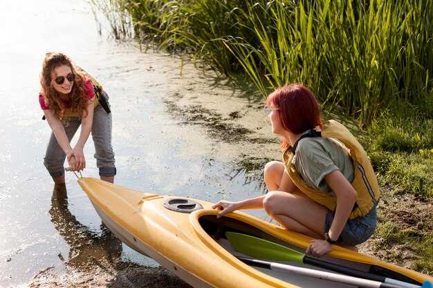
Write a written float plan today and share it with guardians and the operator before you head on-water.
Your plan should cover the on-water route, the estimated return time, and contact methods for contacting the crew if plans shift. Include the boat name and operator, a line of reference points such as a tower or shoreline markers, and, if available, coordinates. If you can, add a demos section to illustrate how the plan works in practice so guardians can see what to expect.
Before departure, contact guardians by call or text to confirm receipt of the plan, and ensure you have a backup contact. Save the plan in a written file above the console and also keep a copy on your device. Define what to do if contact is lost, and set a check-in cadence so your crew knows when to expect updates back from you.
During the trip, keep a portable power source, maintain radio contact with the operator, and be ready to adjust the plan if conditions worsen; update guardians with a quick status, a brief message, or a short call at milestone times. Maintain a clear timeline above the plan to show progress along the route, and if possible share photos or status updates at key points on-water.
Practical Float Plan Setup for Safer Boating
File a float plan before departure that specifies where you head, your intended line of travel, ETA, and planned check-ins; creating a clear, shareable document helps guardians and authorities stay aligned and reduces risk.
Assign guardians among crew or trusted contacts who monitor milestones, confirm arrivals, and trigger alerts if you drift off schedule; their prompt actions build trust and keep operations smooth.
Stock tools for real-time updates: a VHF radio, a satellite messenger, a chart plotter, and a spare battery with sufficient charge; test channels, set the course, and save the plan for quick reference, with sound alerts for missed check-ins.
Document contingencies for certain weather, currents, and daylight; include alternate routes and a line for filing with the coast guard or port authorities; list where to submit the plan and when to update it to keep operations transparent.
For activities like fishing or skiing, log specifics in the plan, including fishing zones and where skiers may cross; indicate what to expect from responders, show expected message times, and how to notify nearby boats if plans change; include a numbercolor marker to help responders identify you on charts.
Set a practical communications schedule: check-in every two hours, or more often in rough seas; specify radio channels and emergency codes, and ensure you can receive a quick reply; keep a copy with guardians and in the cabin, and follow uscg guidance for training or templates to support safe operations.
| Element | Details | Owner | Poznámky |
|---|---|---|---|
| Route & ETA | Coast-to-offshore path; waypoints A→B→C; ETA targets; check-in windows | Captain | Maintain daylight limits |
| Communications | VHF 16, 69; satellite messenger; message templates | Most | Test pre-departure |
| Safety Gear | Life jackets, throwable, flares, radios | Posádka | Battery checks |
| Filing & Records | Float plan filed with authorities; copy kept aboard and with guardians | Captain | Include numbercolor codes |
| Nepredvídané udalosti | Weather shifts, currents, alternate routes | Operations | Update if conditions change |
Define Trip Details: Route, ETA, and Weather Window
Draft a written route and ETA now, save it as a template, and keep it within reach onboard. The plan should describe departure, next waypoint, pace, and a target arrival window so the crew can review at a glance and give feedback.
Plot the route along the coast from your marina to the next marina or to a trusted fishing spot, marking each leg with coordinates, distance (in nautical miles), and expected time. Use a visible line on the chart to connect points and describe the features of each segment, described here, including terrain, current, and potential hazards close to shore.
Set the weather window as a practical range you can rely on: forecast wind under 20 knots, seas under 2 meters, and visibility at least 3 miles. Prefer a window that covers the next watch, with a buffer to handle small changes in wind or swell. Check trusted sources and write down the forecast time, then compare it with your ETA at each waypoint to confirm the setting.
Build in sufficient margin for safety: add a priority fallback leg if conditions shift, and assign crew tasks so they can respond quickly. Give them clear responsibilities onboard, such as monitoring weather, managing lines, and keeping gear ready. If the forecast isnt favorable, you have a backup on deck and in the engine room, and you can hold position near a safe harbor until conditions improve. This approach reduces worry and keeps operations smooth and controlled. This level of planning also enhances the experience aboard.
Document and store the plan in your setting as a written record, for example in the ship’s log and on the onboard tablet. The template should be described with the next steps and the gear required, so the crew has a trusted reference. Share it with them before departure to avoid miscommunication and to speed decisions when speed changes or visibility drops.
After departure, maintain the same practice: review the route and ETA at the coast, confirm the float plan with all hands, and update the template as conditions change. Revisit the plan during the voyage and close the loop when you reach the next waypoint, using the written record to guide decisions and to hold the vessel on a safe heading. This document is the float plan, commonly called a float plan.
Record Vessel and Crew Info: Registration, Licenses, and Safety Gear
First, hold a single, up-to-date log that records registration numbers, license IDs, and safety gear checks, and keep it in a dry pocket near the helm for quick reference before every trip.
Record details: vessel name, hull ID, registration number, issuing authority, issue date, and expiration. Keep both a paper copy and a digital scan saved in a cloud location you trusted. This found reference saves time if you ever need to respond to questions from coast guard or harbor staff.
Licenses: ensure each operator holds a current certificate appropriate to the vessel, with expiry date clearly listed. Create a roster that includes each member name, role, license type, license number, and contact method. If someone didnt have a license for their role, assign a different task or return to shore. Keep these records on board and in the cloud for safety.
Safety gear: every person onboard wears a U.S. Coast Guard–approved life jacket; ensure sufficient life jackets for all passengers and that they fit properly. Keep a throwable flotation device within reach, a whistle or sound device, and a fire extinguisher that is inspected and not past its expiry. Have a first-aid kit, reliable communication devices, a GPS or handheld radio, and spare batteries. Carry a cell phone in a dry pouch as backup to the radio. Keep space free from clutter so you can grab gear quickly.
Checklist before leaving: verify registration numbers match vessel name; confirm licenses are valid; inspect safety gear: PFDs in good condition, throw bag accessible, fire extinguisher within date, signal devices current, VHF radio ready, backup light and battery, and a spare fuse. The point is to have everything visible and portable, and save a quick list of emergency contacts on the device and in the log.
When boating near the coast, especially around fishing boats and kayakers, reduce speed, keep a safe distance, and make planned passes with signaling. Use your VHF or a cell-based communication to confirm intentions. If a nearby vessel or person needs help, respond with a clear action and log the event. Keep the crew member responsible for communications informed and ready to advise course corrections.
Love for boating grows when you prepare and protect everyone on board. Review the record before each trip, update after maintenance or crew changes, and store copies in a cloud that you can access from shore. This habit saves time and helps you stay safe on every outing.
List Emergency Contacts and Reporting Points
Print a standard template of emergency contacts and keep it with your float plan; review and update it every few days of planning.
List authorities and reporting points clearly, including check-in schedules and the location where you report a problem.
For each contact include name, role, daytime and after-hours numbers, their vessel or company, and a cell or satellite device you can use to reach them.
Assign a person on board as the lead for reporting; store their direct contact and a backup contact so you can reach someone during operations.
Keep the information on at least two formats: a printed copy and a digital copy on your devices; both should stay accessible during drift or wind conditions.
Include reporting points along the route and times; the expected check-in windows help responders track progress amidst shifting conditions.
Record the gear and devices on board that you may need for self-rescue or signaling, and note their locations, so a responder can reach the right person quickly.
Verify the numbers regularly, and test your plan with a dry run; wrong numbers or outdated contacts waste time and risk safety.
Keep a live log of updates, including days since the last change and any new authorities or reporting points you add; that keeps everyone aligned.
Store источник for each contact and note where the information came from for check-in from a remote location.
Nastavenie navigačných a komunikačných protokolov: VHF/DSC, pozície a signalizácia
Teraz by sa mal nastaviť hlavný plán VHF/DSC a všetci by mali byť naň zaškolení. Každý by mal poznať primárny kanál pre bežné hovory, sekvenciu DSC a hlasové postupy pre núdzové prípady. Nechajte si na navigačnom stanovišti laminovaný list s názvom plavidla, MMSI, zoznamom kanálov a jasnými krokmi pre prípad pádu človeka cez palubu. Používajte zariadenia navrhnuté pre redundanciu: pevné VHF, prenosné VHF a EPIRB uložené v záchrannej taške. Do niekoľkých minút po odchode overte, či posádka na stráži dokáže prepnúť na núdzový kanál, a spustite rýchle cvičenie, keď prídete do prístavu alebo si zaplachtíte s priateľmi v blízkosti, aby pomoc našla plavidlo rýchlo. Toto by malo zahŕňať určité kontroly počasia, povedomia o premávke a núdzové kontaktné údaje.
Polohy a signalizácia sa spoliehajú na vysielanie GPS/DSC. Polohu zaznamenávajte ako zemepisnú šírku/dĺžku alebo mriežku, uveďte čas a ak je to možné, vysielajte cez DSC. Kapitán by mal zabezpečiť, aby sa v lodnom denníku uvádzalo, ktorá osoba z posádky má službu, ktorý kanál sa používa a ktoré zariadenie sa používa na určenie polohy plavidla. Pravidelne zdieľajte hlásenia o polohe (každých 5 – 10 minút počas plavby; častejšie na rozbúrenom mori) a zaznamenávajte všetky odchýlky v kurze alebo rýchlosti. Ak sa vyšle núdzový signál, uistite sa, že zariadenia doručia výstrahu všetkým plavidlám v okolí a pobrežnej stráži prostredníctvom DSC, EPIRB, ak VHF zlyhá, a vizuálnym signálom, ak to viditeľnosť umožňuje.
Signálne postupy kladú dôraz na jasnosť. Na doplnenie rádiových hovorov používajte vizuálne signály, ako napríklad vlajkové signály alebo svetlá, najmä v rušných zálivoch alebo preplnených prístavoch. Keď ste v blízkosti inej plachetnice alebo susednej lode, potvrďte porozumenie krátkou rádiovou komunikáciou a potvrďte odpoveď vizuálnym potvrdením. Ak stratíte kontakt, zopakujte hovor na inom kanáli a zvážte zvukové upozornenie pre posádku. Či už plávate sólo alebo s posádkou, stručná, opakovateľná signálna rutina zabezpečí zosúladenie všetkých a zníži oneskorenia.
Záverečné kontroly po plánovaní: meno, volací znak a MMSI na každej obrazovke, uistite sa, že EPIRB je v dosahu a otestovaný a overte, či sú všetky zariadenia nabité. Plán by mal zahŕňať, kto volá, kto zaznamenáva a kto sleduje nebezpečenstvá. Pri prechodoch cez zálivy alebo dlhých pobrežných etapách sa uistite, že kapitán a členovia posádky vedia, kedy majú doraziť na ďalší bod alebo do prístavu. Majte stručný referenčný znak v blízkosti kormidla a náhradnú jednotku v taške. Toto proaktívne nastavenie umožňuje priateľom, susedom a posádke byť informovaní, zlepšuje čas odozvy a udržuje bezpečnostné plány bez medzier.
Zdieľajte, uložte a aktualizujte svoj plán: Kde ho podať a ako ho zmeniť
Pred odchodom odošlite svoj plán plavby na portál USCG a zdieľajte kópie s osobou na brehu, aby všetci zostali v obraze. Ak je to možné, zaregistrujte ho aj na štátnom úrade pre námornú dopravu. Použite ten istý kanál na zmenu, zrušenie alebo doplnenie detailov počas rybolovu, plachtenia a člnkovania. Keď sú plány hotové, pošlite záverečnú správu všetkým zúčastneným, aby ste potvrdili trasu a očakávania.
- Kam odovzdať
- Odoslať cez portál USCG; kópiu zaslať aj štátnemu námornému úradu a prístavu alebo jachtárskemu klubu, ktorý používate.
- Poskytnite kópiu kontaktu v tuzemsku, ktorý môže rýchlo reagovať, ak si úrady vyžiadajú aktualizácie.
- Udržujte prístup pre všetkých uvedených v pláne, aby odpovede mohli prísť okamžite.
- What to include
- Zahrňte: názov plavidla, volací znak, veľkosť (dĺžka a šírka), farbu trupu (ak je modrá), a údaje o motore (značka, model, výkon).
- Plánovaná trasa: východiskové miesto, cieľové miesto, nasledujúce body prechodu a odhadované časy príchodu do kľúčových bodov.
- Počet cestujúcich a úlohy na palube (kapitán, navigátor, pozorovateľ, posádka a prípadní hostia).
- Bezpečnostné vybavenie a výstroj: záchranné vesty, VHF, svetlice, EPIRB, hasiaci prístroj, lekárnička.
- Plánované aktivity: rybolov, plachtárske manévre, vlečenie alebo ukážky postupov pri nehode „muž cez palubu“.
- Orientácia podľa výrazných bodov: veža, maják alebo prvky pobrežia; zaznamenajte všetky nájdené alebo alternatívne referenčné body.
- Kontingencie: počasie, prúdy, preťaženie prístavu a akékoľvek úvahy týkajúce sa poistenia a námornej ochrany.
- Stav pripravenosti: potvrďte, že všetci boli oboznámení, výstroj je zabezpečený a cestujúci sú pripravení na odchod.
- Detaily poistenia: držiteľ poistky, číslo poistky a rozsah krytia pre plánovanú oblasť.
- Zvážte faktory: počasie na palube, príliv a odliv, premávku a potenciálne meškania, aby ste informovali o preplánovaní.
- Konečný plán, kontaktná osoba na palube a predpokladané časy príchodu.
- Uistite sa potom, že existuje plán na lokalizáciu lode, ak driftuje alebo neočakávane zmení kurz; vždy existuje záloha.
- Ako vykonať zmenu
- Aktualizujte okamžite vždy, keď dôjde k zmene trasy, ETA, posádky alebo cieľa.
- Zmeny predkladajte rovnakým kanálom, akým ste predložili plán; do správy zahrňte slovo “zmena” a ak je to možné, odkážte sa na pôvodný plán.
- Ak sa niečo zmení, je nutné súbor urgentne aktualizovať a informovať vášho pobrežného kontaktu a úrady.
- Ak sa plán zruší alebo sa oneskoríte, pošlite záverečnú správu na uzavretie prípadu a vyhnete sa zmätku pre respondentov.
- Vyžiadajte si doklad alebo potvrdenie o aktualizácii a majte ho poruke pre prípadné otázky od pobrežnej stráže USA, poisťovne alebo vášho pobrežného kontaktu.
Udržujte všetkých pripravených na rýchlu reakciu a uistite sa, že vaša posádka rozumie najnovším zmenám. Dodržiavaním týchto krokov si zachováte pokoj mysle pre vybavenie lode, cestujúcich a poisťovateľov a každý bude vedieť, ako nájsť najnovšiu verziu vášho plánu počas pokojného mora alebo uprostred rušného dňa na šírom mori.