

 Unlocking Tidal Waters – Harnessing Ocean Energy for a Sustainable Future">

Recommendation: Start with a 10 MW pilot of tidal-stream turbines in a protected inlet, providing clear performance data to guide the entire lifecycle of decisions. Thanks to modular turbines and a streamlined interconnection plan, you can scale toward 50 MW in five years, making the project feel effective and reliable for stakeholders. The site’s waves and water conditions inform turbine orientation, reducing wakes and boosting energy capture.
Historical benchmarks show feasibility at scale: La Rance in France began operation in 1966 with about 240 MW, and the Sihwa Lake plant in South Korea added about 254 MW. These installations demonstrate that a planned, data-driven approach supports grid integration, while an experiment in corrosion-resistant materials shows how lasting performance can be achieved.
Environmental planning must protect bottom-dwelling life and mangrove ecosystems. Design uses soft-bottom protections and robust monitoring to track sediment changes, water quality, and species responses. A site selection process that minimizes drains and disruptions in estuaries ensures turbines work toward benefiting the entire coastal zone.
Local benefits accrue when young engineers join the field, being empowered by hands-on training that accelerates progress. In places like the Hudson estuary, pilots test tidal devices and learn how to address safety when people are swimming near recreation zones. Clear signage, safety zones, and community programs help build trust, while creating local jobs and strengthening supply chains toward providing reliable energy to nearby towns.
To scale from pilot to broad deployment, an experiment-led plan tracks capacity factor, cost of energy, and reliability metrics. Design teams coordinate with drainage authorities to minimize drains during high tides and maintain healthy water flow. This approach fosters trust and accelerates adoption, directing resources toward resilient energy that respects ecosystems, especially soft sediments and mangroves, and supports coastal communities.
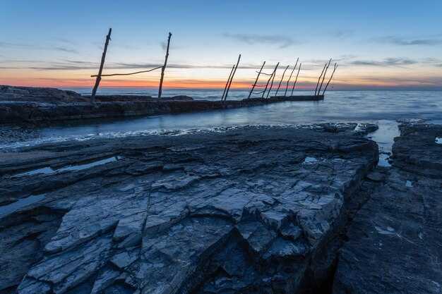
Practical pathways for tidal energy deployment and saltwater-lake fisheries
Begin with a 10 MW modular tidal array in a sheltered estuary where rivers meet a saltwater-lake system. This setup keeps the project less difficult to tackle, enables rapid learning, and reduces upfront risk. Use a robust weight-based mooring plan and a conservative line layout to withstand strong currents and seasonal floods. Co-deploy with local fisheries by establishing a joint monitoring program that tracks temperature, time of day, and fish activity, so operators can respond quickly to changing conditions; theyyll inform adjustments in operating windows and maintenance trips. Target large energy output while protecting favourite species; install fish-friendly screens with openings in the 20–50 mm range and design bypass paths for shrimp and crawfish where they migrate. Employ jigs and on-water surveys during trips to gather practical tips for targeting fish around turbine wakes, and tune turbine control to minimize disruption during peak feeding times. The strategy hinges on a data-driven decision loop–collecting biomass, current, and predator interactions keeps operations aligned with ecosystem needs. This step is critical for risk mitigation, and it helps the project scale over time.
Saltwater-lake fisheries pathways follow two tracks: first, scale toward 40–100 MW in brackish lagoons using modular turbines and fish-friendly screens; maybe staggered deployments to match fish migrations, almost year-round, where feasible. Second, establish a co-management framework that uses shared sensors and data to optimize both energy output and fishery access across systems. In practice, locate nearshore lagoons and river mouths where saltwater blends with freshwater, which naturally provides a predictable hydrology and a natural interface for fish, including shrimp, crawfish, and predatory species. Coordinate with rivers and lakes by aligning harvest seasons, known spawning times, and weather windows; use targeting plans based on temperature and time of day to set practical windows for gear and trips toward harvest. Commonly, fishers rely on jigs and other lure-based gear; knowing seasonal patterns and favourite spots helps adjust siting and timing. Monitoring data–catch counts, bycatch rates, and habitat conditions–supports a safer, more sustainable approach that benefits both energy systems and communities. There, proactive engagement and clear incentives help these pathways succeed.
Tidal resource assessment: site selection and resource mapping
Begin with a solid, data-driven site-screening like a strict filter that weeds out low-yield zones, then narrows to 3–5 candidate locations based on sustained current and suitable depth. Use long-term current data gathered from in-situ probes and remote sensing to estimate energy density, and pair it with bathymetry that supports secure gear installation. This initial pass should be fast and repeatable, so field teams can move from analysis to trips quickly when a site clears the threshold.
From the outset, build a simple yet solid knowledge base that relates hydrodynamics to installation practicality. Collect current profiles at multiple depths, seasonal signals, and near-bottom shear, then relate these to anchor options and scour risk. This approach keeps the focus on the metrics that drive performance and maintenance costs, and helps you compare sites in a consistent way. If a location lacks robust data, mark it for provisional monitoring rather than immediate inclusion in the final plan.
Site selection criteria combine three layers: hydrodynamics, geology, and logistics. In the hydrodynamic layer, prioritise zones with mean current speeds that sustain energy yield during spring tides, stable flow patterns, and limited low-speed pockets or reverse flows. In the geological layer, favour seabed types that support secure moorings and reduced scour while offering predictable construction windows. In the logistics layer, evaluate the ease of access for boats, the presence of rigs or existing infrastructure, and proximity to the grid, ports, or service hubs. A colour-coded colours map can help visualise these layers, with green for high-quality potential, yellow for caution zones, and red for unsuitable pockets.
- Site criteria: mean current speed at 20–30 m depth ≥ 1.8 m/s during peak tides; depth range 15–40 m; seabed that supports anchor spread without excessive scour.
- Infrastructure proximity: grid connection within 30–60 km, sheltered port access, and existing service routes for trips and resupply.
- Ecology and space use: avoid critical habitats and busy shipping corridors; account for ecological commotion during migratory periods and spawning seasons.
Resource mapping workflow follows a practical sequence. Gather existing bathymetric charts, tidal harmonics, and hydrographic data, then generate energy-density grids by integrating current magnitude with depth. Produce initial maps that show seasonal variability, using trip-based data to validate model predictions. Finally, filter to a shortlist and plan detailed field campaigns for verification.
- Data sources: national hydrographic offices, regional ocean models, and compliant in-situ ADCP (acoustic Doppler current profiler) deployments.
- Mapping outputs: energy-density grids, depth contours, substrate likelihood, and proximity to points of interest (ports, rigs, and grid connections).
- Validation steps: compare model estimates with at least two field trips per season to capture variability and confirm performance projections.
Field campaigns proceed with clear objectives. Use a staged approach: first deploy temporary instruments to capture spring-neap variability, then conduct focused boat-based surveys to map seabed types and potential anchorage zones. Keep gear robust and modular so you can test a few configurations within a single campaign. Trips should be scheduled to coincide with favorable weather windows and tide windows, reducing risk and increasing data yield. Use equipment that can be recovered and redeployed quickly to maximize the value of each trip.
- Instrumentation: ADCPs for current profiling, seabed augers or high-resolution sonar for substrate classification, and GNSS-based positioning for precise mapping.
- Deployment plan: staggered deployments to cover depth bands, with shared anchors and modular moorings where possible.
- Quality control: cross-verify profile data with buoyant reference measurements and repeat transects for consistency.
Ecology-aware assessment guides the interaction with living systems without slowing project progress. Identify anchor points where predatory species and schooling fish like herring and bass are known to forage near tidal fronts, and note how those patterns shift with seasons. This knowledge can inform safer routing for trips and avoid sensitive time windows. Effective gear choices, such as robust mooring systems and corrosion-resistant hardware, reduce maintenance demands in harsh offshore conditions. In particular, consider gear compatibility with the local marine fauna to minimize disturbance while maintaining solid performance over the project lifecycle.
Operational practicality matters as much as the science. Distill the data into a final shortlist, and present a transparent, element-by-element comparison. Don’t rely on a single metric; instead, assemble a composite index that weighs energy density, ease of installation, access for boats and rigs, environmental constraints, and maintenance risk. This final step lets you pick a particular site with confidence, ready for detailed design and permitting processes. The final decision should reflect a balance between high energy yield and feasible operations, ensuring a sustainable path from exploration to development.
In practice, one favourite workflow combines field verification with a simple, repeatable mapping approach. Start with a solid, data-driven filter to identify candidates, then expand into seasonal campaigns that tighten estimates of energy density and installation risk. The knowledge gained from each trip builds a practical picture you can relate to both engineers and operators. The result is a plan that could scale across locations, keeping a clear line from data to decision while maintaining a pragmatic focus on execution at each stage. This approach helps you learn faster, reduce uncertainty, and improve performance as you move from site selection to deployment.
Ultimately, the final map and site report should be clear, actionable, and portable for field crews. Include a concise set of recommendations, a transparent justification, and a well-defined data appendix. Your analysis should tell the story of why a site is suitable, what risks exist, and how you will manage them through the life cycle. That clarity makes the difference between a promising concept and a solid, bankable project that aligns with environmental and logistical realities. Remember: the best sites are those where knowledge translates into reliable, repeatable results, and where the gear and operations are tuned to the particular conditions of the tidal environment.
Example of a practical outcome: a shortlist of 3 sites with their final scores, a plan for two initial trips per site to validate current profiles, a proposed gear configuration for anchor stability, and a risk register focused on accessibility, weather windows, and ecological constraints. The favourite choice should be the one that blends robust energy yield with manageable field operations, while keeping ecological and community considerations in view. This approach ensures a clear path from resource mapping to successful installation and long-term performance.
Technology options: tidal turbines, lagoons, and hybrid approaches
Deploy a modular tidal-turbine array in an inshore creek channel with multiple spots facing incoming tides, paired with a compact lagoon to store energy and level loads. This hybrid setup delivers reliable output and flexibility through seasonal swings while keeping maintenance and retrieval work manageable.
Tidal turbines
- Principle: capture energy from fast, predictable currents in inshore channels and creek mouths; group turbines to reduce wake losses and maximize delta flow efficiency.
- Layout: place turbines in evenly spaced backs along the channel; select spots with current velocity above a threshold to avoid excessive scour; use weighted sensors to monitor performance and salinity changes across the lagoon interface.
- Operational data: capacity factors at high-flow sites typically range from the mid-20s to the low-40s percent; incoming tides create peaks in output; retrieval operations occur during slack water to minimize vessel time; maintenance windows can be scheduled twice yearly in low-activity seasons.
- Fisheries interaction: early studies track fish patterns around turbine arrays; zman data from creek surveys help identify spots with high activity; implement exclusion zones for walleye and minnow habitats as needed.
Lagoons
- Principle: enclose a portion of coastal water behind a natural bank to create a stable head; operate turbines or pumps to balance daily energy output; lagoons provide predictable cycles through tidal storage and controlled release.
- Site considerations: delta regions offer sheltered inshore lagoons with reduced storm exposure; salinity gradients influence species movement and ecological risk; install fish-passable gates to support creek connectivity.
- Economics and build-out: since capital cost is higher upfront, lagoons offer lower operating costs, higher lifecycle predictability, and the ability to stack storage options and multiple generation modes; typical projects target tens of MW in a single lagoon with modular expansions.
Hybrid approaches
- Стратегия: объединить группы приливных турбин с лагуной или аккумуляторной батареей для сглаживания выработки и предоставления сетевых услуг; использовать интегрированную систему управления для переключения между режимами генерации по мере изменения приливов в течение дня.
- Операционный дизайн: направление приливных потоков через турбины для улавливания скорости с одновременным отводом избыточного напора в лагуну для последующего высвобождения; такой подход обеспечивает высокую степень использования мощности в течение дня и в разные сезоны; группу устройств можно масштабировать кратно по мере роста спроса.
- Экологическое и рыбное планирование: мониторинг солености, связности ручьев и характера перемещения рыбы; поддержание коридоров обратного течения для поддержки таких видов, как судак и гольян; обеспечение извлечения вышедших из строя устройств и безопасного прохода для водных обитателей; это снижает экологический риск и повышает признание общественностью.
Практические рекомендации по выбору площадки
- Определите места с сильным течением и минимальным накоплением отложений; оцените дельты и речные сети для максимального улавливания энергии; используйте гидролокатор для картирования входящих потоков и убедитесь, что выбранные прибрежные зоны будут обеспечивать стабильную мощность.
- Оценить логистику технического обслуживания: доступность для извлечения оборудования; обеспечить наличие запаса запасных частей; запланировать дважды в год периоды технического обслуживания турбин и ворот лагуны.
- Взаимодействуйте с заинтересованными сторонами рыбного промысла на ранних этапах; собирайте данные местных съемок среды обитания пескарей и судаков, чтобы свести к минимуму воздействие и согласовать его с сезонными миграциями.
Экологические меры безопасности: базовые исследования и стратегии смягчения последствий
Вот непосредственная рекомендация: запустить 12-месячное базовое исследование прибрежных и ближних к берегу местообитаний для фиксации текущих моделей, скорости потока и общей активности до ввода в эксплуатацию каких-либо устройств. Документировать неустойчивые движения и плавательное поведение ключевых видов, а также установить баланс между энергетическим тестированием и экологической защитой. Включить измерения цвета субстрата для определения адаптации участка и выявления четких эталонных условий для последующих сравнений. Эта база обеспечивает ориентир для будущих сравнений.
Координировать междисциплинарную программу: гидрографические исследования для картирования течений и батиметрии, биологические исследования для инвентаризации видов и местообитаний, а также физико-химический мониторинг для отслеживания мутности и кислорода. Посредством сотрудничества с местными сообществами и другими заинтересованными сторонами применять практические подходы, такие как береговые наблюдения и легкие датчики. Местные полевые группы, включая наблюдателей на основе яков и сети grubz, обеспечивают сезонный охват и подтверждение со стороны сообщества. Регистрировать данные об основных факторах: скорости потока, течениях и их сезонной изменчивости. Эти базовые данные очень ценны для соотнесения результатов с целевыми показателями смягчения последствий.
Меры по смягчению рисков снижают опасность: поддерживайте плавный ввод в эксплуатацию, чтобы избежать шумовых пиков; применяйте селективные средства контроля шума; установите автоматические пороги отключения при обнаружении охраняемых видов или превышении током безопасных пределов. Регулярно проводите учения по извлечению и держите запасные части наготове для быстрого ремонта. Используйте точное наведение, чтобы избегать зон интенсивного рыболовства и мест скопления, где используются приманки. Расширьте меры защиты вдоль побережья, чтобы свести к минимуму побочный вылов. Постоянно следите за движением судов и обеспечьте наличие четких карт для обеспечения доступа.
Разработайте полноценный и точный режим работы с данными: задокументируйте исходные данные в общедоступном и прозрачном формате и поддерживайте обновления, отражающие новые измерения. Обеспечьте извлечение архивных данных и проверки QA/QC для получения четких, практически применимых результатов. Соотнесите реакции окружающей среды с текущими условиями и работой системы, осуществляя постоянный прибрежный мониторинг вдоль побережий и эстуариев. Отслеживайте изменения в схемах плавания местных популяций и убедитесь, что активность остается в безопасных пределах.
Интеграция в сеть и экономика: передача, хранение энергии и стимулы
Рекомендация: запустить пилотный проект с тремя узлами, объединяющий накопители мощностью 40 МВт*ч на узел с модернизацией линий электропередач на 0,7 ГВт, и привязать стимулы к показателям производительности в режиме реального времени, таким как надежность разряда, время отклика и предотвращенные потери. Такая схема позволит сократить годовое ограничение выработки на 18–26% в сезоны высокой выработки возобновляемой энергии и снизить системные потери на 5–8% в первый год. Обеспечьте доступность панелей мониторинга в местах реализации проектов и делитесь знаниями с операторами, регулирующими органами и местными сообществами.
Интеграция в сеть требует выбора совместно оптимизированного сочетания передачи и хранения энергии. Внедрите взвешенную оценку рисков для ранжирования вариантов и используйте дельта-анализ для приведения прогнозов в соответствие с фактическими условиями. Используйте динамические рейтинги линий для более частого использования тепловых запасов и обоснования линий электропередач постоянного тока высокого напряжения (HVDC) на протяженных коридорах. Стройте трансграничные межсистемные соединения там, где рыночные выгоды превышают затраты на получение разрешений, и представляйте непрерывный поток данных для поддержки решений на той стороне сети, где надежность особенно важна. Описанные здесь методы обеспечивают снижение предельных издержек и более предсказуемую поставку энергии. Ветряные электростанции с лопастями, вращающимися при порывах ветра, создают изменчивость; взвешенный подход помогает сгладить эти колебания, и команда может добавлять планы действий в чрезвычайных ситуациях по мере изменения условий.
Экономика хранения энергии строится на сбалансированном портфеле. Склоняйтесь к быстрореагирующим литиевым модулям для 4–6-часовых периодов и сочетайте их с долгосрочными вариантами, такими как гидроаккумулирующие электростанции, где география предлагает естественный бассейн. Затраты падают, косвенные затраты растут по мере расширения мощностей EPC, а текущие капитальные затраты составляют примерно $300–450 за кВтч в зависимости от химического состава и масштаба. Это создает широкие возможности для оптимизации с помощью модульных установок. Каждый проект улучшает показатели производительности, включая общую эффективность и срок службы циклов. Методы максимизации срока службы – терморегулирование, интеллектуальная зарядка и надежное управление BMS – помогают уменьшить разницу между ожидаемыми и фактическими результатами и поддерживать стабильность портфеля. Правильный выбор сочетания также поддерживает прибрежные районы, где ресурсы ветра и приливов согласуются с существующей инфраструктурой, включая богатые форелью речные бассейны, в которых можно разместить гибридные решения с минимальным дополнительным землепользованием.
Стимулы и рынки формируют потоки капитала. Разработайте сочетание энергетических платежей, платежей за мощность и вознаграждений за надежность с четкими этапами. Используйте микростимулы в стиле grubz для вовлечения прибрежных сообществ и малых операторов, и проводите периодические турниры среди агрегаторов для стимулирования обнаружения цен. Подготовьте убедительную презентацию результатов для банков и регулирующих органов, чтобы привлечь инвестиции, и поддерживайте стабильные политические сигналы, чтобы снизить риски для разработчиков и рыбаков вблизи портов, которые зависят от стабильной энергии для холодильного хранения и переработки рыбы. Привлечение инвестиций зависит от видимой производительности, задокументированных различий между обещаниями и результатами, а также прозрачного пути к ликвидности. Со стороны сети привлечение новых участников расширяет возможности для выездов сервисных флотов, при этом сохраняя предсказуемые затраты для потребителей.
| Scenario | Трансмиссия (GW) | Хранилище (МВт·ч) | Капзатраты (млрд долл. США) | Окупаемость (лет) | Ключевые стимулы |
|---|---|---|---|---|---|
| Базовый случай | 0.7 | 40 | 1.3 | 6–8 | Стандартные тарифы и существующие субсидии |
| Мотивированное дело | 0.95 | 60 | 1.8 | 5–7 | Платежи за производительность, платежи за мощность |
| Высокая доля ВИЭ | 1.2 | 100 | 2.6 | 4–6 | Grubz: микро-поощрения, турниры |
Надёжное управление, прозрачные показатели и своевременный обмен данными обеспечивают эффективное масштабирование проектов. Эта структура поддерживает пользователей, операторов и сообщества, обеспечивая стабильную, устойчивую работу и расширяя возможности в сферах передачи, хранения и разработки стимулов.
Рыболовство в соленых озерах: виды рыб, орудия лова и методы устойчивого промысла
Установите сезонные запреты и используйте орудия лова с селективным размером ячеи для защиты молоди и обеспечения пополнения запасов. Такой подход обеспечивает стабильные уловы и сохраняет функции экосистемы в соленых озерах, расположенных в засушливых регионах. Установите единую, прозрачную квоту на каждое озеро и корректируйте ее на основании данных CPUE, чтобы поддерживать интенсивность промысла на низком и контролируемом уровне.
Виды во внутренних соленых озерах варьируются в зависимости от солености и притока воды. Цисты Artemia franciscana доминируют во многих системах и обеспечивают постоянный источник пищи для инкубаторов и местных рынков, предоставляя рыбакам возможность диверсифицировать доходы. Соленость колеблется от 20 до 250 ppt, и четыре основные зоны обитания поддерживают различные объекты промысла. В прибрежных зонах с низкой соленостью часто встречаются мелкие рыбы и моллюски; в более глубоких, более соленых водоемах преобладают артемии, привлекающие внимание покупателей. Разнообразие форм жизни привлекает внимание местных жителей, а запах рассола может указывать на продуктивные участки. Цвет раковин и кожи выглядит ярким при правильном освещении, и любимые объекты промысла меняются в зависимости от сезона, поэтому соответствующим образом адаптируйте снаряжение и время.
Выбор снаряжения должен акцентировать безопасность и селективность. Для рыбы используйте жаберные сети с ячеей 25–40 мм для вылова взрослых особей, позволяя молоди уйти; вентери и ставные сети с ячеей 50–120 мм могут добывать более крупных особей с минимальным приловом. Для ракообразных и моллюсков используйте сачки с мелкой ячеей или ручной сбор в неглубоких заливах, а также используйте корзины для уменьшения потерь. Устанавливайте снаряжение на рассвете и извлекайте в течение четко ограниченного времени, чтобы снизить стресс для диких животных. Обеспечьте простоту и хорошую маркировку снаряжения для повышения соблюдения правил и избежания конфликтов.
Методы сбора урожая требуют постоянного мониторинга. Ограничьте ежедневные и сезонные усилия и документируйте прилов; отслеживайте вес на единицу площади и перераспределяйте усилия в случае снижения CPUE. Защитите не менее 20% критически важных местообитаний путем создания зон, свободных от вылова; используйте данные из промысловых журналов для корректировки правил. Убедитесь, что порты и рынки отражают реальную стоимость улова, и подтвердите, что промысел остается устойчивым в будущем. Система должна быть гибкой и изменяться в зависимости от количества осадков, притока воды и изменения солености, чтобы промысел оставался устойчивым. На отдаленных рынках яки перевозят улов из лагерей в города, что подчеркивает необходимость тщательного планирования транспортировки для сохранения свежести и товарного вида.