

 Советы по плаванию в международных водах – безопасность, закон и навигация">

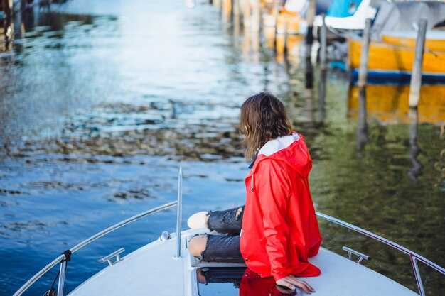
Always file a float plan before leaving international waters to reduce risk and inform a trusted onshore contact. Include vessel name, registration, exact route, estimated times, radio frequencies, and emergency procedures. A full plan kept on board and shared with a member on shore helps staying aligned if signals drop today.
Equip with the latest safety gear: life jackets for everyone, a working VHF radio, an EPIRB, and a 406 MHz beacon. Carry waterproof charts and a tight emergency kit, and verify your anchor setup and propeller health before every offshore leg. Regular checks are useful to keep the crew informed and calm.
Know the convention and flag-state obligations that cover your voyage. Understand basic rules of the road for international waters and how they apply near routes with heavy traffic. If you belong to a member club, use its coverage for weather alerts and rescue coordination, but verify information with official sources today.
Plan your route with official charts and the latest ENC data, and actively avoid frequented lanes during poor conditions. Confirm the forecast from national meteorological services and coastal rescue centers, and keep a full weather briefing on board. Update your plan if visibility or wind speed changes, and share updates with your shore contact to reduce surprises.
Be aware of political developments that can affect rescue coverage or safety in border zones. Monitor advisories, maintain an open line with coast guard authorities, and respect any temporary traffic separation schemes. Staying proactive and informing your crew about changes helps everyone stay safe and avoid unnecessary risk today.
Keep on-board practices safe by limiting speed near anchored vessels and frequented bays, performing prop checks, and recording a full log of events. Use route planning tools, stay informed with official coverage updates, and ensure things on board stay organized for a smooth, disciplined operation.
International Waters Boating Guide
Taking epirbs onboard and filing a float plan before venturing beyond legal limits of coastal waters sets a baseline for safety. This simple action speeds rescue and clarifies your course for responders.
Useful, practical actions cover safety, law, and navigation across nations. Use this guide to plan with confidence, and adjust accordingly as conditions change.
Even when the forecast looks calm, verify notices, restrictions, and regional guidance before departure. Across the world, boaters share practical lessons to improve safety and legal compliance.
- Equipment and readiness: include life jackets for all crew, waterproof charts, a working VHF radio, a handheld backup radio, AIS if available, and epirbs placed for quick access; carry spare batteries and a first-aid kit; tailor kits for small yachts and craft.
- Documentation and legality: legally operate by flag state rules; keep vessel registration, operator licenses, passports when crossing borders, and a crew list. Stay aware about local regulations and note restrictions that vary by country and zone, including exclusive economic zones and safety requirements for on-water activities.
- Navigation and course planning: plot a route with current, wind, and tide data; load up-to-date charts; use AIS and GPS to maintain situational awareness; set a fuel and daylight limit and plan for contingencies.
- Pirate risk and security: check current advisories before long crossings; avoid known hot spots; adjust your course with routing; never sail toward visibly suspicious waters; report incidents to naval or coast guard authorities.
- Vessel operations and crew: assign a driver and a lookout; maintain a strict watch schedule; practice man-overboard drills; keep a life raft and throwable device accessible on-water.
- Emergency planning: epirbs, distress calls on VHF 16, and satellite beacons improve response times; have a clear action plan for flooding, fire, or engine failure; have a backup plan to reach a safe harbor or near-shore assistance.
- After-action and learning: log every voyage, capture notes on restrictions encountered, and share useful findings with companions; include economic considerations such as port costs and mooring fees to plan financially when crossing nations.
Pre-Departure Safety Gear Checklist (PFDs, Flares, EPIRB, Liferaft)
Verify PFDs, Flares, EPIRB, and Liferaft are on board, accessible, and within service dates before you depart.
PFDs: Ensure every passenger has a properly sized, Coast Guard-approved life jacket. Inspect straps, buckles, seams, and reflective tape; replace any item showing wear. Keep at least one spare PFD for each known passenger in a dry, visible location near the companionway. If a buckle or strap shows deterioration, it is indicating replacement.
Flares: Check expiration dates on handheld and parachute flares and discard anything past date or damaged. Store in a sealed, labeled container in a cool, dry spot. Rotate stock so older units are used first and replace spent flares before the next voyage.
EPIRB: Verify registration is valid for the vessel and the device is up to date. Test per the manufacturer’s procedure, ensure the battery is within service life, and confirm the antenna is clear. Mount the unit for rapid activation in an emergency and log the last test date; carry a backup beacon if feasible.
Liferaft: Inspect the inflation system, painter line, sea anchor, and repair kit. Confirm the hydrostatic release unit is connected and free of corrosion; check canopy fabric for tears and confirm accessibility of the launch handle. Ensure the liferaft has been serviced within the manufacturer’s interval and record the service date; schedule annual service before longer coastal passages.
Packing and storage: Assemble gear into a compact safety kit, with each item clearly labeled and stored in its own watertight container. The kit includes a safety log and a quick-reference card for all passengers, helping you plan the boarding sequence. Taking these actions pays off in real time, and you can prep passengers in minutes. Secure all items so they do not interfere with movement, access to the cockpit, or navigation gear, with some items stored over labeled bins for easy sighting.
Documentation and reporting: Maintain a small safety log with the date of checks, any issues, and corrective actions. If you identify known issues or damage, report them to national authorities or coast guards and update your EPIRB registration records as needed. Be aware of restrictions that apply to coastal routes and international water passages, and adjust plans accordingly.
Ocean-wide practice: In global oceans, this kit is useful for protecting passengers and ecosystems. There, conditions can change quickly, so a steady rate of checks helps you catch wear early and reduces risk over the voyage, including during an encounter with distress signals. Taking these steps without delay makes the operation safer for everyone.
AIS and Monitoring: Transmission Requirements and Best Practices
Enable AIS Class A on all eligible international voyages today and verify your MMSI, vessel name, flag, call sign, vessel type, and route before departure. Accurate data improves response times for search-and-rescue and makes you easier to identify by port authorities and nearby traffic.
Designed for reliability, install AIS with a dedicated power supply and a stable GPS input, then run a full self-test. Position the antenna as high as possible with a clear line of sight to open-sky reception, and route cables away from high-EMI gear. Maintain a clean deck layout to prevent multipath signals that can mislead a navigator and potentially indicate equipment faults.
Class A is mandatory for vessels on international voyages under flag authority guidelines; Class B provides visibility for smaller boats and enhances safety in busy lanes and at anchor. Review the requirements of your flag authority and any visa or border rules that might affect your route before planning long passages with mixed traffic.
For monitoring, keep AIS on continuously and compare your own data with nearby targets on the bridge display. Use radar or VHF together with AIS to validate tracks and adjust speed or course early to avoid conflicts. If you observe an approaching vessel that’s indicating risk, reduce speed and alter course in a predictable, rule-compliant manner.
epirbs and SARTs remain essential redundancy. Ensure epirbs are registered with the flag authority and tested according to the manufacturer’s schedule; keep SART within reach and test the distress alarm. Do not rely on AIS alone in distress situations, and practice using both AIS and GMDSS procedures during drills, especially if youre operating near diving operations or boarding teams.
Special considerations apply to operations on adventurous routes: near busy harbors, in fishing grounds, or during load-ins and boarding. Keep alcohol off watch, avoid operating radios during critical maneuvers, and ensure crew understand the priority of AIS visibility in such conditions. Something should always be in place to prevent misinterpretation of data and to avoid false alarms.
Tips: test your setup before departure, validate target data with radar, and maintain a log of AIS events. Youre responsible for keeping your data accurate, up to date, and consistent with the flag authority’s records. comfortable, unmatched situational awareness helps create a smoother experience for your crew and fellow boaters when navigating open routes and coastal waters.
Указание готовности и соблюдение международной практики улучшит ваш опыт и опыт других моряков, снизит угрозу в море и упростит взаимодействие с властями, если возникнет заход в порт или проверка визы.
| Aspect | Класс A | Класс B | Заметки о передовых методах |
|---|---|---|---|
| Динамическое обновление данных | 2 секунды при движении; ~3 минуты в режиме ожидания | ≈30 секунд при движении; дольше в состоянии покоя | Поддерживайте данные в актуальном состоянии; сверяйте с радаром |
| Обновление статических данных | Каждые 6 минут или при изменении | Каждые 6 минут или при изменении | Проверьте название судна, MMSI, флаг, тип и маршрут |
| Необходимые данные | MMSI, наименование, флаг, позывной, тип, маршрут | MMSI, название, флаг, тип | Поддерживать согласованность с записями авторитетных источников флагов |
| Электропитание и резервное копирование | Выделенное обеспечение + резервное копирование | Рекомендуется выделенное снабжение | Тестирование работоспособности; предотвращение одноточечных отказов |
| Размещение антенн | Высокая, ясная линия видимости | Высокая, ясная линия видимости | Избегайте препятствий; проверяйте во время посадки |
| Мониторинг интеграции | Радар/ECDIS соединены; непрерывный контроль. | Регулярно отслеживайте; интеграция с приложением | Согласовывайте цели AIS с другими датчиками, чтобы снизить угрозу. |
| Аварийные устройства | Зарегистрированы эпирбы; САРТ готов. | рекомендуемые радиобуи | Зарегистрируйте эпирбы в уполномоченном органе; проводите испытания по расписанию. |
Colregs Справочник: право прохода, огни и сигналы
Определяйте суда, имеющие право идти на попутном курсе и уступающие, в считанные секунды, и корректируйте курс, чтобы избежать столкновения. Если ситуация остаётся неясной, снизьте скорость до безопасной и оставайтесь на безопасном расстоянии.
При сближении судов уступайте дорогу, если другое судно находится у вас по правому борту; судно, сохраняющее курс и скорость, поддерживает видимость и предсказуемость для всех находящихся поблизости мореплавателей.
Ночью показывайте стандартные навигационные огни: красный на левом борту, зелёный на правом борту и белый свет, указывающий на то, что вы находитесь в движении; добавляйте всесторонний белый свет, если вы на якоре или ограничены видимостью; следуйте опубликованным схемам и сохраняйте их чистотой и видимостью в районе, где вы работаете.
Используйте краткие звуковые сигналы для координации движений при угрозе столкновения; в туман или при ограниченной видимости снижайте скорость и действуйте с повышенной осторожностью; имейте при себе VHF-радиостанцию и сообщайте о бедствии или необходимости координации на канале 16 в качестве первого шага.
Держите свой путеводитель с действующими правилами для страны, в которой вы находитесь; проверяйте опубликованные сведения о правилах судоходства вокруг вас и убедитесь, что ваши действия соответствуют местным правилам, опубликованным в вашем навигационном руководстве.
При навигации по оживлённым водным путям вблизи популярных круизных маршрутов соблюдайте увеличенные промежутки и будьте внимательны к таким объектам, как буи, суда и пловцы; используйте вашу карту и ваше положение, чтобы подтвердить курс и двигаться по предсказуемой траектории, избегая резких изменений.
Если вы столкнулись с раненым человеком или спасательной операцией, скоординируйтесь со спасательной командой и сообщите властям; обеспечьте безопасность экипажа и оказывайте помощь только в том случае, если это не ставит под угрозу вашу безопасность или безопасность других людей на борту.
Протоколы радиосвязи VHF и процедуры подачи сигналов бедствия/срочности
Немедленно передайте сигнал бедствия MAYDAY на канале 16, если вы столкнулись с непосредственной угрозой и нуждаетесь в помощи, затем переключитесь на рабочий канал для координации спасательной операции. Включить название судна, позывной или MMSI, местоположение, количество людей на борту и характер бедствия. Повторите MAYDAY три раза, затем предоставьте краткие, действенные сведения для ускорения реагирования.
Формат вызова «Мэйдей»: MAYDAY, MAYDAY, MAYDAY. Это Sea Spirit, ММСИ 987654321, позиция 37.7749 N, 122.4194 W, курс 120°, скорость 3 узла, 4 человека на борту, пожар двигателя. Мы находимся в суровых погодных условиях и просим немедленной помощи. Если вы это слышите, подтвердите и передайте эту информацию соответствующим службам на ближайших каналах. После контакта перейдите на рабочий канал для координации по указанию руководителя на месте.
Формат вызова Pan-Pan: PAN-PAN, PAN-PAN, PAN-PAN. Это Sea Spirit, MMSI 987654321, позиция 37.7749 N, 122.4194 W, недалеко от Золотых ворот, срочно, но не угрожающе для жизни. У нас механическая неисправность и требуется помощь. Следите за каналом 16 и будьте готовы переключить на береговую охрану или спасательные службы на рабочий канал. Подтвердите и запишите детали для отчета.
Дисциплина и процедуры канала: сохраняйте канал 16 свободным для первоначальных сообщений бедствия и переходите на назначенный рабочий канал для дальнейшего диалога со службами спасения. Используйте DSC на канале 70 для отправки сообщений бедствия, когда голосовая связь невозможна, и постоянно следите за каналом 16 во время всех передач. Используйте простой счетчик вызовов, чтобы избежать дублирования передач и предотвратить засорение эфира, особенно когда на вызов отвечают близлежащие суда.
Готовность к эксплуатации: проверить наличие лицензии и обучение радиопроцедурам для назначенного оператора, убедиться в готовности функций отчетности и держать радиоприемник и запасной аккумулятор заряженным и под рукой. Составить карту каналов для каждого рейса, с четким переходом с 16 на предпочтительный рабочий канал, такой как 6, 13 или региональные эквиваленты, и согласовывать действия с местными береговыми службами.
Средства индивидуальной защиты и поведение на борту: в любой чрезвычайной ситуации, сохраняйте jacket on and speak slowly and clearly. State your position with degrees or landmarks, confirm the next action with the other party, and avoid unnecessary chatter that can obscure critical details. If conditions worsen, begin relaying information to nearby vessels to form a cooperative response.
Reporting and accountability: after a MAYDAY or Pan-Pan event, report to the appropriate authority and your services provider, and document times, positions, messages, and actions taken. This reporting supports marpol compliance and licensing requirements, mitigates liability, and helps planners coordinate rescue assets across agencies. Indicate the number of people involved, the vessel’s direction into safety, and any environmental or medical considerations, so responders can tailor their response.
Planning and coordination: throughout all activities at sea, establish a dedicated communications lead, keep other crew informed, and maintain a clear chain of reporting. With a coherent plan, you can avoid confusion and ensure that many rescue assets–nearby coast stations, harbor services, and rescue boats–assist in a timely manner. In practice, a well-maintained plan reduces delays by countering miscommunications and keeping all parties on the same page.
Documentation, Flag State Rules, and International Licensing for Your Route
Verify licensing and flag state requirements for every leg of your route at least six weeks before departure. Contact the flag state authorities and the port states you will visit to confirm required certificates, endorsements, and documents. Share them with the captains to keep plans aligned.
Compile a documentation package: vessel registration or proof of ownership; current radio license and MMSI; GMDSS certification; safety equipment testing results; insurance certificate; crew certificates for captains, engineers, and able crew; medical certificates; passenger manifests; and your voyage plans.
Flag State Rules: When you sail under a flag, that state governs your vessel in international waters and during entry at foreign ports. Schedule annual surveys, ensure valid tonnage and safety endorsements, and keep crew licenses current. Some flags require drills and formal record-keeping you must log.
International Licensing: Identify which licenses are recognized across jurisdictions along your route. Secure an appropriate captain’s license and any engineer or radio operator endorsements; obtain endorsements for carrying passengers if you plan to transport them; keep expiry dates visible and renew on time.
Territories and jurisdictions: Your route may touch multiple territories; each may demand different clearances. Before calling at a port, confirm local port entry and clearance procedures; maintain a cross-border log with contact details for authorities in each area; track submission dates for permits. If you want to minimize delays, pre-file forms with the relevant offices.
Practical tips for staying compliant: Maintain digital and physical copies of all documents; store in a shared drive accessible to captains and crew; review licenses annually with a seasoned leader; set reminders six months before expiry; if an injury occurs, notify the local authorities and the flag state to receive guidance; ensure transport plans and on-board procedures cover emergency response. If crew changes require flying, coordinate with authorities to confirm that licenses, medicals, and endorsements remain valid for the trip.
Benefits you gain include smoother check-ins at ports, faster clearance with authorities, enhanced protection for passengers, and better access to insurance coverage when you keep licensing and documentation up to date. Staying compliant supports responsible voyages and respects nearby ecosystems while leaders and captains keep plans on track.