

 Navigation on the Wrist – Smartwatches for Sailors Put to the Test">

Escolha um smartwatch com pelo menos 48 horas de duração da bateria no modo expedição, um GPS robusto e uma lanterna confiável para verificações noturnas. Há menos desordem na tela quando a interface permanece simples, e o grupo segue o curso com um único display legível que resiste a distrações.
Para dados de navegação, priorize atualizações contínuas do gráfico e carregamento mais rápido do mapa. Procure um dispositivo que mostre um chart view, supports offline maps, and maintains a stable coordinate fix under variable conditions. The ratio a relação de brilho da tela com o uso da bateria deve permanecer dentro de uma faixa previsível, para que você possa operar por mais tempo sem carregar; da aurora ao anoitecer, isso importa quando você precisa maximum conhecimento situacional.
Durabilidade importa: um leve plastic o chassi resiste à corrosão, mantendo o peso baixo; available modelos com molduras reforçadas podem suportar spray de sal. Se você trabalha com uma pequena equipe, uma porta USB dedicada ou um dock de carregamento ajudam a manter os dispositivos prontos entre os turnos, e a morning verificação da bateria garante contínuo operação durante uma expedição.
Na prática, você quer que o dispositivo lide com dynamics em deck e no cockpit: defina alertas para deriva, habilite a iluminação noturna e teste em morning furos. Embora as interfaces de relógio são rápidas, funcionam melhor como uma referência secundária juntamente com gráficos impressos ou um segundo dispositivo; não mantenha um único dispositivo substituindo a boa condução, e use o dispositivo de pulso para complementar, não substituir, as rotinas da tripulação.
Navegação no Pulso do Marinheiro: Avaliando as Capacidades de Smartwatches
Recommendation: Escolha um smartwatch de qualidade marítima com GPS integrado, um altímetro e um sensor de frequência cardíaca. Garanta que o dispositivo tenha um cristal de safira, seja customisable com painéis de exibição e pode fornecer dados em tempo real juntamente com gráficos na tela. Certifique-se de que se conecta de forma confiável via Bluetooth e wi-fi para atualizações de mapa, com um robusto tracker para o uso diário durante adventure no mar.
Teste como um modelo lida com a navegação estilo plotador de cartas: confirme se consegue exibir rotas costeiras e sobreposições na tela, ler a data e a hora com precisão e atualizar morning logs as you are rowing across calm seas. Ensure the apps a loja oferece navegação offline confiável e que você pode start um diário de viagem que inclui latitude, longitude e altitude a partir de altímetro, e monitorando em tempo real.
Hardware e notas de exibição: escolha um painel de cristal de safira com alta resolução para que os ícones permaneçam legíveis à primeira vista. O heart-rate sensor deve permanecer preciso em movimento e o altímetro deve reagir rapidamente a mudanças de pressão ao rolar sobre as ondas. A customisable watchface ajuda você a posicionar dados críticos – velocidade, distância, data e outras métricas – onde você quiser. Para morning workouts ou remada sessões, tornando a tela legível sob o brilho e com um retroiluminamento intenso, mesmo ao inclinar o pulso.
Conectividade e longevidade importam: garanta que o dispositivo possa sincronizar atualizações over o ar e suporta confiável wi-fi ou Bluetooth handoffs para um tablet ou chartplotter apps. Considere um modelo com longa duração de bateria, idealmente durando vários dias. adventure e fornecendo um tracker para o progresso. Se você navegar com tripulação, verifique o suporte multiusuário e seguro apps compartilhamento, e decida se você prefere um relógio de pulso ou um dispositivo preso à estrutura para operações marítimas.
Vida útil da bateria no mar: gerenciamento de energia e longevidade
Ative o modo de economia de energia e desative a exibição Always-On para prolongar o tempo de execução diário, especialmente durante a navegação diurna, garantindo que os alertas de notificações importantes ainda cheguem até você.
Com o GPS ativado, a maioria dos relógios usados por velejadores oferece de 6 a 12 horas de navegação contínua, reprodução de música ou elaboração de gráficos. Quando o GPS está desligado e o brilho da tela permanece moderado, espere de 2 a 4 dias de uso; em stand-by, alguns modelos atingem de 5 a 7 dias, dependendo da carga dos sensores e das notificações. Ajuste os modos para se adequarem às condições de navegação.
Para maximizar o tempo de atividade durante o monitoramento, implemente estas etapas: ligue o modo de economia de energia, reduza o brilho para 30–40%, desative a exibição sempre ativa e silencie as vibrações não essenciais. Limite os acordes e use mapas e músicas offline armazenados na memória do relógio; o armazenamento disponível varia de acordo com o modelo. Configure um perfil de notificação focado que mostre apenas alertas de navegação e informações meteorológicas. Outra dica: defina uma visualização intuitiva que destaque a linha da rota em vez de cada métrica. Faça isso antes de partir, para que você comece com uma configuração otimizada.
Escolha um modelo com vidro de safira e uma caixa resistente para suportar o spray da embarcação. Uma classificação IP68 registrada ajuda a proteger contra umidade e respingos. O sensor de frequência cardíaca adiciona demanda de energia, portanto, desative-o durante longos períodos de monitoramento passivo; quando precisar de monitoramento, use a taxa de amostragem mínima. Para visibilidade diurna e operações náuticas, escolha um mostrador de relógio intuitivo que permaneça legível no vidro. Alguns relógios incluem um economizador de energia dedicado ou modo náutico, que minimiza a atualização da tela e desativa o streaming de música.
For a sailor, plan charging on shore or at anchor. Keep a spare charger included in your kit. If your model supports solar charging, position the device to capture daylight while keeping deck duties safe. A well-balanced setup prioritizes navigation view and clock face information you rely on, with notifications kept to a minimum during rough seas. As mentioned, maintain registered accessories and keep the view clear of glare; ensure the sapphire glass protects the display, and check the heart rate sensor status to manage power accordingly. This keeps the sailor well powered for watch rotations.
GPS, Maps, and Navigation Aids: Accuracy and Practical Use
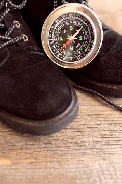
Opt for a smartwatch with offline maps and multi-constellation GPS; pair it with your phone for backup, and keep the device slim to avoid bulky interference with the antenna. Check the features list: offline maps, compass, and route alarms. Use it as your primary reference, but carry a paper chart and a manual as a quick reference on deck.
Currently, GPS accuracy on modern smartwatches typically lands in the 3–5 meter range in open water, rising to 10–20 meters near shore or in urban canyons. A multi-constellation receiver (GPS plus Galileo and GLONASS) improves fix stability, and WAAS/EGNOS corrections can shave a few meters when available. When signals are weak, preloading maps and saving anchor points helps you stay oriented even during a breakdown in signal.
- Plan the route once on shore, loading offline maps and saving waypoints before you cast off. This avoids data bursts at sea and gives you a reliable reference if the connection drops.
- On deck, glance at the map to confirm current position, bearing, and distance to the next waypoint. Use the touchscreen to zoom in on critical turns, while keeping eyes on the water for safety.
- Set up clear navigation fields: coordinates, heading, speed, and estimated time to waypoint. If available, enable tide or current overlays and keep respiration and activity data visible as fatigue indicators during long watches.
- Utilize open map sources when possible, and ensure compatibility with your phone for chart transfer and backup. If your watch supports OpenStreetMap or other open formats, keep a small cache of coastal contours and harbor entries for quick reference.
- During a sporting leg or maneuver, rely on a steady track rather than constant screen checks. A short, confident glance to confirm the next leg is enough, while the vision is still scanning the horizon.
Runtimes matter: in GPS-only mode, expect 8–12 hours of continuous use on rugged models; with maps and sensors active, plan for 4–8 hours. If the watch begins to drop accuracy during a long passage, switch to a simpler map layer and minimize sensor load to extend runtimes without sacrificing core navigation cues.
Practical setup tips: keep the display readable in bright sunlight, disable nonessential alerts to reduce drain, and keep the watch open to the sky whenever possible to maximize satellite visibility. A dedicated reference sheet aboard–showing charted waypoints, magnetic variation, and preferred routes–complements the digital tools and supports quick decisions during a tight maneuver.
Value comes from redundancy. Use the smartwatch as a primary tool for routine navigation, but maintain a fallback plan with a loaded paper chart and a basic manual. If the smart device fails, you still have a solid reference to steer by. This approach aligns with a clear vision of safety and preparedness on every voyage, where functionality, reliability, and easy access to data support steady decision‑making during every activity on deck.
Tides, Wind, and Weather: Real-time Nautical Data on Your Wrist
Enable tide, wind, and weather widgets on your smartwatch now to access real-time nautical data on your wrist. Use the primary data feeds, customised alerts for tides, wind shifts, and barometer trends. If you purchased a model with built-in tide data, ensure the source is active and syncing with your smartphone so data everywhere stays current.
Tides: The tide widget shows current height, next high tide, next low tide, and tidal range. Example: current tide 1.2 m, next high 04:15 in 3h 20m, next low 10:40 at 0.3 m; forecast horizon 12 hours. Widget sizes can be adjusted to fit your clock face; choose certain sizes for compact data. Update cadence is 5–10 minutes at sea, 1–2 minutes when near shore.
Wind and weather: wind speed 12–28 knots, direction 180–210 degrees; gusts to 32 knots in squalls; sea state 2–5 ft; visibility 4–7 NM; rain probability 20–60% depending on fronts. The event feed updates every 5 minutes; screen resolution on the clock face is typically 320×320, and the data is accessible on smartwatches and smartphone apps. If the signal isnt stable, the watch uses the last known values and recovers when the link returns; you can rely on primary sources, andor offline mode to stay informed.
Recovery and connectivity: If Bluetooth drops, the watch stores the last 20 minutes of data and re-syncs within 60–120 seconds. Data is distributed through brand subsidiaries and regional feeds, so some regions may show slight variations in tide timing. If a data feed ended, switch to the backup automatically. Keep the plug in charger in the cabin to prevent battery drain during long legs.
Cadence and planning: Use the cadence metric for sail coordination; set event alerts for wind shifts and tide changes. These cues help optimise tacks and sail handling during sporting activities. Data links from the watch and smartphone work together to keep you informed, wherever you sail.
Customization and offers: customised watch faces, widgets, and data streams let you tailor information to your routine. Choose high-resolution clock faces and adjust sizes to fit different watch cases. Some subsidiaries offer different widget packs; later, install firmware updates that improve data fidelity. If your model is purchased recently, you can benefit from offers like extended battery packs and additional offline maps by visiting the brand’s app store. Remember to plug the charger overnight and carry a spare cable for longer events.
Rugged Design and Water Resistance: Saltwater, Immersion, and Durability
Start with this recommendation: choose a model with IP68 or MIL-STD-810G ratings and a sealed, screw-down crown; saltwater seals must be tested for immersion beyond typical conditions. Look for corrosion-resistant materials such as titanium or reinforced stainless, among models with gaskets at buttons and the charging port. This design reduces failure risk when spray or a sudden incident arises. Before you head out, consult the manual and perform a quick check of the operation and warranty terms. This setup requires periodic gasket checks. Another factor is the availability of replacement seals, so consider placing an order if you expect heavy salt use.
Rugged chassis prove their value in rough seas: reinforced case back, raised bezel, protected side buttons, and scratch-resistant sapphire or toughened glass. Choose sizes that fit over a wetsuit or gloves, and a strap that resists salt and sun. The operation remains intuitive, and you can navigate, track waypoint data, and view realtime metrics without fiddling, even during a gusty stretch. For sailors who also enjoy offshore golfing on calmer days, the same seals keep moisture out when the deck splashes. This design makes you able to rely on critical data at a glance, even in spray.
Saltwater immersion takes its toll: salt accelerates corrosion on metal parts and can affect seals. Rinse immediately with fresh water after exposure and dry before storing. Check that the crown, charging contacts, and sensors stay clean. Confirm the model’s water-resistance rating after maintenance; including salt spray in routine checks, many watches deliver 8–12 hours of GPS mode, with longer operation in smartwatch mode depending on sensors used. Battery life varies with times of day and sensor usage. If a seal is damaged, you may need to order replacements.
On a voyage, you rely on downloaded charts and offline maps to navigate to waypoint without cellular connectivity. In realtime, the tracker shows GPS accuracy, wind data, and tide timings. Each crew member can read metrics quickly on the intuitive interface and operate independently, even if you are sailing solo. Worn on the wrist, it stays legible in rain and spray. After each trip, inspect seals and battery health to extend the life of the device; myself I test a watch under rough conditions before a formal voyage.
Readability and Controls: Using Watches in Rough Seas and with Gloves
Use a 51mm watch with large, high-contrast digits and four glove-friendly buttons; in rough seas rely on physical controls rather than the touchscreen.
Choose a watch face with bold numerals, a dark background, and a simple layout that shows time, compass, and depth at a glance; enable a land-based mode when docked to reduce glare and conserve battery.
Position two primary buttons on each side of the case and program long-press actions for critical tasks, such as confirming a waypoint or switching to storm mode; ensure each press provides a tactile click through a motor-backed haptic system.
Test with gloves of different thicknesses, from wool to neoprene; targets should be large and clear, minimum 12–14 pt digits, and use a plug-style protective cover for ports to prevent salt ingress.
Apps should be lightweight and offline-capable; keep essential data on-screen and pull surfline data for forecasts without opening heavy menus; offer on-screen prompts for critical actions and support card and payment options for services when land-based ports are reached.
The status strip must display battery level, GPS lock, signal strength, and a risk indicator; keep a small amount of data on view to avoid overload and provide a backup card with offline maps for storms and rough conditions.
Provide training for a group of sailors with dry-land drills and sea trials; use quick reference cards for rapid actions and repeat practice until handling becomes second nature, even when the boat rolls and spray hits the face of the watch.