

 US Virgin Islands Boating Guide – Routes, Charters & Island Hopping">

Start with a half-day charter from Charlotte Amalie to Water Island for a swim and a relaxed afternoon on Honeymoon Beach. This quick run gives you hands-on practice with local moorings, tide changes, and clear, sheltered water that suits first-timers, made for a confident start. Plan to return before dusk to keep your crew fresh for the next leg of your usvi itinerary.
From there, map routes that connect usvi highlights: Cruz Bay na St John, Cinnamon Bay, and the breezy coves along the north shore. If you want a longer day, theres a practical option to include a stop near maho and a snorkel along protective reefs. The idea is fairly flexible hops, which skip crowds and keep a safe pace.
Choose charter services that offer reliable access to weather windows and safety gear. For a family or group, order a plan that splits days between anchorages, with a night stop near sand beaches and easy dinghy trips to shore. Start with shore pickup in usvi ports to keep logistics smooth and to anchor those island stays. Keep a buck in cash for a quick snack ashore.
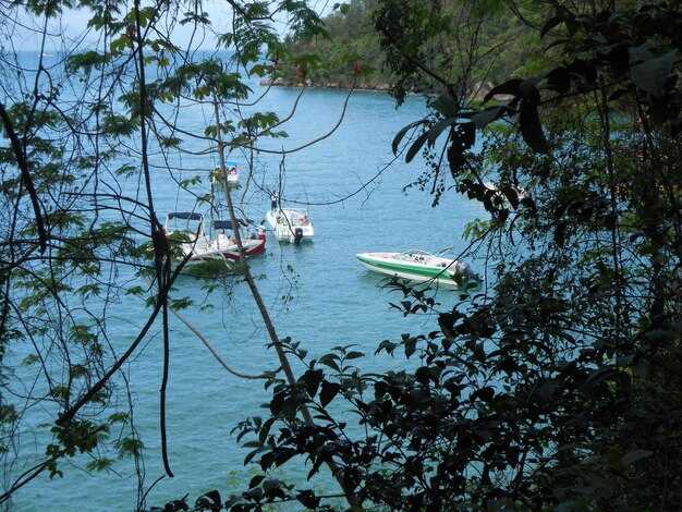
anchoring tips: In protected bays, pick sand bottoms rather than rocky patches. Use a long scope and set your anchor with a second line if wind shifts are possible. In mangrove lagoons, watch the trunk of the vegetation as you pick your spot to protect roots and avoid chafing. Your crew should maintain a protective lookout for boats passing along the shoreline and adjust if you hear shallow water or see fish activity.
night moorings near parks and beaches let you enjoy starry skies and gentle surf. If you plan a night departure, check access points and lighting at the harbor. Make a walking plan along nearby trails to catch the sand scent at dawn, then return to your vessel well rested for the next leg of your usvi routes.
Day-Trip Routes: St. Thomas to St. John and Water Island
Begin at Red Hook Harbor at 9:00 a.m., head for Honeymoon Beach on Water Island, anchor in a shallow area, and enjoy a 45-minute snorkel along the reef. From there, sail 9–11 nm to Cruz Bay, St. John, and drop anchor near the waterfront for a stroll to cafes and the National Park trailhead. Then travel north to Trunk Bay or Cinnamon Bay for a relaxed beach stop, before returning to Red Hook or the Charlotte Amalie harbor by sunset.
Keep charts current, monitor winds and currents, and keep a VHF on Channel 16 for local safety updates. Favor calm mornings, and allow 4–5 hours total for the core loop, with extra time if you want to linger ashore for lunch or a quick hike on St John.
Stops and Timing
| Leg | Distance (nm) | Duration (hrs) | Uwagi |
|---|---|---|---|
| St. Thomas (Red Hook) → Water Island (Honeymoon Beach) | 4–6 | 0.75–1.25 | Calm anchor area; snorkel along reef; easy entry |
| Water Island → Cruz Bay, St. John | 9–11 | 1.5–2.0 | Dock or anchor near waterfront; cafes nearby |
| Cruz Bay, St. John → Cinnamon Bay or Trunk Bay | 6–8 | 1.0–1.5 | National Park beaches; photo spots |
| Cinnamon Bay/Trunk Bay → Red Hook / Charlotte Amalie | 18–22 | 3.0–3.5 | Return leg with scenic views; watch for currents |
Optional add-ons: a short lunch ashore, beach chair rentals, or a guided on-board briefing covering reef etiquette and safety considerations. Make sure to have a backup plan if winds shift and tides rise, and keep a flexible pace to enjoy the islands without rushing.
Charter Options: Bareboat, Captained, and Crewed Charters
For most travelers in usvi, a captained charter is the best starting point. A captain handles weather decisions, navigation, and mooring choices, while you explore island beaches and little-visited coves and sandy shores. If you arrive on convenient flights, the captain can adjust the pace so you still reach parks and beaches before sunset.
Bareboat charters suit experienced sailors who know winds, currents, and the quirks of USVI waters. Expect to handle navigation and docking, including maneuvering over reefs and through crowded marina zones. Pack light and plan routes over open water to island-hopping segments, with clear safety margins. This option works best for a confident crew who can read weather and adjust plans on the fly.
Captained charters offer a skipper plus optional crew, letting you set a pace that matches everyone. Plan days that explore lovango, ride to beaches along sandy coastlines, and loop through parks and trails that show little-visited corners. The captain handles routes, weather decisions, and marina calls, while you enjoy the scenery and conversation with a built-in guide–also someone like cyril or james who knows the best anchorages and snorkel spots.
Crewed charters step up with a full crew: captain, chef, and host who coordinate provisioning, meals, and daily schedules. Expect a tailored island-hopping itinerary that balances time aboard with on-shore adventures, such as hiking trails, beach days, or a visit to a protected park. A crewed charter feels like the king of comfort, letting travelers rest while the crew handles navigation, weather checks, and shore services at every marina.
Decision guide: start with captained or crewed if you want ease, local know-how, and the option to adapt on the fly; thats a practical plus for first-time island hopping. Bareboat fits experienced sailors who want maximum control and a lower price. In usvi, many routes connect St Thomas, St John, and other anchorages where travelers can explore over beaches and trails. Lovango and other spots offer sandy shores, clear water, and easy marina access. Pack your bags, and coordinate with your crew to arrange flights, provisioning, and guided experiences that fit your schedule and weather. This approach works well for travelers who want to explore over multiple islands and parks while staying flexible and comfortable.
Anchorage and Marinas: Where to Stop for Fuel, Repairs, and Overnight
Dock at Yacht Haven Grande on Saint Thomas for fuel, repairs, and an overnight slip. This major marina offers a full-service fuel dock, on-site marine shop, secure slips, and protective breakwaters. Reserve ahead; during peak season a quick turnaround at the fuel dock keeps your schedule on track. The waters here stay calm under typical trades, with the south-facing head of the harbor delivering easy access to shore facilities, provisioning, and nearby dining.
Major marinas and fueling points
Two strong options anchor your usvi itinerary: Yacht Haven Grande (St Thomas) and American Yacht Harbor (Red Hook). Both offer available slips, repair services, and reliable fuel docks, and they sit within easy reach of protective coves and bays for shorter hops between isles. For a straightforward stop, these marinas provide showers, laundry, provisioning, and crew-friendly services–perfect for a married crew seeking smooth logistics. Buck Island sits nearby as a common day-trip target, pairing sheltered head seas with great snorkeling opportunities and turtle sightings when conditions cooperate. IC-24 channels help you coordinate with harbor control and approaching traffic along the south shore.
Anchorage and overnight options
If you prefer anchorage, seek free or low-cost spots in protective coves along the south and west shores. Within two-thirds of a mile of shore you’ll find bays with solid holding and a lively sea life where you can rest for the night. These anchorages offer a quiet alternative to dockage while keeping access to the life ashore, trails, and snorkeling sites on nearby isles. Buck Island provides sheltered water and a short nature hike, making it easy to combine an early morning swim with a shoreline walk. When planning the next leg, monitor IC-24 for updates and watch for favorable weather windows to keep your voyage within the usvi pace.
Navigation Rules and Local Hazards: Currents, Shallow Passages, and Tides
Start with updated charts and tide tables before every leg; plot a route to avoid shallow passages and sand banks around Lovango and the head of the north coast, and keep a backup plan for a quick hop to a safe harbor. While you plot, november winds can shift in the afternoon, so slow to near shoals and monitor wildlife along the Parks. Airliners overhead create noise but do not affect navigation or radio; pack lunch and keep a mind on the energy of the crew. You want to stay ahead of fast-changing currents and choose calmer coves for a mid-trip break.
Currents and Navigation Rules
Currents run with the tide along the north shore, especially near Lovango. Sailing and cruising craft need space in congested channels; give right of way to crossing vessels and stay clear of shoals. Use VHF channel 16 for emergencies and check charts for buoy positions and shoal warnings. The guide and updated charts are available online, helping you plan the most efficient routes while avoiding shoal areas. Mind the depth when passing near parks and wildlife refuges; parrot sightings and other wildlife may appear in calm bays, so maintain a respectful distance and stay clear of nesting sites. The most breathtaking wildlife often gathers along coral lagoons, so keep an eye on the water while you cruise. Several routes around Lovango offer safe choices for cruising, and you can enjoy the journey without rushing.
Shallow Passages, Tides, and Practical Tips

Shallow passages demand careful steering and a clear plan B. Use depth sounder and charts; if your draft exceeds shoal depth, pause or choose a route around Grande and Lovango. At low water, channels shrink; plan for mid to high tide windows. When crossing unfamiliar inlets, align entrances with headlands and use visible landmarks for navigation; watch for shifting sand shoals driven by wind and current. The last thing you want is a shoal surprise, so several shoal patches shift with current, and you should adjust speed accordingly. The most enjoyable lunch breaks occur in sheltered ponds or calm harbors near wildlife parks; you can stretch legs, observe wildlife, and many guests, married couples included, enjoy the moment. If a swimming break is needed for cooling, choose a safe area with calm conditions and keep mind on wind changes and weather.
Seasonal Windows: Weather Patterns, Trade Winds, and Booking Tips
Book your Virgin Islands sailing during the dry season (November through April) to secure steady south-to-northeast trade winds, calmer seas, and less rain, making anchoring easier and your day-by-day plan more predictable.
Wzorce sezonowe
- Dry season (Nov–Apr): NE trades, 15–25 mph; seas offshore typically 2–5 ft, with calmer water in protected bays along the south area. Great for island-hopping between isands like St. Thomas, St. John, and St. Croix; there are several anchorages with palm trees along the shorelines, and navigation feels straightforward for both sailors and beginners.
- Wet season (May–Oct): afternoon showers and higher humidity; winds can shift and squalls may form quickly. Plan around weather windows of 4–6 hours for sailing days; theres more variability, so choose routes that keep you within easy reach of havens and national parks when needed.
- Hurricane season (Jun–Nov): elevated risk; monitor the National Hurricane Center advisories; keep a flexible plan and have a fallback haven in mind. Pack light but robust safety gear; travelers should stay alert and adjust itineraries within a day if a storm approaches.
- Best windows for wildlife and beaches: early mornings and late afternoons often offer calmer water and better visibility for swimming and exploring the coastline where wildlife thrives; explore along the coastlines and beaches, and pack a camera for stunning moments.
Booking Tips
- Start planning 8–12 weeks ahead for peak-season slots; early booking secures preferred boats, dates, and departure points like Charlotte Amalie or Red Hook.
- Be flexible with routes within the area to catch cleaner seas and favorable wind alignments for island hopping between islands; if a day looks rough, shift to sheltered coves or nearby bays.
- Ask about mooring options–some anchorages use mooring balls instead of anchoring; bring a short line and know mooring etiquette to minimize impact on the marine environment.
- Pack light but complete: reef-safe sunscreen, rash guards, water shoes, a waterproof bag, and a compact first-aid kit; include a light sweater for cooler nights and a small headlamp for after-dark checks along beaches and coves.
- Plan provisioning within reach of the marina or harbor towns; most travelers find reliable options in the national towns and island markets, but verify delivery windows in advance.
- Navigation and safety: confirm chart updates and weather forecasts daily; stay mindful of currents and tides, especially when anchoring or entering narrow passages; keep the mind on boat handling and crew duties at all times.