

 Florida Boating Guide – Where to Boat in Florida – Top Spots">

Start with the Gulf coast corridor around the Tampa Bay area to maximize calm shallows, quick entry, and access to major harbors. This choice minimizes risk and offers reliable wind patterns for a first exploration, with a unspoiled coastline experience and a clear design for safe navigation along coastlines.
Along the Atlantic stretch, a sequence of city hubs forms a practical region for year-round cruising. Incredibly generous shallows and river mouths create a flexible corridor for day trips, with calm bays and beaches feeding culture-rich anchorages. Maintain alert for shifting currents and tidal rates as you move between harbors and inlets.
Od busiest entry points such as Miami, Fort Lauderdale, and Palm Beach, the opportunities for slip availability, fueling, and quick hops along the coast are unparalleled. Here, culture thrives on water traffic, with lively harbors and a strong wind breeze that shapes daily plans. Stay alert to congestion and commercial traffic in major channels.
Beyond the metro corridors, the panhandle and the north Atlantic region offer unspoiled river routes and shallow entry channels. Projekt your itinerary with a focus on sheltered harbors and safe moorings; monitor currents and wind forecasts to avoid strong gusts and to align with the prevailing rates for fuel and moorage.
Rankings compiled from anchorages, accessibility, and slip quality place these coastal districts high; for a first-time voyage, target a major port with a shallow approach and a stable slip that can be reserved ahead. The combination of calm shallows, a bustling culture, and diverse river currents makes this route incredibly adaptable for any season.
Choose your region based on wind windows; if forecasts were uncertain, adjust your plan toward calmer passages. The best opportunities lie where traffic, culture, and unspoiled coastline converge.
Top Sarasota Boating Spots and Access Points on Florida’s Gulf Coast
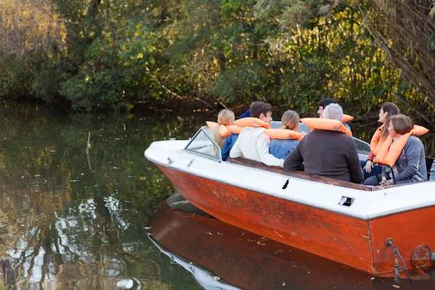
Start at downtown Marina Jack and launches a watercraft for a 2–3 hour loop through Roberts Bay, around Lido Key, and back through New Pass toward Longboat Key; this well-spent plan taps into energy here on the coast and proves ideal for families seeking a safe, wildlife-filled escape.
-
Downtown Sarasota Harbor & Marina Jack – On-site fueling, restrooms, and a short ride to Roberts Bay; this hub makes the first stop for many trips, offering easy access to a protected corridor and skyline views.
-
South Lido Public Access (Lido Key) – Direct gulf-entry ramps into Big Pass; coral formations nearby, ideal for short loops and wildlife watching; parking is limited on crowded days; best at sunrise or late afternoon.
-
Blackburn Point Park Access (Nokomis) – A sheltered entry to the intracoastal route toward residential canals and small islands; carry essentials, enjoy the mangrove canopy, and watch for manatee.
-
Casey Key & New Pass Area – Two linked launch points along a gulf-channel loop; include beach stops and island views; especially good for photographer families; trips lasting 1.5–2 hours.
-
Longboat Key Access Points – Channel launches near Longboat Pass; connect to Anna Maria Island or continue south toward the mainland; beware shallow bars at low tide and follow marked channels.
-
Johns Pass Corridor (for extended trips) – A longer route that channels vessels toward the Panhandle coast; this work requires current maps and local advisories; it broadens options beyond the core Sarasota area.
-
Islands & Wildlife Spots – Siesta Key, Lido Key, and neighboring islets offer beaches, coral patches, and manatee-watch opportunities; families frequently spend time watching dolphins and shorebird roosts; the energy here is widespread and inviting to miamis locals and visitors alike.
News: Always check local advisories before launching; wind shifts and currents can change conditions quickly; carry a VHF radio, life jackets, signaling devices, and a chart; public ramps here generally offer parking and fuel services, and access has become a popular weekend activity, making this area a go-to for residents and visitors who want a quick trips option that can be executed as a loop or as part of a longer cross-coast run.
Ramps, Marinas, and Access Points in Sarasota
Start your day at South Lido Public Boat Ramp for swift access to gulf passes and calm mornings, then head toward crescent beaches a short paddle away. plan to launch near first light, when winds are mild and reefs and schools of fish are easier to spot from the bow.
Ramps and access points number four main public launches around the island and mainland corridors: South Lido on the island of Lido Key, Nokomis Public Boat Ramp, Siesta Key Boat Ramp near Crescent Beach, and Venice Public Boat Ramp. Operators staff each site with parking, basic docks, and restrooms; remain courteous in busy hours, especially around residential channels their neighbors rely on for quiet mornings.
Marinas anchor the waterfront with tangible services: Marina Jack on the bayfront offers transient slips, fueling, and dining, making it a popular start or stop for swift hops. Residential and smaller private marinas line the inland canals and island backwaters, with their own access points and limited provisioning. Operators here emphasize efficient turnover for recreational craft while keeping safety a priority.
Access points thread the coast from island neighborhoods to the intracoastal, providing straightforward routes to inlets and reef edges. In mornings, plan for light currents and check weather windows; socializing on docks is common, yet respect the pace and space of nearby residents while you coordinate moves with their crews and guests.
For longer ambitions, many skippers map routes toward Jupiter or Lauderdale, timing crossings with favorable winds and the weather. Inland connectors via the okeechobee waterway beckon for multi-day itineraries; confirm current conditions with operators before committing to that leg. From the local ramps, keep a steady plan, watch the reefs and schools, and remain aware of other vessels’ priorities as you share the water from dawn to dusk.
Best Seasonal Routes: Gulf of Mexico vs. Intracoastal Waterway
Opt for a Gulf coast run in late fall through winter for short crowds and vast, uninterrupted banks. A week-long transition to the Intracoastal Waterway offers a convenient, harbor-hopping cruise without crowds. Boaters can combine both routes for a balanced itinerary. One week covers most highlights.
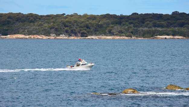
From Tarpon Springs to Naples, roughly 350 miles of navigable coast unfold with mangrove banks and open flats. In the cooler season, water temperatures range around 60–75°F, winds stay light, and beaches along the coast remain enjoyable for day trips. This stretch offers expansive coastal views. Marinas along these stops handle millions of visits annually, amenities included, so booking in advance is wise.
On the Atlantic Intracoastal Waterway, expect a sequence of sheltered passages between barrier neighborhoods, with easy contact points at marinas, shops, and parks. Each neighborhood along the ICW offers unique dining and dockside services. Those seeking a calm, learning-friendly cruise will find a vast corridor of lagoons and inlets around Amelia Island, Jacksonville, Daytona, Cape Canaveral, Palm Beach, and Miami. A local store is available in many towns, and rest stops near communities; this segment examines seasonal wind patterns and crowd trends to help plan windows. Park facilities along the route support restful days. The corridor remains popular with students and families, but you must watch weather and stay within limits for depth and lock spacing. Does this plan fit a student schedule? It does. Those preferring a shorter, predictable cruise can plan a two- or three-day hop between marked channels.
No-Wake Zones, Speed Limits, and Navigation Rules You’ll Encounter
Begin by respecting marked no-wake zones and keeping idle speed along nearshore corridors; thats the quickest way to protect shorelines, seagrass beds, and nesting habitats. Respond to posted signs and buoys, as an abundance of markers helps you stay compliant in bustling coastal waters of the state.
Speed limits are posted clearly; in no-wake zones you must be at idle or at the slowest practical pace. In channels and passes, adjust to conditions–traffic, currents, and wildlife can demand lower speeds. Additionally, monitor weather, wind, and crowds; boater concentration can change quickly in bustling harbors, so plan your approach with caution.
Navigation rules you’ll encounter include right-of-way procedures, safe passing, and signaling requirements. Remember red markers on your right when returning to shore and green markers on your left; keep to the channel center, yield to vessels restricted in maneuverability, and avoid crossing ahead of commercial traffic.
Safety and etiquette: nearshore areas demand respect for crews and visitors alike. For visitors renting gear, keep a safe distance from paddlers and crab pots. Plan a looping route that minimizes back-and-forth traffic; arrange stops at marinas and parks with a compact schedule, and tailor your style to conditions. Maintain proper safety gear and communicate with your crew; college crews and recreational groups often practice in busy bays, contributing to the bustle. If conditions change, respond quickly and adjust.
Required Safety Gear and Quick Checks Before Leaving the Dock
Put on a properly fitted, USCG-approved life jacket for every passenger aboard before leaving the dock. This simple action saves lives and helps ensure compliance across the country, which varies by region and area, and which supports a safe start to your journey.
This checklist helps cover everything you need for a safe departure and offers an opportunity to rehearse quick drills with those aboard.
- Abundance of PFDs and throwable devices: ensure one USCG-approved life jacket per person on board, with a readily accessible throwable device; visiting crews should have sizing adjusted to fit quickly.
- Light devices: navigation light, deck light, and anchor light; verify operation before dawn or dusk and keep a waterproof flashlight with spare batteries on hand.
- Fire extinguisher: type B:C, mounted in an accessible location; check the gauge and inspection tag for the current year.
- Sound signaling: whistle or horn with a spare, plus a loud signaling option for low-visibility situations.
- First-aid kit: include antiseptic wipes, bandages, gauze, tweezers, and emergency contacts; store in a dry, accessible container.
- Communication devices: VHF radio on channel 16; moonlit or distant operations may rely on a handheld unit to allow contact if the main unit fails.
- Tools and spares: bilge pump or bailer, spare fuses, duct tape, pliers, and engine-specific spare parts for those running older or regional models.
- Provisions for safety and comfort: ample water, sun protection, appropriate clothing, and non-slip footwear for boarding and disembarking in various locations along the coast.
- Rope and anchor kit: a long length of line for MOB recovery and a reliable anchor with sufficient chain or rope to hold in the chosen area.
- Documentation bundle: vessel registration, insurance details, and emergency contact information in a dry bag for quick access if needed.
- Weather and tides: pull live forecasts from NOAA/NWS, check gusts, seas, and a potential shifting pattern; if advisories exist, postpone if your craft cannot handle the conditions on the next leg.
- Hazards and proximity: identify sandbars, shoals, distant rocks, and river mouths; review current location with marks and charts, and slow to near-idle speeds in shallow or crowded locations.
- Fuel and range: calculate burn rates for your cruise speed; ensure ample fuel for planned distance plus 25–40% reserve; example: if your craft burns about 6 GPH at cruise and you plan a 2-hour run, carry at least 15 gallons on board depending on tank size and distance.
- System readiness: test kill switch, verify throttle response, steering control, and trim; start the engine and listen for abnormal noises; check bilge for leaks prior to leaving the dock area.
- Lights and signaling: confirm all running lights and an anchor light operate; verify audible signals are functional for day or night operations; ensure you can signal if visibility is reduced.
- Communication plan: keep VHF on 16 when underway; have a backup device to contact the marina or country-wide coast guard if needed; establish who to call if conditions deteriorate, which improves your response time.
- Crew readiness: brief everyone on MOB procedures, life-jacket fit, and hand signals; assign roles to those aboard to speed up decision-making in rough conditions.
- Float plan and coordination: share a float plan with a trusted contact on shore; note your intended route through the area and the approximate times; include a plan to modify the itinerary if hazards or proximity to shorelines change.
- Route planning note: if heading eastward toward open water, keep a watchful eye on channel markers and ensure you can reach a safe harbor or shore quickly if wind or seas rise; avoid distant routes without landmarks.
Rentals, Charters, and Local Guides for Sarasota Waters
Begin with a Hillsboro-area 4-hour sailing charter that includes a sandbar stop and palm-fringed shore; this test run keeps you within limits and delivers an impressive introduction to these waters.
Planning should present a pile of options that fit group size and budget; a variety of vessels range from compact sailboats to roomy pontoons. Popular choices include private charters and guided sailing experiences, with flexible itineraries that can swap to snorkeling or sunset routes. Many marinas have a store on-site to rent extra gear or grab essentials.
Notes on inclusions: verify insurance coverage, life jackets, and required safety gear; many operators include basic equipment, while some offer add-ons like snorkeling gear or fishing rods. Rates vary by boat size, duration, and demand, so confirm inclusions and cancellation terms before booking. That builds confidence with clear briefings and practiced routes.
Local guides reveal gems around Hillsboro, bays, and lakes within reach; they often tailor routes to your scene, and policies allow adjustments for weather, while delivering a skyline backdrop that recalls downtown Tampa at dusk. Respect for wildlife and habitats is expected, and guides help you stay within regulations while maximizing safety and enjoyment.
| Operator | Rental Type | Duration | Included | Rates | Uwagi |
|---|---|---|---|---|---|
| Sunset Sail Co. | Charters | 4 hours | Life jackets, fuel, basic gear | $320–$520 | Insurance available; popular for families |
| Sandbar & Palm Tours | Guided Rentals | 2–3 hours | Guided route, safety briefing | $180–$260 | Great for beginners; plenty of photo ops |
| Harbor Stars Charters | Private Charters | 4–6 hours | Boat, captain, safety gear | $450–$900 | Includes notes on local wildlife; flexible itineraries |