

 How to Create a Float Plan – The Complete Guide for Safe Boating">

Write a written float plan today and share it with guardians and the operator before you head on-water.
Your plan should cover the on-water route, the estimated return time, and contact methods for contacting the crew if plans shift. Include the boat name and operator, a line of reference points such as a tower or shoreline markers, and, if available, coordinates. If you can, add a demos section to illustrate how the plan works in practice so guardians can see what to expect.
Before departure, contact guardians by call or text to confirm receipt of the plan, and ensure you have a backup contact. Save the plan in a written file above the console and also keep a copy on your device. Define what to do if contact is lost, and set a check-in cadence so your crew knows when to expect updates back from you.
During the trip, keep a portable power source, maintain radio contact with the operator, and be ready to adjust the plan if conditions worsen; update guardians with a quick status, a brief message, or a short call at milestone times. Maintain a clear timeline above the plan to show progress along the route, and if possible share photos or status updates at key points on-water.
Practical Float Plan Setup for Safer Boating
File a float plan before departure that specifies where you head, your intended line of travel, ETA, and planned check-ins; creating a clear, shareable document helps guardians and authorities stay aligned and reduces risk.
Assign guardians among crew or trusted contacts who monitor milestones, confirm arrivals, and trigger alerts if you drift off schedule; their prompt actions build trust and keep operations smooth.
Stock tools for real-time updates: a VHF radio, a satellite messenger, a chart plotter, and a spare battery with sufficient charge; test channels, set the course, and save the plan for quick reference, with sound alerts for missed check-ins.
Document contingencies for certain weather, currents, and daylight; include alternate routes and a line for filing with the coast guard or port authorities; list where to submit the plan and when to update it to keep operations transparent.
For activities like fishing or skiing, log specifics in the plan, including fishing zones and where skiers may cross; indicate what to expect from responders, show expected message times, and how to notify nearby boats if plans change; include a numbercolor marker to help responders identify you on charts.
Set a practical communications schedule: check-in every two hours, or more often in rough seas; specify radio channels and emergency codes, and ensure you can receive a quick reply; keep a copy with guardians and in the cabin, and follow uscg guidance for training or templates to support safe operations.
| Element | Details | Owner | Opmerkingen |
|---|---|---|---|
| Route & ETA | Coast-to-offshore path; waypoints A→B→C; ETA targets; check-in windows | Captain | Maintain daylight limits |
| Communicatie | VHF 16, 69; satellite messenger; message templates | Bridge | Test pre-departure |
| Safety Gear | Life jackets, throwable, flares, radios | Bemanning | Batterijcontroles |
| Filing & Records | Float plan filed with authorities; copy kept aboard and with guardians | Captain | Include numbercolor codes |
| Contingencies | Weather shifts, currents, alternate routes | Operaties | Update if conditions change |
Define Trip Details: Route, ETA, and Weather Window
Draft a written route and ETA now, save it as a template, and keep it within reach onboard. The plan should describe departure, next waypoint, pace, and a target arrival window so the crew can review at a glance and give feedback.
Plot the route along the coast from your marina to the next marina or to a trusted fishing spot, marking each leg with coordinates, distance (in nautical miles), and expected time. Use a visible line on the chart to connect points and describe the features of each segment, described here, including terrain, current, and potential hazards close to shore.
Set the weather window as a practical range you can rely on: forecast wind under 20 knots, seas under 2 meters, and visibility at least 3 miles. Prefer a window that covers the next watch, with a buffer to handle small changes in wind or swell. Check trusted sources and write down the forecast time, then compare it with your ETA at each waypoint to confirm the setting.
Build in sufficient margin for safety: add a priority fallback leg if conditions shift, and assign crew tasks so they can respond quickly. Give them clear responsibilities onboard, such as monitoring weather, managing lines, and keeping gear ready. If the forecast isnt favorable, you have a backup on deck and in the engine room, and you can hold position near a safe harbor until conditions improve. This approach reduces worry and keeps operations smooth and controlled. This level of planning also enhances the experience aboard.
Document and store the plan in your setting as a written record, for example in the ship’s log and on the onboard tablet. The template should be described with the next steps and the gear required, so the crew has a trusted reference. Share it with them before departure to avoid miscommunication and to speed decisions when speed changes or visibility drops.
After departure, maintain the same practice: review the route and ETA at the coast, confirm the float plan with all hands, and update the template as conditions change. Revisit the plan during the voyage and close the loop when you reach the next waypoint, using the written record to guide decisions and to hold the vessel on a safe heading. This document is the float plan, commonly called a float plan.
Record Vessel and Crew Info: Registration, Licenses, and Safety Gear
First, hold a single, up-to-date log that records registration numbers, license IDs, and safety gear checks, and keep it in a dry pocket near the helm for quick reference before every trip.
Record details: vessel name, hull ID, registration number, issuing authority, issue date, and expiration. Keep both a paper copy and a digital scan saved in a cloud location you trusted. This found reference saves time if you ever need to respond to questions from coast guard or harbor staff.
Licenses: ensure each operator holds a current certificate appropriate to the vessel, with expiry date clearly listed. Create a roster that includes each member name, role, license type, license number, and contact method. If someone didnt have a license for their role, assign a different task or return to shore. Keep these records on board and in the cloud for safety.
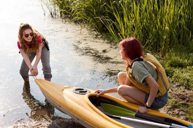
Safety gear: every person onboard wears a U.S. Coast Guard–approved life jacket; ensure sufficient life jackets for all passengers and that they fit properly. Keep a throwable flotation device within reach, a whistle or sound device, and a fire extinguisher that is inspected and not past its expiry. Have a first-aid kit, reliable communication devices, a GPS or handheld radio, and spare batteries. Carry a cell phone in a dry pouch as backup to the radio. Keep space free from clutter so you can grab gear quickly.
Checklist before leaving: verify registration numbers match vessel name; confirm licenses are valid; inspect safety gear: PFDs in good condition, throw bag accessible, fire extinguisher within date, signal devices current, VHF radio ready, backup light and battery, and a spare fuse. The point is to have everything visible and portable, and save a quick list of emergency contacts on the device and in the log.
When boating near the coast, especially around fishing boats and kayakers, reduce speed, keep a safe distance, and make planned passes with signaling. Use your VHF or a cell-based communication to confirm intentions. If a nearby vessel or person needs help, respond with a clear action and log the event. Keep the crew member responsible for communications informed and ready to advise course corrections.
Love for boating grows when you prepare and protect everyone on board. Review the record before each trip, update after maintenance or crew changes, and store copies in a cloud that you can access from shore. This habit saves time and helps you stay safe on every outing.
List Emergency Contacts and Reporting Points
Print a standard template of emergency contacts and keep it with your float plan; review and update it every few days of planning.
List authorities and reporting points clearly, including check-in schedules and the location where you report a problem.
For each contact include name, role, daytime and after-hours numbers, their vessel or company, and a cell or satellite device you can use to reach them.
Assign a person on board as the lead for reporting; store their direct contact and a backup contact so you can reach someone during operations.
Keep the information on at least two formats: a printed copy and a digital copy on your devices; both should stay accessible during drift or wind conditions.
Include reporting points along the route and times; the expected check-in windows help responders track progress amidst shifting conditions.
Record the gear and devices on board that you may need for self-rescue or signaling, and note their locations, so a responder can reach the right person quickly.
Verify the numbers regularly, and test your plan with a dry run; wrong numbers or outdated contacts waste time and risk safety.
Keep a live log of updates, including days since the last change and any new authorities or reporting points you add; that keeps everyone aligned.
Bewaar de bron voor elk contact en noteer waar de informatie vandaan kwam voor check-in vanaf een externe locatie.
Navigatie- en communicatieprotocollen instellen: VHF/DSC, posities en signalering
Stel nu een masterplan voor VHF/DSC in en train iedereen hierin. Iedereen moet de primaire zender voor routinegesprekken, de DSC-sequentie en de spraakprocedure voor noodsituaties kennen. Houd een gelamineerd blad bij de navigatietafel met de naam van het schip, de MMSI, de zenderlijst en duidelijke stappen voor 'man overboord'. Gebruik apparaten die zijn ontworpen voor redundantie: een vaste VHF, een draagbare VHF en een epirb in de greepzak. Binnen enkele minuten na vertrek, verifieer of de bemanning die dienstdoet naar de noodzender kan schakelen, en voer een snelle oefening uit wanneer u een jachthaven bereikt of zeilt met vrienden in de buurt, zodat hulp het schip snel kan lokaliseren. Dit omvat bepaalde weerkundige controles, verkeersinzicht en contactgegevens voor noodgevallen.
Posities en signalering zijn afhankelijk van GPS/DSC-uitzendingen. Noteer de positie als Lat/Long of raster, voeg de tijd toe en verzend indien mogelijk via DSC. De hoofdopzichter moet ervoor zorgen dat de log aangeeft welke persoon van de bemanning dienst heeft, welk kanaal in gebruik is en welk apparaat wordt gebruikt om het schip te lokaliseren. Deel positierapporten met regelmatige tussenpozen (elke 5-10 minuten onderweg; vaker bij ruwe zee) en markeer eventuele afwijking in koers of snelheid. Als een noodsignaal verzonden wordt, zorg er dan voor dat de apparaten de waarschuwing naar alle nabijgelegen schepen en de kustwacht via DSC sturen, epirb indien VHF faalt, en een visueel signaal indien de zichtbaarheid het toelaat.
Signaleringspraktijken benadrukken helderheid. Gebruik visuele signalen, zoals vlaggen of lichten, om radioberichten aan te vullen, vooral in drukke golfkanalen of drukke jachthavens. Wanneer u zich in de buurt van een ander zeilboot of aangrenzende boot bevindt, bevestigt u het begrip met een kort radiobericht en erkent u de reactie met een visuele bevestiging. Als u het contact verliest, herhaal dan de oproep op een ander kanaal en overweeg een hoorbare waarschuwing aan de bemanning. Of u nu solo vaart of met een bemanning, een beknopte, herhaalbare signaleringsroutine houdt iedereen op één lijn en vermindert vertragingen.
Final checks after planning: name, callsign, and MMSI on every screen, ensure the epirb is within reach and tested, and verify that all devices are charged. The plan should cover who calls, who logs, and who looks out for hazards. In gulf crossings or long coastal legs, make sure the master and crew members know when to arrive at the next waypoint or port. Keep a quick-reference sign near the helm and a spare unit in the bag. This proactive setup lets friends, neighbors, and crew stay informed, improves response time, and keeps safety plans free from gaps.
Deel, archiveer en update uw plan: waar u het kunt indienen en hoe u het kunt wijzigen
Dien uw drijfplan in bij het USCG-portaal voordat u vertrekt, en deel kopieën met uw contactpersoon aan wal, zodat iedereen op één lijn blijft. Indien beschikbaar, dien ook in bij de autoriteit voor de scheepvaart van uw staat. Gebruik hetzelfde kanaal om wijzigingen aan te brengen, te annuleren of details toe te voegen tijdens het vissen, zeilen en varen. Wanneer de plannen zijn vastgesteld, stuur dan de definitieve boodschap naar alle betrokkenen om de route en verwachtingen te bevestigen.
- Waar indienen
- Dien in via het USCG-portaal; kopieer ook uw staatsvaartautoriteit en de marina of zeilclub die u gebruikt.
- Geef een kopie aan een onshore contactpersoon die snel kan reageren als de autoriteiten updates aanvragen.
- Zorg ervoor dat iedereen die in het plan staat toegang behoudt, zodat er snel gereageerd kan worden.
- What to include
- Neem op: naam van het schip, roepnaam, afmetingen (lengte en breedte), rompkleur (blauw indien van toepassing) en motorgegevens (merk, model, vermogen).
- Geplande route: punt van vertrek, bestemming, tussenliggende waypoints en geschatte aankomsttijden op belangrijke punten.
- Aantal passagiers en rollen aan boord (kapitein, navigator, uitsichtwaarder, bemanning en eventuele gasten).
- Veiligheidsuitrusting en -materieel: reddingsvesten, VHF-radio, flares, EPIRB, brandblusser, verbanddoos.
- Geplande activiteiten: vissen, zeilmanoeuvres, slepen of demonstraties van reddingsprocedures bij een man overboord.
- Landmarken om te lokaliseren: toren, baken of oeferkenmerken; noteer eventuele gevonden of alternatieve referentiepunten.
- Contingenties: weer, stromingen, havencongestie, en eventuele verzekerings- of maritieme-dekkingsaspecten.
- Klaarheid status: bevestig dat iedereen is ingelicht, uitrusting is veiliggesteld en passagiers klaar zijn voor vertrek.
- Verzekeringsgegevens: verzekerde, polisnummer en dekkingsomvang voor het geplande gebied.
- Houd rekening met factoren: weersomstandigheden ter plaatse, getijden, verkeer en mogelijke vertragingen om het herschrijven van de planning te bepalen.
- Neem een notitie mee voor de respondenten: het definitieve plan, contactpersoon aan boord en verwachte aankomsttijden.
- Zorg er vervolgens voor dat er een plan is om de boot te lokaliseren als deze afdrijft of onverwacht van koers verandert; er is altijd een back-up.
- Hoe aan te passen
- Update onmiddellijk bij elke wijziging in de route, ETA, bemanning of bestemming.
- Dien wijzigingen in via hetzelfde kanaal dat u hebt gebruikt om het plan in te dienen; voeg “wijziging” toe aan de boodschap en verwijs indien mogelijk naar het oorspronkelijke plan.
- Als er iets verandert, is er urgentie om het bestand bij te werken en uw onshore contactpersoon en de autoriteiten te informeren.
- Als het plan wordt geannuleerd of u vertraging oploopt, stuur dan een laatste bericht om het bestand te sluiten en verwarring bij de hulpverleners te voorkomen.
- Vraag een ontvangstbewijs of bevestiging van de update aan en houd deze bij de hand om vragen van de USCG, verzekeringen of uw contactpersoon aan wal te kunnen beantwoorden.
Zorg ervoor dat iedereen klaar is om snel te reageren, en dat uw bemanning de laatste wijzigingen begrijpt. Door deze stappen te volgen, behoudt u gemoedsrust voor bootuitrusting, passagiers en verzekeraars, en iedereen weet hoe de laatste versie van uw plan te lokaliseren in rustige wateren of te midden van een drukke dag op open water.