Understanding the Beaufort Scale - Wind and Sea Conditions in Greece
The world of maritime navigation presents unique challenges that require mariners to possess a comprehensive understanding of various environmental factors. Among these, the Beaufort Scale stands as an essential tool for recognizing wind and sea conditions, particularly in areas like Greece, where the motion of water and air can significantly affect both safety and performance. As advancements in technology allow for more accurate estimations of current conditions, understanding the Beaufort Scale can enhance a sailor's ability to prepare for the challenges they may face.
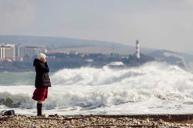
The Beaufort Scale, created in the early 19th century, provides a standardized method to describe wind force and its impact on sea behavior, ranging from zero to hurricane-force winds. This scale not only helps mariners estimate visibility and wave appearance but also serves as a testament to the observational skills developed throughout maritime history. During the stormy months of November, it becomes increasingly important for sailors and swimmers alike to pay close attention to the conditions described by this scale, as even high winds can lead to breaking waves that pose extreme risks.
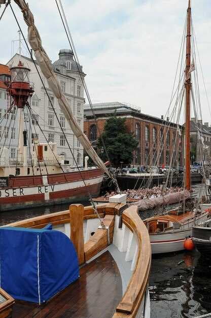
In Greece, the diversity of coastal regions further complicates the understanding of wind and sea conditions. Different areas may exhibit varied reactions to wind forces, leading to subjective interpretations based on local knowledge. By employing the Beaufort Scale as a guide, mariners can improve their decision-making, ensuring that cargo vessels and recreational boats alike maintain safe steerage in challenging conditions. This article will delve into examples of how the Beaufort Scale is applied in Greece, illustrating its importance in ensuring the survival of vessels and the safety of those on board.
📚 You may also like
The Beaufort Scale: An Overview
The Beaufort Scale is a timeless method for assessing wind and sea conditions, first introduced by Sir Francis Beaufort in the early 19th century. This numerical scale ranges from 0 to 12, providing a systematic way for sailors and meteorologists to evaluate the effects of wind on water and land, allowing for better navigation and safety measures.
Each category of the Beaufort Scale describes specific wind speeds measured in knots, as well as the resultant sea conditions and effects on different objects. For example, at a Beaufort scale of 0, there is no wind, resulting in a smooth sea with no waves and perfect visibility. As the scale progresses, the wind increases, causing wavelets to form and then advancing to larger waves capable of impacting ships and buildings alike.
The highest levels of the scale indicate significant forces that can break twigs from trees or cause more substantial damage, such as hurricanes. An experienced captain or marine officer uses this knowledge to prepare for different sea conditions, ensuring that their vessel can withstand the current forces of nature.
Although subjective, the Beaufort Scale remains an invaluable tool for sailors who need to remain cautious while paddling in Halkidiki or navigating in rougher waters. This scale helps create a shared understanding of the current weather conditions, allowing for better communication and decision-making at sea.
Advancements in technology, such as anemometers, have improved the accuracy of wind speed measurements. However, the Beaufort Scale is still widely used due to its simplicity and effectiveness in conveying essential information quickly. Whether assessing a gentle breeze or a severe storm, the scale provides a clear framework for understanding the power of the wind and the resulting impact on the marine environment.
What is the Beaufort Scale?
The Beaufort Scale is a timeless tool created to measure wind speeds and describe their effects on maritime conditions. Developed in the early 19th century by Sir Francis Beaufort, this scale includes descriptions that range from calm to extreme, significantly enhancing the understanding of wind's impact on sea operations.
One of the main features of the Beaufort Scale is its safety applications. For shipping and maritime craft, knowing wind speeds is crucial for ensuring safe navigation. As wind speeds increase, the anticipated effects on waves, visibility, and even the movement of objects at sea, such as twigs or larger debris, become significant. Anemometers often retrieve data that aligns with the scale's categories, providing valuable information for experienced sailors.
The scale classifies wind speeds from 0 (calm) to 12 (hurricane), each category illustrating the expected conditions. For instance, at Beaufort 6, or a "strong breeze," trees may sway more noticeably, while at Beaufort 8, or "gale," larger sea waves start to appear. Such details are vital for forecasting as they inform mariners about the conditions they might face.
In addition, the Beaufort Scale has been adopted in various regions, including Vietnam, to aid local maritime communities in understanding the potential impact of tropical cyclones and extreme weather events. This knowledge not only improves safety but also enhances the entire shipping and maritime industry by allowing for better planning and operations.
Ultimately, this scale provides a way to communicate about wind and sea conditions in a clear manner, ensuring that everyone involved–from casual paddlers to the operators of large cargo ships–can make informed decisions about their maritime activities.
History and Development of the Scale
The Beaufort Scale, established by Sir Francis Beaufort in 1805, represents a significant advancement in the ability to measure wind and sea conditions. This scale was designed to provide a standardized method for assessing and describing the effects of wind on the surface of the sea, which was crucial for maritime operations, especially for the navy. The specifications laid out in this scale have proven to be timeless, enabling ships to be better prepared for varying weather conditions.
Initially, Beaufort's focus was on the impact of wind on sailing vessels, particularly cargo ships. He defined 13 levels of wind force, each represented by a number from 0 to 12, and supplemented these with descriptive terms such as "calm," "light air," and "hurricane." This careful categorization allowed mariners to choose the appropriate course of action before their ships moved into more challenging conditions.
Through the years, the scale has evolved, incorporating advancements in meteorological knowledge and technology. In July, it was noted that wind forces could significantly affect vessel motion. Teams of meteorologists began to archive specific examples of weather patterns, following the influence of Beaufort's original work. The importance of understanding these phenomena has only increased, as changes in climate lead to longer streaks of extreme weather.
Beaufort's legacy is still visible today, as the scale is widely used in maritime and meteorological contexts. It has been adapted not only for traditional sailing but also for inflatable vessels and other watercraft. The forces represented by the Beaufort Scale remain crucial for safety on the water, ensuring that sailors and fishermen can make informed decisions regarding their ventures.
In places like Macau and Hong Kong, where maritime activities are vital, the Beaufort Scale has played a critical role in preparing crews for the changing conditions they might encounter. Objects such as flags and tree leaves serve as indicators of wind force, reinforcing the scale's practical applications in real-world scenarios.
Overall, the evolution of the Beaufort Scale signifies a critical development in the maritime field, showcasing the enduring need for effective weather measurement and the way it has become an integral part of nautical knowledge and safety practices.
How Wind Speed is Measured
Wind speed is a critical factor in maritime navigation, affecting the maneuverability of vessels and the safety of crews at sea. Various methods are adopted for measuring wind speeds, each providing essential data for assessing environmental conditions. The most common instruments used for this purpose are anemometers, which can significantly vary in design and functionality.
Monitoring systems involve both mechanical and digital anemometers that display wind speed in knots. The standard measurement is vital worldwide, especially in regions prone to severe conditions such as storms and hurricanes. Anemometers can calculate wind speeds by utilizing the forces that the wind exerts against them, allowing crews to navigate effectively, even under difficult circumstances.
During adverse conditions, such as what may occur in the presence of a cyclone, understanding wind speed becomes crucial. This is particularly significant in coastal areas like Greece, where large maritime traffic exists, and reliable navigation is required. In December, when storms are more frequent, the specifications of the measuring devices become even more critical. In experienced hands, these instruments help crews steer vessels safely through completely formed waves and adverse weather.
Additionally, visual assessments using flags can also offer a quick estimation of wind speed and conditions. For example, a gentle breeze may flutter a flag, indicating lower speeds, while extreme conditions can completely limit visibility and pose a threat to vessels carrying cargo. Therefore, using both technological and traditional methods is essential in ensuring the safety of maritime operations.
Ultimately, understanding how wind speed is measured and effectively interpreting those values ensures that crews can seek safe passage, thereby enhancing navigation while reducing risks in challenging environments. As a result, adopting the right terminology and tools is key for those who navigate the world's oceans, allowing them to manage forces of nature with confidence.
Application in Maritime Context
The Beaufort Scale plays a significant role in maritime operations, especially in Greece, where changing wind and sea conditions are frequent. Mariners rely on this scale to gain practical knowledge for safe navigation and sailing.
With advancements in measuring technology, such as anemometers, sailors are able to retrieve data that enhances their understanding of wind patterns and sea states. Although the scale primarily categorizes wind speed, it also provides insights into sea conditions that affect visibility and behavior of waves.
- Cargo Shipping: The Beaufort Scale is essential for cargo shipping, as it helps captains make informed decisions regarding when to set sail or when to seek shelter. For instance, higher Beaufort ratings indicate powerful winds that would create significant waves, impacting safe steerage.
- Marine Safety: Mariners must explore the parameters of the Beaufort Scale to ensure the safety of their vessels. A practical understanding of how wind affects the environment allows for cautious sailing, particularly in the upper ranges of the scale where conditions can shift quickly.
- Historical Examples: Historical incidents, such as Shackleton's expedition, demonstrate the devastating effects of ignoring wind conditions. By studying such examples, modern mariners can learn from the past and implement strategies to avoid similar risks.
- Visibility Considerations: The scale also impacts visibility, with increased foam and reduced sightlines occurring at higher wind speeds. This information is vital for navigation, particularly for military organizations like the Vietnam Navy, which must operate under varied conditions.
In summary, the Beaufort Scale is an invaluable tool in the maritime context, serving as a guide for sailors to understand and adapt to the sea conditions they encounter. Knowing how to interpret and apply the scale allows for safer maritime operations, ultimately reducing the potential for accidents.
Wind Conditions in Greece
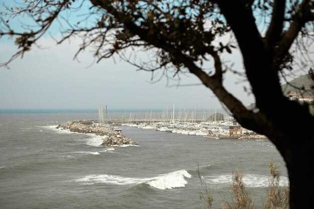
Wind conditions in Greece are diverse and can vary significantly across different regions. The coastal areas, especially those along the Aegean Sea, are particularly influenced by the Meltemi, a strong northerly summer wind. This wind becomes a defining feature of summer navigation, showing its extreme power and causing challenges for sailors. The National Meteorological Service often issues warnings related to these winds to ensure the safety and integrity of maritime operations.
The empirical data retrieved from various weather stations represent a model of wind patterns that can help in forecasting. This modeling is crucial for understanding how wind forces interact with the terrain and buildings, especially in urban areas such as Athens. The edges of the coastline can experience increased wave activity and reduced visibility during windy conditions, posing challenges for navigation.
During the winter months, winds can shift dramatically, causing snow in mountainous regions and strong gusts that can reach hurricane-force levels in open areas. Such extreme conditions can affect maneuverability for small boats and inflatable vessels. Understanding the specifications of each Beaufort Scale category can improve safety measures and guide sailors in managing their sails and hulls effectively.
Visibility can be affected greatly by wind-driven waves, which can reach impressive heights during storms. These conditions create a challenging environment, where maintaining sufficient situational awareness is essential. Twigs and branches may fall from trees, presenting additional hazards along coastal paths.
| Beaufort Scale Category | Wind Speed (knots) | Effects |
|---|---|---|
| 2 - Light Breeze | 4-6 | Small waves begin to form; leaves and twigs in constant motion. |
| 5 - Fresh Breeze | 17-21 | Sailing is still manageable; larger waves occur, and some spray may be present. |
| 7 - Strong Breeze | 28-33 | Considerable waves; visibility may be compromised due to spray. |
| 9 - Strong Gale | 41-47 | Mainly difficult sailing conditions with damage to small vessels; trees may sway significantly. |
| 12 - Hurricane-force | 64+ | Extreme conditions with very high waves posing significant threats to structures and navigation. |
As you explore the wind conditions in Greece, it is essential to remain informed of current weather patterns and warnings. This knowledge will help you navigate the complexities of sailing in this beautiful yet challenging environment.
Regional Variations in Wind Patterns
Understanding the Beaufort scale is essential for sailors navigating the diverse waters of Greece. The variations in wind patterns across different regions can significantly impact sailing conditions and, consequently, the integrity of boats and crew safety. Each area has its unique characteristics influenced by geographical features, which leads to variations in wind strength and direction.
For instance, in areas near mountainous terrains, winds can be more powerful and subject to sudden changes, offering a challenging environment for experienced sailors. On the other hand, coastal regions may provide more stable wind patterns, ideal for those who wish to stay informed and maintain a practical approach to seamanship. These regional differences necessitate a thorough understanding of local weather behaviors.
Satellite advancements enhance our knowledge of these wind conditions, allowing for accurate forecasts essential for safe navigation. Different scales of wind strength on the Beaufort scale–from zero to powerful levels–translate into specific warnings for sailors, informing them of what to expect on the water.
During the winter months, particularly in December, wind patterns can be further complicated by snow and dust, reducing visibility and presenting additional challenges. Thus, sailors must remain vigilant and well-prepared to ensure their safety and the secure operation of their vessels. Utilizing objective measurements and following appropriate guidelines are useful strategies for all navigating these waters.
The use of flag warnings and other visual objects helps communicate the realities of expecting turbulent conditions. Overall, a thorough understanding of regional variations in wind patterns equips sailors with the knowledge needed to make informed decisions, optimizing their sailing experience while respecting the enduring legacy of seamanship in Greece.
Common Wind Events in the Aegean Sea
The Aegean Sea is characterized by a variety of wind events that significantly influence navigation, particularly for vessels operating in this region. Understanding these phenomena is crucial for ensuring the safety and efficiency of maritime activities. The most common winds include the Meltemi, which is a strong north-northwest wind occurring from late spring to early autumn. It can create high waves and pose challenges for sailors, requiring careful planning and maneuverability.
Additionally, the occurrence of Sirocco winds from the south can cause a rapid increase in wind strength, often raising concerns among crews navigating in the open sea. These winds are not only noticeable due to their intensity but also for their ability to affect weather conditions, leading to longer periods of bad visibility and potentially hazardous situations. The Aegean is also home to frequent local breezes, such as the Etesians, which are characterized by their gentle to moderate strength, providing ideal conditions for cruising and overall pleasant sailing experiences.
To improve the safety of operations, Greece has invested in various technological advancements, including the use of satellite observations and anemometers to monitor wind patterns. These tools enhance the ability of naval teams to forecast conditions accurately. With sufficient attention given to these wind events, ships can be better prepared to respond appropriately and avoid potential dangers. Furthermore, understanding the numerical scales that describe wind strengths can help in categorizing these events and aid in making informed decisions while at sea.
Ultimately, the enduring nature of these wind occurrences requires sailors to consider their expected behavior during specific seasons. Using practical descriptions of wind strength and its effects on the sea will allow navigators to identify safe operational limits for their vessels. By staying informed and actively monitoring conditions, crews can enhance their preparedness and ensure a safe passage through these dynamically changing waters.