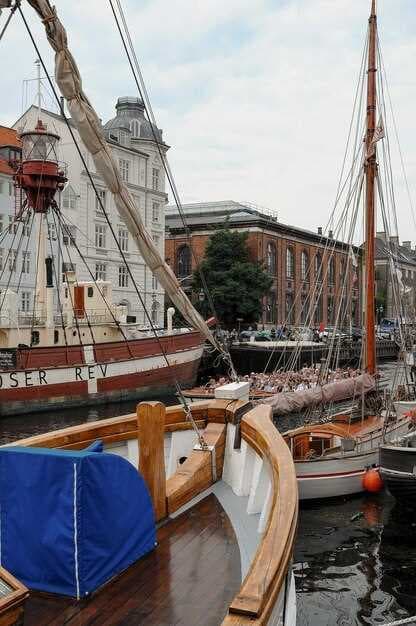
Top 5 Marine Navigation Apps for Android - Navigate the Seas with Confidence
Alexandra


In the ever-evolving world of marine navigation, having the right tools is essential for both amateur sailors and seasoned mariners alike. We've compiled a list of the top five marine navigation applications for Android that provide intuitive features and easy-to-use interfaces. These apps not only simplify the process of plotting routes and calculating tides, but also enhance safety while boating, allowing users to navigate with confidence across various waters. With annual updates and the latest industry technology, these applications are designed to meet the diverse needs of all boaters.
Navigating can often be a confusing endeavor, especially for those new to sailing or operating commercial vessels. However, with the right application, you can ditch the complexity and focus on enjoying the journey. Each of the applications listed here offers unique features such as live charts, real-time weather updates, and detailed harbour information. From anchor chain calculators to customizable routes, these applications are suitable for different boating scenarios. The user-friendly interfaces make it a breeze to access essential data, ensuring you can spend less time worrying about navigation and more time enjoying the open water.
📚 You may also like
Whether you're cruising through busy marinas or exploring uncharted territories, our selected seapilot apps come with a high value proposition. We have tested them thoroughly, analyzing their compatibility with local conditions and their overall performance in various scenarios. The comparison of their unique features helps in understanding how each app can cater to your specific needs, ensuring that you select the right one for your next sailing adventure. From keeping track of fuel efficiency to understanding the contours of the sea and wind patterns, these apps offer everything a modern sailor requires.
Overview of Marine Navigation Apps
Marine navigation apps have transformed the way sailors and boaters navigate the seas. These applications serve as essential tools, providing users with precise information needed to safely traverse waterways. With the ability to function offline, they make it possible for mariners to access critical navigational data, even in remote areas.
Most of these applications come equipped with advanced features that allow users to track their location and navigate efficiently. For instance, many provide tidal information, weather updates including thunderstorm alerts, and even temperature and pressure readings. This level of detail is crucial for planning a safe journey, giving boaters the confidence to make informed decisions.
- InavX: This app is particularly popular among the sailing community due to its specialized features tailored for boats of all sizes.
- Nautical charts: Many marine navigation apps provide access to a vast range of nautical charts, making them suitable for diverse regions.
- Marina databases: Some applications include extensive information on marinas, helping users find suitable docking locations.
Additionally, the background of the technology used in these marine applications comes from years of innovation in navigational devices. They calculate routes with a high degree of precision, which mitigates the risks associated with traditional navigation methods. Furthermore, these apps often allow users to share their experiences and photos, enhancing the community aspect of sailing.
While there are many options available, selecting the right marine navigation app depends on your specific needs. Some are designed for casual boaters, while others cater to experienced sailors, offering advanced functionalities. It's important to ditch unnecessary applications that don't meet your requirements, focusing instead on those that provide the essential features you need.
- Research the latest models and make sure to read reviews.
- Check if the app is compatible with your devices.
- Consider the costs associated with premium features.
Effectively utilizing these applications can save time and provide valuable assistance during your journeys. By staying informed with real-time data and community updates, you’ll be able to navigate the seas with confidence, ensuring that your boating experiences are both enjoyable and safe.
What Features to Look for in Navigation Apps
When choosing a marine navigation app, it's essential to focus on specific features that can significantly enhance your sailing experience. Firstly, look for apps that provide real-time updates on weather conditions and nautical forecasts. These features ensure you are aware of changing weather patterns, which is crucial for safe navigation. Apps that offer wind forecasts and tidal information at regular intervals can make your planning process much easier.
Another critical feature is the app's ability to display detailed nautical charts and depth contours. Many apps include both raster and vector charts, allowing users to access comprehensive information about the waterways. Features that allow users to add layers, such as local hazards, anchorages, and points of interest, can improve the navigation experience. These added functionalities are particularly valuable for those sailing in unfamiliar waters.
A user-friendly interface is also paramount when selecting a navigation app. The menu should be easy to navigate, allowing users to access essential functions without hassle. Many apps use a classic design that is easy on the eyes, but a more modern layout might suit some users better. Compatibility with various devices, including tablets, should be a significant consideration as well, ensuring flexibility while sailing.
Another aspect to evaluate is the app's algorithm for plotting courses. A smart routing function that takes into account currents and obstacles provides a more efficient sailing route. Apps that loop the data from marine traffic can help in comparison with historical data, giving users a more rounded understanding of their sailing conditions. This functionality can save time and fuel, providing added value on longer journeys.
Additionally, consider budget-friendly options that provide discounted rates for features. While many premium apps offer comprehensive functionalities, some free or low-cost options may also fulfill necessary requirements without compromising on quality. Always check the store for user reviews and ratings to gauge the app's effectiveness before purchasing.
Lastly, updates are crucial for maintaining the accuracy of navigation data. Apps that are constantly updated to incorporate the latest maritime information should be prioritized. This ensures you are not navigating with outdated data, which could lead to dangerous situations. By selecting an app that checks all these boxes, you can navigate the seas with confidence and ease.
Importance of User Reviews and Ratings

User reviews and ratings play a crucial role in selecting the right marine navigation application for your journey. As a boater, having access to accurate and reliable information is essential for safely navigating vast waters. Reviews offer insights into how well different applications, such as Navionics and WindyCom, perform in real-world scenarios. These insights often highlight strengths and weaknesses that can be confusing to decipher from promotional materials.
The user interface of a navigation app can significantly impact your experience on the water. An application with an intuitive design allows users to navigate menus effortlessly and access vital features without hassle. For instance, AquaMap has become popular due to its user-friendly interface. Reviews often emphasize whether an app is designed with the user’s needs in mind, giving potential users clarity before making a choice.
Advanced features like offline maps and custom routes could enhance your boating experience, but the value of these features often depends on user feedback. Many users share how applications like Seapilot were effective in specific anchorage areas or challenging weather conditions. This real-world insight may guide prospective users in determining which app could meet their unique requirements.
Moreover, the energy users dedicate to writing detailed feedback helps others make informed decisions regarding their subscriptions. For instance, the algorithms employed by apps like Windfinder are often discussed in terms of reliability and accuracy during challenging conditions. When reviews reflect consistent performance over the years, users are more likely to trust and invest in a particular application.
Every positive or negative rating provides a wealth of information regarding that application’s performance in specific situations. Users often address whether these navigational tools could handle complicated scenarios with ease, such as moments when wind direction shifts rapidly or when navigating through crowded waters. This personal experience is a huge benefit when deciding between applications like Navship and Paper Raster maps.
Furthermore, ownership experience shapes user perspectives significantly. Reviewers frequently share their complete journeys with applications, showcasing how effective they were during planned trips and unexpected detours. Users seeking advice from established boating communities can cautiously compare ratings, ensuring they choose an application that has garnered respect across a wide array of users.
In conclusion, leveraging user reviews and ratings can profoundly impact your decision-making process. As every individual’s boating habits and needs vary, these insights offer real value to potential users trying to navigate the confusing marketplace of marine applications. By critically observing past user experiences, you could ultimately find the right tool to ensure your boating adventures are enjoyable and safe.
Compatibility with Different Android Devices
When selecting a marine navigation app, compatibility with various Android devices is crucial. This factor affects how well the app performs during operation, especially for skippers relying on accurate data. Testing the application on a variety of phones and tablets ensures that users can navigate confidently, irrespective of the device's age or specifications. The best apps support a wide range of devices, offering features that enhance usability for everyone on board.
It is important to understand that older devices may struggle with high-performance applications due to limited processing power. Consequently, some marine navigation apps are designed with simpler interfaces that cater to different needs. This focus on providing performance across devices can help skippers enjoy seamless operation, making it easier to manage their vessel during rain or adverse weather conditions.
Networking capabilities also play a significant role in the effectiveness of marine navigation apps. Connectivity can vary widely between devices, which affects real-time updates and the ability to access local weather data. Many modern applications take advantage of this by combining online and offline functionalities. Therefore, users with older technology should look for apps that operate efficiently in offline mode, ensuring that core navigation features are not lost when out of network coverage.
Annual updates are another aspect that contributes to device compatibility. Regularly updated applications maintain a high level of performance by fixing bugs and introducing new features that cater to evolving technology. Reviewing comments from other users can provide insights into how well an app has adapted to various Android devices over time. Compatibility with newer systems not only enhances operational efficiency but also maximizes the user experience.
Some apps are more customisable than others, which can significantly benefit skippers using different devices. Levels of customization can range from adjusting layers on the map to setting specific alarms for particular events, making the app versatile for each user's preferences. This custom approach helps in creating a tailored experience that meets the specific needs of the vessel’s operation and the skipper’s style.
In conclusion, when exploring marine navigation apps, it is essential to consider compatibility with both newer and older Android devices. A clear understanding of the performance capabilities of devices can aid in making an informed choice. Apps like NavShip offer competitive pricing and a range of features that adapt to various conditions, making them a wise choice for navigation needs at sea.
Overall, the right marine navigation app can provide a significant advantage for skippers looking to enhance their experience on the water. By focusing on compatibility, users can gain peace of mind knowing that their navigation system will operate effectively, regardless of the Android device in use. This not only makes navigation easier but also allows skippers to explore new passages confidently and with a clear understanding of their surroundings.
iSailor: Key Features and Benefits

iSailor, created with a focus on providing accurate marine navigation solutions, offers an extensive array of features that cater to both novice and experienced sailors. Among its standout capabilities is the ability to customize chart overlays and routing options, allowing users to visualize detailed nautical charts, including official German charts, with ease. This level of customizability makes it easy for sailors to plan their passages efficiently, save time, and avoid potential navigational hazards. With the anchorchain calculator, iSailor provides vital information on anchor types and chain lengths, ensuring users have the knowledge to drop anchor securely, especially during heavy thunderstorms. The app operates beautifully offline, ensuring that users can navigate the seas without depending on cellular data.
One of the most significant advantages of iSailor is its competitive pricing structure, which provides incredible value compared to other navigation apps on the market. Though there are subscription options, users can also opt to ditch monthly fees in favor of a one-time payment for essential features. This flexibility, combined with extensive maps and routing capabilities, makes it a must-have tool for those who wish to explore the oceans with freedom and confidence. Furthermore, the app has been developed over the years to include extended wind data and a thorough background of marine environments, enhancing navigation processes during all types of journeys. Whether watching for current conditions or preparing for an extended trip, iSailor surely stands as a reliable choice in today's marine navigation landscape.
| Feature | Description |
|---|---|
| Customizable Overlays | Personalize the view with important charts and information. |
| Routing | Efficiently plan your passage with detailed routing options. |
| Anchorchain Calculator | Calculate optimal anchor setups for secure anchoring. |
| Offline Functionality | Navigational use without cellular data reliance. |
| Competitive Pricing | Flexible payment options providing great value for users. |


