

 세인트 마틴에서 요트 타기를 위한 상위 10가지 팁">

Always check wind and tide charts 48 hours ahead, then pick two sheltered stops where winds stay calm. Peaceful mornings and clear routes reduce stress on crew. This approach reduces risk well while cruising along a sunlit coast near a vibrant island hub.
Keep groceries, a basic tool kit, and spare parts in your vessel; carry water and a portable VHF to stay in touch when outside the harbor. Smart packing keeps you mobile. Even after selecting two sheltered stops, you still have options nearby. Choose a peaceful bay to anchor during the hottest part of the day, then return to the marina before sunset.
During hurricane season, national alerts can change plans quickly; you should frequently check the forecast to adjust routes with fewer risks. Flexibility saves time. Stay alert to wind shifts and keep your crew ready to reduce speed or switch to an alternate anchorage.
Evening dockside scenes blend local music with a gentle breeze; you sample wines and pick up groceries while the quay hums with chatter. The louis breeze carries salt and a peaceful mood as traders greet you with friendly smiles. Most shops accept dollars, and small markets offer fresh fruit, bread, and island specialties; like local vendors, you can negotiate fair prices with a smile.
learned captains keep a compact kit aboard and return to base with a clear plan. They keep a simple log of daily changes, note wind shifts, and adjust routes with calm coordination. The habit reduces risk and preserves island mood, especially when winds shift and gusts rise.
Tip 1–Tip 2: Pre-trip planning and required documents
Decide your route now and assemble essential papers eight weeks ahead; keep clear digital copies and printed versions. maho area on the island often brings huge crowds, which makes early preparation crucial; expect clearance lines near peak season, especially at first light.
Usually, clearance checks run fastest at dawn near busy ports around maho; plan arrival accordingly.
- Passport: valid at least six months beyond planned departure; verify island entry rules in each country you visit.
- Vessel documents: registration, flag state authorization, radio license, and vessel papers; keep digital and printed versions.
- Insurance: hull and liability, medical coverage; bring copies and review limits with your insurer; nevertheless, ensure protection in expensive port calls.
- Medical certificates: crew medicals and vaccinations if required by countries you visit; maintain up-to-date records.
- Crew documentation: crew list, IDs, and permits as required; ensure names match passport details.
- Firearm: if you carry one, confirm permits, import restrictions, transport rules, and secure storage; comply with each country’s rules.
- Permits and rules: certain permits or zones apply near anchorage; verify customs forms, quarantine requirements, and port authority notices; each country may differ.
- Navigation and communications: charts, AIS, and VHF license where needed; confirm gear works with local channels.
- Costs and provisioning: harbour dues, mooring fees, provisioning costs; local stores on busy islands can be expensive; plan a budget ahead.
Post arrival, review all documents to spot gaps in planning; post-licence checks, adjust the year’s plans as needed. Additionally, keep a plug kit to handle quick fixes, and ensure you can anchor safely in a range of spots around the island.
Tip 3–Tip 4: Weather, winds, and optimal sailing times
start between 9:30 and 11:00 with NE trades steady at 15–20 knots. right-hand marks keep you in a safe lane; head toward a lee area when gusts sharpen; example route is a short hop to a nearby anchorage to test trim; keep a steady hand on the sheets for fine control.
seasonal pattern: dry season (dec–apr) brings easterly winds 15–22 knots; spring often lifts to 18–25 knots by mid-afternoon; nevertheless, mornings stay calmer and navigation simpler. the best window is typically 09:30–14:00, when seas remain manageable and visibility is good. avoid long passages after 15:00 in late spring to limit exposure to gusts.
provisioning: riteway stores nearby provide provisioning; markets in the area, including markets at marigot and philipsburg, offer fresh produce and bread. louis and scott at the marina desk can quote rates and outline clearing steps. example: head to riteway, load water and provisions, then enjoy a dining break ashore. montserrat area becomes relevant only for longer trips; if you aim toward mexico, wind patterns shift and sails need adjustment.
trip planning: keep yourself within a comfortable schedule by mapping short hops and using the period of calm between squalls for repositioning. still, always check the forecast after dawn and adjust plans accordingly; provisioning done, you can head out with confidence and handle trips yourself with ease.
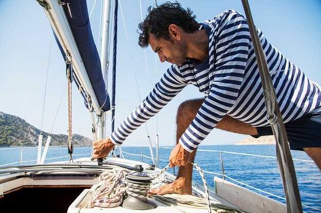
Tip 5–Tip 6: Boat selection, crew roles, and sail plan
Choose catamarans with a simple rig, twin hulls, ample stowage, and a clear sail plan that the crew can follow easily. This base setup keeps the trip relaxing and your budget realistic, with room for an additional stop or two.
Crew roles
Assign roles clearly: captain, navigator, mainsail and jib trimmer, bow lookout, line handlers, and galley manager. Keep shifts short, post a simple plan in the cabin, and use a checklist so youll miss nothing.
Sail planning
Draft a day-by-day plan based on forecasts and channel winds: a short hop into the channel, then a relaxing beachside stop, with a downtown harbor option if weather stays steady. Bread and baguettes from a downtown store supply simple meals. Here, a backup plan toward lucia or a gulf inlet if winds swing; a longer trip toward mexico adds miles but may be worth the extra solitude. Always check forecasts each morning and again at dusk; in november winds can shift, so you pass near a sheltered inlet as needed.
Tip 7–Tip 8: Mooring, anchoring, and docking in major bays
Reserve a buoy mooring in Simpson Bay Lagoon to stay overnight; it provides protected shelter, quick access to Philipsburg, and predictable fees. Contact the buoy operator or harbor authority to confirm a spot and obtain the mooring number before tying in. If buoy space is full, anchor only in designated sand pockets well clear of ferry lanes, keeping a 5:1 scope in calm conditions and increasing to 7:1 with gusts or residual surge.
In the area, mooring is commonly handled by private operators with official oversight. Expect nightly rates that scale with length and vessel type; smaller craft typically pay less, larger yachts more. Always sign in at the marina office or harbor master, use approved cleats and lines, and maintain generous fenders to avoid hull damage during tidal swings.
When anchoring, choose a sandy bottom away from charted channels and shallow shoals; drop anchor with a 5–7:1 scope in settled conditions, and extend to 7–10:1 if wind or current increases. Use a second line tied to a stern cleat or stable buoy to limit movement. Avoid coral beds and restricted zones; verify bottom holding with a drag check and adjust as needed.
Docking in popular venues requires planning: approach from the windward side, reduce speed to idle, and secure using spring lines to control drift. Check in at the nearby harbor office before entry, observe marked lanes, and coordinate with the crew on deck for fender alignment. Keep a watch on VHF channel 16 and the marina channel during approach to stay informed about arrivals and dock assignments.
Practical notes include access to water, electricity, and Wi‑Fi at marinas; request pump-out if needed; arrange tender service as required. Carry spare lines and fenders, and maintain a tidy deck to minimize hazards in crowded water. If local traffic is heavy, consider an alternate anchorage in a sheltered bay and review tide changes, weather outlook, and official regulations before setting gear.
Tip 9–Tip 10: Safety procedures, local regulations, and reef-friendly practices
최근에 도착했나요? 조타실에 라미네이트된 안전 및 지역 규정 점검표를 게시하고 컴퓨터 노트에 여분의 사본을 보관하십시오. 겨울 순항 중에 의존할 수 있는 소형 세트가 있습니다.
갑판을 이동할 때는 PFD, 안전벨트, 안전줄을 착용하고, 정박지를 떠나기 전에 조난 상황 훈련을 실시하며, VHF를 채널 16으로 확인한 다음 자신과 승무원에게 조난 계획을 공유하고, 화장실을 깨끗하게 유지하십시오.
닻, 정박 장치 및 폐기물 처리에 대한 현지 규정을 준수하십시오. 산호초 친화적인 접근 방식에는 이용 가능한 정박 장치를 사용하는 것, 산호에서 거리를 유지하고, 산호초 근처의 앵커 체인 드래그를 제한하는 것이 포함됩니다. 교통로 근처에서는 시속 6~8 노트, 얕은 산호초 지역에서는 시속 6 노트 미만으로 유지하십시오.
산호초 지역은 정밀한 처리가 필요하므로, 일상 업무의 일부로 표지판을 확인하고 지정된 계류 장소를 이용해야 합니다. 장비를 투하하기 전에 산호초 건강 상태를 사진으로 찍고, 눈에 보이는 취약 지역에는 닻을 고정하지 마십시오.
단일선체와 쌍동선 선원들은 흘수와 회전에 차이가 있습니다. 계류지 할당을 신중하게 계획하십시오. 많은 배들이 해외에서 도착하듯이, 차터업체, 육지의 친구, 그리고 지역 선장들과 조율하십시오. 그레나다 차터 경험은 이 부분에서 도움이 됩니다.
11월 행사 및 겨울 스케줄은 준비태세에 영향을 미칩니다. 여기에 지속적인 점검 목록을 유지하고, 정박지 주변의 교통 상황을 모니터링하고, 빠른 사진으로 변경 사항을 기록하세요. 섬에 오실 경우, 추진력 제한을 이해한 다음, 상황에 맞춰 계획을 조정하세요.