

 National Marine Sanctuaries – Protecting Ocean Habitats">

Start by reviewing permits and selecting sanctuaries that match your goals, such as papahnaumokukea and monterey, to guide your study and fieldwork. These sanctuaries protect essential habitats and connect researchers with coastal communities.
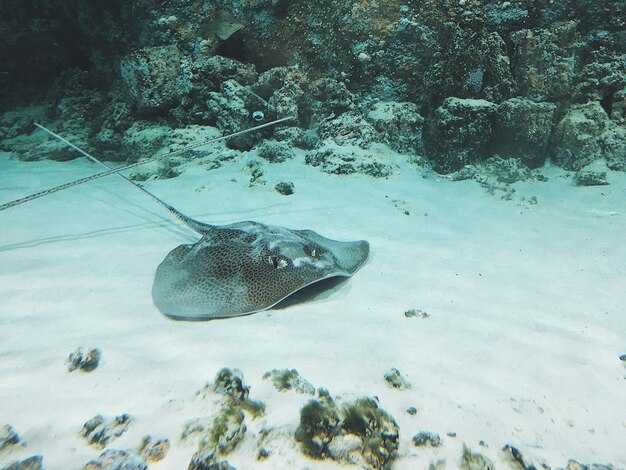
noaa‘s National Marine Sanctuaries System manages more than a dozen sites across the oceans, balancing protection with responsible research. It operates with clear rules and data-driven plans; these common protections cover habitats like coral reefs, kelp forests, and migratory corridors. Researchers conduct work under approved permits, aligning activities with sanctuary goals.
Some sites are military-connected or adjacent to training ranges, so coordination with local authorities and the armed forces ensures safety. Sanctuaries restrict gear and vessel operations; expect gear restrictions on nets, dredges, or heavy gear to minimize impact. These measures protect species thriving in oceans around hawaii and other regions, helping endangered populations recover.
To begin your project, contact the sanctuary office through noaa’s official portals and request a project briefing. Be sure to include your goals, timelines, baseline data, and safety plans. These offices will guide you through permit requirements and gear guidelines, helping you align with your site’s protections and engage local stakeholders.
By choosing to conduct work within the National Marine Sanctuaries, you contribute to protecting species and habitats across the oceans. These efforts already support monitoring, research, and public education, creating a model for responsible exploration with communities, scientists, and policymakers. Will your project fit within these protections? Start with papahnaumokukea, monterey, and the others to build a stronger, more resilient marine network.
Subjects, Outings by Year, and Challenges in Safeguarding Remote Sanctuaries
Coordinate annual field outings by year with standardized data sheets and a defined decision tree to strengthen protection and response times.
Subjects include marine researchers, sanctuary officers, enforcement specialists, marine-education staff, and fishery representatives. Each group provides monitoring, education, and enforcement input, ensuring what we learn translates into action. Online dashboards streamline reporting from distant stations, while in-person visits validate remote observations. The coastal office coordinates sunday outreach and caretta caretta sightings to inform summer protections.
There are distinct outing types for remote sanctuaries, from on-site surveys and boat-based monitoring to remote sensing and community education events. Outings by Year track progress, adjust priorities, and reveal where to focus limited resources. This approach helps monitor changes, build capacity online, and strengthen engagement with marine-maccess and education partners.
Outings by Year: table below summarizes yearly activity, focus, and results
| Year | Outings | Avg Duration (days) | Participants | 주요 초점 | Key Outcomes |
|---|---|---|---|---|---|
| 2019 | 12 | 4 | 9 | Baseline habitat mapping; rare species surveys | Data for 2 distant sanctuaries; improved data templates |
| 2020 | 6 | 5 | 7 | Remote monitoring; pandemic constraints | Online reporting dashboard launched; partnerships with online portals |
| 2021 | 9 | 4 | 8 | Caretta caretta nesting-site surveys; community education | New nesting-site map; training in nest protection |
| 2022 | 11 | 5 | 9 | Enforcement coordination; patrol planning | Joint ops with coast guard; improved reporting triggers |
| 2023 | 13 | 5 | 11 | Education and outreach; military-connected coordination | Education materials; sunday outreach events; online resources |
| 2024 | 14 | 5 | 12 | Cross-border data sharing; citizen science | Online reporting; July field weeks; data-sharing agreements |
Challenges in safeguarding remote sanctuaries arise from distance and limited access. Distant sites demand meticulous logistics, with weather and atmospheric conditions shaping every itinerary. There is pressure from some fishery activities and illegal operations near critical habitats, which requires constant enforcement readiness and rapid response. Where operations overlap with military-connected zones, coordination with base partners matters, and access may be paused during training or live-fire exercises. There, field teams must adapt to limited windows and rely on monitor data, online feeds, and research-backed guidance to inform decisions.
Caretta caretta nesting periods in July intensify monitoring needs, while Sunday outreach and education sessions help communities understand why certain zones remain restricted. To strengthen protection, provide cross-agency training, expand remote sensing capabilities, and ensure clear, published restrictions. More resources for field teams, extended patrols in key corridors, and added support for coastal communities will reduce pressure on fragile reefs and seagrass beds. In practice, codified bans on high-impact activities and timely enforcement actions protect habitats while delivering consistent education to members and partners.
Identify Target Habitats and Keystone Species Across Sanctuaries
Begin by identifying target habitats across sanctuaries and design a standardized plan to document presence and breeding activity of keystone species in each location. This approach, designed for 수생의 systems, supports comparability across maryland, hawaiian, and other sites.
Build a two-layer survey framework: a habitat layer to map substrate type, living cover, and structural complexity, and a species layer to log keystone predators, engineers, and their prey. Collect data along kilometers of transects and watch for shifts under pressure from fisheries interactions and pollution.
Identify keystone species whose presence signals resilience across every location already and through seasonal cycles, including hawaiian and maryland sites; note breeding activity and the role these species play in sustaining living communities and ecological connections.
Use results to guide management: designate habitat-rich zones, limit activities that raise pressure in breeding hotspots, and maintain connections between layer habitats, which supports ecosystem structure and functions and would help managers adapt and provide more targeted actions.
Share findings with united agencies, fisheries managers, and local communities. Highlight Obama-era protections that helped shape cross-jurisdictional strategies and outline ways to apply this approach across the nation.
Describe the National Marine Sanctuary Foundation’s Public Outreach Roles
Target coastal communities with clear, accessible messages that explain how outreach protects sanctuaries. The National Marine Sanctuary Foundation says public outreach roles are designed to translate science into practical actions for families and visitors, and to explain what people can do day by day to protecting water and wildlife, the most impactful steps.
What outreach does includes education programs for family audiences, school visits, and in-venue interpretation; example activities include volunteer-guided tours, shipwrecks used as living classrooms, and interactive displays that bring marine habitats to life, and other experiences that engage curious minds.
On the west coast, monterey programs anchor local engagement while partnerships extend to riviera and mexico coastlines, reflecting a regional effort to connect people with wildlife, water quality, and aquatic habitats, including whales, that are essential to a healthy ecosystem and more than education alone.
Public input shapes messaging and partnerships. The foundation runs listening sessions, surveys, and community meetings to capture input from diverse stakeholders; this helps address challenge areas such as overfishing and illegally caught seafood, and shows what protecting sanctuaries means for local economies and everyday choices, including what is eaten and what remains in the oceanic food web. Messages stress controlled access to sensitive sites and practical steps families can take at home and in water-based recreation, using means to support coastal resilience and protecting marine life.
Document 2023 Outings: Locations, Activities, and Student Involvement
Start with two designated sanctuaries and one outdoor field day centered on hands-on surveys of mammals and reef systems; set specific objectives, use short transects, and have a simple data template for every student. Tie the fieldwork to a monument example–Papahānaumokuākea Marine National Monument–which was expanded under Obama in 2016 to protect distant atolls and the home of endangered species.
Locations include Florida Keys National Marine Sanctuary off Key West, Stellwagen Bank National Marine Sanctuary off Massachusetts, and Channel Islands National Marine Sanctuary off California. Each site offers a different habitat mix–from seagrass beds to rocky reefs–making it easy to design specific activities. They compare outcomes with mexico’s designated parks and protected home nations, noting how designation shapes access, tourism, and long-term stewardship.
During the outings, they conduct boat-based transects, anchored moorings for transect surveys, shoreline cleanups, water-quality sampling, and mammal watches for species such as dolphins and seals. Instructors emphasize safety, legal guidelines, and the means to record environmental conditions, with noaas data-collection systems used to standardize submissions. They also document distant migratory corridors and the ways human activity intersects park boundaries.
Hundreds of students participate, mostly high school juniors and seniors and some first-year college entrants, in roles that include field leads, data entry, GIS mapping, and public outreach. They come from home districts across the state and often from military-connected families, enriching discussions with diverse perspectives. They document the learning outcomes in a shared digital portfolio and present findings to classmates, park staff, and local nations’ representatives, reinforcing how tourism, protection, and science interconnect.
To maximize impact, schools schedule site-specific prep, secure permits, and ensure compliance with designated rules and noaa guidelines. They plan boat logistics with anchored-boat routines, emphasize avoiding illegal activities, and frame results within the broader National Marine Sanctuary program. After-action reviews help refine safety, student leadership, and future routes–including opportunities to visit nearby largo communities and partner with marine parks to sustain student engagement and protection of hundreds of protected habitats.
Plan 2024 Outings: Grade-Level Goals, Curriculum Links, and Safety
Plan two NMSS outings by June that align with grade-level goals and safety standards. Use field experiences along the coasts and Gulf to illustrate sanctuary protections and living habitats.
These outings connect to NMSS objectives and provide hands-on practice with nets in controlled demonstrations, water-quality monitors, and vegetation surveys. From Louisiana to Hawaii and the Florida Keys, students discover how many species rely on protected spaces, and they learn to communicate findings with transceivers while boating in designated zones and monitoring conditions below the surface.
Policy milestones from the Obama administration inform sanctuary protections, guiding our approach to field ethics, accessibility, and inclusive participation for every student.
- Grade-Level Goals
- K–2: Observe and describe at least three living things in a habitat, name one action to protect them, and record one simple weather or water characteristic.
- 3–5: Collect two water-quality data points at two sites, sketch a habitat map of one kilometer of shoreline, and explain how protected spaces support breeding and feeding for various species.
- 6–8: Map a 4–6 kilometer segment of coast, identify habitat types (seagrass, reef-like structures, dune grasses), and compare at least two species’ roles in a fishery or food web.
- 9–12: Analyze sanctuary status with case studies, design a small citizen-science project, and present findings with data visuals and citations.
- Curriculum Links
- Science: NGSS and state standards for life science, earth science, and ecology; Mathematics: basic data analysis; ELA: evidence-based writing and speaking.
- Cross-curricular skills: field notebook use, map reading, and responsible communication with partners on boats and ferries; reference materials and transceiver notes support reading comprehension and oral reporting.
- Content themes: coasts, gulf ecosystems, north-south migratory patterns, and living communities such as flowering seagrass beds and coral-like structures that host juvenile fish.
- 안전 프로토콜
- Boating logistics: require approved PFDs for every participant, pre-trip safety briefing, and a strict ratio of one adult supervisor for every ten students.
- Equipment and hazards: enforce banned gear types within sanctuaries; inspect nets, lines, and transceivers before departure; run a site-specific risk assessment for nets, slips, and weather changes.
- Communication and monitoring: deploy a transceiver system for each group and designate a lead monitor who tracks location, weather updates, and emergency procedures; establish clear hand signals and a check-in cadence.
- Emergency planning: predefine safe harbors, establish evacuation routes, and practice a drill that covers jika injuries, dehydration, or equipment failure.
- Logistics and Destination Planning
- Timing: schedule outings in June and early fall, ensuring at least one coastal-site visit and one inshore estuary or riverine system; plan each trip for 4–6 hours.
- Distance and travel: target 8–12 kilometers of shoreline exploration per trip; coordinate carpools and boat allocations to minimize travel time and maximize instruction time.
- Sites and access: use NMSS units along the coasts, including the gulf region, the Keys, and selected Hawaii coastal areas; consider a Riviera-zone field site for comparative habitat lessons.
- Communication and data: require students to record at least two observation types per site and to summarize findings in a short report using data from their monitors and transceivers.
- Equity and inclusion: ensure accessible paths, translated materials when needed, and involvement of diverse communities to reflect many voices in discovering sanctuary values.
- Destination Examples
- Louisiana coast NMSS areas for estuary ecology and living seagrass communities; small-boat outings along protected coasts with monitored currents.
- Florida Keys and nearby NMSS zones to study coral-like habitat features and the breeding patterns of key reef species.
- Hawaii coastal sanctuaries for monitoring monk seal or seabird breeding sites and flower-like coral formations in protected waters.
- North Atlantic/Northwest coasts to compare habitat types, ship traffic impacts, and net restrictions in different sanctuary zones.
- Riviera-area field sites as a cross-regional reference to discuss coastal management and the influence of various policy regimes on protection measures.
- Ocean-systems literacy across multiple type habitats, from shallow mangroves to deeper, offshore habitats, to broaden students’ ability to discover connections below the surface.
Below are actionable steps to implement this plan: assign roles to teachers and parent volunteers, prepare field notebooks that integrate data tables and sketches, and schedule debrief sessions to monitor progress toward grade-level goals. Here, nmss serves as the anchor for safety, science, and stewardship across every outing.
Design 2025 Outings: Logistics for Remote Monuments and Protection Measures
Secure permits from the designated sanctuary office at least 60 days before the outing and limit groups to six participants per boat. This keeps activities compliant and protects habitat while you provide a clear purpose: students observe how sanctuaries protect habitats and learn field methods. For monterey and other designated sites along the west coast, this approach supports more reliable research by avoiding peak winds and heavy traffic in busy months.
Develop a logistics layer that covers transport, safety gear, on-site etiquette, and waste handling. Use a dedicated research vessel or an allowed charter with an experienced crew. Plan departures in october when seas are more predictable and weather forecasts are reliable. Map the banks and shelf locations to keep teams in the designated zones and away from fragile communities. Brief everyone on the outing location, allowed activities, and the need to minimize disturbance to marine life with strict waste containment.
During the outing, the habitat is protected by maintaining a safe distance from aquatic life; stay on the marked channel; no touching; dont feed wildlife. Maintain slow speeds to reduce wake, and ensure all staff and students know what to do if wildlife approaches. Those on deck must monitor for signs of distress and report issues to the lead navigator. If any participant sees a species, record the sighting without triggering a chase or disturbance. These steps keep the experience informative and respectful.
For students, implement a simple data collection protocol: record surface temperature, salinity, and the presence of biota; collect species observations, and photograph habitats with consent. Submit data to a west coast marine research network and pair with monterey colleagues to extend coverage. The purpose is to provide a shareable dataset that supports protection efforts and informs future outings. This collaboration says a lot about how research and protection go hand in hand.
Operational tips for success: schedule field prep in the week before october outings; confirm weather windows with the national weather service and the sanctuary lead; ensure you bring spare parts and an emergency plan; designate a lead for each team to coordinate with the shore station. The west-facing banks and coasts around monterey require flexible plans, so always have a contingency plan in case a site becomes inaccessible; design 2025 outings with safety first, then education to maximize takeaways for those who join. First, outline the purpose of the outing and the location of designated zones, then build logistics around it.