

 Must-Have Sailboat Navigation Equipment – Essential Gear for Safer Voyages">

믿을 수 있는 나침반, 밝은 조명, 믿을 수 있는 충전 옵션을 포함하는 작고 다양한 기능을 갖춘 액세서리 키트로 시작하세요. 이 구성은 해뜰녘과 해질녘에 선박의 방향을 정확히 유지하도록 해 주며, 해도에 눈부심을 최소화하는 선수 방향 지시 장치 나침반과 갑판 조명이 있습니다. 앞을 내다보며 악천후가 닥쳤을 때를 대비한 간단한 백업 계획을 세우십시오.
확실한 가시성 징후를 찾으십시오. 300–600 루멘 데크 라이트, 적/녹색 항해등, 작은 신호 경적을 갖추고 있어야 합니다. 돌풍이 몰아치고 가시성이 떨어질 때 여유 공간이 얼마나 소중한지 알게 될 겁니다.
통신 및 신호용으로는 DSC 기능이 있는 소형 VHF 무전기와 휴대용 확성기를 함께 준비하십시오. 차트에 현재 위치를 표시할 작은 표지판을 비치하고, 여분의 배터리는 방수 파우치에 보관하십시오. 이렇게 하면 해상 상태가 좋지 않을 때 불필요한 추측을 줄일 수 있습니다.
충전 방식이 중요합니다. 10,000mAh USB-C 보조 배터리와 갑판에 둘 수 있는 6W 또는 10W 접이식 태양광 패널을 함께 사용하십시오. 이 조합은 일반적으로 차트 플로터와 GPS 수신기를 전체 당직 시간 동안 작동시킵니다. 마모를 방지하기 위해 고무 스트랩으로 잡을 수 있는 난간에 설치하십시오.
기술적인 접근 방식에서는 자기 나침반을 백업으로 준비하고, 오프라인 차트가 있는 견고한 방수 태블릿이나 휴대폰을 준비하십시오. 디지털 디스플레이를 미터법으로 설정하여 일관된 판독값을 얻고, 실리콘 케이스로 장치를 물보라로부터 보호하십시오.
갑판 위 편안함은 스마트한 배치에서 비롯됩니다. 헬름, 전원, 신호 장비를 위한 작고 명확하게 레이블이 붙은 구역을 만드세요. 항해 중 헬름과 선실 사이에서 이 키트를 옮기면 거친 물결 속에서도 침착함을 유지하면서 필요한 장비에 손을 뻗을 수 있습니다. 항해를 계획할 때는 예비 배터리 팩과 휴대용 비컨을 짐 목록에 추가하세요.
매달 테스트: 나침반 오차 확인, 주전원 및 백업 전원 모두에서 조명 작동 확인, 충전 포트 부식 여부 확인. 간단한 체크리스트 포함–전원 켜기, 신호 테스트, 가시성 확인, 통행 후 재충전.
더 안전한 항해와 2개의 음료 홀더를 위한 필수 요트 내비게이션 장비
필수적인 풀 내비게이션 키트로 시작하세요: GPS, AIS, VHF가 완전히 통합된 방수 차트 플로터와 앱과의 호환성을 갖추고 있습니다. 이 실용적인 설정은 신뢰성으로 상을 받았으며, 갑판 위나 항해 중에도 햇빛 아래에서 쉽게 읽을 수 있는 차트를 제공하며, 섬으로 가는 해안 경로도 포함됩니다.
Install 2개의 음료 거치대 조종석 테이블에는 컵 받침과 거친 바다에서도 단단히 고정되는 자석이 있습니다. 장거리 항해를 위해 조타 장치에서 접근 가능한 풀사이즈 냉장고를 사용하고, 홀더는 내후성이 뛰어나고 섬 여행에 적합한지 확인하십시오. 이 기능은 엎지름을 줄이고 조타 장치에 있는 친구들을 보호합니다.
웨어러블 안전 기술: 손목 장착 GPS 장치와 계기판의 간편한 분리형 거치대에 고정된 전화기. 위치, 날씨, 경로를 동기화하는 선박 전체 앱과 페어링하고 격벽에 충전 케이블용 작은 고리를 보관하십시오. 이 조합은 보호 기능을 추가하고 탑승한 친구들을 위해 실용적인 사용성을 제공합니다.
독특한 것을 선택하세요., suitable 귀하의 위치와 갑판 레이아웃에 맞는 시스템: 자동 조종 장치, 소형 레이더 애드온, 그리고 케이블을 깔끔하게 정리하는 설치. 물보라 속에서도 차트를 쉽게 읽을 수 있도록 대비가 더 강한 디스플레이를 사용하십시오. 방수 용기에 예비 부품을 보관하고 빠른 점검을 위해 기술 중심의 평이한 언어 설치 가이드를 따르십시오. 이 완벽하게 준비된 설정은 승무원과 친구들의 안전을 향상시킵니다.
더 안전한 항해를 위한 핵심 항해 장비
중심 허브로서 AIS, 레이더, 자동 조종 장치가 통합된 다기능 GPS/차트플로터를 설치하여 실시간 교통 정보, 경로 계획, 해상 통항 시 생명을 구하는 인지 능력을 제공하고, 쌍동선과 단동선을 모두 지원합니다. 이 작업은 장거리 항해에 적합하며, 승무원들이 경로상의 모든 지점에서 자신감을 유지하도록 돕습니다.
주요 장비 및 실용적인 설정:
- AIS 및 레이더 기능이 탑재된 GPS/차트 플로터: 장거리 상황 인식, 해상 교통 경보 및 충돌 방지 기능 제공; 이중 데이터 소스와 몇 분마다 시간 기반 업데이트를 제공하는 초고휘도 디스플레이를 선택하고 자기 나침반과 판독값을 대조하여 확인하십시오.
- DSC 및 날씨 채널이 있는 VHF: 선박 간 통신 및 날씨 업데이트에 필수적이며, 조타 장치에서 쉽게 닿을 수 있는 곳에 장착하고 DSC 호출을 매달 테스트하십시오.
- 자기 나침반 및 방향 센서: GPS 백업용으로 사용; 정확한 지점 간 방향을 위해 강철 물질로부터 떨어진 단단한 격벽에 보정된 플럭스게이트 나침반을 설치하십시오.
- 수심 측정기와 속도계: 해안선 근처의 수심과 얕은 수로에서의 수심을 모니터링하고, 최적의 세일 트림을 위해 선체 속도를 추적합니다. 매 교대 근무 시작 시 판독값을 확인하십시오.
- 레이더: 악천후 시 날씨 및 교통 정보 제공; 조종석 위쪽에 장착하고 다양한 해상 상태 및 범위 설정을 위한 사전 설정을 프로그래밍합니다.
- AIS 트랜시버: 보고 보여지기; 수신 및 송신 모드로 작동; MMSI를 최신으로 유지하고 정기적으로 테스트하십시오.
- 자동 조종 장치/조향 시스템: 긴 연안 항해 시 조타 부담을 줄여줍니다. 풍향 및 해류 데이터와 함께 사용하면 최소한의 입력으로 최적의 코스를 조종할 수 있습니다. 안전 자동 방향 전환 제한을 설정하고 잔잔한 물에서 테스트하십시오.
- 풍향풍속계: 정확한 풍향 및 풍속 측정; 차트플로터에 데이터 전송하여 효율적인 항로 설정 및 세일 플랜 조정; 빠른 업데이트를 위한 차세대 센서 사용.
- 위성 통신: 전 세계적인 커버리지를 제공하는 업체를 선택하십시오. 유럽 및 그 외 지역의 선원들을 위해 VHF 통신 범위 밖에서 안정적인 데이터 및 음성 서비스를 보장하십시오.
- EPIRB 및 SART: 생명을 구하는 장치; 접근 가능한 출구 근처에 배치하고 매월 점검하십시오. 필요에 따라 배터리를 교체하고 여분의 조난 신호기를 선박에 보관하십시오.
- 전력 및 백업: 교류 발전기 및 태양광 어레이로 충전되는 배터리 뱅크; 자동 절체 스위치 및 강력한 충전 컨트롤러 포함; 헬름과 항해 스테이션에서 전압 및 온도 모니터링; 최소 2일 분량의 필수 전자 장비 예비 전력 확보 목표.
- 의류 및 승무원 장비: 새벽 점검과 바람 부는 갑판을 위한 플리스; 긴 당직 근무 동안 집중력을 유지할 수 있도록 따뜻한 옷을 겹쳐 입을 수 있게 준비하십시오.
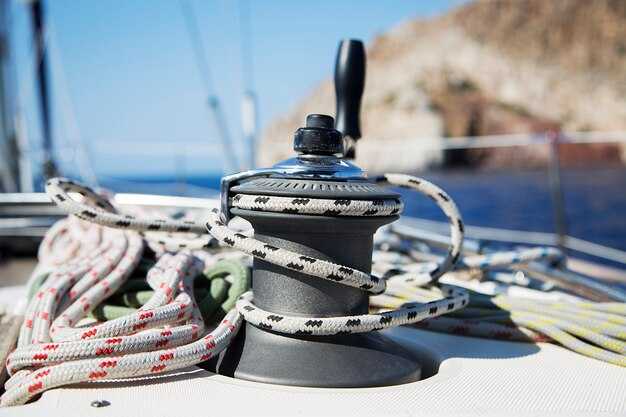
- 설치 팁: 케이블을 깔끔하게 정리하고, 방수 커넥터를 사용하며, 모든 전선에 라벨을 부착하십시오. 민감한 전자 장치에는 진동 차단을 제공하고, 적절한 인체 공학을 위해 디스플레이를 눈높이에 맞게 장착하십시오.
- 쌍동선 특성: 이중 선체와 넓은 폭을 고려; 레이돔을 갑판 그림자를 피하고 양쪽 선체 주변에서 AIS 커버리지를 강하게 유지하기 위해 선실 위에 배치.
설치 우선순위 위치는 마스트 헤드, 조종석 조타 구역, 항해 장비 스테이션, 선미 트랜섬, 엔진룸 근처이며, 케이블 길이와 간섭을 최소화하기 위해 단일 평면에 매핑합니다.
점검 일정: 항해 또는 시즌당 5회 점검 실시; 매 교대 근무 전에 GPS 수신, 레이더 범위, AIS 트래픽, VHF 도달 범위, 배터리 상태 확인; 다음 입항 시 수정할 이상 현상에 대한 로그 유지.
매달 한 번씩 모든 인명 구조 및 통신 장비를 테스트하고 결과를 기록합니다.
GPS 및 차트 플로터 통합: 신뢰할 수 있는 디스플레이 선택
주간 시인성이 뛰어난 디스플레이(7~9인치), WAAS가 통합된 GPS, 강력한 NMEA 2000 백본을 갖춘 차트 플로터를 선택하십시오. 이것은 must-have 설정은 차트, 웨이포인트, 경로를 여러 장치에서 일관되게 유지하고 GPS 안테나에 직접 연결하여 거친 바다에서도 안정적인 위치를 제공합니다. 방수 및 EMI 내성에 대한 해양 표준을 충족하여 해무와 어두운 환경에서도 가시성을 확보해야 합니다. 빠른 화면 갱신과 직관적인 컨트롤을 제공하는 모델을 선택하여 즉석에서 경로를 조정하고, AIS 비콘을 추적하며, 승무원이 안전하게 이동할 수 있도록 하십시오. 상황 인식을 위해 항해 차트와 레이더 오버레이를 단일 화면에서 실행할 수도 있습니다.
인기 있는 옵션으로는 Garmin, Raymarine, Furuno, Simrad, B&G 등이 있습니다. 이러한 브랜드는 기저도, 벡터 차트, AIS/비콘 통합 기능이 미리 로드된 7~9인치 차트 플로터를 제공합니다. 햇빛 아래 가독성(1000+ 니트 목표), 빠른 화면 갱신율, 신뢰성 있는 지도 업데이트를 확인하십시오. 거의 모든 인기 있는 옵션이 터치 또는 하이브리드 입력을 제공합니다. 다음을 고려하십시오. kinds 어떤 장착 방식을 선호하는지 (매립형, 패널형, 포드형) 확인하고, 거친 바다에서도 빠르게 사용할 수 있도록 인터페이스가 터치 및 물리적 컨트롤을 모두 지원하는지 확인하십시오. 가치를 평가하는 경우 간단한 나란히 데모를 실행하고 차트 전환에 걸리는 시간을 기록하십시오. 이는 나중에 시간을 절약해 줍니다.
전력 관리는 중요합니다. 전용 전원 공급 장치 또는 공유 버스 옵션과 함께 12V로 작동하는 디스플레이를 선택하십시오. 낮은 유휴 전력 소비와 다음에서 실행할 수 있는 기능을 찾으십시오. 교류 발전기 또는 전용 배터리. 계획하세요. spend 차트 플로터와 NMEA 2000 버스에 보트 전원 시스템에서 퓨즈가 있는 직결 전원을 몇 분 동안 배선합니다. 링 단자의 부식을 점검하고 접지를 확실히 하십시오. 퓨즈, 여분의 전원 케이블, 백업 메모리 모듈과 같은 예비품을 비치해 두십시오. 케이블이 빌지 아래로 내려가지 않도록 하고, 배선을 짧고 보호되게 유지하며, 장치를 배기구에서 멀리 두십시오. 유지 보수를 위해 접근이 용이하면서도 열과 환기 스프레이를 피할 수 있도록 충분히 높이 장착하십시오. 또한 호환성을 극대화하기 위해 레이더 및 자동 조종 장치에 대한 개방형 데이터 연결을 확인하십시오.
데이터 신뢰성 및 중복성: 여러 피드에서 차트, 날씨 오버레이, 조수 데이터 및 AIS 비콘을 가져오도록 디스플레이를 설정합니다. 이렇게 하면 데이터 누락 가능성을 줄일 수 있습니다. nereide 디스플레이는 견고한 IP 등급을 제공하여 습한 조종석에서 유용합니다. 작고 밀폐된 케이스 솔루션이 필요한 경우 고려해 보십시오. 이것 상기 사항: 중복이 중요합니다.
VHF DSC 무선 통신 장비: 깨끗한 통신과 구조 준비 태세
전원 켜기 and keep the unit powered by the vessel’s 12-volt system before departure, enable DSC watch, and keep channel 16 for voice while configuring the DSC function to monitor calls on channel 70.
Store the MMSI, vessel name, and call sign in the contents so the provider can identify you quickly during an incident. If available, enable GPS-linked DSC to send your position automatically; this is specifically helpful when time matters and you need a precise signal for rescue crews.
Most models support functions for distress (Mayday), safety calls, routine calls, and group calls. These uses cover direct calling between 요트, fleets, and coast stations; when DSC fails, use the equivalent voice channel to reach a nearby station, and you’ll still have a useful fallback.
Position the antennae as high as possible and away from heavy machinery to maximize reception. Route cables with shielded coax, check for water intrusion, and install a mounting that provides protection from salt spray. A poor installation reduces range, almost the same amount as the gains you expect from good placement.
In practice, during fishing near an 섬 or along busy coasts, you can use group calls to coordinate with other vessels; the signal travels best when you maintain direction from the shore to the vessel. Keep the antennae oriented for optimum reception from a distant station and keep the channel 16 monitor active for voice backup.
Keep a simple diagnostic 쿠키 in the log to confirm the unit identity, test results, and the time of the last check. Do a monthly radio check with a remote or coastal provider, and review the contents of memory to ensure the most critical numbers are current. For remote runs, ensure a spare battery is available and charged, to guarantee at least one backup power source.
Radar, AIS, and Collision Avoidance: Reading Signals for Safe Navigation
Set radar range to 3 NM in harbor, 6 NM on busy channels, and 12 NM when crossing open ocean; connect AIS to a dedicated app on your smartphone to log targets and compare directly with radar echoes; maintain a dedicated lookout. This direct workflow improves detection of smaller yachts and gives you extra time to react.
A radar with a high refresh rate and a diameter of 30–60 cm performs best on 요트; install it high on a hard deck or in a dedicated compartment to minimize spray and vibration. Keep the radar dome clear of fleece, towels, and other fabrics that could block signals. Enable a multi-sensor overlay to merge AIS identities with radar echoes; use tecnologie that fuse GPS, compass, and autopilots for a cohesive display. Expect contacts at 5–8 NM in calm seas and 2–4 NM in rain or fog; check for electric interference from winch motors and move antennas away from windlass or battery compartments.
Read AIS data to identify vessel type, speed, and heading. Use CPA and TCPA thresholds to decide when to act: alert on CPA above 0.25 NM and TCPA under 8 minutes, then verify with radar bearing. In dense traffic near a harbor entrance, treat similar vessels as potential risks within 2–3 miles and pre-plan a safe turning arc. If a contact appears in the same location across several sweeps, verify visually and physically confirm the bearing by sighting fixed landmarks if conditions allow, then coordinate with the other vessel using direct VHF or digital messaging.
When risk appears, execute a three-step plan: slow down, adjust course by a few degrees to increase TCPA, and maintain a steady course with autopilots while you communicate with the crew. Channel your kahuna-level calm to lead the operation across all locations. If signal is lost, switch to manual steering and rely on an independent display on your smartphone as a backup. Keep extra gear ready–arrestor line, winch, and a spare battery–and return to checklists after the maneuver. Training drills on a quiet day, with towels handy to dry gear and a fleece layer for night watches, build readiness for high-ocean conditions.
Practical tips for yachts: practice cross-checks between radar, AIS, and GPS at least once a week; maintain dedicated settings for night and fog; check the diameter and mounting alignment during seasonal maintenance; create a simple routine to compare signals from similar targets and confirm their angles and distances. This disciplined routine improves safety and keeps you prepared for unpredictable turns in big seas.
Backups and Redundancy: Compass, Paper Charts, and Sextant Skills
Recommendation: Always maintain a properly stored backup navigation kit including a magnetic compass with a spare ring, a dedicated dry box, a full set of paper charts, and regular sextant practice. A saying among sailors is that two backups beat one failure, and this approach has proven reliable for years across sailboats of various sizes. Have this ready for times when electronics fail or when you face heavy weather, so you can keep steering and plotting with confidence.
Compass backups: Install the primary binnacle compass and place a second magnetic compass in a dry, fleece-lined pouch. Installation should be secure and within easy reach, without blocking sightlines or the wheel. Use both to check bearings against known waterway features at regular intervals, and note results in a log. When available, compare the spare’s readings with GPS-derived bearings to confirm accuracy, thereby sharpening your situational awareness. The ring dial on the compass helps readability in rough seas and dim light.
Paper charts: Sailboats benefit from waterproof, tear-resistant charts for the waterways you sail. The table includes chart numbers, scales, and edition dates; always carry a second copy in a protected chart case or in a fleece-lined pocket for humidity defense. Update data after new dredging, harbor changes, or chart corrections, and rotate copies so the oldest are used least. Store charts in a space that stays dry and clearly labeled; bring tide tables and current data for your routes, including coastal approaches and open-water legs. This redundancy lets you navigate calmly if the electronic path goes dark.
Sextant skills: Practice sun fixes and star sightings to maintain a viable line of position. Learn altitude measurement, apply index corrections, and use a chronometer as a time reference when GPS is unavailable. Regular drills keep you comfortable with the process and allow you to plot a fix quickly on a chart, often in minutes. Those skills hold value for years, and they deliver a dependable fallback when technology falters, thereby preserving safety and progress on long passages. This discipline lets you maintain a clear navigator’s mindset even when radios fade or screens go blank.
Storage, care, and planning: Keep a compact, buoyancy-friendly kit near the helm, with a fleece lining to protect optics and reduce noise in rough seas. The installation should be straightforward, fit in available space, and allow quick access during maneuvers. Theres a simple rule: test, use, and refresh on a set cadence across years and times. This approach links hands-on skills with tecnologie and cross-checks between charts and compasses to keep your navigation robust.
| Item | Primary role | Redundancy level | Storage location | Maintenance cadence |
|---|---|---|---|---|
| Magnetic compass (primary) | Directional reference | Basic backup | Binnacle or cockpit dry box | Check bearings weekly; calibrate annually |
| Magnetic compass (spare) | Backup reference | Dual backup | Dry pouch, easily accessible | Inspect monthly; rotate with primary |
| Paper charts | Reference navigation | Redundant editions | Waterproof case and fleece pocket | Update after changes; replace every few years |
| Chart tide/current tables | Plan routes | Supplemental | Chart case pocket | Review before each voyage |
| Sextant | Celestial navigation backup | Skills-based | Pouch in cockpit locker | Weekly practice; lens and mechanism check quarterly |
| Chronometer (time reference) | Time anchor for sight fixes | Critical | Protected case | Calibration annually |
Drink Holders: Two Secure Mounts, Spill Prevention, and Easy Access
Install two secure mounts on the cockpit coaming, one within reach of the helm and one on the opposite side, using marine-grade stainless steel brackets with locking clamps to prevent loosening in heavy seas. This two-mount setup keeps cups stable when the boat heels and speeds along, so you stay hydrated without chasing contents across the deck.
Each holder features a raised splash lip, a silicone gasket, and an anti-slip liner to keep the contents steady, with a snap-on lid or flip-cap for extra spill prevention during open-boat conditions or gusts. Position the rims slightly above the deck to intercept spray and prevent liquids from traveling toward the line management area.
For easy access, place mounts so you can enter and operate the cups with one hand; the inserts accommodate 2.5–3.5 inch diameter cups and allow a clear read of the fill level. If you run a bluetooth-enabled boat, pair a sensor kit to track whether a cup is present and its temperature, aiding knowing and time management during watches. The open cockpit layout keeps access fast, and a nearby ventilator helps maintain cabin air without blowing spills onto electronics.
To boost safety, use cups with buoyancy or add buoyant inserts so a topple leaves the contents afloat rather than lost. This buoyancy helps during rescue drills and real rescue scenarios, and reduces the risk of spills onto fuel lines during heavy weather. Labeling the setup with a small rescueme cue can speed teammate response in drills and during an actual incident.
In choosing gear, check the requirements for compatibility, durability, and mounting security. The two-mount arrangement should sit about 40–60 cm apart, with mounts fixed into solid backing rather than a soft core. Stick to marine-grade materials, keep away from fuel sources, and ensure the system aligns with your boat’s management approach and buoyancy goals–this third-generation option is a winner for many marine layouts and fulfills those practical requirements.