

 5 Best Beaches in St. Petersburg, FL to Explore by Boat">

Begin with a 4-hour watercraft outing to southern gulf islands near petersburg; youll enjoy peaceful coves, clear water, and efficient sightseeing, setting the tone for your day on the water.
Each destination offers a distinct vibe: a Pass-a-Grille Beach-like stretch with shallow sand and calm water; Egmont Key‘s wildlife habitat and historic ruins; Shell Key Reserve‘s protected sands; Fort De Soto Park Beach for family-friendly spots and fishing; and Clearwater Beach’s lively marina scene at times.
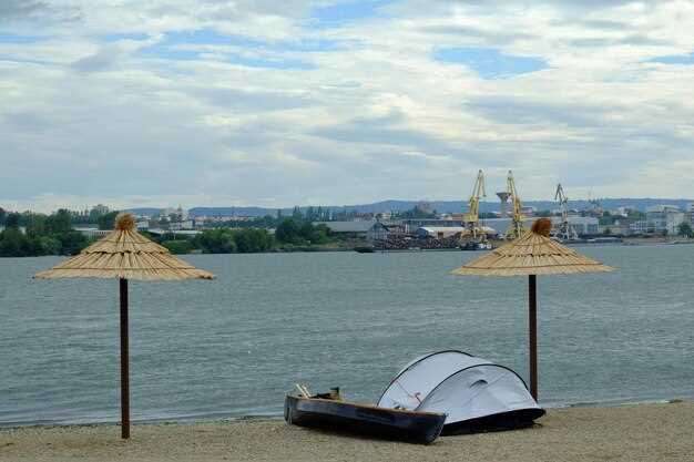
Pack light: umbrellas for shade, a compact cooler, and sunscreen. The area is famed for its popularity with boaters, yet quiet coves appear during early hours. Anchorage spots offer free access at certain times, perfect for planning sightseeing breaks and occasional volleyball on sunny afternoons. If your itinerary overlaps with the 나이트라이프 scene along the marina, youll find easy shore access and peaceful alternatives after dark.
This approach preserves coastal beauty while offering opportunities to observe wildlife along mangrove edges. youll gain flexibility, while the plan will spare crowds and support dog-friendly stops. After returning, you can enjoy southern nightlife options within easy reach of your base.
Boat-Ready Beaches of St. Petersburg, FL
Fort De Soto Park offers a reliable ramp, ample docks, and a sheltered entry to the channel, making it the go-to start for a day on the water. If you’re willing to depart before the weekend crowds, head toward the flats; whether you fish, skim the shallows, or simply cruise, you’ll find calm water and clear signals. For private launches, a captain’s license is not required; registration and local ramp rules apply.
Shell Key Preserve lies beyond the pass, a boat-accessible barrier island famous for shells and soft sand. Weekdays bring less crowd; take a break on a sandy patch, watch for shorebirds, and keep nature pristine. Pack water, shade, and a trash bag; daily visits appreciate quiet. Nearby towns and residents from peteclearwater head here, alongside other routes. heres a tip: visit at low tide to maximize exposed shells.
Egmont Key State Park is a longer ride from the mainland but rewards with a serene shoreline, a lighthouse, and fort ruins. Facilities are sparse; plan for water, shade, and a picnic. There are no concession options; check regs before heading out, and note daily traffic from residents in peteclearwater and nearby towns so you can time your approach and tie-offs.
Caladesi Island, reached by private craft through a sheltered channel, rewards with uncrowded sands and a calm approach. Services are minimal; bring water, sunscreen, shade, and a trash bag. The shoreline runs alongside mangroves and sea oats, offering a natural contrast to the more developed spots.
From Pass-a-Grille to the soto coast, private boats can anchor on a shallow sandbar and take strolls along the edge of the surf. The play in the shallows attracts families and anglers alike, while morning light reveals serene horizons. Some itineraries even include mexico-bound trips as part of a broader plan.
Daily planning matters: check tide windows, wind forecasts, and channel traffic before departure. Bring sun protection, water, and a trash bag. Drawback: limited shade and few facilities; lifeguards are not present at most stops. These shorelines complemented by nearby parks and piers alongside coastal towns provide a balanced day for residents from peteclearwater and the surrounding area.
Fort De Soto Park Beach: Boat access routes, anchorage points, and harbor detours
Start by entering Johns Pass Channel in a calm morning and head into Boca Ciega Bay to reach a sheltered anchorage. This route offers a less crowded atmosphere and a low-key respite suitable for family days on the watercraft, with hammocks along the mangroves and a fresh breeze to soak in. Keep dogs on leash on deck and watch for shallow flats near the shoreline; here you’ll spot dolphins and seabirds while gulf air promises a relaxed vibe.
Two dependable access routes lead here: Route A follows the Johns Pass Channel into Boca Ciega Bay, then threads toward Fort De Soto Park’s outer shoreline, using marked turns to stay in shallow, navigable water. Route B comes from the south via Pass-a-Grille Channel and the Egmont Key corridor, again keeping to marked lanes and avoiding the busiest traffic. Both paths add more safety, enhance situational awareness, and are viable year-round during season windows; always consult local reviews and latest notices.
Anchorage points to consider are: Point One – the eastern bay near the park’s hammocks, where mangrove roots create natural shelter and calmer water for daytime stays; Point Two – the southern flank along Boca Ciega Bay still close to shore amenities. Local skipper morgan notes these spots reduce fuel use and improve spotting opportunities of wildlife. This setup is suitable for mid-size watercraft and for dogs on leash.
Harbor detours occur when dredging or construction closes channels used for harbor traffic; follow posted markers and advisories, and use the detour around the north harbor if the main inlet shifts due to storms. In addition, temporary aids may alter current flow while operations proceed. Season-specific conditions may require slower speed or alternate routes; addition promises calmer days on the water, and morgan confirms the detours are temporary.
Essentials for a day on the water include sun protection, water, and a culinary add-on to cater to a family outing; shore shops offer fresh snacks and gear, boosting essentials and convenience. Reviews highlight a welcoming atmosphere, with swimming and picnicking options, and hammocks providing shady spots for a quick break. The gulf breeze enhances the feel, making it easy to soak up the vibe here and plan a longer stay.
Egmont Key State Park Beach: Reaching by boat, safety considerations, and wildlife watching
Launch from Clearwater-area marinas at first light; calm weather makes the crossing about 45–60 minutes, depending on current and wind. Aim for the island’s northeastern shore for a straightforward landing and shore access. The essence of the ride is a low-key, line-by-line navigation through sparkling Gulf waters, with the atmosphere and endless sky around you offering respite from crowded shorelines. Kayaks can ferry gear for a quiet approach, letting you minimize disturbance in wildlife zones. Lets keep planning concise to maximize time ashore.
Reaching options include starting from Clearwater Beach or Fort De Soto Park. From Clearwater Beach, steer southwest through the Gulf toward the island’s east flank; from Fort De Soto, take the Boca Ciega Bay entrance into Tampa Bay and hug the eastern edge of the key. Expect 40–70 minutes depending on wind and tide; always watch the forecast and tide tables. This route across the bay offers a spectacle of glassy water and sky, with locals often crossing here with practiced skill during day trips and pursuits around the area. The water around Egmont Key carries a Clearwater hue and a picturesque backdrop that invites exploration across the shallow flats and along the shoreline.
Safety comes first: everyone aboard must wear a life jacket; monitor Channel 16 on a marine radio for weather and traffic updates; avoid storms and gusts over 15 mph; beware of large vessel traffic in the main channel and navigation aids. Carry dry bags, sufficient water, sunscreen, a hat, and a compact first-aid kit. Navigate with charts or a GPS and stay in designated channels; do not land near active nesting areas during bird season, and anchor only in permitted zones while respecting posted signs. The quartermaster ruins along the shore add a charming, historically grounded angle to the trip, and they provide a quiet vantage to observe wildlife without crowds. Restroom facilities are not available on shore, so plan accordingly.
Wildlife watching centers on a roost of terns, pelicans, and other shorebirds that concentrate along the north and east shores. Keep a respectful distance to avoid disturbing nests; watch for dolphins patrolling the flats and, in season, sea turtles coming ashore to nest on the sandbars. The scenery around Egmont Key is endlessly photogenic, with a picturesque backdrop and a timeless atmosphere that elevates the experience. This spots-friendly destination suits a low-key activity that couples nature watching with a touch of history, ideal for families and solo visitors alike who want to observe wildlife in a relatively uncrowded environment.
Practical notes: arrive with sun protection and ample water; there are remnants of a lighthouse and a former quartermaster building to observe from the shoreline, adding a layer of interest to a simple day out. Facilities ashore are minimal, so pack out what you bring. If you’re coming from across the Bay, this stop pairs well with other coastal stops and nearby resorts, offering a charming contrast to resort life and a chance to recharge before continuing explorations around the area.
Shell Key Preserve Beach: Navigational tips, permit requirements, and tide planning

Start daytime entry with a shallow-draft craft and stay in the main channel, following the buoyed markers and updated charts. Keep speeds slow near shoals and seagrass beds, and assign a watch partner to scan for other vessels and drifting gear. Southwest winds can shift chop quickly, so plan to ride calmer windows in the morning and have a backup route in mind for routing around turning tides.
Navigational notes: crystal-clear water in the channels helps you spot deeper cuts, but shallow flats form as tides fall. Use a reliable GPS plotter and carry a chart, compass, and water-depth app. If you’re unsure, revert to the marked channel and avoid abrupt turns near the shore where currents funnel toward the southwest shore. A memorial marker or signs along the approach provide situational cues about protected zones–respect them and adjust your path accordingly. Watching for drifting sandbars and eelgrass beds is essential to keep trips safe for yourself and them.
Permits and rules: no land-use permit is typically required for landing by water, but fishing requires a valid saltwater license from the Florida Fish and Wildlife Conservation Commission. If you’ll be parking a vehicle at a nearby ramp, confirm with Pinellas County Parks whether a day-use parking pass is needed. Always verify any seasonal restrictions or closures on the official county or state sites before visiting; staying compliant avoids delays and protects the area’s cleanliness and wildlife.
Tide planning: check NOAA tide tables for your date and time, and target a mid-tide window to minimize risk of grounding during entry and exit. Expect a 1–2 feet tidal range in this area, with higher swings on spring tides. Plan your trip so most of the travel happens during daytime lit hours, and depart before any strong evening convection or storms roll in. On rising tides, shallow areas widen; on falling tides, deeper channels are easier to hold in but sandbars may become exposed; use that knowledge to time your crossing and shore landings.
Practical tips and packing: essentials include water, sun protection, a cooler for snacks, and a dry bag for valuables. Bring a compact first-aid kit, a whistle, signaling device, and kid-friendly safety gear. Visually scan the nearshore for kids and pets, and keep them within arm’s reach on calmer sections. Locals and buffs know the area’s quirks, so seek quick advice at the launch and through daytime talks with fellow travelers. Packing smart while respecting cleanliness helps preserve the gems along the shore for future visiting crowds, until you return with another comfortable day on crystal-clear seas.
Pass-a-Grille Beach: Quaint district and laid-back atmosphere for boating adventures
Begin with a dawn launch from the Pass-a-Grille waterfront, glide across to Shell Key Preserve, and return along the island edge for a calm circuit that’s ideal for families and solo travelers alike, with water that invites swimming when the light is right.
If you’re staying in peteclearwater, many hotels offer pool facilities for a quick rinse after the outing.
Walk the brick lanes of the historic district to admire pastel cottages that reflect local history. They preserve a small-town charm; a park at Gulf Way provides a shaded pause and a view of the water, and the space along the waterfront stays welcoming for everyone.
Near the shore, fauna thrives: manatees surface in cooler months; seeing these animals in the wild is truly memorable. Dolphins may be spotted offshore, and the scene over the water offers ongoing opportunities to observe wildlife without crowding.
Parking is convenient at the public lot near Gulf Way; the space is compact but manageable. For families, a brief stop at the park helps kids burn off energy. A weekend sushi-making demonstration at a nearby market adds a distinct local rhythm and a chance to sample fresh flavors. The area boasts famous sunsets, a charming style, and a welcoming vibe that invites you onto the next crossing, making it easy to forget the stress of daily life, thats truly memorable, dont forget this space is ideal for relaxing after a day on the water. thats the moment when you remember why this place is truly special.
| cons | Weekend crowds can limit space near the market; parking may fill by mid-morning. |
| Access | Public waterfront points and a compact nearby lot near Gulf Way. |
| Wildlife | Manatees and other fauna frequent the shallows; seeing them is common in early hours. |
| Family-friendly | Walkable streets, a small park, and calm bayside edges suit everyone. |
St. Pete Beach: Boat-friendly access, anchorage options, and sunset vantage spots
Anchor off the Pass-a-Grille channel for easy watercraft landings and a front-row view of gulf sunsets. Marked channels keep you in deeper water while you swing in ample space, with a sandy-bottom pocket that holds anchors reliably even after a short chop.
Also, you’ll notice rich birdlife along mangrove stands and occasional sightings of dolphins and manatees as you approach from the gulf. Afternoon showers break the day with brief rain, then clear for a colorful sky over white-sand shorelines.
Anchorage options
- Sheltered coves in Boca Ciega Bay offer ample space and a bottom that favors anchor hold in sand and mud, with easy dinghy access to shore points.
- Outer-gulf approach near the Don CeSar’s front provides deeper water and dramatic sunset silhouettes; follow marked channels and avoid shallow flats.
- South toward Blind Pass yields deeper water, mangrove stands, and quick shore access; ideal for longer watercraft stays with a tranquil backdrop.
- Public docks and all-inclusive moorings: check local regulations and seasonal permits; some spots provide water and power for guests, creating a convenient, inclusive experience.
Sunset vantage spots
- Don CeSar lawn and seawall: historic backdrop with west-facing sightlines, best during golden hour.
- Pass-a-Grille Pier: open horizon and occasional sea-spray, perfect for long-range sunset photos and chef-curated picnic setups on board or ashore.
- West-facing shores along Gulf Boulevard: walkable access with vantage points over white-sand shorelines and subtle color shifts on the water.
Landside options
After lift-off, a quick visit to a nearby arboretum on the mainland provides shade, rich space for a stroll, and a chance to create a relaxed post-sail moment while the chef arrives with a simple, all-inclusive picnic aboard for a longer excursion.