

 How to Create a Float Plan – The Complete Guide for Safe Boating">

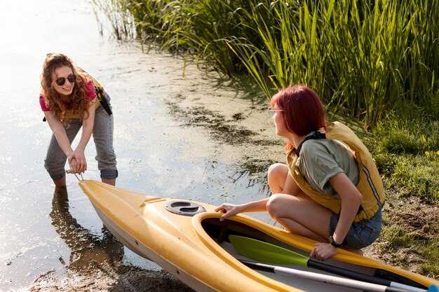
Write a written float plan today and share it with guardians and the operator before you head on-water.
Your plan should cover the on-water route, the estimated return time, and contact methods for contacting the crew if plans shift. Include the boat name and operator, a line of reference points such as a tower or shoreline markers, and, if available, coordinates. If you can, add a demos section to illustrate how the plan works in practice so guardians can see what to expect.
Before departure, contact guardians by call or text to confirm receipt of the plan, and ensure you have a backup contact. Save the plan in a written file above the console and also keep a copy on your device. Define what to do if contact is lost, and set a check-in cadence so your crew knows when to expect updates back from you.
During the trip, keep a portable power source, maintain radio contact with the operator, and be ready to adjust the plan if conditions worsen; update guardians with a quick status, a brief message, or a short call at milestone times. Maintain a clear timeline above the plan to show progress along the route, and if possible share photos or status updates at key points on-water.
Practical Float Plan Setup for Safer Boating
File a float plan before departure that specifies where you head, your intended line of travel, ETA, and planned check-ins; creating a clear, shareable document helps guardians and authorities stay aligned and reduces risk.
Assign guardians among crew or trusted contacts who monitor milestones, confirm arrivals, and trigger alerts if you drift off schedule; their prompt actions build trust and keep operations smooth.
Stock tools for real-time updates: a VHF radio, a satellite messenger, a chart plotter, and a spare battery with sufficient charge; test channels, set the course, and save the plan for quick reference, with sound alerts for missed check-ins.
Document contingencies for certain weather, currents, and daylight; include alternate routes and a line for filing with the coast guard or port authorities; list where to submit the plan and when to update it to keep operations transparent.
For activities like fishing or skiing, log specifics in the plan, including fishing zones and where skiers may cross; indicate what to expect from responders, show expected message times, and how to notify nearby boats if plans change; include a numbercolor marker to help responders identify you on charts.
Set a practical communications schedule: check-in every two hours, or more often in rough seas; specify radio channels and emergency codes, and ensure you can receive a quick reply; keep a copy with guardians and in the cabin, and follow uscg guidance for training or templates to support safe operations.
| Element | Details | Owner | 備考 |
|---|---|---|---|
| Route & ETA | Coast-to-offshore path; waypoints A→B→C; ETA targets; check-in windows | キャプテン | Maintain daylight limits |
| Communications | VHF 16, 69; satellite messenger; message templates | Bridge | Test pre-departure |
| Safety Gear | Life jackets, throwable, flares, radios | クルー | Battery checks |
| Filing & Records | Float plan filed with authorities; copy kept aboard and with guardians | キャプテン | Include numbercolor codes |
| Contingencies | Weather shifts, currents, alternate routes | Operations | Update if conditions change |
Define Trip Details: Route, ETA, and Weather Window
Draft a written route and ETA now, save it as a template, and keep it within reach onboard. The plan should describe departure, next waypoint, pace, and a target arrival window so the crew can review at a glance and give feedback.
Plot the route along the coast from your marina to the next marina or to a trusted fishing spot, marking each leg with coordinates, distance (in nautical miles), and expected time. Use a visible line on the chart to connect points and describe the features of each segment, described here, including terrain, current, and potential hazards close to shore.
Set the weather window as a practical range you can rely on: forecast wind under 20 knots, seas under 2 meters, and visibility at least 3 miles. Prefer a window that covers the next watch, with a buffer to handle small changes in wind or swell. Check trusted sources and write down the forecast time, then compare it with your ETA at each waypoint to confirm the setting.
Build in sufficient margin for safety: add a priority fallback leg if conditions shift, and assign crew tasks so they can respond quickly. Give them clear responsibilities onboard, such as monitoring weather, managing lines, and keeping gear ready. If the forecast isnt favorable, you have a backup on deck and in the engine room, and you can hold position near a safe harbor until conditions improve. This approach reduces worry and keeps operations smooth and controlled. This level of planning also enhances the experience aboard.
Document and store the plan in your setting as a written record, for example in the ship’s log and on the onboard tablet. The template should be described with the next steps and the gear required, so the crew has a trusted reference. Share it with them before departure to avoid miscommunication and to speed decisions when speed changes or visibility drops.
After departure, maintain the same practice: review the route and ETA at the coast, confirm the float plan with all hands, and update the template as conditions change. Revisit the plan during the voyage and close the loop when you reach the next waypoint, using the written record to guide decisions and to hold the vessel on a safe heading. This document is the float plan, commonly called a float plan.
Record Vessel and Crew Info: Registration, Licenses, and Safety Gear
First, hold a single, up-to-date log that records registration numbers, license IDs, and safety gear checks, and keep it in a dry pocket near the helm for quick reference before every trip.
Record details: vessel name, hull ID, registration number, issuing authority, issue date, and expiration. Keep both a paper copy and a digital scan saved in a cloud location you trusted. This found reference saves time if you ever need to respond to questions from coast guard or harbor staff.
Licenses: ensure each operator holds a current certificate appropriate to the vessel, with expiry date clearly listed. Create a roster that includes each member name, role, license type, license number, and contact method. If someone didnt have a license for their role, assign a different task or return to shore. Keep these records on board and in the cloud for safety.
Safety gear: every person onboard wears a U.S. Coast Guard–approved life jacket; ensure sufficient life jackets for all passengers and that they fit properly. Keep a throwable flotation device within reach, a whistle or sound device, and a fire extinguisher that is inspected and not past its expiry. Have a first-aid kit, reliable communication devices, a GPS or handheld radio, and spare batteries. Carry a cell phone in a dry pouch as backup to the radio. Keep space free from clutter so you can grab gear quickly.
Checklist before leaving: verify registration numbers match vessel name; confirm licenses are valid; inspect safety gear: PFDs in good condition, throw bag accessible, fire extinguisher within date, signal devices current, VHF radio ready, backup light and battery, and a spare fuse. The point is to have everything visible and portable, and save a quick list of emergency contacts on the device and in the log.
When boating near the coast, especially around fishing boats and kayakers, reduce speed, keep a safe distance, and make planned passes with signaling. Use your VHF or a cell-based communication to confirm intentions. If a nearby vessel or person needs help, respond with a clear action and log the event. Keep the crew member responsible for communications informed and ready to advise course corrections.
Love for boating grows when you prepare and protect everyone on board. Review the record before each trip, update after maintenance or crew changes, and store copies in a cloud that you can access from shore. This habit saves time and helps you stay safe on every outing.
List Emergency Contacts and Reporting Points
Print a standard template of emergency contacts and keep it with your float plan; review and update it every few days of planning.
List authorities and reporting points clearly, including check-in schedules and the location where you report a problem.
For each contact include name, role, daytime and after-hours numbers, their vessel or company, and a cell or satellite device you can use to reach them.
Assign a person on board as the lead for reporting; store their direct contact and a backup contact so you can reach someone during operations.
Keep the information on at least two formats: a printed copy and a digital copy on your devices; both should stay accessible during drift or wind conditions.
Include reporting points along the route and times; the expected check-in windows help responders track progress amidst shifting conditions.
Record the gear and devices on board that you may need for self-rescue or signaling, and note their locations, so a responder can reach the right person quickly.
Verify the numbers regularly, and test your plan with a dry run; wrong numbers or outdated contacts waste time and risk safety.
Keep a live log of updates, including days since the last change and any new authorities or reporting points you add; that keeps everyone aligned.
各連絡先に対して情報源を保存し、遠隔地からのチェックインのために情報がどこから来たのかを記録する。.
航法および通信プロトコルを設定: VHF/DSC、位置情報、および信号
今すぐマスターVHF/DSC計画を設定し、全員を訓練する必要があります。誰でも、通常の通話のためのプライマリカナル、DSCシーケンス、および緊急時の音声手順を知っているべきです。船名、MMSI、チャンネルリスト、および明確な転落手順を記載したラミネートシートを航海所に保管してください。冗長性を考慮した機器を使用する:固定VHF、ハンディVHF、そしてイマーजेंसीバッグに収納されたEPIRB。出発数分以内に、見張り中の乗組員が非常チャンネルに切り替えられることを確認し、マリーナに到着したり、近くに友人とのセイル時には、誰かが迅速に船を見つけることができるようにクイックな訓練を実施してください。これには、特定の気象チェック、交通状況の認識、および緊急連絡先が含まれる必要があります。.
位置と信号は、GPS/DSCブロードキャストに依存します。位置を緯度/経度またはグリッドとして記録し、可能であればDSC経由で送信してください。船長は、乗組員の誰が監視を担当しているか、どのチャンネルが使用中であるか、および船舶の位置を特定するためにどのデバイスが使用されているかを示すように記録を確認する必要があります。定期的な間隔で位置情報を共有します(航行中は何分かに一度、荒れた海ではさらに頻繁に)、コースまたは速度の逸脱をマークします。遭難信号が送信された場合、デバイスが近隣船や海技庁にDSC経由で警告を発信し、VHFが故障した場合はEPIRBを使用し、視界が許せば視覚信号を発信することを確認してください。.
合図の手法は、明確さを重視します。 ラジオ通話の補完として、旗信号や照明などの視覚的合図を使用し、特に交通量の多い湾路や混雑したマリーナでは、積極的に使用してください。 他のセールボートや隣接するボートに近づいた場合は、簡単な無線交信で理解を確かめ、視覚的な確認で応答を認識してください。 連絡が途絶えた場合は、別のチャンネルで再度呼びかけを行い、乗組員への可聴アラートも検討してください。 ソロセーリングの場合でも、乗組員がいる場合でも、簡潔で反復可能な合図ルーチンは、全員を連携させ、遅延を減らします。.
計画後の最終確認: 画面すべてに名前、コールサイン、MMSIを表示し、EPIRB が手の届く範囲にあるかテストし、すべてのデバイスが充電されていることを確認してください。計画には、誰が連絡を取り、誰が記録し、誰が危険を監視するかを網羅する必要があります。湾の横断や長距離の沿岸航行では、船長と乗組員が次の途経地または港にいつ到着するかを知っていることを確認してください。速報参照の標識を舵の近くに置き、予備の機器をバッグに入れてください。この積極的なセットアップにより、友人、隣人、乗組員が情報を把握し、対応時間を改善し、安全計画の隙間を防ぐことができます。.
計画を共有、ファイル化、更新する:提出場所と変更方法
出発前にUSCGポータルに航路予定書を提出し、陸上連絡先と共有して、全員が連携するようにしてください。利用可能な場合は、州のボート当局にも提出してください。釣り、セーリング、ボートの最中にも、同じチャネルを使用して修正、キャンセル、詳細の追加を行ってください。計画が確定したら、関係者全員に最終メッセージを送信して、ルートと期待を確定させてください。.
- 提出先
- USCG ポータルを通じて提出してください。また、州のボート当局と、利用するマリーナまたはセーリングクラブにもコピーを送ってください。.
- 当局から更新を求められた場合に迅速に対応できる国内担当者にコピーを提供してください。.
- 計画に記載されている全員へのアクセスを維持し、迅速に対応できるようにします。.
- What to include
- 含む:船名、コールサイン、サイズ(長さと幅)、船体色(該当する場合青)、およびエンジン詳細(メーカー、モデル、馬力)。.
- 計画ルート:起点、目的地、経由する途中のポイント、および主要地点の到着予定時刻。.
- 乗客数と船上の役割(船長、航海士、監視員、乗組員、およびゲスト)。.
- 安全用具および装備品:ライフジャケット、VHF、フレア、EPIRB、消火器、救急箱。.
- 予定されている活動: 釣り、セール操縦、曳航、または転落者対応手順の実演。.
- 位置を特定するランドマーク:塔、ビーコン、または海岸線上の特徴。発見したランドマーク、または代替参照点を記録してください。.
- 緊急事態:天候、潮流、港湾の混雑、および保険または海洋保険の考慮事項。.
- Ready status: 状況確認、全員がブリーフィングを受け、装備が確保され、乗客が出発の準備ができていることを確認してください。.
- 保険詳細:保険契約者、保険番号、および計画エリアの補償範囲。.
- 考慮すべき要素:船上の気象状況、潮汐、交通状況、および潜在的な遅延を、再スケジュールに役立てるため。.
- 応答者への注意:最終計画、オンボード連絡先、および予想到着時間を含めてください。.
- 予期せぬ漂流やコース変更があった場合に、船の捜索計画を確実に用意しておきましょう。常にバックアップがあることを確認してください。.
- How to amend
- ルート、ETA、乗組員、または目的地に変更があった場合は、速やかに更新してください。.
- 提出した計画と同じチャネルを通じて修正を送信してください。メッセージに「修正」を含め、可能であれば元の計画を参照してください。.
- 何か変更があった場合、ファイルの内容を更新し、オンショア担当者と当局に通知する緊急性があります。.
- 計画がキャンセルされた場合や遅延が発生する場合は、ファイルを閉じるための最終メッセージを送信し、対応者の混乱を避けてください。.
- アップデートの受領書または確認を依頼し、USCG、保険会社、または陸上担当者からの問い合わせに対応できるよう、手元に置いておいてください。.
迅速に対応できるよう、常に準備を整え、乗組員が最新の変更点を理解していることを確認してください。これらの手順に従うことで、ボートギア、乗客、保険会社にとっての安心感を維持し、穏やかな海中や賑やかな遠洋航海の日であろうと、誰でもプランの最新バージョンを見つけられるようになります。.