

 Top 25 Destinations to Explore by Boat – Scenic Sailing Guide">

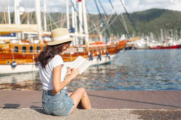
Consigli per il tuo primo viaggio: inizia con un anello costiero di 4 giorni lungo una costa nazionale occidentale, mantenendo le tratte brevi e costanti per evitare la fatica. Questo piano si basa su corsi d'acqua riparati, con foci di fiumi affidabili e buoni ancoraggi, e abbina un facile imbarco e soggiorni in hotel a una vita equilibrata a bordo.
Vantaggio stagionale: Nei mesi più caldi, la luce dura a lungo e un ritmo da siesta ti aiuta ad allineare le visite alla costa con caffè e mercati locali. Fermati nelle città costiere per pranzi freschi, poi passa a una pensione tranquilla o local hotel per la notte; il life Ashore è facile da godersi tra una nuotata e il tramonto.
Su 25 percorsi, le deviazioni spaziano da estuari fangosi a lagune cristalline, con ogni tappa progettata per brevi tragitti che mantengono il ritmo umano anziché affrettato. Aspettatevi che i ponti segnino le transizioni, con una svolta a destra al canale, e lunghe serate ancorati vicino a restaurants che offrono specialità locali.
Planning tips: mappare le maree per i segmenti dei corsi d'acqua e verificare le finestre di attracco in ogni porto. Con un short finestre di imbarco, puoi adeguarti alle condizioni meteo e alle esigenze dell'equipaggio e preventivare l'ormeggio. Prenota in anticipo in alta stagione; soggiornare vicino a buone restaurants semplifica le serate e troverai opzioni per ogni festa e stile di vita.
Everyone trovare un itinerario adatto a un fine settimana, una breve fuga o un anno di esplorazione. Con equipaggi locali, comode cuccette e cittadine costiere lungo l'acqua, un circuito ben pianificato diventa un ritmo memorabile di vento, scia e deliziosi pasti nei ristoranti in riva a un bridge o lungo una banchina tranquilla.
Guida pratica per rotte in barca per navigazioni panoramiche
Consigli: iniziare a Maiorca, ormeggiare nel riparato porto turistico di Palma, quindi dirigersi verso Ibiza Città come prima tappa; la distanza è di circa 60–70 miglia nautiche; a 6–8 nodi la traversata dura 9–11 ore; le mattine sono tranquille con mare leggermente mosso, acqua limpida e l'ingresso di Ibiza è accessibile alla maggior parte delle imbarcazioni; soggiornare a Palma consente di verificare provviste, carburante e dotazioni di sicurezza e fornisce una solida base di partenza per le prossime tratte.
Da Ibiza a Formentera: 15–25 nm; 2–4 ore a 6–7 nodi; ormeggiare a La Savina o ancorare vicino a Ses Illetes; la costa premia con calette ricche di natura, acqua più calda e panorami senza tempo; un rapido giro in auto sulle rive di Formentera offre la possibilità di assaggiare i prodotti locali e ammirare un tramonto.
Da Formentera dirigiti all'isola di Cabrera, circa 50–70 nm; 8–12 ore a seconda del vento; Cabrera offre un unico porto più rade tranquille ed è abbastanza isolata da sembrare remota; aspettati granchi corridori lungo le coste rocciose e pianifica i regolamenti del parco prima di sbarcare.
Rientro verso Maiorca: Cabrera a Palma o Sant Antoni copre 40–60 mn; 6–9 ore; si conclude in una vita più calda e vivace; ogni notte offre una luce diversa lungo la costa meridionale, con la possibilità di soggiornare vicino alla città o ancorare in una cala appartata per la notte.
Estensione più lunga: se il tempo lo permette, una tappa verso la Grecia per toccare le isole greche aggiunge una fantastica opportunità per variare le rotte; richiede una pianificazione più lunga, ma i ritmi e i venti spesso si allineano a fine primavera o inizio autunno, mentre l'atmosfera pacifica delle Baleari rimane una base affidabile.
Le 25 migliori destinazioni: regione, acque e punti di accesso
Il profondo e autentico Inside Passage dell'Alaska offre baie tranquille e imponenti ghiacciai; pianifica questa tappa a ottobre per la magia della luce autunnale e gli avvistamenti di balene.
Costa della Patagonia, Americhe, fonde scogliere frastagliate con canali turchesi; accesso via Puerto Natales o Punta Arenas; questo percorso mozzafiato diventa un rifugio per la fauna marina e gli appassionati di pagaia, con grotte lungo le insenature e rare formazioni rocciose di raro.
Il corridoio del Canale di Panama offre acque calme e trafficate e un intreccio di fiumi; accesso dai moli di Balboa o Colón; lì puoi osservare navi classiche e traffico di navi moderne, oltre a un rifugio per gli uccelli delle mangrovie.
I fiordi norvegesi offrono insenature profonde, mattine tranquille e spettacolari grotte nelle scogliere; accesso da Bergen o Åndalsnes; pianifica partenze anticipate in ottobre, quando gli uccelli marini volteggiano e l'acqua si trasforma nella tela di un pittore.
Fiordland, Nuova Zelanda, fonde montagne rese lucide dalla pioggia con lunghe baie; accessibile tramite Milford Sound o Manapouri; pagaiare qui sembra un sogno, con crinali mozzafiato e acque verde intenso che diventano la dimora della fauna selvatica.
La costa della British Columbia, Americhe, offre insenature e lunghi passaggi; accesso da Vancouver, Port Hardy o Prince Rupert; questa regione fonde fauna selvatica e mattinate tranquille, una delle mete preferite per il kayak a fine stagione e l'osservazione delle balene.
L'arcipelago delle Galápagos nelle Americhe offre acque cristalline e un raro rifugio per la vita marina; accesso tramite Baltra o Santa Cruz; le prime nuotate rivelano banchi di pesci e opportunità di osservare il comportamento delle balene.
La Baja California Sur offre infinite baie e lagune tranquille; accessibile da La Paz o Cabo San Lucas; questo paradiso per il kayak offre viste mozzafiato sulle scogliere, approdi con panga e occasionali affioramenti di grotte lungo la costa, con serate di poker a terra.
I corsi d'acqua del bacino amazzonico scavano canali profondi attraverso la lussureggiante foresta pluviale; accesso da Belém o Manaus; questo vasto sistema supporta un mix di vita fluviale e uccelli della foresta, e ci sono luoghi in cui scivolare in acque calme per pagaiare sotto una volta verde.
La costa dalmata lungo la Croazia offre acque limpide e profonde tra le isole calcaree; accesso da Spalato o Zara; la luce del tardo pomeriggio sull'acqua è impressionante, con villaggi arroccati sulle scogliere e mari che sembrano un'aula tranquilla per le imbarcazioni.
Le isole greche nell'Egeo offrono calette azzurre e scogliere spettacolari; accesso da Creta o Rodi; pagaiare qui fonde antiche coste con venti freschi, e la luce mattutina rivela colori mozzafiato lungo i villaggi imbiancati a calce.
La Costiera Amalfitana, Italia, offre ripide scogliere e acque cristalline; accessibile da Salerno o Sorrento; pagaiare di primo mattino rivela grotte e archi simili a grotte che accendono le classiche vibrazioni mediterranee.
Il sistema di canali di Amsterdam, nei Paesi Bassi, offre percorsi tranquilli e poco profondi e passaggi attraverso le chiuse; accesso dai moli centrali; questa combinazione di via navigabile urbana è perfetta per pagaiare a fine stagione e osservare le imbarcazioni che passano accanto ai timpani storici.
La Valle del Douro portoghese offre scenari intessuti di fiumi con profonde sacche vinicole; accesso da Porto o Barca d'Alva; sezioni pulite, simili a canali, e maree tranquille rendono facile pagaiare in ottobre.
Il Delta del Mekong in Asia offre ampi e calmi bassifondi e fitte mangrovie; accesso da Ho Chi Minh City o Can Tho; questo connubio di vita fluviale e mercati galleggianti prospera vicino a villaggi anau e grotte nascoste lungo insenature più tranquille.
Le formazioni carsiche calcaree di Halong Bay nel Mar Cinese Meridionale creano canali e grotte marine spettacolari; accesso da Hai Phong; pagaiare qui è un saggio mozzafiato di forme rocciose e acque riflettenti, con mattine calme e riflessi di nuvole.
Raja Ampat nel Triangolo dei Coralli offre acqua cristallina, lagune profonde e barriere coralline prolifiche; accessibile da Sorong; pagaiare tra gli isolotti carsici regala un mix di sole, banchi di pesci e isolamento, c'è sempre qualcosa di impressionante.
Le scene della baia di Bacuit e di El Nido a Palawan combinano baie turchesi e calette nascoste; accesso da El Nido o Coron; pagaiando al mattino presto si scoprono grotte e barriere coralline dorate, e l'acqua rimane calma e fedele al suo colore.
Le isole Whitsunday, in Australia, offrono baie tranquille e vivide pareti coralline; accesso da Airlie Beach; questa classica zona di crociera attrae appassionati della barriera corallina e osservatori di balene, con una luce straordinaria e una profonda sensazione di casa a bordo.
Le acque della Grande Barriera Corallina intorno al Queensland offrono canali caldi e limpidi con una ricca fauna ittica; accesso da Cairns o Port Douglas; pagaiare tra isolotti e barriere coralline rimane un'esperienza classica, con i più mattinieri che catturano il colore sull'acqua.
L'arcipelago di Dubrovnik nell'Adriatico fonde canali blu con cittadine a picco sulla scogliera; accesso dal porto di Dubrovnik; pagaiare qui rivela scalinate in pietra lungo la costa e grotte marine nascoste dietro gli isolotti.
Il delta del Nilo in Africa offre ampie canne e tranquari estuari; accesso da Alessandria; questo percorso fluviale diventa un raro rifugio per l'avifauna, con antiche coste e un ritmo di pagaiata lento adatto sia ai principianti che ai veterani.
Siargao e le isole circostanti nelle Filippine offrono acque calde, giardini di corallo e lagune; accesso tramite Siargao Town; il percorso fonde la vita dei pesci con scenari di alberi di cocco e lagune color smeraldo che si rivelano al mattino presto.
Le coste caraibiche intorno a Grenada offrono acque turchesi, piattaforme coralline e calette riparate; accesso da St. George's; questo tratto di fine stagione diventa un rifugio per la vita marina e un'opportunità per avvistare balene in zone più profonde.
Le Lofoten, in Norvegia, offrono mari profondi e gelidi e cime spettacolari; accessibili da Svolvær o Tromsø; pagaiare lì fonde la luce polare con pareti rocciose e un classico senso di avventura, con mari calmi e tramonti precoci.
Migliori finestre stagionali e condizioni di marea per ogni fermata
Cerca sempre la finestra sulla spalla a Paradise Cove: maggio–luglio offre uno stato del mare calmo con maree di 0,3–0,6 m, tipicamente dominate dalle quadrature, e venti mattutini di 6–12 nodi da ovest, ideali per pagaiare e per brevi spostamenti vicino al porto.
-
Paradise Cove – Costa Mediterranea
- Finestra ideale: maggio–luglio
- Escursione di marea: 0,3–0,6 m
- Tipo di marea: sizigiale dominante
- Vento: 6–12 nodi (mattina, O–SO)
- Lato migliore per l'ingresso: lato est del porto
- Attività consigliata: pagaiate lungo le bianche scogliere; brevi spostamenti verso le calette
- Caratteristiche notevoli: roccia a tunnel spettacolare nelle vicinanze; panorami mozzafiato
- Note: ancoraggi tranquilli; evitare la folla del fine settimana nei mesi di alta stagione
-
Delta del Waimakariri – Costa della Nuova Zelanda
- Finestra ideale: Ott–Dic
- Escursione di marea: 1,2–2,6 m
- Tipo di marea: mista (maree sizigiali–quadraturale)
- Vento: 8–16 nodi (potenziale da sud-ovest)
- Lato migliore per entrare: costa settentrionale
- Attività consigliata: lunghe pagaiate lungo banchi di sabbia; foci tranquille dei fiumi
- Caratteristiche notevoli: canali in continuo cambiamento; infinite sabbie pallide.
- Note: attenzione ai canali intrecciati con la bassa marea; lì, i solchi del Waimakariri sono frequenti.
-
Dorado Point – Costa caraibica
- Finestra ideale: dic–apr
- Variazione di marea: 0,8–1,5 m
- Tipo di marea: mista, con maree sizigiali più forti in concomitanza con la luna piena
- Vento: ENE 10–18 nodi
- Lato migliore per l'ingresso: il lato sud per ridurre al minimo il chop
- Attività consigliata: snorkeling lungo le barriere coralline; gite in paddle-lank o con piccole imbarcazioni
- Caratteristiche notevoli: ambientazioni da isola paradisiaca; avvistamenti di lampughe vicino alle barriere coralline
- Note: aumento della folla durante le festività; pianificare passaggi prima dell'alba per canali tranquilli
-
Tunnel Bay – spettacolare costa atlantica
- Finestra ideale: apr–giu
- Escursione di marea: 1,2–2,0 m
- Tipo di marea: maree diurne regolari
- Vento: NW 12–20 nodi
- Lato di entrata migliore: lato sottovento dell'ingresso del tunnel
- Attività consigliata: esplorare la grotta marina; pagaiare oltre il bagliore della luce del giorno
- Caratteristiche notevoli: un tunnel naturale scavato dalle onde; alte scogliere
- Note: mantenersi entro i canali segnalati; forte risacca possibile durante la bassa marea
-
Michaels Wharf – tranquillo porto di paese
- Finestra ideale: maggio–set.
- Escursione di marea: 1,0–2,0 m
- Tipo di marea: mista, con massime superiori durante le maree sigiziali
- Vento: 6–12 nodi (leggere brezze di mare pomeridiane)
- Miglior lato di accesso: approccio occidentale al bacino riparato
- Attività consigliata: pagaiate tranquille lungo le banchine; passeggiate nei villaggi a terra
- Caratteristiche notevoli: il fascino del lungomare di Michaels; segnali portuali; case dipinte di bianco
- Note: questo lungo e tranquillo tratto è l'ideale per gli amanti della classica vita portuale.
-
Folsom Anchorage – Contrafforti del Pacifico nord-occidentale
- Finestra ideale: apr–giu
- Escursione di marea: 2,0–3,0 m
- Tipo di marea: misto con alte maree pronunciate
- Vento: NW 8–14 nodi
- Migliore lato di entrata: lato sottovento a sud per ridurre le raffiche
- Attività consigliata: pagaiata alla deriva tra canali sempreverdi; costa panoramica
- Caratteristiche notevoli: costa frastagliata; suggestivo sfondo sempreverde
- Note: fai attenzione alle correnti vicino alle foci dei fiumi; le lunghe giornate premiano una pianificazione paziente
-
Angolo degli innamorati – Fronte Adriatico
- Finestra ideale: maggio–set.
- Variazione di marea: 0,8–1,4 m
- Tipo di marea: moderata
- Vento: SE 6–12 nodi
- Lato di entrata migliore: banchina del porto esposta a est
- Attività consigliata: pagaiata al tramonto; baie tranquille per una pausa romantica.
- Caratteristiche notevoli: insenature intime; acque calme in baie riparate
- Note: attenzione ai pescherecci al crepuscolo; le ancore tengono bene sui fondali sabbiosi
-
Villaggio di White Harbor – Costa baltica
- Periodo ideale: giu–ago
- Variazione di marea: 2,0–2,5 m
- Tipo di marea: ciclo sizigie-quadratura regolare
- Vento: SO 10–18 nodi
- Lato migliore per l'ingresso: accesso da nord per mantenere la zona sottovento calma.
- Attività consigliata: passeggiate costiere; pagaiate lungo il litorale di sabbia bianca
- Caratteristiche notevoli: coste bianche; atmosfera da villaggio portuale
- Note: le prime ore del mattino offrono acque cristalline; prepararsi ai cambiamenti stagionali dell'affluenza.
-
Promontorio di High Cliff – panorama della costa occidentale
- Finestra ideale: apr–giu
- Escursione di marea: 1,0–2,0 m
- Tipo di marea: mista, con scambi rapidi
- Vento: N 8–14 nodi
- Miglior lato d'ingresso: insenatura protetta sul fianco sinistro
- Attività raccomandata: pagaiata a contatto con le scogliere; viste panoramiche sul mare mosso
- Caratteristiche notevoli: imponenti pareti calcaree; scenari alpini panoramici.
- Note: le correnti possono intensificarsi in prossimità del promontorio; in caso di incertezza, consultare i piloti locali
14 Consigli per l'Ormeggio, l'Ancoraggio e Informazioni Utili sui Porti Locali negli Hamptons, NY
Consiglio: prenota in anticipo un ormeggio o uno scalo per l'alta stagione tramite Boatsetter, quindi programma un arrivo nel tardo pomeriggio per facilitare i controlli e l'approvvigionamento. Scegli un porto protetto a sud lungo Sag Harbor o Three Mile Harbor per ridurre la deriva e goderti un magico benvenuto mentre le barche a vela scivolano davanti alle mura naturali del porto. Questo approccio rende il tuo viaggio efficiente e senza stress, sia che tu stia trascorrendo un fine settimana o un soggiorno più lungo.
Sag Harbor offre un'insenatura naturale e ben protetta, con un riparo affidabile quando il vento cambia da sud. Prenota in anticipo e pianifica la sosta per il rifornimento di carburante al vicino porto turistico prima del tramonto. L'approccio al canale laterale è semplice e troverai un piccolo rifugio dal suono intenso nel suo bacino calmo, dove la qualità dell'acqua supporta una diversificata specie di uccelli e la vita della barriera corallina lungo i pali.
Three Mile Harbor offre un bacino più lungo e piatto con facile accesso alla Peconic Bay. È l'ideale per famiglie e viaggi più lunghi, con ormeggi semplici e banchine comunali affidabili. Se arrivate in ritardo, le luci del porto vi guidano verso il campo boe meridionale, e potete rifornirvi di provviste in un mercato vicino prima di una gita al tramonto attraverso il canale.
Montauk offre un cambio di scenario radicale: la lunga e frastagliata costa e le imponenti scogliere creano uno sfondo magico per una notte al molo. L'ingresso richiede cautela durante un forte vento da sud o una mareggiata di fine stagione, quindi pianifica il transito in condizioni di corrente debole attraverso il canale principale e considera uno scalo laterale riparato presso un ormeggio pubblico o lo yacht club locale. Una breve passeggiata fino a un muro di protezione simile a un forte e alla grotta marina vicino alla punta offre ai visitatori una memorabile parentesi naturale prima della prossima tappa.
Per una portata più ampia, Greenport e i porti vicini di North Fork offrono alternative quando hai terminato l'arco principale degli Hamptons. Questi luoghi offrono un ritmo diverso: più vita di paese, giornate più lunghe e una rete di banchine più ampia, utile se stai pianificando un itinerario più lungo o cerchi un rifugio invernale con meno folla. Se sei in visita con un equipaggio, organizza la condivisione della barca tramite Boatsetter e controlla gli orari dei comandanti dei porti locali per evitare conflitti con le flotte di pesca e il traffico dei traghetti.
Consigli per un'esperienza locale: porta con te una radio VHF di riserva, conferma le finestre di marea e tieni pronto un piccolo piano, consapevole delle maree, per le insenature. Fai una passeggiata al negozio di artigianato Michaels per attrezzature o regali dell'ultimo minuto e pianifica una piccola gita secondaria per vedere le grotte naturali e le sacche costiere vicine che rendono questa costa davvero magica, soprattutto al tramonto.
In ogni tratta, rispetta i segnali privati e i limiti indicati, e assicurati che il tuo equipaggio comprenda l'approccio a ogni porto attraverso un'attenta navigazione costiera. Questa costa premia la preparazione, la pazienza e la volontà di adattarsi ai groppi del tardo pomeriggio o a una calda accoglienza rurale dopo una lunga giornata in mare.
Che si tratti di una breve sosta o di un itinerario più lungo, queste opzioni portuali offrono affidabilità, bellezza naturale e facile accesso a provviste, carburante e comodi servizi a terra che renderanno memorabile il tuo viaggio attraverso gli Hamptons.
| Harbor | Migliore opzione di ormeggio/posto barca | Depth Range | Note |
|---|---|---|---|
| Sag Harbor | Sag Harbor Village Marina / boe di ormeggio | 6–12 ft | Chiama in anticipo; i posti in estate si esauriscono velocemente; carburante e provviste nelle vicinanze. |
| Three Mile Harbor (East Hampton) | Molo della città di East Hampton / porti turistici privati | 1,5–4,5 m | Ideale per famiglie; facile accesso a Little Peconic Bay |
| Porto di Montauk | Montauk Yacht Club / posti barca pubblici | 8–20 piedi | Costa frastagliata; le correnti possono intensificarsi nel canale; pianificare l'entrata con la bassa marea |
| Greenport / Opzione North Fork | Greenport Harbor Marina | 12–18 piedi | Scena portuale più vivace; salti più lunghi; ormeggio invernale limitato |
Elementi essenziali per la sicurezza: attrezzatura, condizioni meteorologiche e normative locali
Tieni sempre a bordo un giubbotto di salvataggio omologato dalla Guardia Costiera per ogni persona e un dispositivo di galleggiamento lanciabile a portata di mano; conserva una borsa impermeabile con batterie di ricambio per il VHF e un GPS portatile, oltre a un kit di attrezzi di base, un kit di pronto soccorso e attrezzatura di segnalazione (razzi o uno specchio di segnalazione). Porta con te un'ancora con almeno 15-20 metri di cima e una piccola corda di scorta, una pompa di sentina o una捞iutatrice, un coltello robusto e un estintore adatto all'uso marino. Includi carte nautiche o mappe offline, un giornale di bordo per i controlli quotidiani e un semplice quaderno meteorologico per annotare i cambiamenti del vento. Queste misure creano un'ottima base di sicurezza per le gite costiere.
Pianificazione meteorologica: rivedere una previsione a 12 e 24 ore prima della partenza e controllare le tabelle di marea locali. Monitorare la velocità del vento, le raffiche e lo stato del mare; rimandare la partenza in caso di vento forte (spesso 20-25 nodi) o mare mosso oltre i limiti pratici. Nelle regioni tropicali o durante la primavera, le tempeste possono formarsi rapidamente; avere un piano di rifugio e conoscere il porto riparato più vicino. Cercare di arrivare in un porto turistico protetto o in un ancoraggio sicuro prima del tramonto; queste precauzioni aiutano a mantenere un'operatività fluida con meno rischi. Lo sfondo di nuvole e sole dovrebbe essere una scena calma e prevedibile.
Normative locali: nelle Americhe, verifica la registrazione dell'imbarcazione, l'assicurazione e i requisiti dell'operatore per le rotte scelte. Molte aree limitano l'ancoraggio o impongono permessi per le zone protette; rispetta i limiti di velocità vicino agli habitat, le zone senza scia vicino ai porti turistici e le aree di rifugio designate. Porta sempre con te un documento di identità, la prova dell'assicurazione e i contatti di emergenza e segui le istruzioni delle autorità portuali; le normative possono cambiare di anno in anno, quindi ricontrolla prima di ogni viaggio.
Disciplina operativa: presentare un piano di navigazione alla capitaneria di porto o al responsabile del porto turistico, includendo rotta, ETA e alternative. Eseguire un controllo di sicurezza giornaliero dell'attrezzatura di coperta, della sentina, dei sistemi elettrici e della preparazione delle zattere di salvataggio o dei PFD; testare il VHF e le comunicazioni di backup. Mantenere un piano semplice e scalabile: se le condizioni peggiorano, dirigersi verso il rifugio più vicino; esercitarsi nelle fermate di emergenza e nelle esercitazioni di uomo in mare quando le condizioni lo consentono.
Manovre in acqua vicino alla costa: gli appassionati di pagaia devono tenersi ben lontani dalla corrente principale, fare attenzione alle imbarcazioni di passaggio e mantenere almeno una lunghezza della barca di distanza da scogliere e insenature; evitare di nuotare vicino a pareti rocciose durante le mareggiate. Quando si naviga verso Capri o altre coste famose, lo stile di vita può essere fantastico, ma preparatevi alla folla e mantenete una velocità costante per ridurre la scia. Con una routine affidabile, aumentate le possibilità di tornare sani e salvi e avrete più opportunità di godervi il sole tropicale, l'atmosfera di livello mondiale e l'impressionante fascino di queste coste.
Esempio di itinerario di 5 giorni: da Sag Harbor a Montauk con soste sulla costa
Parti da Sag Harbor all'alba per quattro o cinque ore in acqua, concedendoti una sosta a Three Mile Harbor per una pausa riparata sulla spiaggia, pranzo e una passeggiata lungo sentieri appartati costruiti nell'insenatura. La splendida costa qui offre una luce che può ricordare Maiorca all'alba o Santorini al tramonto, con yacht che solcano il canale mentre ti immergi nel ritmo della giornata.
Il secondo giorno si sposta verso est, verso Mecox Bay, con una tratta di navigazione di tre-quattro ore a sei-otto nodi. Le soste a terra includono una spiaggia a Bridgehampton, una passeggiata su un sentiero tra le dune e un pranzo al molo; potrai anche pescare dalla prua o partecipare a una breve battuta di pesca. La costa rimane fotogenica e appartata, con basse scogliere e insenature di marea che invitano a una passeggiata più lunga prima di proseguire.
Il giorno 3 prevede dalle tre alle quattro ore di navigazione da Mecox Bay a Coecles Harbor a Shelter Island. Una nebbia mattutina può formare un tunnel attraverso lo stretto, offrendo una luce spettacolare per le foto. Dopo aver gettato l'ancora o essersi ormeggiati a una boa, noleggiate delle biciclette per esplorare le stradine di mare di Shelter Island o fate una passeggiata lungo il porto.
Il giorno 4 si dirige a Greenport, un salto di due o tre ore con la possibilità di esplorare la cultura marittima al museo, passeggiare sullo storico lungomare e fare una pausa sulla riva al molo. Se non vi siete organizzati prima, questo è il momento ideale per rifornirvi e gustare pesce fresco prima della tappa finale, mentre il porto di Greenport mostra una delle più grandi flotte pescherecce d'America e una vivace e pratica cultura costiera.
Il giorno 5 è la tappa finale: da Greenport a Montauk, in genere dalle quattro alle sei ore di navigazione a seconda del vento. Costeggerai la costa superando Ditch Plains e il faro di Montauk Point, il più antico di New York, e getterai l'ancora a Montauk Harbor per una cena celebrativa. La costa porta con sé nelle sue storie una storia di caccia e baleniere, un ricordo del patrimonio marittimo americano. In estate la luce tropicale indugia dopo il tramonto; in inverno la tavolozza diventa cristallina. Concludi il viaggio con una sessione di poker sul ponte sotto le stelle e brinda alla traversata.