

 How to Create a Float Plan – The Complete Guide for Safe Boating">

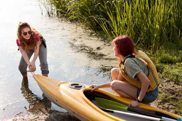
Write a written float plan today and share it with guardians and the operator before you head on-water.
Your plan should cover the on-water route, the estimated return time, and contact methods for contacting the crew if plans shift. Include the boat name and operator, a line of reference points such as a tower or shoreline markers, and, if available, coordinates. If you can, add a demos section to illustrate how the plan works in practice so guardians can see what to expect.
Before departure, contact guardians by call or text to confirm receipt of the plan, and ensure you have a backup contact. Save the plan in a written file above the console and also keep a copy on your device. Define what to do if contact is lost, and set a check-in cadence so your crew knows when to expect updates back from you.
During the trip, keep a portable power source, maintain radio contact with the operator, and be ready to adjust the plan if conditions worsen; update guardians with a quick status, a brief message, or a short call at milestone times. Maintain a clear timeline above the plan to show progress along the route, and if possible share photos or status updates at key points on-water.
Practical Float Plan Setup for Safer Boating
File a float plan before departure that specifies where you head, your intended line of travel, ETA, and planned check-ins; creating a clear, shareable document helps guardians and authorities stay aligned and reduces risk.
Assign guardians among crew or trusted contacts who monitor milestones, confirm arrivals, and trigger alerts if you drift off schedule; their prompt actions build trust and keep operations smooth.
Stock tools for real-time updates: a VHF radio, a satellite messenger, a chart plotter, and a spare battery with sufficient charge; test channels, set the course, and save the plan for quick reference, with sound alerts for missed check-ins.
Document contingencies for certain weather, currents, and daylight; include alternate routes and a line for filing with the coast guard or port authorities; list where to submit the plan and when to update it to keep operations transparent.
For activities like fishing or skiing, log specifics in the plan, including fishing zones and where skiers may cross; indicate what to expect from responders, show expected message times, and how to notify nearby boats if plans change; include a numbercolor marker to help responders identify you on charts.
Set a practical communications schedule: check-in every two hours, or more often in rough seas; specify radio channels and emergency codes, and ensure you can receive a quick reply; keep a copy with guardians and in the cabin, and follow uscg guidance for training or templates to support safe operations.
| Element | Details | Owner | Note |
|---|---|---|---|
| Route & ETA | Coast-to-offshore path; waypoints A→B→C; ETA targets; check-in windows | Captain | Maintain daylight limits |
| Communications | VHF 16, 69; satellite messenger; message templates | Ponte | Test pre-departure |
| Safety Gear | Life jackets, throwable, flares, radios | Equipaggio | Controllo batteria |
| Filing & Records | Float plan filed with authorities; copy kept aboard and with guardians | Captain | Include numbercolor codes |
| Contingenze | Weather shifts, currents, alternate routes | Operations | Update if conditions change |
Define Trip Details: Route, ETA, and Weather Window
Draft a written route and ETA now, save it as a template, and keep it within reach onboard. The plan should describe departure, next waypoint, pace, and a target arrival window so the crew can review at a glance and give feedback.
Plot the route along the coast from your marina to the next marina or to a trusted fishing spot, marking each leg with coordinates, distance (in nautical miles), and expected time. Use a visible line on the chart to connect points and describe the features of each segment, described here, including terrain, current, and potential hazards close to shore.
Set the weather window as a practical range you can rely on: forecast wind under 20 knots, seas under 2 meters, and visibility at least 3 miles. Prefer a window that covers the next watch, with a buffer to handle small changes in wind or swell. Check trusted sources and write down the forecast time, then compare it with your ETA at each waypoint to confirm the setting.
Build in sufficient margin for safety: add a priority fallback leg if conditions shift, and assign crew tasks so they can respond quickly. Give them clear responsibilities onboard, such as monitoring weather, managing lines, and keeping gear ready. If the forecast isnt favorable, you have a backup on deck and in the engine room, and you can hold position near a safe harbor until conditions improve. This approach reduces worry and keeps operations smooth and controlled. This level of planning also enhances the experience aboard.
Document and store the plan in your setting as a written record, for example in the ship’s log and on the onboard tablet. The template should be described with the next steps and the gear required, so the crew has a trusted reference. Share it with them before departure to avoid miscommunication and to speed decisions when speed changes or visibility drops.
After departure, maintain the same practice: review the route and ETA at the coast, confirm the float plan with all hands, and update the template as conditions change. Revisit the plan during the voyage and close the loop when you reach the next waypoint, using the written record to guide decisions and to hold the vessel on a safe heading. This document is the float plan, commonly called a float plan.
Record Vessel and Crew Info: Registration, Licenses, and Safety Gear
First, hold a single, up-to-date log that records registration numbers, license IDs, and safety gear checks, and keep it in a dry pocket near the helm for quick reference before every trip.
Record details: vessel name, hull ID, registration number, issuing authority, issue date, and expiration. Keep both a paper copy and a digital scan saved in a cloud location you trusted. This found reference saves time if you ever need to respond to questions from coast guard or harbor staff.
Licenses: ensure each operator holds a current certificate appropriate to the vessel, with expiry date clearly listed. Create a roster that includes each member name, role, license type, license number, and contact method. If someone didnt have a license for their role, assign a different task or return to shore. Keep these records on board and in the cloud for safety.
Safety gear: every person onboard wears a U.S. Coast Guard–approved life jacket; ensure sufficient life jackets for all passengers and that they fit properly. Keep a throwable flotation device within reach, a whistle or sound device, and a fire extinguisher that is inspected and not past its expiry. Have a first-aid kit, reliable communication devices, a GPS or handheld radio, and spare batteries. Carry a cell phone in a dry pouch as backup to the radio. Keep space free from clutter so you can grab gear quickly.
Checklist before leaving: verify registration numbers match vessel name; confirm licenses are valid; inspect safety gear: PFDs in good condition, throw bag accessible, fire extinguisher within date, signal devices current, VHF radio ready, backup light and battery, and a spare fuse. The point is to have everything visible and portable, and save a quick list of emergency contacts on the device and in the log.
When boating near the coast, especially around fishing boats and kayakers, reduce speed, keep a safe distance, and make planned passes with signaling. Use your VHF or a cell-based communication to confirm intentions. If a nearby vessel or person needs help, respond with a clear action and log the event. Keep the crew member responsible for communications informed and ready to advise course corrections.
Love for boating grows when you prepare and protect everyone on board. Review the record before each trip, update after maintenance or crew changes, and store copies in a cloud that you can access from shore. This habit saves time and helps you stay safe on every outing.
List Emergency Contacts and Reporting Points
Print a standard template of emergency contacts and keep it with your float plan; review and update it every few days of planning.
List authorities and reporting points clearly, including check-in schedules and the location where you report a problem.
For each contact include name, role, daytime and after-hours numbers, their vessel or company, and a cell or satellite device you can use to reach them.
Assign a person on board as the lead for reporting; store their direct contact and a backup contact so you can reach someone during operations.
Keep the information on at least two formats: a printed copy and a digital copy on your devices; both should stay accessible during drift or wind conditions.
Include reporting points along the route and times; the expected check-in windows help responders track progress amidst shifting conditions.
Record the gear and devices on board that you may need for self-rescue or signaling, and note their locations, so a responder can reach the right person quickly.
Verify the numbers regularly, and test your plan with a dry run; wrong numbers or outdated contacts waste time and risk safety.
Keep a live log of updates, including days since the last change and any new authorities or reporting points you add; that keeps everyone aligned.
Memorizzare la fonte per ogni contatto e annotare da dove proviene l'informazione per il check-in da una posizione remota.
Definisci i protocolli di navigazione e comunicazione: VHF/DSC, Posizioni e Segnalazioni
Dovrebbe stabilire un piano VHF/DSC principale ora e formare tutti su di esso. Tutti dovrebbero conoscere il canale primario per le chiamate di routine, la sequenza DSC e la procedura vocale per le emergenze. Tenere un foglio plastificato alla stazione di navigazione con il nome dell'imbarcazione, l'MMSI, l'elenco dei canali e i passaggi chiari per l'uomo a mare. Utilizzare dispositivi progettati per la ridondanza: una VHF fissa, una VHF portatile e un EPIRB riposto nella borsa di salvataggio. Entro pochi minuti dalla partenza, verificare che l'equipaggio in servizio possa passare al canale di emergenza ed eseguire un rapido test quando si arriva in una marina o si naviga con amici nelle vicinanze in modo che i soccorsi possano localizzare rapidamente l'imbarcazione. Ciò dovrebbe includere determinate verifiche meteo, consapevolezza del traffico e dettagli di contatto di emergenza.
Posizioni e segnalazioni si basano sulle trasmissioni GPS/DSC. Registrare la posizione come Lat/Long o griglia, includere l'ora e trasmettere tramite DSC quando possibile. Il comandante deve assicurarsi che il registro mostri quale persona dell'equipaggio è in servizio di guardia, quale canale è in uso e quale dispositivo è utilizzato per localizzare l'imbarcazione. Condividere i rapporti di posizione a intervalli regolari (ogni 5-10 minuti in navigazione; più frequentemente in mari agitati) e segnare qualsiasi deviazione in rotta o velocità. Se viene inviato un segnale di soccorso, assicurarsi che i dispositivi trasmettano l'allarme a tutte le imbarcazioni vicine e alla guardia costiera tramite DSC, EPIRB se il VHF si guasta e un segnale visivo se la visibilità lo consente.
Le pratiche di segnalazione enfatizzano la chiarezza. Utilizzare segnali visivi come bandiere o luci per integrare le chiamate radio, soprattutto nei canali del golfo trafficati o nei porti turistici affollati. Quando ci si trova vicino a un'altra vela o imbarcazione vicina, confermare la comprensione con un breve scambio radio e riconoscere la risposta con una conferma visiva. Se si perde il contatto, ripetere la chiamata su un canale diverso e considerare un allarme acustico all'equipaggio. Che tu navighi da solo o con un equipaggio, una routine di segnalazione concisa e ripetibile mantiene tutti allineati e riduce i ritardi.
Controlli finali dopo la pianificazione: nome, nominativo e MMSI su ogni schermo, assicurarsi che l'epirb sia a portata di mano e testato, e verificare che tutti i dispositivi siano carichi. Il piano dovrebbe coprire chi chiama, chi registra e chi fa attenzione ai pericoli. Nelle traversate del Golfo o nelle lunghe tratte costiere, assicurarsi che il comandante e i membri dell'equipaggio sappiano quando arrivare al prossimo punto di ruta o porto. Tenere un cartello di consultazione rapida vicino al timone e un'unità di riserva nella borsa. Questa configurazione proattiva permette ad amici, vicini ed equipaggio di rimanere informati, migliora i tempi di risposta e mantiene i piani di sicurezza privi di lacune.
Condividi, Carica e Aggiorna il Tuo Piano: Dove Inviare e Come Modificare
Inoltra il tuo piano di navigazione al portale della Guardia Costiera statunitense prima della partenza e condividi copie con il tuo contatto a terra in modo che tutti rimangano allineati. Se disponibile, presenta anche la domanda all'autorità competente per le imbarcazioni del tuo stato. Utilizza lo stesso canale per modificare, cancellare o aggiungere dettagli durante la pesca, la vela e la nautica. Quando i piani sono definitivi, invia il messaggio finale a tutti i soggetti coinvolti per confermare il percorso e le aspettative.
- Dove inviare
- Invia tramite il portale della Guardia Costiera statunitense; inoltre, copia la tua autorità statale per la navigazione e il marina o il club velico che utilizzi.
- Fornire una copia a un contatto interno che possa rispondere rapidamente qualora le autorità richiedano aggiornamenti.
- Mantenere l'accesso per tutti quelli elencati nel piano in modo che le risposte possano arrivare tempestivamente.
- What to include
- Includere: nome della nave, insegna distintiva, dimensioni (lunghezza e larghezza), colore dello scafo (blu se applicabile) e dettagli del motore (marca, modello, cavalli vapore).
- Percorso pianificato: origine, destinazione, punti di passaggio successivi e tempi stimati di arrivo in punti chiave.
- Numero di passeggeri e ruoli a bordo (capitano, navigatore, vedetta, equipaggio e qualsiasi ospite).
- Attrezzature e dispositivi di sicurezza: giubbotti di salvataggio, VHF, bengali, EPIRB, estintore, kit di pronto soccorso.
- Attività programmate: pesca, manovre a vela, traino o dimostrazioni di procedure di recupero persona in mare.
- Punti di riferimento da localizzare: torre, faro o elementi della linea di costa; annotare quelli individuati o punti di riferimento alternativi.
- Contingenze: condizioni meteorologiche, correnti, congestione portuale e qualsiasi considerazione relativa ad assicurazioni o coperture marittime.
- Pronta allo decollo: confermare che tutti siano stati informati, l'equipaggiamento sia stato fissato e i passeggeri siano pronti per la partenza.
- Dettagli assicurativi: titolare della polizza, numero di polizza e ambito di copertura per l'area pianificata.
- Considerare fattori: condizioni meteorologiche a bordo, maree, traffico e potenziali ritardi per informare la riprogrammazione.
- Includere una nota per i rispondenti: il piano finale, il contatto a bordo e gli orari di arrivo previsti.
- Poi assicurarsi che ci sia un piano per localizzare l'imbarcazione se dovesse andare alla deriva o cambiare rotta inaspettatamente; c'è sempre un piano di riserva.
- Come modificare
- Aggiorna tempestivamente in caso di modifiche al percorso, ETA, equipaggio o destinazione.
- Invia le modifiche attraverso lo stesso canale utilizzato per presentare il piano; includi “modifica” nel messaggio e fai riferimento al piano originale quando possibile.
- Se qualcosa cambia, c'è urgenza di aggiornare il file e informare il tuo contatto onshore e le autorità.
- Se il piano viene cancellato o sarai in ritardo, invia un messaggio finale per chiudere il file ed evitare confusione per i risponditori.
- Richiedi una ricevuta o una conferma dell'aggiornamento e tienila a portata di mano per rispondere alle richieste della Guardia Costiera statunitense, dell'assicurazione o del tuo referente a terra.
Mantenete tutti pronti a rispondere rapidamente e assicuratevi che il vostro equipaggio comprenda le ultime modifiche. Seguendo questi passaggi, manterrete la tranquillità per l'attrezzatura da nautica, i passeggeri e gli assicuratori, e tutti sapranno come individuare l'ultima versione del vostro piano, durante mari calmi o in mezzo a una giornata intensa in acque blu.