

 Your Guide to Marine Navigation Technology – Tools, Techniques, and Trends for Safe Sailing">

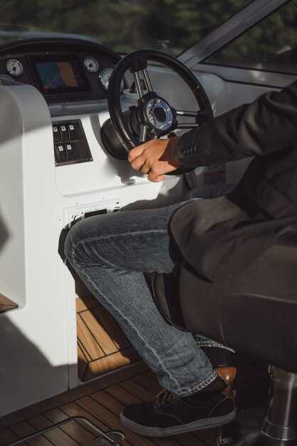
Start every voyage with a robust backup navigation setup: pair a multi-sensor instruments suite with offline charts and a rugged handheld radio as a fallback. This approach reduces risk when GNSS or data links fail, keeping you confident at the helm.
Modern technology brings advancements in collision avoidance, route planning, and weather awareness. Know where you sail? Use charts with overlays from AIS, radar, and GNSS. Set short-range alerts and limit autopilot responses to maintain safe margins. Do not rely on a single data source; relying on multiple feeds keeps you accurate. This approach feels practical because it relies on multiple data sources, not a single feed.
Keep dead reckoning skills fresh as a fallback when signals drop. Plot a fix from speed, course, and time against your charts and known land features. Treat shipping lanes as a road at sea: monitor traffic, verify with AIS, and use radar for crossing situations. This awareness helps you take quick corrective action without panic.
Always follow colregs and keep your onboard sensors aligned with official sources. Maintain a routine to review harbour entry charts, depth contours, and navigational aids. A mismatch between the chart and radar data signals a potential issue: switch to the backup display and check with land-based forecasts, including weather and tide data. It is important to train the crew on these checks to maintain readiness.
Practice drills build awareness and reduce accidents in high-traffic zones near mega ports. Create a pre-sail routine that validates instruments, confirms charts, and tests backup communications. In coastal operations, keep a simple mental model of routes and shipping lanes to avoid congested traffic, and stay vigilant for shifts in weather, currents, and traffic patterns.
Coastal Navigation: Focused Tools and Methods for Safe Approaches
Always plan the coastal approach using updated charts and a tide table, then verify bearings with compasses and GPS while cross-checking with radar. The approach involves cross-checks between multiple data sources to confirm safe entry and allows timely corrections in busy harbor traffic.
Youll find the following tools and methods practical for a clear, repeatable approach. Notes as referred to in the table highlight rocks and hazards, indicate risk, and the approach will offer multiple data sources to avoid surprises.
- Updated charts from international hydrographic offices
- Tide table and current data; keep a printed table on board
- Compasses and bearing calculations for fixes
- GPS, AIS, and radar to locate your ship relative to rocks and hazards
- Books and harbor guides to learn what local hazards and landmarks to expect
- Local knowledge from fishermen and harbor authorities to confirm the best entry path
- Visual references: lights, buoys, and leading marks that mark safe channels
- Harbor entry plans for charter operations and yachting crews to avoid busy traffic
- Preparation: gather updated charts, tide table, and local hazard notes. Then compute the approach bearing and plan the route, noting any rocks or shoals to avoid. Detail hazards and recommended distances in the route plan.
- Observation: monitor radar, AIS, and GPS; cross-check against the chart notes that indicate the same bearing.
- Execution: steer to the entrance with a safe distance from rocks; adjust for current and wind; maintain the bearing until you clear the hazards.
- Verification: confirm the track with at least two independent indicators; if discrepancies appear, widen the entry and reassess with crew input.
- Post-approach: log what worked and what hazards were encountered; youll update your notes in the books and share with the crew.
To keep your crew ready, review this content before each coastal approach. The approach relies on updated information, on-board tools, and local insight; youll master the process and share techniques with other captains in yachting or charter operations. This practice allows safer, more predictable entries and helps you avoid rocks and hazards in busy coastal zones.
GPS and GNSS Accuracy for Narrow Coastal Waters
Use multi-constellation GNSS with live corrections and verify your position against charts; theres no need to rely on a single signal in waters where rocks and breakwaters create multipath. Enable GPS, Galileo, GLONASS, and BeiDou and connect to an available correction service (NTRIP, DGNSS) when you can. This setup supports safer decisions while approaching your destination. youll notice smoother tracking in channels and harbors.
In narrow coastal waters, accuracy varies: standalone GPS often sits in the 3-7 m horizontal range; available SBAS lifts this to about 1-2 m; combining four constellations reduces typical uncertainty to roughly 0.5-2 m; RTK/PPK corrections deliver centimetre- to decimetre-level fixes when sky view is good, but multipath near rocks or piers can push errors to tens of centimetres or more.
To improve reliability: enable mega-constellations (GPS, Galileo, GLONASS, BeiDou) to increase satellites in view; connect corrections via NTRIP or a local broadcaster; set update rate to 5 Hz or higher; turn on integrity monitoring; review the satellite list and how many satellites are visible; understand how HDOP relates to drift; keep a clear sky view by avoiding narrow skylines and heavy canopy. youll notice fewer dropouts when you optimize these settings.
Backup practice: read the charts and use their compasses as cross-check; when GNSS shows drift, align the course with landmarks and known rocks; combine depth readings and radar if present; always have a manual plan for the road to your destination.
Product choices: this article recommends receivers that support four constellations and multi-band signals, accept RTK/PPK and NTRIP, and provide clear accuracy readouts and integrity flags; ensure your devices can display HDOP, the number of visible satellites, and a reference to where status can be read; test new settings on open water before entering tight channels; document their performance in a article-based log to track changes and improvements for their team.
VTS and Coastal AIS Data for Traffic Management
Set up a unified VTS-AIS workflow that feeds a single display for real-time traffic management along busy coastal corridors. youll integrate AIS with VTS radar, ensure time-synced feeds, and configure alerts for collision risk. Use 2-second AIS updates for Class A vessels and 30-second updates for Class B to keep plotting around the latest positions.
Plotting strategy centers on layering AIS tracks on chart fields that include area boundaries, landmarks, and shallow zones. note the landmarks such as lighthouses, breakwater buoys, and coastlines to anchor orientation. Maintain a polygon around shallow vizek (< 20 m) to trigger warnings, and create a dedicated lane or time window for watersports near popular beaches to reduce conflicts.
Decision workflow relies on a clear, repeatable process. When CPA falls below 3 NM and time to closest point is under 15 minutes, the operator can alter the vessel’s route by issuing speed changes or a recommended heading. The display mutat color-coded statuses: green for normal, amber for rising risk, red for imminent risk; decisions are shared with the local coastguard or port authority as needed.
Starting with a pilot corridor of roughly 15–20 NM along the main approach, youlL extend the region once lessons are embedded. Journeys of ships and small craft around landmarks and along shorelines reveal where risk concentrates; discover patterns by plotting historical tracks and cross-referencing with weather and tide data.
In zones where watersports and fishing fleets mingle with commercial traffic, ensure a separate monitoring lane and alert layer. available coastal AIS feeds plus shore-based radar improve coverage where some vessels don’t broadcast AIS; note that signals may degrade near shore or in heavy surf. Youll periodically review and adjust area boundaries, signs, and warnings to keep local traffic flowing around critical obstructions and shallow channels.
ECDIS Configurations: Chart Integrity and Shoreline Overlays
Recommendation: Enable automatic chart integrity checks and verify shoreline overlays before every journey. Pull ENC data from official international sources, validate digital signatures, and confirm the chart status is final before you plot routes. This keeps depths, markers, lights, and shoreline features aligned with recent events, helping safer navigation on practical journeys.
Configure shoreline overlays to render with consistent alignment across scales. Use a single authoritative data source and set a tolerance that flags drift above a few meters at 1:10,000 to 1:50,000. The look of coastlines should be crisp as you zoom; use short-range overlays near busy ports to support decisions, showing depths relative to landing approaches, and highlighting navigation lights and markers along the shore. lets crew compare the overlay with on-board benchmarks and plan the next plot with confidence.
Note: For data governance and practical workflow, keep a note for each overlay detailing source, update time, and limitations; avoid relying on pencil annotations on charts when the ECDIS displays official data, and keep a separate log for annotations. Run routine checks comparing overlay data to tide, currents, and weather feeds, and flag any events like dredging or shoreline erosion. For international operations, standardize configurations across vessels to support safer navigation and consistent training; this coherence helps crews handle multiple journeys. Like a final cross-check, glance at coastline geometry before you plot to catch misalignment early.
Practical steps: enable alerts for depth or offset drift beyond a chosen threshold; use a single primary source for shoreline overlays and a secondary backup; ensure crews receive briefings on how to interpret overlay cues such as turning points, range rings, and markers; document all steps in the ship’s log to support traceability across home ports and international legs.
Radar–AIS–Echo Sounder Fusion in Confined Channels
Install a fused radar–AIS–echo sounder tool at the bridge, with auto-alerts and a dedicated display that combines targets from radar, identity from AIS, and depth along the planned routes within confined channels.
Radar yields silhouettes of around ships and fixed structures; AIS provides identity of bodies and direction they travel; echo sounder adds bathymetry, letting you compare depth with charted data as you navigate narrow channels.
Combine these sources with a simple fusion strategy: parallel tracking, time-synchronization, and a confidence score per contact. They reduce ambiguity at decision points. Present as layers on one screen populated from data feeds. Use Mercator charts, and keep a dedicated environment layer that shows channels, shoals, and traffic density.
Recommended settings for confined channels: set radar range to 0.5–2 nautical miles depending on channel width, update rate at 1 Hz, AIS at 2–3 s, echo sounder at 1 Hz, and depth resolution of 0.25–1 m. Keep a running estimate of nav risk that updates every cycle; display a table of risk factors and an alert when CPA drops below a threshold.
For reckoning, compute closest approach by pairing radar/ AIS tracks with echo-sounder depth along the vessel’s course. If an intersection with a vessel on routes within a narrow bend appears on the display, trigger an audible alert and suggest a safe speed or altered approach. In this context, colregs compliance is shown as a separate flag and cross-checked against authority advisories.
Training note: practice with parallel routes and test cases that include crossing traffic and overtaking boats. Use sample scenarios from books or manuals to reinforce decision logic, and validate fusion outputs against data tables and charts. These exercises help crews stay aware of traffic density and possible misreads in busy waterway environments.
Operational workflow: pre-sail check of sensors and power; verify AIS, radar, and echo sounder integration; confirm calibration with a known depth; maintain clean surface and keep towels at hand for quick wipedowns to avoid sensor glare–tiny delays become misreads in tight channels.
Display and decision tips: show direction and speed of targets, label with identity codes, show the closest distance to channel banks, and highlight vessels that cross your intended routes. This approach helps authorities and bridge crews judge risk in real time and supports safer decisions around traffic management.
todays navigational environment demands reliable fusion, with data drawn from multiple sources and cross-checked against colregs. Practitioners should keep a current set of reference books and standards, and continuously update the fusion logic to reflect new channel geometry. By incorporating a robust radar–AIS–echo sounder fusion, boats gain a clearer sense of around their own position and the positions of others, enabling safer passage through confined channels.
Tidal Currents and Tide Gauge Data for Local Coastal Planning
Use tide gauge data as a must-have input for local coastal planning. Technology-enabled gauges within maritime networks provide continuous measuring readings that support safe sailing and resilient shore projects. What matters is how readings translate into actionable information for boater safety and infrastructure design. Leading planners compare data from the nearest source, then check a gauge at a farther distance to capture the difference and ensure redundancy for critical decisions. Before any design work begins, establish a data-sharing workflow that keeps the whole team aligned.
Measuring nearshore dynamics relies on multiple data streams. Tide gauge heights establish the baseline, while current speed and direction come from supplementary instruments and methods positioned in short-range zones. The angle of flow relative to channels affects mooring loads, dredging needs, and vessel routing. For accurate planning, combine reading from gauges with velocity estimates to build a clear vector picture for each coastal segment.
In terms of methods and innovations, adopt data fusion, open-source information, and cross-agency sharing. A practical approach: collect, validate, and compare readings from multiple sources; map the data into harbor models; and publish information in a concise article for mariners and planners. This routine helps a boater anticipate tides during channel crossings and reduces risk for sailing activities near the coast. The source of truth remains tide gauge data, but the value grows when integrated with short-range sensors and forecast inputs.
| Time (UTC) | Gauge Height (m) | Current Speed (m/s) | Direction (deg) | Megjegyzések |
|---|---|---|---|---|
| 06:00 | 1.23 | 0.45 | 210 | Neap baseline |
| 12:00 | 1.31 | 0.62 | 180 | Strongest midtide |
| 18:00 | 1.15 | 0.40 | 230 | Evening easing |
| 00:00 | 1.05 | 0.30 | 195 | Low-velocity lull |
Information from tide gauges and associated methods gives mariners a clear read on local conditions. For planners, the difference between a single gauge reading and a multi-site data set is measured in reduced risk and more reliable coastal outcomes. Article references and data sharing improve transparency for the maritime community and support better decisions before voyages and harbor operations.