

 Sardinia Sailing Itinerary – The Ultimate 7-Day Coastal Route">

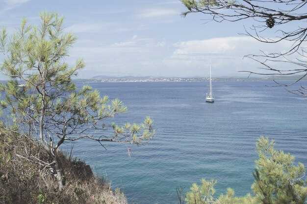
Start with a 7-day coastal loop that begins in Olbia and heads toward La Maddalena, delivering a first taste of Sardinia’s azure bays. Hire a capable boat for 2–4 guests, keep daily legs in the 20–35 nautical mile range, and you’ll enjoy a pearl-like mix of coves, charming town squares, and calm anchorages.
From Olbia, sail a sheltered leg to La Maddalena, where you can swim in turquoise water and explore the old town’s marina. In the afternoon, visit Caprera with its pine forests and quiet coves, or swing to Santa Teresa di Gallura to stroll the waterfront, pop into a portside bakery, and sample handmade gelato while chatting with locals visiting the harbor.
Continuing along the northern arc, anchor near Porto Cervo and Cala di Volpe, then ease toward the eastern Gulf of Orosei. A swim in azure coves, a stroll through a sunny town square, and snorkeling around shipwrecks tucked into sheltered reefs add intrigue to the day.
As you head toward the southern coast, drop anchor near Cagliari’s historic harbor and wander the maze of alleys in the Castello district, with nearby tavernas offering fresh seafood. A morning market, a lunch of bottarga, and an afternoon sail toward Villasimius or Costa Rei deliver exceptional scenery and calm water. For a final touch, anchor near Portoscuso at sunset and observe the rocky headlands glow.
With a number of routes and time-saving options, this itinerary fits a range of wind patterns and sea states. Where you anchor, nearby towns invite you to stroll the waterfront, sample seafood, and plan a second visit. The southern leg reveals a different mood–hushed coves, rugged cliffs, and sunsets that feel like a pearl in a marine canvas. If conditions shift, habe a backup plan and adjust to a sheltered bay; the day doesnt have to follow a rigid map, and that makes the route truly intriguing.
Sardinia Sailing Itinerary
Begin with La Maddalena archipelago for a sheltered, special start that yields easy anchorage and a network of marinas.
-
Day 1: Olbia to La Maddalena archipelago
- Sail along the northeast coast into protected waters, choosing Cala Gavetta or Cala Spalmatore for a calm first mooring.
- Explore the medieval town of La Maddalena and Caprera, soaking up the ambience and recording a few clear waypoints for them to reference later.
- Ask giuseppe at the marina for help with weather checks and the best routes along sardinias coast.
-
Day 2: La Maddalena to bonifacio ( Corsica )
- Cross the pass to bonifacio, watching for currents between Sardinia and corsica.
- Dock in the francese-influenced harbor, where the backdrop of white cliffs and ancient walls frames a striking scene.
- While you stroll the old town, enjoy fresh seafood and the quiet ambience before the next leg.
-
Day 3: bonifacio to lavezzi
- Head toward lavezzi, a protected marine area with small, intimate anchorage options among the islets.
- Keep to short hops between coves to minimize wake and maximize sheltered time in crystal water.
- Use a mark on the chart for a late-afternoon stop and enjoy the stillness above the seabed.
-
Day 4: lavezzi to southeast Sardinia ( Villasimius / Costa Rei )
- Proceed southeast along the Sardinian shore, selecting a stop in Villasimius or the Costa Rei marinas for a lively yet protected base.
- Enjoy the ambience of seaside taverns and local shops, then settle into a quiet anchorage for the night.
- Note how the coastal roads frame distant hills, giving a sense of continuity between sea and land.
-
Day 5: Villasimius to Cagliari
- Slip into Cagliari’s marinas, where a sheltered harbor awaits and town life is an easy reach by tender.
- Stroll through the Bastion and marina area, sampling seafood and pausing at shops along the water’s edge to mark souvenirs.
- Keep a flexible schedule to catch a sunset over the Poetto backdrop, then rest in a protected anchorage nearby.
-
Day 6: Cagliari to Golfo di Orosei (Ogliastra)
- Chart a course north to the Gulf of Orosei, with standout anchorages near Cala Luna or Cala Goloritzè when conditions allow.
- In the afternoon, drop anchor near secluded coves and savor the marine clarity and rugged coastline.
- Adjust plans if seas rise; this segment rewards patience with calmer water and dramatic scenery.
-
Day 7: Golfo di Orosei to Olbia or return loop along sardinias east coast
- Return toward Olbia by following the east coast’s bays and roads, stopping at a final anchorage to celebrate the week.
- Review the chart, make notes for a future mark, and reflect on the week’s highlights across the Sardinian coast.
Last-leg start point, optimal departure time, and routing for Friday
Depart Cala Gavetta, La Maddalena, at 08:50 local time. Sail northeast along the protected front of the maddalenas archipelago, avoiding the lavezzi shoals to the south, and steer toward Porto Cervo to follow the coast. This choice delivers a scenic, dazzling backdrop of cliffs, coves, and shimmering water, with the afternoon sun creating beautiful color on the shorelines.
Distance Cala Gavetta to Porto Cervo: 40-45 NM. Target 6.5-7.5 hours at 6-7 knots; ETA around 15:20–15:45. Mark Capo Ferro as the turning point, then continue along the coast to Porto Cervo marina for a lunch and fuel break before the next leg.
Porto Cervo to Olbia leg runs 25-30 NM in 4-5 hours at 6 knots, with an ETA near 19:30–20:00. Dock Olbia by 20:00, enjoy dinner ashore at a locally-sourced spot, and let the community vibe set the tone for the final evening. The route keeps you close to sheltered coves and ports along Costa Smeralda, exposing a beautiful and shimmering maritime backdrop.
For years, geduldig weather checks help you stay in protected waters, and hatten gusts often ease by the afternoon. If wind shifts, shorten the leg to Porto Cervo or swing directly into Olbia’s outer harbor; also keep a backup stop at Golfo Aranci. Carry a small book for notes on marks, tides, and timings. This plan pairs maddalenas charm with Olbia’s ports, presenting two worlds of beauty and practicality, and ends with a dinner that highlights locally caught seafood.
Final-night mooring options: harbors, tides, and docking tips
Pick a protected harbor for your final night–Olbia or Golfo Aranci are solid, easy-to-reach options that keep seas calm and docking straightforward. This choice will give you quick access to water, fuel, and a delightful boutique dining scene, plus a center of shops and caprerabudelli tasting rooms along the quay. The utmost priority is shelter from swell, so prioritize harbors with solid breakwaters and marina staff who can help if you arrive after hours.
If you crave a coastal cruising vibe while staying sheltered, target inner harbors such as Porto Rotondo or Santa Teresa di Gallura. The guardia costiera can confirm slip numbers and tide windows, and many harbors offer reserved berths for late arrivals. On Tuesday and Saturday evenings, some marinas report lighter traffic, which makes final-night stays calmer and easier. From these places you can stroll to intriguing waterfront boutiques and enjoy a glass of local wine. Some locations also offer caprerabudelli tastings and other small delights you can savor after docking.
Tides in Sardinia stay modest, but you still need to time your approach. Plan arrivals near slack water if possible and verify with the marina center before you depart, as a calm entry reduces risk of contact with other vessels. Use the local tide table and wind forecast to predict swells above the quay; this information helps you select the best berth. A quick check at the center will also help you locate a protected slip near the center of the marina.
Docking tips for the final night: approach slowly from the seaward side, align with the fingerprint, and keep a short, steady swing if gusts arrive. Deploy soft fenders and angle two lines to bow and stern cleats, plus a spring line to control drift. Call the guardia or the marina office when you’re five minutes out so staff can guide you to the right slip. In protected harbors, berths are available for visiting yachts; verify depth and clearance with the dock master before you tie off. In most harbors, berths accommodate average cruising yachts; confirm the slip size with the center desk to ensure a smooth fit.
After you secure the boat, stroll to the quay for a breathtaking sunset and a delightful finale. Watch for creatures–seabirds and crabs skittering along the pilings–and savor hatt en pastries with caprerabudelli at a sea-front boutique. This experience, from the intriguing market to the quiet harbor lights, offers a memorable end to a coastal cruising itinerary. vivre the moment, this final night in Sardinia will stay with you long after you depart the places you visited.
Weather, wind shifts, and safety checks for Day 7
Check the 48‑hour forecast and set a contingency plan for wind shifts on Day 7, then secure one reliable mooring in a protected bay before the first gust arrives.
Day 7 runs along the northeast side of Sardinia with Corsica nearby; the mediterranean breeze shifts through the day, and funnel effects between headlands can tighten gusts. Corsica boasts rugged coastlines and famous rock formations that concentrate wind in narrow channels, so expect wind shifts near shore and gusts that can surprise a line of moorings. The francese coast adds micro‑currents that can alter boat speed on small triangles of water, so plan for changes that affect both sides of the boat.
In the morning, anticipate a northeast tilt around 12–18 knots, rising to 18–25 knots by midday, with occasional bursts to 28 knots in sheltered channels. By late afternoon the wind can back toward the southwest or west as thermal heating builds, which changes the sail plan and requires quick reefing. Those shifts create brief lulls suitable for sunbathing on deck, but they also demand steady vigilance when approaching rocks, bays, and protected harbours that often double as sheltered flotilla moorings.
Safety checks flow from the forecast into action: verify that all crew members wear life jackets when gusts sharpen, secure harness lines for those on deck, and keep a tether ready near the helm. Maintain a ready weather watch with VHF on channel 16 and a backup handheld radio, because timely alerts save moments if a shift comes quickly. Conduct a quick engine check and confirm steering responsiveness, bilge pump readiness, and sail‑trim reef lines; changed conditions require fast sail alterations and clear communication among crew on every person onboard. That thats why a compact, practiced routine matters more than a lengthy plan.
Lorsque vous planifiez des manœuvres à proximité de la côte, identifiez à l'avance les abris protégés et notez lesquels conviennent à la stratégie d'ancrage de la flottille. Les criques les plus célèbres offrent une eau calme pour les pauses bronzage, mais seulement après avoir vérifié un abri contre le courant et le changement de vent. Utilisez des amarres marquées et des approches établies dans ces zones protégées pour réduire les risques pour le groupe, et surveillez les points de récifs et les affleurements rocheux qui forment des flancs dangereux si les prévisions s'aggravent.
| Checklist item | Détails | When |
|---|---|---|
| Météo et changements de vent | Surveiller NE 12–18 kt le matin, rafales à 28 kt dans les chenaux ; surveiller les changements vers SW/WSW en fin de journée ; effets de convergence près des côtes de Corse | De matin au milieu de l'après-midi |
| Moorings et plan de flottille | Confirmer les zones de mouillage protégées, vérifier les postes d'amarrage disponibles, pré-attacher les pare-chocs, coordonner la manœuvre des câbles pour plusieurs navires | Avant le départ |
| Safety gear | Gilets de sauvetage pour tous les passagers, harnais prêts, dispositif de lancer, postes VHF chargés | Pre‑sail et pendant le voyage |
| Navigation et communications | Tableaux des zones de l'est du nord de la Sardaigne et de la Corse ; vérifications AIS/GPS ; veille sur la chaîne 16 | Morning |
| Systèmes de bateau | Contrôle du moteur, direction, drisse de voile, test de la pompe de cale | Pre‑sail |
| Crew readiness | Attribuer des rôles pour les changements de vent, confirmer les tâches de maniement de la ligne, informer sur la sécurité solaire et l'hydratation | Avant de prendre la mer |
Points de navigation : trace précise, repères et horaires pour la voile de vendredi.
Départ du port d'Alghero à 08h00, direction 306° le long de la côte ouest, maintenir une distance de 1 NM au large pour la sécurité et pour garder les oiseaux de mer sur la proue. Utilisez ces points de passage pour maintenir une trajectoire précise, avec vérification des points de repère et des fenêtres d'arrivée prévues (ETA) qui conviennent à une journée détendue mais efficace sur l'eau.
- WP1 Phare de Capo Caccia – distance 9 NM, relèvement 306°. Point de repère : phare blanc perché sur la falaise ; la pointe était spectaculaire à mesure que l'aube illuminait la roche. Heure d'arrivée prévue 09h30 à 5,5–6,0 nœuds. Notes : passer à 0,8 NM au large pour éviter les rochers ; ajuster en fonction des changements de vent.
- WP2 Isola Piana entrée ouest – distance 8 NM, cap 288°. Point de repère : Isola Piana avec des hauts-fonds peu profonds sur l'approche. Heure d'arrivée estimée 11h00 ; vitesse 5,5–6,0 nœuds. Notes : confirmer l'eau profonde avec le sondeur ; surveiller les lignes de pêcheurs près des eaux calmes.
- WP3 promontoire de Porto Conte – distance 6 NM, relèvement 296°. Point de repère : cap couvert de pins, avec la petite marina de Porto Conte en vue. Heure d'arrivée estimée 12h15 ; vitesse 5,5–6,0 nœuds. Notes : eaux abritées en amont ; se préparer à un arrêt déjeuner si nécessaire.
- WP4 Cala Reale Cove – distance 5 NM, bearing 281°. Landmark: the cove’s white-sand beach tucked between cliffs; ideal for a basic sunbathing break. ETA 13:45; speed 5.0–5.5 knots. Notes: anchorage or mooring on the west side; check tidal current.
- WP5 La Pelosa approach (Torre della Pelosa) – distance 14 NM, bearing 265°. Landmark: Torre della Pelosa and iconic white sands. ETA 16:00; speed 5.5–6.0 knots. Notes: reserve a mooring if wind shifts; sunset looks great over the water; optional stop for a short swim or a visit to the resort lights for an evening highlight.
La route offre des falaises architecturales, telles que Capo Caccia, et un charme sauvage tel que la côte semblait particulièrement accueillante. Le vent de l'ouest vous a aidé à longer la côte en douceur, au-delà de la voile de base, jusqu'à un point final paisible et pittoresque à La Pelosa. Ce plan permet à tout le monde de rester confortablement à bord et en toute sécurité, avec les questions d'assurance et de location vérifiées avant le départ. Si une réunion est reportée au mardi, ajustez les horaires d'environ 30 minutes pour accommoder toute l'équipe et maintenir un calendrier serré pour tous les participants. Les perspectives incluent des bains de soleil, des oiseaux de mer tournant autour de la proue, et une soirée empreinte du charme du nord-ouest de la Sardaigne – des moments forts que chacun peut apprécier, visiter et se souvenir autour de la pointe, avec des voiles stables et le moral au plus haut.
Onshore finale : dîner, endroits avec vue sur le coucher de soleil et occasions de prendre des photos après le débarquement.
Ancrez dans une marina abritée et promenez-vous jusqu'à une terrasse de restauration en bord de mer pour un excellent dîner de fruits de mer d'inspiration française qui rend la finale à terre vraiment exceptionnelle. Les marinas le long de la côte offrent des options similaires, afin que vous puissiez choisir l'ambiance que vous aimez.
Choisissez une terrasse de sable près de la marina où vous aurez une lueur verte provenant des lanternes et une vue directe sur l'eau. Dans les marinas de la côte sud-est de l'Italie, recherchez des établissements qui combinent des cadres de jardin luxuriants avec la brise marine ; commandez du dorade grillé au citron et une sauce beurre blanc française, puis terminez par une panna cotta. Un Vermentino vif de la région se marie mieux qu'un rouge corsé, surtout après un passage en haute mer. Pour une recommandation, je vous recommande de choisir une table avec des reflets sur l'eau.
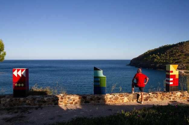
Les meilleurs endroits pour admirer le coucher de soleil : Pour le coucher de soleil, visez une pointe verdoyante le long de la côte sud-est ou le quai ouest de la marina, là où les couleurs de l'étoile s'épanouissent et où les vues s'étendent vers les mondes au-delà. Les amateurs de photographie apprécieront les longues silhouettes et la lumière douce.
Photos d'opportunités après le mouillage : capturez les reflets de la coque sur la jetée, encadrez l'ancienne tour de guet derrière la côte luxuriante et utilisez l'ancre comme une silhouette contre l'eau scintillante. Photographiez exactement à l'heure bleue depuis le bout de la jetée vers le sud-est pour inclure quelques points d'étoiles et les mondes au loin.
Passez les dernières heures avec votre skipper et une poignée de marins ; ils partagent des conseils pour de meilleurs angles et un meilleur timing. Faites une courte promenade vers les points de vue de Capo le long du bord de la péninsule pour des vues spectaculaires, ou restez sur le quai si vous préférez la lumière des marinas. Si vous voulez nager, choisissez une crique abritée ; les brises offshore gardent l'air frais lorsque les lumières s'allument.