

 What Is a Float Plan and Why You Should Use One | Boating Safety">

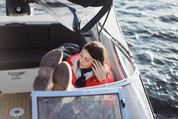
File a float plan before you depart and share it with a trusted local contact. This plan has a clear mean: it helps responders locate you and coordinate help if you are delayed. If weather shifts or someone on board becomes unavailable, publish an update to the contact list so you can adjust quickly.
Your float plan should capture the essentials: boat model, size, and length in feet; number of passengers; and the gear you carry. For example, a 6 foot dinghy or a 30 foot cruiser. Include the crew and any passengers; note the local marina you’ll head toward; log your route and the expected return time; add a backup plan if conditions change.
Anyone on board can benefit: solo boater, family crew, members of a club, or a local guide. Recognizing risk factors like crowded marinas, night trips, and rough weather helps you set realistic expectations. Use the plan to set clear roles, such as who backs up tracking and who takes the call if you go offline.
When filing, share the plan with the marina office, harbor master, or coast guard liaison. Keep a copy onboard and another in the cloud; update it if routes, crew, or return times change. If conditions shift, send a quick update to at least one other boater or family member.
Why this matters: it reduces miscommunication and speeds safety actions. It helps you manage risk for passengers and crew, especially in local waters where response times depend on accurate location data. By taking 3–5 minutes to fill the plan and update it when conditions change, you take a good step that protects gear and people.
What Is a Float Plan and Why You Should Use One for Boating Safety
Create and share a float plan for every outing. youll capture boat details, crew, the planned route, start and end times, and a shore contact who can act quickly if plans change.
Included in the plan are the boat description, registration, length and draft, fuel level, safety gear, life jackets, signaling equipment, VHF channel, and the take-out schedule. List nearby landmarks such as a marina, fuel docks, and your intended refueling stop so anyone can find you in trouble.
Know where you go by naming the area and the marina, noting the expected path, and sketching a rough foot-by-foot route you expect to travel along the coast, channel, or inlet. Include potential alternate routes in case weather shifts; this helps back-up teams act fast.
Share the plan with friends, fellow boaters, and rescuers you trust. Include a reliable phone number and a short note on when you’ll check back in. If youve got a satellite or cell link, add it; if not, specify the take-out method and who will confirm you’re safe. This transparency keeps everyone informed and ready to respond.
Tech and timing matter. A satellite phone or other dependable device improves reach, and a quick update if your situation changes goes a long way. A simple video check-in at a scheduled time lets you show that you’re moving along as planned, especially when you’re in busy areas or near the marina after a long crossing.
Having a float plan reduces risk and clarifies roles. Obviously, rescuers need clear, actionable details to start search and rescue operations sooner, and that saves time when seconds count. A short, current plan also helps you stay organized on the water and keeps every involved party informed.
What Is a Float Plan and Why You Should Use One for Boating Safety; What Should Be Included on a Float Plan
Create and document a float plan before you leave the marina. This short plan maps your boat, crew, itinerary, and route, so friends can know your position and when to expect you back.
Use these sections to build a helpful plan that anyone can reference during boating days, paddling trips, or take-out runs.
-
Boat and crew details: record the boat name, registration numbers or hull ID, and the number of people aboard. Attach a recent photo of the group for easy recognition, and list personal notes such as medical needs or experience with the area. This keeps everyones information exact and ready.
-
Itinerary and route: outline the exact itinerary with legs, specific stops, and take-out points. Include start point, planned times, and a short fallback if conditions shift. If you paddle, note paddling segments and any gear changes.
-
Area and geography: describe the area you’ll cover, notable landmarks, shoreline features, and potential hazards. Mention distances or markers when helpful, including any foot or distance references you use to gauge progress.
-
Timing and duration: provide a clear plan for when you depart, how long each leg should take, and a latest return time. Add buffer time for weather checks and rest breaks so you wont feel rushed.
-
Weather and conditions: include a forecast from a reliable source, current water conditions, and wind or current expectations. Record the forecast units (knots, mph, or m/s) so everyone can interpret the data quickly.
-
Safety gear and equipment: list the essential gear for everyone (PFDs, signaling devices, flashlight, first aid kit) and the boat’s safety items (fire extinguisher, spare parts, communications gear). Indicate the presence of radios or cell capability and a plan for emergencies.
-
Communication and sharing: identify a primary contact and backup, and specify how you’ll share updates if plans change. Leave contact instructions with a friend or at the marina so anyone can help if needed.
-
Documentation and access: keep the float plan as a simple document that’s easy to share in print or digital form. Include a map, the itinerary, and all critical data, so you can hand it to someone at the marina or save it with the boat’s records.
-
Varaumat ja ulosvienti: Kirjoita auki, mihin vedät, jos olosuhteet huononevat, ja mikä on vaihtoehtoinen suunnitelma. Jos sinun on lähdettävä aikaisin, merkitse tarkka vetopaikka ja keneen ottaa yhteyttä turvallista paluuta varten.
-
Extras to consider: sisältää nopean pikkukuvan reitistäsi, yksinkertaisen tarkistuslistan ensiapu- tai hätävarusteista sekä henkilökohtaisia mieltymyksiä tai tarpeita. Näiden asioiden pitäminen yhdessä paikassa auttaa pysymään järjestäytyneenä ja vähentää riskejä.
Muista käydä suunnitelma läpi kaikkien kanssa ennen lähtöä, jätä kopio satamaan ja päivitä sitä jokaisen matkan jälkeen. Tämä tekee veneilystä turvallisempaa kaikille matkakumppaneillesi – ystäville, perheelle ja kaikille, jotka saattavat pitää sinua silmällä matkan varrella.
Kelluntasuunnitelman määrittely ja tarkoitus
Laadi matkasuunnitelma ennen lähtöä. Se luettelee matkustajat, varusteet ja suunnitellut reitit. Kajakille, kanootille tai pienelle veneelle, sisällytä vasen- ja oikeakäännökset, arvioitu rantautumisaika ja keinot yhteydenpitoon paikallisen yhteyshenkilön kanssa. Jaa suunnitelma ystäville satamassa tai puiston henkilökunnalle, ja pidä myös kopio mukanasi seikkailun aikana.
Purjehdussuunnitelma on kirjallinen dokumentti, johon on kirjattu matkan tiedot: veneen tyyppi, kaikkien aluksella olevien nimet, ensisijainen yhteyshenkilö ja suunnitellut reitit. Luettelo mukaan otettavista varusteista ja laitteista sekä mahdollisista vaihtoehtoisista reiteistä sään tai olosuhteiden muuttuessa. Merkitse mahdolliset vaarat ja arvioitu paluuaika. Suunnitelma on arvokas viite, jonka voit jakaa paikallisten viranomaisten kanssa etsinnän helpottamiseksi, jos jokin menee pieleen, ja se käyttää käytännöllisimpiä keinoja turvalliseen paluuseen.
Miksi sillä on väliä: se selkeyttää, mitä olet tekemässä ja missä aiot olla, jotta ystävät tai paikalliset pelastajat tietävät milloin aloittaa. Viivästyessäsi he voivat jakaa päivityksiä tai hälytyksiä varayhteyshenkilöllesi ja muuttaa etsintäreittejä. Se auttaa myös varmistamaan, että arvokkaita turvavarusteita on mukana ennen matkan alkua, mikä vähentää riskiä, että jätät kriittisiä varusteita taaksesi, mikä vaarantaisi suunnitelmasi. Jos pelastajat pääsevät sinne, he saavat selkeän käsityksen reitistäsi.
Ohjeet: täytä perustiedot ja anna sitten kopio paikalliselle yhteyshenkilölle kohteessa ja ystävälle kotona. Päivitä sitä, jos vaihdat reittejä, pidennät aikaa tai muutat seikkailun laajuutta. Pidä kopio kajakissa tai veneessä ja toinen jaetussa kansiossa, jotta kaikki pääsevät siihen käsiksi. Tämä yksinkertainen vaihe tukee turvallisuutta ja antaa sinun keskittyä matkan nautinnollisimpaan osaan: seikkailuun.
Kenelle matkasuunnitelma tulisi jättää ja milloin se tulisi jättää?
Tee jokaisesta rannalta lähtevästä tai useita veneitä, melojia tai hiihtäjiä sisältävästä retkestä matkasuunnitelma. Näin varmistat, että pelastajilla on tarvittavat tiedot valmiina, jos jotain menee pieleen.
Kenen tulee jättää: Aluksen päällikön tulee jättää suunnitelma. Jos vesillä on muita mukana tai ollaan ryhmässä, nimeä johtava veneilijä, joka jättää suunnitelman koko matkasta ja jakaa tiedot muiden yksiköiden kanssa. Jos purjehdit yksin, kapteeni tai käyttäjä jättää ja vahvistaa suunnitelman miehistön kanssa.
Milloin tiedosto lähetetään: Lähetä tiedosto ennen lähtöä. Päivitä suunnitelma, jos matka-aikasi muuttuu, reitti siirtyy tai lisäät aluksen. Lähetä tiedosto uudelleen ennen merialueiden ylityksiä tai syrjäseutumatkoja. Jos matkustat usealla veneellä, lähetä suunnitelma kerran ryhmälle ja jaa suunnitelma muille. Jos suunnitelmat muuttuvat vesillä, ilmoita luotettavalle maahenkilöllesi ja lähetä päivitetyt tiedot uudelleen.
Mitä sisällyttää: selkeä description kukin vene, engine tyyppi ja number ihmisiä aluksella; trip reitti ja vaihtoehtoinen tarvittaessa matkustustapa; määränpää ja arvioitu paluuaika; luettelo phone numerot ja a vaihtoehtoinen yhteys; ytimekäs photo kunkin aluksen; lyhyt field kiinnostavia paikkoja tai pudotuspisteitä; источник (luotettava yhteyshenkilö) ja lyhyt trust kuvaus; ja selkeä maininta siitä, mitä accept jos vastaajien on toimittava.
Miten jakaa: anna matkasuunnitelma trusted henkilö maalla, kuten источник tai nimettyyn kenttäyhteyshenkilöön ja jaa se myös jokaisen yksikön kipparille. Jos ryhmässä on useita veneitä, jaa luettelo jokaiselle veneilijälle ja säilytä kopio rannalla. Näin muut voivat tarkastella suunnitelmaasi, jos sinulle käy kadonnut; hyväksyt, että viranomaiset voivat käyttää näitä tietoja pelastusoperaatioiden ohjaamiseen.
Pakolliset tiedot: Alus, reitti, aikataulu ja yhteystiedot
Laadi neljä ankkuria yhteen suunnitelmaan, jota pidät mukanasi ja jaat ryhmäsi kanssa. Tämä tiedosto sisältää aluksen, reitin, aikataulun ja yhteystiedot sekä muistiinpanot, jotka kattavat mahdolliset muutokset ja kolmen kohdan yhteenvedot nopeaa viittausta varten. Pidä tiedosto ajan tasalla ja helposti saatavilla, jotta miehistö voi napata sen tarvittaessa. Tämä voi tarkoittaa vähemmän kysymyksiä kaikille, ja voit pitää tulostettua versiota matkustajien varalta, jotta olet valmis tarkistamaan sen yhdellä silmäyksellä.
Aluksen tiedoissa tulee mainita virallinen nimi, rekisterinumero, pituus, tyyppi, väri ja nykyinen käyttäjä. Liitä mukaan ajantasainen valokuva tunnistusvirheiden välttämiseksi. Merkitse kotisatama ja mahdolliset käyttämäsi venepaikat, jotta olet tietoinen laituriin pääsystä ja mahdollisesta vaihtuvuudesta.
Reittisuunnitelmat: lähtöpiste satamassa, reittipisteiden järjestys, suunnitellut pysähdykset, turvalliset vaihtoehdot ja tunnetut vaarat. Sisällytä yksinkertainen kartta tai valokuvareunus, joka näyttää reitin. Tarkka lähtöpisteen tunteminen auttaa käyttäjää pysymään linjassa. Nämä suunnitelmat pitävät luonnollisesti jokaisen henkilön tietoisena yhteyspisteestä, jos reittiä on muutettava. Siksi suunnitelmien tulisi olla selkeitä.
Aikataulun yksityiskohdat: lähtöaika, arvioitu saapumisaika, lähtöselvitysajat ja aikavyöhyke. Sisällytä kolme tarkistuspistettä matkan aikana, jotta kaikki pysyvät ajan tasalla. Jos olosuhteet muuttuvat, hyväksy uudet ajat ja jätä suunnitelmaan huomautus operaattorille ja matkustajille.
Yhteystiedot: luettelo ensisijaisesta toimijasta ja puhelinnumeroista sekä varahenkilöistä. Sisällytä miehistönjäsenten ja matkustajien henkilökohtaiset numerot. Tarjoa vähintään kaksi tavoittamiskeinoa (puhelin ja jokin muu menetelmä). Valmistele luettelo niin, että voit jättää kopion venesataman toimistoon tai luotetulle ryhmän jäsenelle, ja päivitä sitä aina suunnitelmien muuttuessa.
Kelluntasuunnitelman laatiminen eri veneilytilanteisiin
Laadi reittisuunnitelma ennen vesille lähtöä; hallitset riskejä, pidät kaikki jäsenet ajan tasalla ja tiedät minne mennä, jos suunnitelmat muuttuvat. Anna reitin tiedot, matka-aika, tarkastuspisteet ja maihinnousupaikat. Jaa se ryhmäsi kanssa ja paikalliselle kontaktille, joka voi seurata edistymistä. On paljon otettavaa huomioon, mutta selkeä suunnitelma auttaa sinua löytämään oikean tasapainon seikkailun ja turvallisuuden välillä.
- Ydinelementit, jotka sinun on sisällytettävä
- Veneen tiedot: alustyyppi, moottorin tila, polttoainemäärät ja kaikki suorituskykyyn vaikuttavat varusteet.
- Reitti ja sijainnit: lähtöpiste, tärkeimmät reittipisteet ja noutopaikka; merkitse käännökset (vasen) ja maamerkit, joita käytät navigointiin.
- Aika ja tahti: aloitusaika, arvioitu saapumisaika (ETA) jokaiseen tarkastuspisteeseen ja tarkistussoitot 60–90 minuutin välein; varaudu viivästyksiin.
- Turvallisuus ja signaalit: pelastusliivit jokaiselle matkustajalle, radio tai puhelinliittymä, turvallisuusvideo katsottavaksi ennen lähtöä ja merkinantovälineet.
- Hätäsuunnitelma: selkeät ohjeet, lähimmät noutoruokavaihtoehdot ja keneen ottaa yhteyttä, jos eksyt ryhmästä.
- Ympäristötietoisuus: sääennuste, vesitilanne, virtaus, näkyvyys ja tunnetut vaarat.
- Daily readiness: verify gear, food and water, and ensure daylight remains for the return.
- Scenarios to tailor your plan
- Calm inland lake or reservoir with a kayak group
- Number of participants: 2–6; assign a lead and a sweeper so there’s always a clear line of sight.
- Timing: plan 2–4 hours of travel with short breaks for rehydration and snacks; adjust for heat or shade availability.
- Take-out strategy: find a good shore access point with reliable cell service; confirm there’s space for gear and a safe exit.
- Equipment and safety: enough dry bags, a spare paddle, whistles, and a compact repair kit for minor issues.
- Rivers with moderate current or moving water
- Navigation: map entry and exit, note potential hazards like strainers or low-hanging branches; plan a portage if needed.
- Communication: post a concise plan at the put-in and share a digital copy with your local contact.
- Rest and resupply: identify a safe stop to rehydrate; ensure there’s space on the bank to stage gear.
- Coastal or offshore day trips
- Fuel and engine margins: carry at least one-and-a-half times the expected run distance in fuel, and monitor engine temperature and oil levels hourly.
- Weather discipline: review the forecast daily; if wind or seas rise, reassess before leaving the harbor.
- Communication discipline: assign a remote safety watcher and check in on a fixed interval; have a shore-based fallback plan.
- Multi-boat groups or family adventures
- Roles and pace: designate a lead, a sweep, and a decoupled plan so no one feels rushed; keep groups within visual range.
- Coordination: use a shared plan with a common take-out and rendezvous point; establish simple signals and brief check-ins via video or calls.
- Contingencies: select a backup route and a second take-out; ensure everyone knows where to regroup if someone deviates.
- Practical tips for everyday planning
- Review the plan with all members the evening before traveling and again at the launch; this reinforces trust and reduces last-minute questions.
- Keep the plan lightweight and portable; store it in a waterproof case or share a digital copy that can be updated on the fly.
- Use a short video briefing to illustrate the route, hazards, and signals; this helps new members learn quickly.
- Always designate a first-aid kit spot and a designated take-out for emergencies; know where to find shelter if weather shifts.
Sharing, Storing, and Updating Your Float Plan
First, create and share your float plan before you depart, including your route and itinerary, and keep a live copy accessible at your marina and with the operator. A good plan keeps your crew aligned and reduces last-minute surprises.
Store a take-out printed copy and a digital version that works offline. For each vessel, include boat name and registration, the operator contact, emergency numbers, departure point (marina), planned route, key waypoints, estimated times between stops, and daily check-in times. Also note weather or tide considerations and things that could shift your itinerary. Many plan elements help everyone know what to expect, and the table includes a concise summary you can use on-site. The term “mean” here refers to the outcome: clear actions, quick checks, and coordinated response.
Share the plan with your crew, the marina staff, and the operator, and give a quick summary on what to do if conditions change. First, include alternate routes and safe landing options in case you need to alter course, and make sure everyone knows what to do if you are separated or lost. For clarity, indicate who is responsible for updates and where to check the latest version. If the group were split, the plan shows where to rejoin and this reduces the risk of being out of touch.
Storing options: keep the take-out copy in a weatherproof folder at the marina desk and in a waterproof pouch on the vessel. Save the digital copy in a cloud drive and on a USB drive on board. Lock sensitive data and keep a separate contact list. Foot-depth notes for shoals and low-water channels help paddling and small vessels stay safe along the route. If you want a quick reference, include life jackets, radios, and GPS details like what you carry daily on every trip.
Updating: update cadence is daily or with any significant change. If you alter the route or times, refresh the plan and notify the designated contact. When you reach a new waypoint or stop, note hazards or observations and confirm the new ETA with your operator and crew; lastly, review who has access and refresh permissions for your team. The plan includes fields for alternates and notes to cover changes.
| Option | Where to store | What to include | Update cadence |
|---|---|---|---|
| Digital copy (cloud) | Cloud drive or email to yourself | Route, itinerary, vessel info, crew, emergency contacts, check-in times | Daily or with any change |
| Printed take-out copy | Weatherproof folder at marina; on board | Same details as above; weather and tide notes | Daily or when plan changes |
| Onboard device copy | Tablet or phone | Key details plus GPS coordinates | Sync with cloud; update during leg breaks |