

 Best Lakes Near Vancouver – Top Spots for Day Trips Around Vancouver, BC">

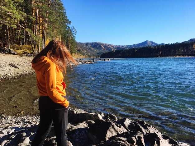
Begin with brohm Lake as your first stop for a quick, stunning escape from the city. The drive along a pine-dusted road passes stands of trees and a loop around the shore, delivering a crisp breeze and a compact portion of wilderness. Water clarity invites a brief dip, and a seaplane can lift you high for a mountain panorama before you return to a cabin stay or staying on a belted bench at sunset.
From there, swing toward the harrison area for a lakeside mix of beaches and quiet parks. In harrison the water invites calm paddling, and the surrounding trail network circles the arts scene where galleries display local works. A short drive spins you toward hills that host mountain views, with hotels and cabin stays within easy reach for those who want to linger.
Next, the loop continues toward whistler and the sea-to-sky spine where several alpine pools reward a late-morning hike. Getting there early helps beat crowds, then you can kayak, paddleboard, or simply soak up the views from beaches along the shore. The suspension option–access via a ridge trail and a bridge–adds a dose of thrill, and you can cap the excursion by strolling the village’s shops or catching a quote from a local about the crisp air and dramatic peaks.
In the Capilano Suspension Bridge detour, cedar trails weave past mossy trunks and pine at the shore, pairing perfectly with a quick road back to arts venues and craft shops. For those who want to linger, a small cluster of hotels and a cabin near the river offer a staying option with easy access to these routes and several parks along the way. If you ever feel lost, this path keeps you oriented by maps, signs, and friendly hikers.
Plan with a flexible mindset: craft a loop that hits brohm, harrison, and whistler, then fill gaps with short stops to admire pine silhouettes and beaches. These getaways reward patience, with opportunities to stay in a cabin or a hotel, and to enjoy parks, trails, and arts programs that make them memorable.
Day Trip Lakes Near Vancouver
Cultus Lake is your prime pick for a well-rounded day out, easily reached in about 1.5–2 hours by car from the metro core, with grassy shorelines and a gentle water entry ideal for kids.
Permitted activities include swimming, canoeing, stand-up paddleboarding, and fishing for rainbow trout. The site is among the largest day-use destinations in the Fraser Valley’s belt, with well-marked trails, a belted shoreline for easy walks, and ample parking. Hours vary by season; источник: BC Parks provides the latest details, and you can browse the forum for recent tips from visitors. your day can easily combine a quick hike in Lynn Headwaters regional park before the drive, if you’re chasing a longer, scenic combo of forest and water.
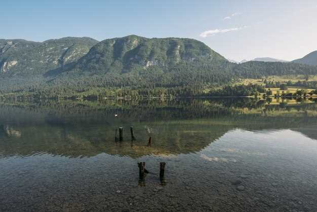
Sasamat Lake, tucked into Belcarra Regional Park, about 40–60 minutes from the metro area, treats you to clear water and pretty views against the north-facing slopes of the mountains. The shore is lined with trees, with grassy margins ideal for a relaxed picnic, and a short, easy walk along the shore reveals quiet coves and tiny island features visible on calm days. Whether you’re paddling, strolling, or simply breathing in the fresh air, this spot blends quality recreation with a peaceful vibe well suited to families.
Alouette Lake sits inside Golden Ears Park near Maple Ridge and offers a broad, calm surface with easy access for a short walk to sandy or grassy beaches. Parking can fill on weekends, and hours vary by access point; it’s a solid option for a longer, laid-back day with chances to spot trout feeding in deeper zones. The north-facing shoreline provides striking views of distant mountains and tall trees, making it a dependable backdrop for photos and a quiet afternoon by the water.
Stave Lake, near Mission, provides a quieter option with boat launches and several picnic spots. It’s ideal whether you want a quick morning of fishing or a longer shoreline stroll; the water stays pleasantly warm into late season, and the surrounding hills offer a belted line of pines that frames a well-rounded outing. For your planning, check on hours and parking through the forum and local park pages, and consider a short pre-visit walk to scope entry points.
Beaver Lake: Access Routes, Parking, and Best Time for a Tranquil Visit
Park in the West Lot on Cleveland Avenue and begin the forest trail at sunrise to enjoy a serene mirror on Beaver Lake.
- From Whistler: take Sea-to-Sky Highway (Hwy 99) toward the coast, exit at the Cleveland Avenue trailhead, and follow a well-marked route into the forest; cross a wooden bridge over a creek, then reach Beaver Lake after roughly an hour of steady hiking; the shore welcomes kids with shallow margins and smooth rocks; kingfishers often skim the surface.
- From Victoria: a longer itinerary via coastal connectors leads to the same trailhead; the hike remains gentle, and you loop back along the same path; parking tends to fill later, so arrive early for a calm start; plan about two hours including a rest at the shore.
- From america-bound planning: visitors commonly pair a Whistler leg with this route; use the same access, check seasonal open times, and opt for a short, easy climb; the forest between the lake and the trailhead offers a clear refuge.
Parking tips: West Lot on Cleveland Avenue holds a limited number of vehicles; arrive before 9 am on weekends if possible; if full, a short walk from the avenue shoulder reaches the trailhead; wheelchairs and strollers gain access via a level segment near the junction.
- Winter access includes snowshoeing or skiing on adjacent trails; traction devices may be needed; parking remains limited, plan accordingly.
- Canoe enthusiasts will find options on nearby water bodies, a complement to a tranquil shore visit; check with local guides for rental windows.
- Kingfishers and other forest birds provide wildlife watching; bring binoculars and keep a respectful distance.
Planning notes: data from rangers highlights variable conditions; check the bridge status across the creek before stepping onto the boardwalk; this area sits between conifer forest and open shore, delivering a clear, low-noise experience; nearby trails connect with a historic logging road that continues toward entirely different scenery; for those seeking deeper solitude, this route will deliver a well-earned sense of calm.
Buntzen Lake: Family-Friendly Trails, Swim Zones, and Picnic Areas
Recommendation: When you plan a compact family escape, begin with a gentle loop around Buntzen Lake’s central shoreline, then explore the east and west segments to gain varied viewpoints and easy footing, with lovely views along the way.
The main circuit runs about 4–6 km and is well-marked, forgiving to all ages. Look for the hendry trailhead marker to access flatter sections, where several benches invite rest without breaking rhythm.
Designated swim zones line the shore, with clear water by the beach and shallow entry ideal for small swimmers. A roped-off area during peak months keeps boats and swimmers apart, while anglers sometimes spot fish along the docks in early morning or late afternoon. Alongside, playgrounds and gentle amusements offer extra options for people who want to relax after a swim.
Picnic areas sit along the east side, featuring shaded tables and grills; concessions and restrooms are spread throughout the park, making a vacation snack or lunch easy to plan. If you want a full meal afterwards, nearby restaurants in the valley and port neighborhoods offer kid-friendly options.
Planning tip: check data on parking at the hendry access, weekends fill quickly; aim mid-morning or late afternoon to avoid crowds. Whether you come with friends or family, the area draws visitors from central and west corridors and beyond to enjoy a peaceful, relaxing outing with chances to canoe, fish, or cruise the shoreline; this pacific-adjacent setting also invites comparisons to alpine routes in banff via broader itineraries.
Alouette Lake: Facilities, Boat Launch, and Shoreline Safety
Arrive early to secure a parking spot and quick access to the boat launch. The lake is surrounded by mountains, with striking views of the seymour and tantalus ranges as you stand on the shore.
This location is known for calm water, making it a lovely spot for families and visitors; accessible paths from the lot to the water help people move easily, and the white-sand shoreline adds to the charm.
The boat launch is paved and handles a range of craft, with a separate zone for canoes and kayaks. Check posted hours and any length restrictions before you head out, and be mindful of nearby beaver activity along the shoreline when pulling gear out of the water.
lifeguards are on duty in peak-season at the main swim area; stay within buoyed boundaries, supervise children, and wear a properly fitted life jacket when on the water. To keep safety simple, avoid rocky pockets and watch for sudden drop-offs after warm afternoon winds. The surrounding terrain can shift light quickly, so plan accordingly while you enjoy the scenery.
For added convenience, hendry access brings you to the main facilities, and staff publish current times for the ramp and comfort amenities. If aerial views appeal, a seaplane tour can offer a unique perspective over the lake and surrounding mountains; stock photos from shutterstock can capture the white peaks, while beaver ponds and other wildlife add character. In the broader region, Banff-style scenery sometimes shows up in photos, and timeshares in the area offer a comfortable stay for those who want more than a single visit, their location serving as a lovely base for a day out.
Pitt Lake: Boat Regulations, Shore Access, and Wildlife Viewing
Launch a kayak from Debecks access along Pitt Lake Road, stay in marked channels, and verify current rules with local authorities before launching; calm mornings reduce chop, boosting wildlife viewing opportunities; visitors visiting Pitt Lake should dress in cold weather gear and keep a dry bag handy.
Shore access is limited to publicly posted zones along the east flank and along the Lynn area trails; there is a whyte access corridor indicated on the map; respect private property; walking on designated paths only; you must avoid dense brush where nesting birds gather; look for exclusive location signage indicating closures and permitted access, share the shoreline responsibly. Plan a full day in the area.
Wildlife viewing tips: dawn and dusk yield best sightings of herons; fish frequent reed beds; trout inhabit shallow zones; light sports activity, such as kayaking, occurs when weather allows; use a long lens, keep a safe distance, and avoid chasing wildlife; seaplane activity from the vancouvers region will cross overhead, which can briefly disrupt the soundscape; visitors from victoria often integrate Pitt Lake into a broader itinerary within the vancouvers area, sharing time between walking along the east shore and looking up at the mountains; there are limited access points, which keeps the area exclusive location for wildlife observers; the roads running between town and lake offer pretty views and a sense of place in this landscape.
| Aspect | Details | Tips |
|---|---|---|
| Access points | Debecks access on Pitt Lake Road; public shoreline segments along the east flank; limited services | Arrive early; parking can fill; bring dry bags |
| Regulations | No fuel-powered craft in sensitive zones; posted closures; watercraft speed limits may apply near nesting sites | Check BC Parks updates; obey signage; respect fishing regulations |
| Wildlife viewing | Herons concentrate along reed beds; fish and trout frequent edges; quiet observation yields best results | Use binoculars; maintain distance; avoid loud noises |
| Facilities & access | Restaurants and services in surrounding towns; Debecks provides basic supplies; road access from town | Plan a full day; consider victoria-based itineraries within the region |
Planning Essentials for Vancouver Day-Trip Lakes: Weather, Gear, and Transit Tips
Check an hour-by-hour forecast and target a morning start around 7:30–9:30. If rain is likely, pack a breathable shell, waterproof pants, and spare socks; keep meals ready and plan to be back before parking restrictions tighten. For the chilliwack corridor, spring and fall mornings offer clearer windows and fewer crowds; these conditions reduce crowding and parking pressure. источник: regional park service.
Gear and accessibility: layer up with a moisture-wicking base, mid layer, and a waterproof shell; sturdy boots with good grip; bring a compact camera and, if you mount a small tripod, use a stable platform to steady long-exposure shots. Carry a hydration pack with 1–2 liters and high-energy snacks; a map or offline copy helps when service is spotty. Many trailheads offer accessible routes with paved sections; forest shade keeps temperatures comfortable, but protection from sun is still wise. Respect wildlife such as beaver habitats and avoid entering dam zones; stay on marked paths to protect the environment. Some venues provide concessions at the parking area or small kiosks; plan to share plates or drinks with friends or fellow passengers, and keep within a short distance of the trailhead. These options support a smooth day and reduce parking stress. These waters harbor some of the largest fish populations in the region; when you fish, follow regulations and practice catch-and-release where allowed. quote Leave no trace.
Transit and planning: From the metro region, reach Whyte Lake, Alouette Lake, or Stave Lake by car within roughly 30–90 minutes, depending on route and traffic. Parking lots can fill by mid-morning, so aim to arrive early and have a backup plan for return. When travelling with friends and a full crew, organize carpooling to shrink overall vehicle count and keep congestion down. Looking for parking options? Public services link town centers to trailheads, but verify schedules a day ahead and keep a fallback plan with a rideshare option. If you base yourself in Chilliwack or Debecks corridor, you gain time for a relaxed start and a warm-up coffee before heading out. These decisions help sustain a smooth rhythm and reduce stress for everyone; share the plan with your friends and your group, and stay flexible with the return time due to parking peak periods.