


To enhance your understanding of sailing, familiarize yourself with these 50 key phrases. They provide clarity in communication and contribute to a safer experience at sea.
Understanding the difference between terms like mizzen ja backstay is crucial for effectively managing the sails and rigging. Each term holds significance; for example, knowing bearing allows sailors to navigate more confidently, identifying their position relative to obstacles and currents.
As you delve into the intricacies of sailing, you might have wondered about the role of a stopper or how to quickly secure a line. The knowledge of such words helps prevent potential issues like sinking or losing control. Strong communication on board can stop confusion in otherwise challenging situations.
When out on the water, positioning yourself correctly is key. An alternative route may be necessary if strong currents are present. By mastering these terms, you empower yourself while ashore or at sea, ensuring a smooth and enjoyable experience.
Understanding Key Nautical Terms Starting with ‘L’
Learn these crucial terms beginning with ‘L’ to enhance your maritime vocabulary:
- Leeway: The sideways drift of a vessel caused by wind and current. To minimize leeway, adjust the sails and angle relative to the wind.
- Length Overall (LOA): The total length of a watercraft from the bow to the stern, measured in metres. This measurement is vital for docking and mooring.
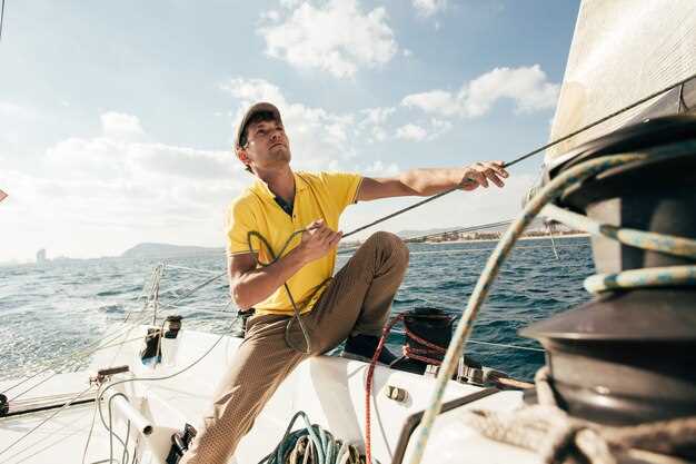
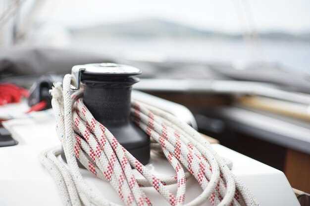
- Line: A term used to describe any rope, except for the anchor line. Always ensure lines are fastened securely to avoid accidents.
- Launch: To set a boat afloat or to begin a journey. Make sure the launch area is clear and check the watercraft for flotation devices before proceeding.
- Latitude: A geographical coordinate that specifies the north-south position on the Earth’s surface. Use latitude as a reference point for navigating.
- List: The tilt of a vessel to one side. A list can occur due to uneven loading or water accumulation; it’s crucial to correct it promptly.
- Sijainti: The specific position of a vessel. Maintain awareness of your location to ensure safe passage and proper navigation through channels.
- Lookout: A person designated to watch for navigational hazards, other vessels, and changes in weather. Always have a lookout on board during busy sailing times.
These terms are integral for effective communication and safety while onboard. Understanding and using them correctly can enhance your sailing experience significantly.
What Does ‘Luff’ Mean in Sailing?
‘Luff’ refers to the act of bringing the sail closer to the wind, causing it to “flap” instead of catching the breeze properly. This maneuver can occur when trim adjustments are made to manage the sail’s angle to maximize propulsion.
When a sail luffs, it loses efficiency and can become less secure, impacting the vessel’s speed and maneuverability. Properly adjusting sails is crucial for getting the best performance, especially in challenging weather conditions like a storm.
In sailing, understanding how the luff affects your spinnaker is important. A clean, well-trimmed spinnaker helps maintain a steady flow of air around it, while a luffing sail may indicate you’re pointing too close to the wind.
It’s essential to comply with optimal sail configurations to prevent getting adrift in deep waters. A well-rigged bowline can keep the sail in position, reducing the chances of accidental luffing.
Regular cleaning and maintenance of sails, including checking for zinc or other materials on the cover, can ensure longevity and performance. Wooden boats often have specialized areas where luffing might apply differently due to their unique design and characteristics.
Understanding the relationship between luffing and sail angles allows sailors to fine-tune their approach while chartering, ensuring they navigate the waters effectively and safely.
How to Use ‘Leeward’ in Navigational Contexts
When determining your position on the water, the term ‘leeward’ is crucial. It designates the direction away from the wind, providing essential information for safe maneuvering. Keep your vessel oriented with the headsail trimmed properly, as this reduces the risk of capsizing in strong winds.
Use floating markers, such as buoys, to help identify leeward areas. These objects serve as reliable references for locating safe anchorage, especially in conditions where visibility may be compromised. Their positions often indicate the leeward side of navigational hazards.
In navigation, reducing error in your bearings is vital. When determining leeward direction, correctly figure the wind’s position relative to your boat. This aids in adjusting cordage and sail configurations to increase stability.
Remember that currents can affect your location in leeward areas. Being driven off course by external forces means you need to frequently check your bearings against fixed objects or portable navigational aids.
In summary, understanding the concept of leeward helps you make informed decisions while on the water, ensuring a safer and more controlled experience. Minimize risk with careful planning and attention to your surroundings in this context.
The Importance of ‘Latitude’ in Chart Reading
Understanding latitude plays a critical role in successful chart reading. Hatches that expose the helmsman to open air can also be the vantage point for observing landmarks along the shore, aiding in precise navigation.
Latitude determines the position of watercraft in relation to the equator and helps in identifying navigable paths. It allows crew members to communicate effectively about the ship’s location, especially in rough waters where obstacles and reefs may cause unexpected challenges.
When plotting a course, it is vital to have accurate latitude readings. Fathom calculations, which measure water depth, become more meaningful when layered with latitude data, providing a complete view of the marine environment. This knowledge helps in avoiding areas that lack adequate depth and safe structure.
Pulling into a moor or anchoring will often rely on understanding where you are in terms of latitude. Choosing a green area near the coastline can be beneficial for swift departures. With accurate readings, crews can fill sails more confidently, enhancing speed while avoiding potential hazards.
In practice, remembering the concept of the chine–where the hull meets the waterline–can assist in understanding how latitude affects your vessel’s behavior on the water. The angle of approach may require adjustments based on the latitude, especially when coming close to islands or shorelines.
Replacement of navigational tools requires precise latitude coordination, as it impacts the overall journey’s success. With every recalibration, crew members must rely on consistent latitude readings to maintain accuracy in their charting endeavors.
‘Lifeline’ ja sen turvallisuusrooli
Pelastuslinja on aluksen kriittinen rakenne, joka tarjoaa turvallisen tukijärjestelmän, joka voi pelastaa ihmishenkiä. Se kiinnittyy tukevasti veneen laidan yläreunaan muodostaen esteen, joka auttaa estämään ihmisiä putoamasta yli laidan vaikeissa olosuhteissa.
Nämä linjat on tyypillisesti tehty kestävistä materiaaleista, jotka kestävät kovia tuulia ja meren aiheuttamaa kulumista. Pelastuslinjan muoto muodostaa jatkuvan linjan kannen ympäri, mikä lisää ylimääräisen turvallisuustason haastavissa vesissä navigoitaessa.
On olennaista tarkastaa pelastuslinjat säännöllisesti kulumisen varalta, joka voisi vaarantaa niiden eheyden. Varmista, että kaikki kiinnitykset ovat kunnossa ja että niissä ei ole rispaantumia tai heikkoja kohtia. Lisäksi pelastuslinjojen tulisi olla yhteensopivia muiden turvavarusteiden, kuten valjaiden, kanssa, ja ne on suunniteltu toimimaan yhdessä turvatikkaiden ja tyhjennyslaitteiden kanssa, mikä auttaa pelastustoimissa, jos joku ajelehtii.
Myös luukkujen ja kulkupisteiden sijainti on otettava huomioon. Oikein sijoitetut turvaköydet voivat tukea turvallista liikkumista aluksen sisätiloissa ja minimoida laidan yli putoamisen riskin. Tietämys siitä, miten nämä köydet toimivat yhdessä veneen yleisen rakenteen kanssa, parantaa navigointivarmuutta.
Viimeiseksi, on tärkeää ymmärtää, että turvaköydet lisäävät sekä miehistön että matkustajien turvallisuutta. Ne ovat enemmän kuin pelkkiä köysiä; ne ovat merenkulun turvallisuuden peruskomponentti ja niillä on keskeinen rooli kaikilla matkoilla.
Syvyyden mittaus ‘luotilanka’-menetelmällä
Veden syvyyden mittaamiseksi tarkasti, käytä luotilankaa, jonka päässä on paino, jota kutsutaan “luodiksi”. Pudota se ensin veneen sivulta ja anna sen upota. Varmista, että lanka on riittävän pitkä pohjaan ulottumiseksi. Kun se laskeutuu, tarkkaile vastusta tai äkillisiä pysähdyksiä; tämä osoittaa, että se on saavuttanut pinnan vedenalaisten rakenteiden yläpuolella.
Käytä siiman merkintöjä, usein tietyin välimatkoin asetettuina, syvyyden arvioimiseen. Kiinnitä erityistä huomiota syvyyden muutoksiin, kun lähestyt laituria, sillä pohja voi olla epätasainen. Tarkista pohjan koostumus; eri materiaalit, kuten muta tai hiekka, vaikuttavat siiman liikkeeseen.
Oikeiden varusteiden valinta on avainasemassa. Harkitse anodien kiinnittämistä korroosion estämiseksi, jos linja on alttiina suolavedelle. Jos syvyys vaikuttaa rajalliselta, tarkista se kartoista mahdollisten soiden tai uppoamisvaarojen varalta. Kommunikoi aina kapteenin kanssa asianmukaisen kiinnityksen varmistamiseksi ja kaatumisen välttämiseksi.
Käytetään johdonmukaisesti termejä kuten “johtoköysi”, jotta miehistön jäsenet ymmärtävät asian paremmin. Näiden mittausten seuraaminen auttaa reittien suunnittelussa, erityisesti käytettäessä suurempia purjeita, kuten spinnua, jotka vaativat enemmän tilaa ja huolellista navigointia esteiden ympäri. Vakaa käsi ja säännöllinen johtoköyden tarkistaminen varmistavat turvallisuuden syvemmille vesille mentäessä.
Harjoittele luotinarun käyttöä säännöllisesti. Sen pituuden ja merkintöjen tunteminen parantaa syvyyden arviointitaitojasi, ja sen huomaaminen, milloin kannattaa siirtyä lähemmäs matalampia alueita, voi estää vahinkoja. Tee siitä olennainen osa rutiiniasi vesillä liikkuessasi.