

 How to Create a Float Plan – The Complete Guide for Safe Boating">

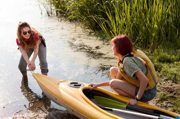
Write a written float plan today and share it with guardians and the operator before you head on-water.
Your plan should cover the on-water route, the estimated return time, and contact methods for contacting the crew if plans shift. Include the boat name and operator, a line of reference points such as a tower or shoreline markers, and, if available, coordinates. If you can, add a demos section to illustrate how the plan works in practice so guardians can see what to expect.
Before departure, contact guardians by call or text to confirm receipt of the plan, and ensure you have a backup contact. Save the plan in a written file above the console and also keep a copy on your device. Define what to do if contact is lost, and set a check-in cadence so your crew knows when to expect updates back from you.
During the trip, keep a portable power source, maintain radio contact with the operator, and be ready to adjust the plan if conditions worsen; update guardians with a quick status, a brief message, or a short call at milestone times. Maintain a clear timeline above the plan to show progress along the route, and if possible share photos or status updates at key points on-water.
Practical Float Plan Setup for Safer Boating
File a float plan before departure that specifies where you head, your intended line of travel, ETA, and planned check-ins; creating a clear, shareable document helps guardians and authorities stay aligned and reduces risk.
Assign guardians among crew or trusted contacts who monitor milestones, confirm arrivals, and trigger alerts if you drift off schedule; their prompt actions build trust and keep operations smooth.
Stock tools for real-time updates: a VHF radio, a satellite messenger, a chart plotter, and a spare battery with sufficient charge; test channels, set the course, and save the plan for quick reference, with sound alerts for missed check-ins.
Document contingencies for certain weather, currents, and daylight; include alternate routes and a line for filing with the coast guard or port authorities; list where to submit the plan and when to update it to keep operations transparent.
For activities like fishing or skiing, log specifics in the plan, including fishing zones and where skiers may cross; indicate what to expect from responders, show expected message times, and how to notify nearby boats if plans change; include a numbercolor marker to help responders identify you on charts.
Set a practical communications schedule: check-in every two hours, or more often in rough seas; specify radio channels and emergency codes, and ensure you can receive a quick reply; keep a copy with guardians and in the cabin, and follow uscg guidance for training or templates to support safe operations.
| Element | Details | Owner | Σημειώσεις |
|---|---|---|---|
| Route & ETA | Coast-to-offshore path; waypoints A→B→C; ETA targets; check-in windows | Captain | Maintain daylight limits |
| Communications | VHF 16, 69; satellite messenger; message templates | Bridge | Test pre-departure |
| Safety Gear | Life jackets, throwable, flares, radios | Πλήρωμα | Battery checks |
| Filing & Records | Float plan filed with authorities; copy kept aboard and with guardians | Captain | Include numbercolor codes |
| Contingencies | Weather shifts, currents, alternate routes | Operations | Update if conditions change |
Define Trip Details: Route, ETA, and Weather Window
Draft a written route and ETA now, save it as a template, and keep it within reach onboard. The plan should describe departure, next waypoint, pace, and a target arrival window so the crew can review at a glance and give feedback.
Plot the route along the coast from your marina to the next marina or to a trusted fishing spot, marking each leg with coordinates, distance (in nautical miles), and expected time. Use a visible line on the chart to connect points and describe the features of each segment, described here, including terrain, current, and potential hazards close to shore.
Set the weather window as a practical range you can rely on: forecast wind under 20 knots, seas under 2 meters, and visibility at least 3 miles. Prefer a window that covers the next watch, with a buffer to handle small changes in wind or swell. Check trusted sources and write down the forecast time, then compare it with your ETA at each waypoint to confirm the setting.
Build in sufficient margin for safety: add a priority fallback leg if conditions shift, and assign crew tasks so they can respond quickly. Give them clear responsibilities onboard, such as monitoring weather, managing lines, and keeping gear ready. If the forecast isnt favorable, you have a backup on deck and in the engine room, and you can hold position near a safe harbor until conditions improve. This approach reduces worry and keeps operations smooth and controlled. This level of planning also enhances the experience aboard.
Document and store the plan in your setting as a written record, for example in the ship’s log and on the onboard tablet. The template should be described with the next steps and the gear required, so the crew has a trusted reference. Share it with them before departure to avoid miscommunication and to speed decisions when speed changes or visibility drops.
After departure, maintain the same practice: review the route and ETA at the coast, confirm the float plan with all hands, and update the template as conditions change. Revisit the plan during the voyage and close the loop when you reach the next waypoint, using the written record to guide decisions and to hold the vessel on a safe heading. This document is the float plan, commonly called a float plan.
Record Vessel and Crew Info: Registration, Licenses, and Safety Gear
First, hold a single, up-to-date log that records registration numbers, license IDs, and safety gear checks, and keep it in a dry pocket near the helm for quick reference before every trip.
Record details: vessel name, hull ID, registration number, issuing authority, issue date, and expiration. Keep both a paper copy and a digital scan saved in a cloud location you trusted. This found reference saves time if you ever need to respond to questions from coast guard or harbor staff.
Licenses: ensure each operator holds a current certificate appropriate to the vessel, with expiry date clearly listed. Create a roster that includes each member name, role, license type, license number, and contact method. If someone didnt have a license for their role, assign a different task or return to shore. Keep these records on board and in the cloud for safety.
Safety gear: every person onboard wears a U.S. Coast Guard–approved life jacket; ensure sufficient life jackets for all passengers and that they fit properly. Keep a throwable flotation device within reach, a whistle or sound device, and a fire extinguisher that is inspected and not past its expiry. Have a first-aid kit, reliable communication devices, a GPS or handheld radio, and spare batteries. Carry a cell phone in a dry pouch as backup to the radio. Keep space free from clutter so you can grab gear quickly.
Checklist before leaving: verify registration numbers match vessel name; confirm licenses are valid; inspect safety gear: PFDs in good condition, throw bag accessible, fire extinguisher within date, signal devices current, VHF radio ready, backup light and battery, and a spare fuse. The point is to have everything visible and portable, and save a quick list of emergency contacts on the device and in the log.
When boating near the coast, especially around fishing boats and kayakers, reduce speed, keep a safe distance, and make planned passes with signaling. Use your VHF or a cell-based communication to confirm intentions. If a nearby vessel or person needs help, respond with a clear action and log the event. Keep the crew member responsible for communications informed and ready to advise course corrections.
Love for boating grows when you prepare and protect everyone on board. Review the record before each trip, update after maintenance or crew changes, and store copies in a cloud that you can access from shore. This habit saves time and helps you stay safe on every outing.
List Emergency Contacts and Reporting Points
Print a standard template of emergency contacts and keep it with your float plan; review and update it every few days of planning.
List authorities and reporting points clearly, including check-in schedules and the location where you report a problem.
For each contact include name, role, daytime and after-hours numbers, their vessel or company, and a cell or satellite device you can use to reach them.
Assign a person on board as the lead for reporting; store their direct contact and a backup contact so you can reach someone during operations.
Keep the information on at least two formats: a printed copy and a digital copy on your devices; both should stay accessible during drift or wind conditions.
Include reporting points along the route and times; the expected check-in windows help responders track progress amidst shifting conditions.
Record the gear and devices on board that you may need for self-rescue or signaling, and note their locations, so a responder can reach the right person quickly.
Verify the numbers regularly, and test your plan with a dry run; wrong numbers or outdated contacts waste time and risk safety.
Keep a live log of updates, including days since the last change and any new authorities or reporting points you add; that keeps everyone aligned.
Αποθηκεύστε την πηγή για κάθε επαφή και σημειώστε από πού προήλθε η πληροφορία για έλεγχο από απομακρυσμένη τοποθεσία.
Ορισμός Πρωτοκόλλων Πλοήγησης και Επικοινωνίας: VHF/DSC, Θέσεις και Σήματα
Θα πρέπει να ορίσετε ένα σχέδιο VHF/DSC αφουγκρανούμενο τώρα και να εκπαιδεύσετε όλους σε αυτό. Όλοι πρέπει να γνωρίζουν το κύριο κανάλι για τις ρουτίνες κλήσεις, την ακολουθία DSC και τη διαδικασία φωνής για τις καταστάσεις έκτακτης ανάγκης. Διατηρήστε ένα πλαστικοποιημένο φύλλο στο σταθμό πλοήγησης με το όνομα του σκάφους, το MMSI, τη λίστα καναλιών και τα σαφή βήματα για το "άνθρωπος στην θάλασσα". Χρησιμοποιήστε συσκευές σχεδιασμένες για εφεδρεία: ένα σταθερό VHF, ένα φορητό VHF και ένα epirb κρυμμένο στην τσάντα ανάγκης. Λίγα λεπτά μετά την αναχώρηση, επαληθεύστε ότι το πλήρωμα στην παρακολούθηση μπορεί να αλλάξει στο κανάλι έκτακτης ανάγκης και να τρέξει ένα γρήγορο drill όταν φτάσετε σε μια μαρίνα ή θα πλεύσετε με φίλους κοντά, ώστε η βοήθεια να μπορεί να εντοπίσει το σκάφος γρήγορα. Αυτό θα πρέπει να περιλαμβάνει ορισμένες ελέγχους καιρού, επίγνωση της κυκλοφορίας και λεπτομέρειες επικοινωνίας έκτακτης ανάγκης.
Οι θέσεις και η σηματοδότηση βασίζονται σε εκπομπές GPS/DSC. Καταγράψτε τη θέση ως γεωγραφικό πλάτος/μήκος ή πλέγμα, συμπεριλάβετε την ώρα και μεταδώστε μέσω DSC όποτε είναι δυνατόν. Ο κυβερνήτης θα πρέπει να διασφαλίσει ότι το βιβλίο καταγραφής δείχνει ποιος από το πλήρωμα είναι στην παρακολούθηση, ποιο κανάλι χρησιμοποιείται και ποια συσκευή χρησιμοποιείται για την εντόπιση του σκάφους. Κοινοποιήστε τις αναφορές θέσης σε τακτά χρονικά διαστήματα (κάθε 5-10 λεπτά εν πλω· συχνότερα σε άγριες θάλασσες) και σημειώστε κάθε απόκλιση στην πορεία ή την ταχύτητα. Εάν σταλεί σήμα κινδύνου, βεβαιωθείτε ότι οι συσκευές μεταδίδουν την ειδοποίηση σε όλα τα κοντινά σκάφη και στην ακτοφυλακή μέσω DSC, epirb εάν αποτύχει το VHF και οπτικό σήμα εάν το επιτρέπει η ορατότητα.
Οι πρακτικές σηματοδότησης δίνουν έμφαση στη σαφήνεια. Χρησιμοποιήστε οπτικά σήματα όπως σήματα σημαίας ή φώτα για να συμπληρώσετε τις ραδιοφωνικές κλήσεις, ειδικά σε πολυσύχναστα θαλάσσια στενά ή γεμάτες μαρίνες. Όταν βρίσκεστε κοντά σε άλλο ιστίο ή γειτονικό σκάφος, επιβεβαιώστε την κατανόηση με μια σύντομη ραδιοφωνική ανταλλαγή και αναγνωρίστε την απάντηση με οπτική επιβεβαίωση. Εάν χάσετε την επαφή, επαναλάβετε την κλήση σε ένα διαφορετικό κανάλι και εξετάστε ένα ηχητικό συναγερμό προς το πλήρωμα. Ανεξάρτητα από το αν πλέετε μόνοι σας ή με πλήρωμα, μια συνοπτική, επαναλαμβανόμενη ρουτίνα σηματοδότησης κρατά όλους ευθυγραμμισμένους και μειώνει τις καθυστερήσεις.
Τελικοί έλεγχοι μετά τον σχεδιασμό: όνομα, κωδικοποιητής κλήσης και MMSI σε κάθε οθόνη, βεβαιωθείτε ότι το EPIRB είναι σε εμβέλεια και δοκιμασμένο και ελέγξτε ότι όλες οι συσκευές είναι φορτισμένες. Το σχέδιο θα πρέπει να καλύπτει ποιος τηλεφωνεί, ποιος καταγράφει και ποιος παρακολουθεί τους κινδύνους. Σε διελεύσεις του κόλπου ή σε μεγάλες παράκτιες διαδρομές, βεβαιωθείτε ότι ο καπετάνιος και τα μέλη του πληρώματος γνωρίζουν πότε θα φτάσουν στο επόμενο σημείο ή λιμάνι. Κρατήστε μια πινακίδα ταχείας αναφοράς κοντά στο τιμόνι και μια ανταλλακτική μονάδα στην τσάντα. Αυτή η προληπτική ρύθμιση επιτρέπει στους φίλους, τους γείτονες και το πλήρωμα να ενημερώνονται, βελτιώνει τον χρόνο απόκρισης και κρατά τα σχέδια ασφαλείας απαλλαγμένα από κενά.
Κοινοποιήστε, Αποθηκεύστε και Ενημερώστε το Σχέδιό σας: Πού να Υποβάλετε και Πώς να το Τροποποιήσετε
Υποβάλετε το σχέδιο πλεύσης σας στην πύλη του USCG πριν από την αναχώρηση και μοιραστείτε αντίγραφα με το θαλάσσιο σημείο επικοινωνίας σας, ώστε όλοι να είναι συντονισμένοι. Εάν είναι διαθέσιμο, υποβάλετε και στην αρμόδια αρχή ναυτιλίας της πολιτείας σας. Χρησιμοποιήστε το ίδιο κανάλι για να τροποποιήσετε, να ακυρώσετε ή να προσθέσετε λεπτομέρειες κατά τη διάρκεια του ψαρέματος, του ιστιοπλοΐα και της βαρκαδόρου. Όταν τα σχέδια είναι οριστικά, στείλτε το τελικό μήνυμα σε όλους τους εμπλεκόμενους για να επιβεβαιώσετε τη διαδρομή και τις προσδοκίες.
- Πού να υποβάλει κανείς
- Υποβάλετε μέσω του πύλωνος της USCG· επίσης, αντιγράψτε την κρατική σας αρχή ναυσιπλοΐας και τη μαρίνα ή το ναυτικό σας σύλλογο που χρησιμοποιείτε.
- Παρακαλώ, δώστε ένα αντίγραφο σε έναν στεριακό επαφή που μπορεί να απαντήσει γρήγορα εάν οι αρχές ζητήσουν ενημερώσεις.
- Διατηρήστε την πρόσβαση για όλους όσους αναφέρονται στο σχέδιο, ώστε οι απαντήσεις να έρχονται γρήγορα.
- What to include
- Συμπεριλάβετε: όνομα σκάφους, κωδικό αναγνώρισης, διαστάσεις (μήκος και πλάτος), χρώμα γάστρας (μπλε, αν υπάρχει), και λεπτομέρειες κινητήρα (κατασκευαστής, μοντέλο, ιπποδύναμη).
- Σχεδιασμένη διαδρομή: αφετηρία, προορισμός, ενδιάμεσοι σταθμοί και εκτιμώμενοι χρόνοι άφιξης σε βασικά σημεία.
- Αριθμός επιβατών και ρόλοι επί του πλοίου (καπετάνιος, πλοηγός, παρατηρητής, πλήρωμα και τυχόν καλεσμένοι).
- Εξοπλισμός ασφαλείας: σωσίβια γιλέκα, VHF, πυρσοί, EPIRB, πυροσβεστήρας, κιτ πρώτων βοηθειών.
- Προγραμματισμένες δραστηριότητες: ψάρεμα, ελιγμοί ιστιοπλοΐας, ρυμούλκηση ή επιδείξεις διαδικασιών ανάσυρσης ατόμου από το νερό.
- Σημεία αναφοράς για την εντόπισή τους: πύργος, φάρος ή παράκτια χαρακτηριστικά· σημειώστε οποιαδήποτε βρέθηκαν ή εναλλακτικά σημεία αναφοράς.
- Απρόβλεπτα: καιρός, ρεύματα, συμφόρηση λιμανιού και οποιεσδήποτε εκτιμήσεις ασφάλισης ή θαλάσσης.
- Έτοιμη κατάσταση: επιβεβαιώστε ότι όλοι έχουν ενημερωθεί, ο εξοπλισμός είναι ασφαλισμένος και οι επιβάτες είναι έτοιμοι για αναχώρηση.
- Λεπτομέρειες ασφάλισης: κάτοχος συμβολαίου, αριθμός συμβολαίου και έκταση κάλυψης για τον προγραμματισμένο χώρο.
- Λαμβάνοντας υπόψη παράγοντες: καιρικές συνθήκες εν πλω, παλίρροιες, κίνηση και πιθανές καθυστερήσεις για την ενημέρωση του επαναπρογραμματισμού.
- Συμπεριλάβετε μια σημείωση για τους ανταποκριτές: το τελικό σχέδιο, την επαφή επί του σκάφους και τους αναμενόμενους χρόνους άφιξης.
- Έπειτα βεβαιωθείτε ότι υπάρχει ένα σχέδιο για τον εντοπισμό του σκάφους εάν απομακρυνθεί ή αλλάξει πορεία απροσδόκητα· πάντα υπάρχει ένα εφεδρικό σχέδιο.
- Πώς να τροποποιήσετε
- Ενημερώστε άμεσα όποτε υπάρχει αλλαγή στην διαδρομή, την εκτιμώμενη ώρα άφιξης (ETA), το πλήρωμα ή τον προορισμό.
- Υποβάλετε τροποποιήσεις μέσω του ίδιου καναλιού που χρησιμοποιήσατε για να υποβάλετε το σχέδιο· συμπεριλάβετε τη λέξη “τροποποίηση” στο μήνυμα και αναφέρετε το αρχικό σχέδιο, όπου είναι δυνατόν.
- Εάν κάτι αλλάξει, υπάρχει επείγουσα ανάγκη να ενημερωθεί το αρχείο και να ειδοποιηθεί η θαλάσσια επαφή σας και οι αρχές.
- Εάν ακυρωθεί το σχέδιο ή υπάρξει κάποια καθυστέρηση, στείλτε ένα τελικό μήνυμα για να κλείσετε το αρχείο και να αποφύγετε σύγχυση για τους ανταποκριτές.
- Ζητήστε μια απόδειξη ή επιβεβαίωση της ενημέρωσης και κρατήστε την πρόχειρη για να απαντήσετε σε ερωτήσεις από το USCG, την ασφάλιση ή τον παραθαλάσσιο σας επαφής.
Διατηρήστε όλους έτοιμους να αντιδράσουν γρήγορα και βεβαιωθείτε ότι το πλήρωμά σας κατανοεί τις τελευταίες αλλαγές. Ακολουθώντας αυτά τα βήματα, θα διατηρήσετε την ψυχραιμία σας για τον εξοπλισμό βάρκας, τους επιβάτες και τους ασφαλιστές, και όλοι θα γνωρίζουν πώς να εντοπίσουν την τελευταία έκδοση του σχεδίου σας είτε σε ήρεμα νερά είτε μέσα σε μια πολυσύχναστη μέρα βαθύστερης θάλασσας.