

 Florida Boating Guide – Where to Boat in Florida – Top Spots">

Start with the Gulf coast corridor around the Tampa Bay area to maximize calm shallows, quick entry, and access to major harbors. This choice minimizes risk and offers reliable wind patterns for a first exploration, with a unspoiled coastline experience and a clear design for safe navigation along coastlines.
Along the Atlantic stretch, a sequence of city hubs forms a practical region for year-round cruising. απίστευτα generous shallows and river mouths create a flexible corridor for day trips, with calm bays and beaches feeding culture-rich anchorages. Maintain alert for shifting currents and tidal rates as you move between harbors and inlets.
Από το busiest entry points such as Miami, Fort Lauderdale, and Palm Beach, the opportunities for slip availability, fueling, and quick hops along the coast are unparalleled. Here, culture thrives on water traffic, with lively harbors and a strong wind breeze that shapes daily plans. Stay alert to congestion and commercial traffic in major channels.
Beyond the metro corridors, the panhandle and the north Atlantic region offer unspoiled river routes and shallow entry channels. Σχεδιασμός your itinerary with a focus on sheltered harbors and safe moorings; monitor currents and wind forecasts to avoid strong gusts and to align with the prevailing rates for fuel and moorage.
Rankings compiled from anchorages, accessibility, and slip quality place these coastal districts high; for a first-time voyage, target a major port with a shallow approach and a stable slip that can be reserved ahead. The combination of calm shallows, a bustling culture, and diverse river currents makes this route incredibly adaptable for any season.
Choose your region based on wind windows; if forecasts were uncertain, adjust your plan toward calmer passages. The best opportunities lie where traffic, culture, and unspoiled coastline converge.
Top Sarasota Boating Spots and Access Points on Florida’s Gulf Coast
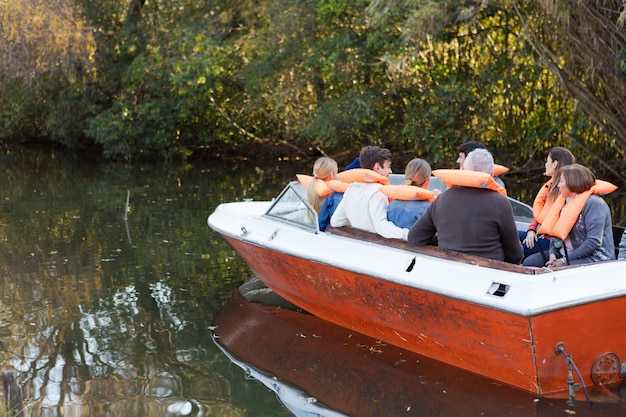
Start at downtown Marina Jack and launches a watercraft for a 2–3 hour loop through Roberts Bay, around Lido Key, and back through New Pass toward Longboat Key; this well-spent plan taps into energy here on the coast and proves ideal for families seeking a safe, wildlife-filled escape.
-
Downtown Sarasota Harbor & Marina Jack – On-site fueling, restrooms, and a short ride to Roberts Bay; this hub makes the first stop for many trips, offering easy access to a protected corridor and skyline views.
-
South Lido Public Access (Lido Key) – Direct gulf-entry ramps into Big Pass; coral formations nearby, ideal for short loops and wildlife watching; parking is limited on crowded days; best at sunrise or late afternoon.
-
Blackburn Point Park Access (Nokomis) – A sheltered entry to the intracoastal route toward residential canals and small islands; carry essentials, enjoy the mangrove canopy, and watch for manatee.
-
Casey Key & New Pass Area – Two linked launch points along a gulf-channel loop; include beach stops and island views; especially good for photographer families; trips lasting 1.5–2 hours.
-
Longboat Key Access Points – Channel launches near Longboat Pass; connect to Anna Maria Island or continue south toward the mainland; beware shallow bars at low tide and follow marked channels.
-
Johns Pass Corridor (for extended trips) – A longer route that channels vessels toward the Panhandle coast; this work requires current maps and local advisories; it broadens options beyond the core Sarasota area.
-
Islands & Wildlife Spots – Siesta Key, Lido Key, and neighboring islets offer beaches, coral patches, and manatee-watch opportunities; families frequently spend time watching dolphins and shorebird roosts; the energy here is widespread and inviting to miamis locals and visitors alike.
News: Always check local advisories before launching; wind shifts and currents can change conditions quickly; carry a VHF radio, life jackets, signaling devices, and a chart; public ramps here generally offer parking and fuel services, and access has become a popular weekend activity, making this area a go-to for residents and visitors who want a quick trips option that can be executed as a loop or as part of a longer cross-coast run.
Ramps, Marinas, and Access Points in Sarasota
Start your day at South Lido Public Boat Ramp for swift access to gulf passes and calm mornings, then head toward crescent beaches a short paddle away. plan to launch near first light, when winds are mild and reefs and schools of fish are easier to spot from the bow.
Ramps and access points number four main public launches around the island and mainland corridors: South Lido on the island of Lido Key, Nokomis Public Boat Ramp, Siesta Key Boat Ramp near Crescent Beach, and Venice Public Boat Ramp. Operators staff each site with parking, basic docks, and restrooms; remain courteous in busy hours, especially around residential channels their neighbors rely on for quiet mornings.
Marinas anchor the waterfront with tangible services: Marina Jack on the bayfront offers transient slips, fueling, and dining, making it a popular start or stop for swift hops. Residential and smaller private marinas line the inland canals and island backwaters, with their own access points and limited provisioning. Operators here emphasize efficient turnover for recreational craft while keeping safety a priority.
Access points thread the coast from island neighborhoods to the intracoastal, providing straightforward routes to inlets and reef edges. In mornings, plan for light currents and check weather windows; socializing on docks is common, yet respect the pace and space of nearby residents while you coordinate moves with their crews and guests.
For longer ambitions, many skippers map routes toward Jupiter or Lauderdale, timing crossings with favorable winds and the weather. Inland connectors via the okeechobee waterway beckon for multi-day itineraries; confirm current conditions with operators before committing to that leg. From the local ramps, keep a steady plan, watch the reefs and schools, and remain aware of other vessels’ priorities as you share the water from dawn to dusk.
Best Seasonal Routes: Gulf of Mexico vs. Intracoastal Waterway
Opt for a Gulf coast run in late fall through winter for short crowds and vast, uninterrupted banks. A week-long transition to the Intracoastal Waterway offers a convenient, harbor-hopping cruise without crowds. Boaters can combine both routes for a balanced itinerary. One week covers most highlights.
From Tarpon Springs to Naples, roughly 350 miles of navigable coast unfold with mangrove banks and open flats. In the cooler season, water temperatures range around 60–75°F, winds stay light, and beaches along the coast remain enjoyable for day trips. This stretch offers expansive coastal views. Marinas along these stops handle millions of visits annually, amenities included, so booking in advance is wise.
On the Atlantic Intracoastal Waterway, expect a sequence of sheltered passages between barrier neighborhoods, with easy contact points at marinas, shops, and parks. Each neighborhood along the ICW offers unique dining and dockside services. Those seeking a calm, learning-friendly cruise will find a vast corridor of lagoons and inlets around Amelia Island, Jacksonville, Daytona, Cape Canaveral, Palm Beach, and Miami. A local store is available in many towns, and rest stops near communities; this segment examines seasonal wind patterns and crowd trends to help plan windows. Park facilities along the route support restful days. The corridor remains popular with students and families, but you must watch weather and stay within limits for depth and lock spacing. Does this plan fit a student schedule? It does. Those preferring a shorter, predictable cruise can plan a two- or three-day hop between marked channels.
No-Wake Zones, Speed Limits, and Navigation Rules You’ll Encounter
Begin by respecting marked no-wake zones and keeping idle speed along nearshore corridors; thats the quickest way to protect shorelines, seagrass beds, and nesting habitats. Respond to posted signs and buoys, as an abundance of markers helps you stay compliant in bustling coastal waters of the state.
Speed limits are posted clearly; in no-wake zones you must be at idle or at the slowest practical pace. In channels and passes, adjust to conditions–traffic, currents, and wildlife can demand lower speeds. Additionally, monitor weather, wind, and crowds; boater concentration can change quickly in bustling harbors, so plan your approach with caution.
Navigation rules you’ll encounter include right-of-way procedures, safe passing, and signaling requirements. Remember red markers on your right when returning to shore and green markers on your left; keep to the channel center, yield to vessels restricted in maneuverability, and avoid crossing ahead of commercial traffic.
Safety and etiquette: nearshore areas demand respect for crews and visitors alike. For visitors renting gear, keep a safe distance from paddlers and crab pots. Plan a looping route that minimizes back-and-forth traffic; arrange stops at marinas and parks with a compact schedule, and tailor your style to conditions. Maintain proper safety gear and communicate with your crew; college crews and recreational groups often practice in busy bays, contributing to the bustle. If conditions change, respond quickly and adjust.
Απαραίτητος Εξοπλισμός Ασφαλείας και Γρήγοροι Έλεγχοι Πριν τον Απόπλου
Βεβαιωθείτε ότι κάθε επιβάτης φοράει σωστά εφαρμοσμένο σωσίβιο εγκεκριμένο από την Αμερικανική Ακτοφυλακή πριν αποπλεύσετε. Αυτή η απλή ενέργεια σώζει ζωές και συμβάλλει στη διασφάλιση της συμμόρφωσης σε ολόκληρη τη χώρα, η οποία ποικίλλει ανά περιοχή, και υποστηρίζει μια ασφαλή έναρξη του ταξιδιού σας.
Αυτή η λίστα ελέγχου βοηθά να καλυφθούν όλα όσα χρειάζεστε για μια ασφαλή αναχώρηση και προσφέρει μια ευκαιρία να εξασκήσετε γρήγορες ασκήσεις με αυτούς που είναι επί του σκάφους.
- Άφθονος αριθμός σωσιβίων και βοηθημάτων ρίψης: βεβαιωθείτε ότι υπάρχει ένα σωσίβιο εγκεκριμένο από την USCG ανά άτομο στο σκάφος, με ένα βοήθημα ρίψης σε άμεση διαθεσιμότητα. Τα πληρώματα που επισκέπτονται το σκάφος θα πρέπει να προσαρμόζουν το μέγεθος ώστε να εφαρμόζει γρήγορα.
- Φώτα: φανός ναυσιπλοΐας, φως καταστρώματος και φανός αγκυροβολίας. Ελέγξτε τη λειτουργία τους πριν από την αυγή ή το σούρουπο και έχετε πρόχειρο έναν αδιάβροχο φακό με εφεδρικές μπαταρίες.
- Πυροσβεστήρας: τύπου B:C, τοποθετημένος σε προσβάσιμη θέση· ελέγξτε το μανόμετρο και την ετικέτα επιθεώρησης για το τρέχον έτος.
- Ηχητική σηματοδότηση: σφυρίχτρα ή κόρνα με ανταλλακτικό, συν μια επιλογή ισχυρής σηματοδότησης για περιπτώσεις χαμηλής ορατότητας.
- Φαρμακείο πρώτων βοηθειών: περιλαμβάνει αντισηπτικά μαντηλάκια, επιδέσμους, γάζες, τσιμπιδάκια και τηλέφωνα έκτακτης ανάγκης· αποθηκεύεται σε στεγνό, προσβάσιμο δοχείο.
- Συσκευές επικοινωνίας: Ραδιόφωνο VHF στο κανάλι 16. Σε επιχειρήσεις υπό το φως του φεγγαριού ή σε απομακρυσμένες περιοχές, ενδέχεται να χρησιμοποιηθεί μια φορητή μονάδα για να επιτρέψει την επαφή σε περίπτωση που η κύρια μονάδα αποτύχει.
- Εργαλεία και ανταλλακτικά: αντλία ή κουβάς σεντίνας, εφεδρικές ασφάλειες, ταινία τύπου duct, πένσες και ειδικά ανταλλακτικά κινητήρα για όσους χρησιμοποιούν παλαιότερα ή τοπικά μοντέλα.
- Προβλέψεις για ασφάλεια και άνεση: άφθονο νερό, αντηλιακή προστασία, κατάλληλα ρούχα και αντιολισθητικά υποδήματα για την επιβίβαση και αποβίβαση σε διάφορες τοποθεσίες κατά μήκος της ακτής.
- Σχοινί και κιτ άγκυρας: ένα μακρύ σχοινί για την ανάκτηση ανθρώπου στη θάλασσα και μια αξιόπιστη άγκυρα με επαρκή αλυσίδα ή σχοινί για να κρατήσει στην επιλεγμένη περιοχή.
- Δέσμη εγγράφων: νηολόγιο σκάφους, στοιχεία ασφάλισης και πληροφορίες επικοινωνίας έκτακτης ανάγκης σε στεγανή θήκη για γρήγορη πρόσβαση εάν χρειαστεί.
- Καιρός και παλίρροιες: λάβετε ζωντανές προβλέψεις από NOAA/NWS, ελέγξτε ριπές, θάλασσες και ένα πιθανό μεταβαλλόμενο μοτίβο· εάν υπάρχουν προειδοποιήσεις, αναβάλετε εάν το σκάφος σας δεν μπορεί να χειριστεί τις συνθήκες στο επόμενο σκέλος.
- Κίνδυνοι και εγγύτητα: προσδιορισμός αμμονησίδων, ξέρων, απομακρυσμένων βράχων και εκβολών ποταμών· έλεγχος της τρέχουσας θέσης με σήματα και χάρτες και μείωση της ταχύτητας σε σχεδόν νεκρή σε αβαθή ή πολυσύχναστα μέρη.
- Καύσιμα και εμβέλεια: υπολογίστε τις ταχύτητες καύσης για την ταχύτητα πλεύσης σας· εξασφαλίστε επαρκή καύσιμα για την προγραμματισμένη απόσταση συν 25–40% εφεδρεία· παράδειγμα: αν το σκάφος σας καίει περίπου 6 GPH στην πλεύση και προγραμματίζετε μια διαδρομή 2 ωρών, μεταφέρετε τουλάχιστον 15 γαλόνια επί του σκάφους ανάλογα με το μέγεθος της δεξαμενής και την απόσταση.
- Έλεγχος ετοιμότητας συστήματος: δοκιμή διακόπτη ασφαλείας, επαλήθευση απόκρισης γκαζιού, έλεγχος τιμονιού και ρύθμισης κλίσης· εκκίνηση του κινητήρα και ακρόαση για μη φυσιολογικούς θορύβους· έλεγχος σεντινών για διαρροές πριν από την αναχώρηση από την περιοχή της προβλήτας.
- Φώτα και σήματα: επιβεβαιώστε ότι όλα τα φώτα πορείας και το φως αγκυροβολίας λειτουργούν· βεβαιωθείτε ότι τα ηχητικά σήματα είναι λειτουργικά για ημερήσιες ή νυχτερινές λειτουργίες· βεβαιωθείτε ότι μπορείτε να στείλετε σήμα εάν η ορατότητα είναι μειωμένη.
- Σχέδιο επικοινωνίας: διατηρείτε το VHF στο 16 εν πλω· να έχετε μια εφεδρική συσκευή για να επικοινωνήσετε με τη μαρίνα ή την ακτοφυλακή ολόκληρης της χώρας εάν χρειαστεί· καθορίστε ποιον να καλέσετε εάν οι συνθήκες επιδεινωθούν, γεγονός που βελτιώνει τον χρόνο απόκρισής σας.
- Ετοιμότητα πληρώματος: ενημερώστε εν συντομία όλους για τις διαδικασίες MOB, την εφαρμογή σωσιβίων και τα σήματα χειρός· αναθέστε ρόλους σε όσους είναι στο σκάφος για να επιταχύνετε τη λήψη αποφάσεων σε δύσκολες συνθήκες.
- Σχέδιο πλεύσης και συντονισμός: κοινοποιήστε ένα σχέδιο πλεύσης σε μια έμπιστη επαφή στην ξηρά· σημειώστε την προβλεπόμενη διαδρομή σας στην περιοχή και τις κατά προσέγγιση ώρες· συμπεριλάβετε ένα σχέδιο για την τροποποίηση του δρομολογίου εάν αλλάξουν οι κίνδυνοι ή η εγγύτητα στις ακτογραμμές.
- Σημείωση για τον σχεδιασμό διαδρομής: εάν κατευθύνεστε ανατολικά προς ανοιχτή θάλασσα, παρακολουθείτε προσεκτικά τα σημάδια καναλιών και βεβαιωθείτε ότι μπορείτε να φτάσετε σε ασφαλές λιμάνι ή ακτή γρήγορα εάν αυξηθεί ο άνεμος ή η θάλασσα· αποφύγετε μακρινές διαδρομές χωρίς σημεία αναφοράς.
Ενοικιάσεις, ναυλώσεις και τοπικοί οδηγοί για τα νερά της Σαρασότα
Ξεκινήστε με μια 4ωρη ναύλωση ιστιοπλοϊκού σκάφους στην περιοχή του Hillsboro, η οποία περιλαμβάνει μια στάση σε αμμουδιά και μια ακτή με φοίνικες. Αυτή η δοκιμαστική διαδρομή σάς κρατά εντός ορίων και προσφέρει μια εντυπωσιακή εισαγωγή σε αυτά τα νερά.
Ο προγραμματισμός θα πρέπει να παρουσιάζει μια σειρά επιλογών που να ταιριάζουν στο μέγεθος της ομάδας και στον προϋπολογισμό· μια ποικιλία σκαφών κυμαίνεται από συμπαγή ιστιοφόρα έως ευρύχωρες πλωτές εξέδρες. Οι δημοφιλείς επιλογές περιλαμβάνουν ιδιωτικές ναυλώσεις και εμπειρίες ιστιοπλοΐας με οδηγό, με ευέλικτα δρομολόγια που μπορούν να αλλάξουν σε διαδρομές για κολύμβηση με αναπνευστήρα ή για το ηλιοβασίλεμα. Πολλές μαρίνες διαθέτουν ένα κατάστημα στις εγκαταστάσεις τους για να νοικιάσετε επιπλέον εξοπλισμό ή να προμηθευτείτε τα απαραίτητα.
Σημειώσεις για τις παροχές: επαληθεύστε την ασφαλιστική κάλυψη, τα σωσίβια και τον απαιτούμενο εξοπλισμό ασφαλείας. Πολλοί πάροχοι περιλαμβάνουν βασικό εξοπλισμό, ενώ ορισμένοι προσφέρουν πρόσθετα, όπως εξοπλισμό για κολύμβηση με αναπνευστήρα ή καλάμια ψαρέματος. Οι τιμές ποικίλλουν ανάλογα με το μέγεθος του σκάφους, τη διάρκεια και τη ζήτηση, επομένως επιβεβαιώστε τις παροχές και τους όρους ακύρωσης πριν από την κράτηση. Αυτό χτίζει εμπιστοσύνη με σαφείς ενημερώσεις και δοκιμασμένες διαδρομές.
Οι τοπικοί ξεναγοί αποκαλύπτουν κρυμμένα διαμάντια γύρω από το Hillsboro, κόλπους και λίμνες σε κοντινή απόσταση. Συχνά προσαρμόζουν τις διαδρομές στις ανάγκες σας, και οι πολιτικές επιτρέπουν προσαρμογές λόγω καιρού, ενώ παράλληλα προσφέρουν ένα σκηνικό με τον ορίζοντα που θυμίζει το κέντρο της Τάμπα στο σούρουπο. Ο σεβασμός για την άγρια ζωή και τους βιότοπους είναι αναμενόμενος, και οι οδηγοί σάς βοηθούν να παραμείνετε εντός των κανονισμών, μεγιστοποιώντας παράλληλα την ασφάλεια και την απόλαυση.
| Operator | Τύπος Ενοικίασης | Duration | Included | Rates | Σημειώσεις |
|---|---|---|---|---|---|
| Sunset Sail Co. | Charters | 4 hours | Σωσίβια, καύσιμα, βασικός εξοπλισμός | $320–$520 | Διαθέσιμη ασφάλεια· δημοφιλές για οικογένειες |
| Sandbar & Palm Tours | Καθοδηγούμενες Ενοικιάσεις | 2–3 hours | Καθοδηγούμενη διαδρομή, ενημέρωση ασφαλείας | $180–$260 | Ιδανικό για αρχάριους, πολλές ευκαιρίες για φωτογραφίες |
| Ναυλώσεις Harbor Stars | Ιδιωτικές ναυλώσεις | 4–6 hours | Σκάφος, καπετάνιος, εξοπλισμός ασφαλείας | $450–$900 | Περιλαμβάνει σημειώσεις για την τοπική άγρια ζωή· ευέλικτα δρομολόγια |