

 Diving Across Quintana Roo, Mexico – Top Dive Sites & Cenotes">

Start with five cenotes on the first week, then expand to reef sites. If you want a clear intro, go there, because you will learn about lagoon ecosystems and how calm water supports a scuba session. We went with a simple plan and stayed until sunset, letting the cave features reveal themselves, making the experience truly amazing for a first brush with Quintana Roo. Over the next weeks, buoyancy drills, surface intervals, and ferry connections shape your rhythm.
From there, chart five core sites along the coast, each offering distinct fish action and coral structures that are perfectly balanced. A diver will notice how reef edges attract snappers and parrotfish, while inland lagoon habitats shelter juvenile species and create varied ecosystems. The variety lets you compare cave-lit environments with open-water zones, staying focused on your destinations and avoiding repetition.
To maximize your time, align Quintana Roo’s cenotes with coastal destinations that can be reached by πλοίο routes along the Riviera Maya. You will probably cover five main sites, making the route loop from inland caves to offshore reefs and back, until you lock a routine that fits your pace. For the diver, the lagoon and cave experiences complement each other, offering a balanced mix of things to see and do.
Practical Quintana Roo diving: sites, cenotes, and current conditions
Plan three active days: two cenote sessions in the morning and a central reef outing in the afternoon; this balance gives divers a mix of shallow, light-filled passages and deeper coral walls, with chances to see charismatic creatures. This approach also lets you sample a new type of underwater experience. These options cover different types of underwater experiences that will probably thrill divers again and again, and help you live the moments you love.
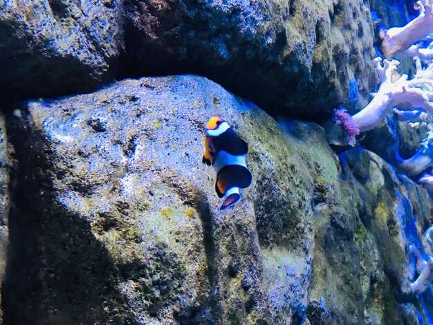
Top sites for a practical itinerary include Dos Ojos and Gran Cenote for accessible, bright passages with depths from shallow to mid-range; Angelita and Siete Bocas offer deeper, more challenging sections for trained divers. Cenotes open up worlds of underwater life with very clear water, often with dramatic light beams. In central Quintana Roo, Cozumel’s walls provide longer drifts and a broad profile of reefs, best timed with light morning seas. Always check local operators for current access and depth limits, and book a guide for safety briefs.
Water temperatures stay warm year-round, typically 26-29°C in the sea and around 25-30°C in cenotes, so a 3-5mm or 5-7mm wetsuit is comfortable; during the dry-season weeks (November–April) bring clearer visibility, often 20-40m on reefs and even better in cenotes, though winds can pick up during March–April. The hurricane season (June–November) can reduce visibility for a few weeks after storms, but cenotes remain very clear with depths and currents more predictable. For week-long trips, plan to alternate 2–3 days near Cancún with 1–2 days near Cozumel or Riviera Maya.
Current conditions in this region vary with the season: winds from the east, sea state calmer in the early mornings, and visibility on the reefs improving after light showers; cenotes stay warm with steady temps and crystal clarity. Mobula migrations peak in December–February along Cancún and nearby islets, while thresher sharks are possible but probably rare in deeper offshore channels, so check with operators about probabilities. Be sure to follow guides and respect their space; these encounters remain charismatic highlights for divers and visitors alike.
Before any sea session, check the forecast, wind and wave updates, and the operator’s safety briefing. Pack a small kit with a spare mask, reef-safe sunscreen, and a microfiber towel; bring a camera with a wide-angle lens to capture corals, small creatures, and the green seagrass beds that shade ecosystems throughout the central coast. In cancun and central Riviera Maya, you’ll love the warm water, shallow cenotes, and active reefs–moments you can live again and again.
Open-water sites by zone: Cozumel, Riviera Maya, and Puerto Morelos
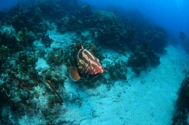
Begin in Cozumel at dawn; warm water often runs 27–29°C, and that allows a smooth drift through the wall topography. Palancar Reef shows green coral gardens with vibrant colors; Santa Rosa Wall drops steeply, offering dramatic vertical faces; Columbia Reef offers a secret drift through deeper channels where bigger pelagics cruise. Nudibranchs stud the surfaces, bull sharks appear seasonally, and many small fish animate the colors. Access from San Miguel is straightforward, and protection zones keep these worlds safe for being and playful life–making everything better again through June visibility.
In Riviera Maya, Tulum Wall delivers a long, graceful drift along a ledge that hosts meticulous corals and colors in depths from 6 to 24 m; Paamul Reef adds a kinder option with gentle slopes through 6–18 m and many macro creatures including nudibranchs. The best conditions cluster in May–June and again in September–October, when visibility is strong and the warm water supports vibrant topography near shore. Accessibility from Playa del Carmen or the town beaches makes this region better for snorkeling and easy swims.
Puerto Morelos keeps a calmer tempo with La Bocana and El Bajo. La Bocana offers a lighter drift along a protected reef edge, accessible from the village, with max depths around 15 m; El Bajo hosts bigger pelagics and schooling fish, great in June and often in the fall, with clear water and playful turtles. These sites sit inside a protected patch of the Mesoamerican Barrier Reef, which enhances access and protection for future seasons and preserves the secret feeling of the region.
| Zone | Site | Access | Max Depth (m) | Best Time | Signature Feature | Wildlife |
|---|---|---|---|---|---|---|
| Cozumel | Palancar Reef | Boat from San Miguel | 15–30 | May–Sept | Colorful gardens, swim-throughs | Green morays, parrotfish, nudibranchs, nurse sharks |
| Cozumel | Santa Rosa Wall | Boat | 18–35 | Mar–Oct | Dramatic vertical wall | Schooling fish, turtles, occasional bull sharks |
| Cozumel | Columbia Reef | Boat | 18–50 | Jun–Oct | Deep channels, pelagic drift | Pelagics, groupers, reef sharks |
| Riviera Maya | Tulum Wall | From Playa del Carmen or Tulum | 6–24 | Μαρ–Ιουν | Μεγάλη ολίσθηση τοίχου, ζωντανά κοράλλια | Barracuda, θαλάσσιες χελώνες, καρχαρίες του κοραλλιογενή ύφαλου |
| Riviera Maya | Paamul Reef | Παραλία Πααμούλ | 6–18 | May–Sept | Ήπιοι λόφοι, κοραλλιογενείς κήποι | Angelfish, μοράδες, nudibranchs |
| Πουέρτο Μορέλος | La Bocana | Πρόσβαση στην πόλη Puerto Morelos | 6–15 | Ιουν–Σεπ | Ελαφρύ ρεύμα κατά μήκος της άκρης του ύφαλου | Θαλάσσιες καβουροφάλες, μύριοι, χελώνες |
| Πουέρτο Μορέλος | El Bajo | Πρόσβαση στην πόλη Puerto Morelos | 12–20 | Year-round | Ωκεάνιες δράσεις, μεγάλα κοπάδια | ναυλονότες, σκουμπριά, τόνοι |
Σπήλαια: επιλογή ανά τύπο σπηλιάς, βάθος και έκθεση στο φως
Επιλέξτε μια ρηχή ανοιχτή τσογκόν με έντονο ηλιακό φως, έναν προσβάσιμο τοίχο και ήρεμα νερά ως την must-Ξεκινά η επιλογή για την πρώτη επίσκεψη. Αυτή η ρύθμιση λειτουργεί καλά για τους ανθρώπους, συμπεριλαμβανομένων των οικογενειών, και τους αντίδραση συχνά είναι θετικό όταν οι έξοδοι είναι άμεσες και η επιφάνεια είναι ορατή από κάτω. Αν το νερό αισθάνεται κρύο στην επιφάνεια, φορέστε μια ελαφριά στολή γυμναστικής και ακολουθήστε μια σταδιακή προσέγγιση πριν κινηθείτε βαθύτερα αργότερα.
Τρεις οικογένειες τύπων σπηλαίων διαμορφώνουν την ημέρα σας: ανοιχτές τσενοτές που πλημμυρίζουν με ήλιο, ημι-ανοιχτές τοποθεσίες με μερική στέγη και σπηλαιώδεις διαδρομές όπου το φως εξασθενίζει και οι τοίχοι στενεύουν. Κάθε τύπος είναι differentανοιχτές τοποθεσίες αποκαλύπτουν κοράλλια και καθαρές γραμμές στον τοίχο, ημι-ανοιχτοί χώροι εξισορροπούν την σκιά και το χρώμα, και τα μονοπάτια σπηλαίων ανταμείβουν περιστατικός πλοήγηση σε καθοδηγούμενη διαδρομή. Τα χαρακτηριστικά τους σας βοηθούν να επιλέξετε το κατάλληλο περιβάλλον για δραστηριότητες και άνεση, και others μπορούν να συμμετάσχουν με τον δικό τους ρυθμό.
Η απόσταση έχει σημασία. Οι ρηχές ζώνες κάτω από τα 8 μέτρα εισάγουν τους εκπαιδευόμενους στη βοήθηση και τη σηματοδότηση, οι ενδιάμεσες ζώνες από 8 έως 20 μέτρα αποκαλύπτουν μεγαλύτερους τοίχους και περισσότερη ζωή, ενώ οι βαθύτερες τσέπες 20–40 μέτρων απαιτούν περιστατικός προγραμματισμό, πιστοποιημένο οδηγό και εγγραφή πριν από την είσοδο μέσω του συστήματος ασφαλείας του χώρου. Επιβεβαιώνετε πάντα το βάθος στην είσοδο και παραμείνετε εντός του επιπέδου κατάρτισής σας.
Η έκθεση στο φως καθορίζει τη διάθεση και το χρώμα. Το έντονο φως του ήλιου κοντά σε ανοίγματα δημιουργεί ζωντανές περιλήψεις, ενώ τα πιο βαθιά ή σκιερά τμήματα δείχνουν μια ψυχρότερη, γαλομπλε λάμψη που αλλάζει την εμφάνιση των κοραλλιών και των σχηματισμών. Σχεδιάστε να επισκεφθείτε γύρω από τα μέσα της πρωινής περιόδου ή αργά το απόγευμα για να εξισορροπήσετε το φως, τις σκιές και την ορατότητα· αυτό βοηθά τόσο τους φωτογράφους όσο και τους περιστασιακούς επισκέπτες., again για ένα διαφορετικό εφέ φωτισμού.
Κλείστε μια εκδρομή με έναν αξιόπιστο χειριστή· η εγγραφή εξασφαλίζει μια οργανωμένη μέρα με άμεση ενημέρωση, ένα σύστημα ασφαλείας και σαφή όρια στο βάθος και την έκθεση. Εκτός από τον χρόνο σε σπηλιές (cenotes), μπορείτε να προσθέσετε επιφανειακές δραστηριότητες και κοντινά κοράλλια ή συναντήσεις με κοράλλια· κατά μήκος της ακτής της Γιουκατάν, συμπεριλαμβανομένης της Holbox και άλλων σημείων κατά μήκος της Καραϊβικής ακτής, αυτές οι επιλογές διευρύνουν την εμπειρία και αυξάνουν τις πιθανότητες να δείτε καρχαρίες όταν οι εποχιακές συνθήκες το επιτρέπουν. Αυτή η ισορροπημένη προσέγγιση παρέχει κάτι για κάθε άτομο και διατηρεί τον ρυθμό άνετο για οικογένειες και αρχάριους.
Παραδείγματα που ίσως να θέλετε να εξετάσετε: Το Dos Ojos προσφέρει εκτεταμένα περάσματα μέσα από σπηλιές και ανοιχτές περιοχές. το Gran Cenote παρουσιάζει καθαρά νερά με φωτεινή επιφάνεια, και το Ik Kil παρέχει ένα θεαματικό βαθύ άνοιγμα. Αυτοί οι χώροι δείχνουν πώς το βάθος και το φως αλληλοσυνδέονται. εδώ στην χερσόνησο θα βρείτε ανθρώπους που πήγαν για μια ποικιλία εμπειριών, συμπεριλαμβανομένων επισκεπτών από όλο τον κόσμο, και άλλους που θέλουν να επικεντρωθούν στην συνειδητή εξερεύνηση ανάμεσα στους κοραλλιογενείς υφάλους και τους τοίχους των cenote.
Εποχική ορατότητα και συνθήκες νερού ανά μήνα
Σχεδιάστε το Φεβρουάριο έως τον Απρίλιο για τη μεγαλύτερη διαύγεια στην ορατότητα της θάλασσας και άνετες θερμοκρασίες. Αναμένετε πιο ήρεμα πρωινά και σταθερές ρευματικές περιοχές κοντά στις άκρες των κοραλλιογενών υφάλων, ιδανικές για πολλαπλές εκδρομές κατά μήκος της Ριβιέρα Μάγια και της περιοχής Κοζουμέλ.
- January
- Ορατότητα: 15–25 m
- Θερμοκρασία: 25–27°C
- Τρέχουσα και άνεμος: ελαφρύ έως μέτριος· άνεμοι ΒΑ το πρωί
- Σημειώσεις: οι άκρες του κοραλλιογενή υπορόφου παραμένουν καθαρές τις περισσότερες ημέρες· οι ρηχές ζώνες εμφανίζουν εξαιρετική ορατότητα
- February
- Ορατότητα: 18–30 m
- Θερμοκρασία: 25–28°C
- Τρέχουσα και άνεμοι: ελαφρύ έως μέτριο· τα πρωινά συνήθως είναι ήρεμα
- Σημειώσεις: οι ανατολικοί κοραλλιογενείς υφάλλοι συχνά παρουσιάζουν έντονη διαύγεια· σταθερές μέρες κοντά σε ακτοπεριβάλλοντα σημεία
- Μάρτιος
- Ορατότητα: 25–35 m
- Θερμοκρασία: 26–29°C
- Τρέχουσα και άνεμοι: γενικά ήπιοι· καλύτερα αποτελέσματα μετά την ανατολή του ηλίου
- Σημειώσεις: βέλτιστα παράθυρα κατά μήκος του Cozumel και του διαδρόμου του ύφαλου
- Απρίλιος
- Ορατότητα: 28–40 m
- Θερμοκρασία: 26–29°C
- Τρέχουσες και άνεμοι: σταθερόι· η ξηρασία υποστηρίζει μεγάλα, καθαρά ανοίγματα
- Σημειώσεις: οι παράκτιες ζώνες παραμένουν καθαρές· προγραμματίστε νωρίς για το καλύτερο φως
- May
- Visibility: 20–32 m
- Temperature: 27–30°C
- Current and winds: breeze increases; brief showers possible
- Notes: turbidity can rise after rain; mornings are ideal
- June
- Visibility: 18–28 m
- Temperature: 28–30°C
- Current and winds: winds pick up; seas can be choppier on exposed sites
- Notes: flexibility helps; check forecasts for offshore routes
- July
- Ορατότητα: 15–25 m
- Temperature: 28–31°C
- Current and winds: humidity high; showers frequent
- Notes: morning windows improve clarity; offshore reefs remain productive
- August
- Ορατότητα: 15–25 m
- Temperature: 29–31°C
- Current and winds: warm, often breezy; storm risk rises
- Notes: plan with a flexible schedule; some days offer excellent clarity
- September
- Ορατότητα: 15–25 m
- Temperature: 29–30°C
- Current and winds: rainy season in full swing; turbidity after rain spikes
- Notes: cenotes stay reliable; choose mornings after dry spells
- October
- Visibility: 20–30 m
- Temperature: 28–30°C
- Current and winds: post-storm stabilization; mornings are clearer
- Notes: early planning helps, especially for offshore routes
- November
- Ορατότητα: 25–35 m
- Temperature: 26–28°C
- Current and winds: dry-season pattern begins; winds moderate
- Notes: the region shows strong clarity; nearshore shelves offer stable conditions
- December
- Visibility: 20–40 m
- Θερμοκρασία: 25–27°C
- Current and winds: north swells possible; mornings often calmer
- Notes: end-of-year slots yield excellent light and long sightlines
Cenotes offer reliable clarity year-round; temperatures stay in the mid-20s °C, with mornings delivering the best light through skylights for photography.
Currents, depths, and safety planning for reef and drift dives
Book a guided, licensed drift session with a local operator who provides a surface marker buoy, reel, and a clear exit plan. Ensure a meticulous safety briefing, check current forecasts, and confirm exit options before entering the water. If winter here brings cooler water, wear a 3–5 mm wetsuit and stay ready to adjust pace; most drift routes around the Yucatán deliver a bucket-list moment when you move with the healthy balance of current and buoyancy, creating a memorable encounter with the natural world and its species. The oceans can be calm yet demanding, so prepare five core steps to stay ready and safe.
-
Currents, angles, and site selection – In this region, surface flows are driven by trade winds and tidal exchange. Most reef lanes run 0.5–1.5 knots on calm days; in calmer morning windows you gain a little more control, while afternoons can bring stronger push toward the back reef. Look for controlled entry points and exit options that align with your plan, such as channels that offer predictable paths back to the shore. Keep an eye on olhos–the eyes of the reef area seen by guides–as indicators of activity and visibility shifts; if the water looks green and murky, slow and reassess. Always have a plan for back-up exits and avoid routes with sharp cross-currents.
-
Depths and bottom time – Typical reef sections stay around 12–18 m, with some wall zones dropping to 20–25 m. For drift-lane safety, plan a bottom time of 25–40 minutes in calm conditions, then add a 3–5 minute safety stop at 5 m. If current accelerates, shorten bottom time accordingly and ascend earlier to maintain a second safety margin. Average gas reserves should be checked against the planned time and depth, aiming to finish the session with a comfortable reserve.
-
Five essential safety checks – Use a short, meticulous checklist before every session:
- Forecast and currents: verify the latest update and confirm that exit routes remain viable.
- Equipment readiness: SMB/reel, whistle, knife, spare gas if available, and a buoyant belt; confirm buddy signals.
- Buoyancy and trim: practice a light, controlled glide with minimal fin work to reduce impact on the water column.
- Site plan and angles: agree on a primary route, back-up exit, and contact points for the team.
- Gas management: ensure reserve, plan the second stage of the mix, and pace work to avoid early depletion.
-
Safety equipment and communication – Carry a surface marker buoy, signal whistle, and a cutting tool; a reel helps you manage drift when currents shift. Communicate with your buddy using agreed hand signals and maintain visual contact as you approach potential narrowing points or silt zones. On calmer days, you may explore closer to green slopes; on stronger days, stay nearer to the exit and maintain a steady rhythm to keep the group balanced.
-
Environmental awareness and site-focused choices – Respect marine life and keep distance from critical habitats. Choose routes where you can observe natural behavior without interfering with wildlife, such as reef crevices or shallow ledges where species like parrotfish and angelfish commonly move. Note how the current shapes your path across the kelp-like greens and sandy patches; plan options that minimize contact with fragile coral and maximize opportunities to observe small natural acts, such as fish schooling and shell activity.
Posterior planning concentrates on safe margins and realistic options, not on pushing limits. A well-chosen route reduces stress on your second stage and supports a healthy balance between exploration and safety. Remember: most memorable moments come from calm, controlled movements, thoughtful angles, and a strong, cooperative team–here in the Yucatán’s tropical oceans, where winter temperatures trend toward the mid-20s Celsius and the game is to stay ready, meticulous, and mindful of the planet we share with countless species.
Gear and safety checklist for Quintana Roo dives
Perform a thorough pre-entry gear check on the beach at least 30 minutes before any underwater outing. Verify regulator and first stage, alternate air source, buoyancy control device, weights, and computer are within specification, and confirm a charged backup light and spare batteries are stowed in a dry bag.
Carry a redundant air source, a bright primary light, spare mask strap, and a safety reel or line for cenotes or reef sections. There should be a clear plan with your buddy for contact if visibility drops or currents shift.
Depths awareness matters: Open Water certification typically limits to 18 m (60 ft). For deeper options, complete Deep or Tec training and accompany a qualified guide. In cenotes, plan your maximum according to experience and follow your guide’s instructions. Request an in-depth briefing before entering any zone.
Wildlife and environment: Caribbean reefs host turtles and eagle rays; keep distance and do not chase. Caribbean reef life is worshipped by locals and divers; observe from a respectful distance.
Πρακτικές προστασίας: Χρησιμοποιήστε αντηλιακό φιλικό προς τους κοραλλιογενείς υφάλους στην ακτή, αποφύγετε την εφαρμογή κοντά στην ακτογραμμή και προστατέψτε την παραλία και τον υφάλους παραμένοντας σε καθορισμένα μονοπάτια και αποφεύγοντας την αφή των κοραλλιών. Φέρτε μια μικρή τσάντα για τα σκουπίδια και ένα επαναχρησιμοποιήσιμο μπουκάλι για να μειώσετε τα απόβλητα.
Επιλογές για εξοπλισμό και πρόσβαση: Η Quintana Roo προσφέρει ενοικιαζόμενο εξοπλισμό και ξεναγούμενες εκδρομές. Η playa del Carmen και οι παρακείμενες περιοχές της παραλίας έχουν καταστήματα. Υπάρχουν και άλλες επιλογές, συμπεριλαμβανομένων καταστημάτων στην ακτή και στο Cozumel. Αν οδηγείτε, ξεκινήστε νωρίς για να αποφύγετε την κίνηση και να έχετε περισσότερο χρόνο για να ελέγξετε τον εξοπλισμό. Θα πρέπει να υπάρχει χρόνος για έναν έλεγχο τελευταίας στιγμής καθώς φτάνετε.
Σχεδιασμός έκτακτης ανάγκης και αξιόπιστες πηγές: μεταφέρετε μια συσκευή σηματοδότησης επιφάνειας, γνωρίζετε τους τοπικούς αριθμούς έκτακτης ανάγκης και έχετε ένα σχέδιο για γρήγορη έξοδο εάν οι συνθήκες επιδεινωθούν. Η πηγή των βέλτιστων πρακτικών βρίσκεται στα χρόνια εμπειρίας που μοιράζονται οι τοπικοί συνεισφέροντες· έχοντας δραστηριοποιηθεί για χρόνια, αυτοί οι συνεισφέροντες καθοδηγούν τους νέους δύτες και στη συνέχεια σας βοηθούν να εξερευνήσετε την Καραϊβική με αυτοπεποίθηση. Η γνώση από έμπειρους οδηγούς μπορεί να επιτρέψει ασφαλέστερες αποφάσεις και στη συνέχεια να σας βοηθήσει να απολαύσετε το θέαμα.