

 Boating Navigation – Essential Tips & Tools for Safe, Confident Cruising">

Ξεκινήστε κάθε ταξίδι με μια λίστα ελέγχου προγραμματισμού πριν την αναχώρηση: ενημερώστε τους χάρτες, επαληθεύστε τους γνωστούς κινδύνους, ορίστε τα σημεία πορείας και επιβεβαιώστε τα δεδομένα καιρού και παλίρροιας. Ενώ ετοιμάζεστε, βεβαιωθείτε ότι ο χρόνος του πληρώματος είναι αφιερωμένος σε μια ενιαία, δομημένη ρουτίνα. Αυτό μειώνει τις εκπλήξεις της τελευταίας στιγμής και βοηθά στη λήψη ενημερώσεων εντός 10 λεπτών σε περίπτωση αλλαγής των συνθηκών.
Παραδοσιακός δεξιότητες συνδυάζονται με το σύγχρονο systems. Να χρησιμοποιείτε ελέγχους πυξίδας παράλληλα με ηλεκτρονικούς χάρτες και AIS για να show την κατάσταση πάνω και κάτω από το νερό, βοηθώντας στην πλοήγηση σε πολυσύχναστα κανάλια. Να τηρείτε μια συνεχή ανασκόπηση ασφαλείας: ελέγξτε τους πυροσβεστήρες, τα σωσίβια και τον εξοπλισμό σηματοδότησης.
Σημειώσεις για τις διαδικασίες λιμένα: διατηρείτε συντηρητική ταχύτητα σε πολυσύχναστα κανάλια (6–8 κόμβους), ακολουθείτε καθιερωμένα πρότυπα κυκλοφορίας και keeping αποφύγετε τις πολυσύχναστες λωρίδες. Κάντε έναν γρήγορο έλεγχο 2 λεπτών μετά από κάθε είσοδο στο λιμάνι και, στη συνέχεια, συνεχίστε τον σχεδιασμό με νέα δεδομένα.
Κατά τη διάρκεια ταξιδιών κοντά σε green σημεία, επαληθεύστε τις διοπτεύσεις με γνωστά τοπόσημα, ο χρόνος περνά και μετρήστε accuracy ενάντια σε παλίρροιες. Στις λωρίδες ποταμών της Βαυαρίας, προσαρμοστείτε σε στενά κανάλια και ισχυρότερο ρεύμα.
Κοινοποίηση δεδομένων σχεδιασμού στο πλήρωμα, καταγραφή notes στις αποκλίσεις και ενημερώστε το αρχείο καταγραφής μετά από κάθε βάρδια. Σε περίπτωση ξαφνικής situation, ενεργοποίησε τον συναγερμό, μεταπήδησε στο εφεδρικό systems, και διατήρησε time Εντάξει.
Ναυσιπλοΐα με Σκάφος: Πλοήγηση με Μαγνητική Πυξίδα – Πρακτικές Συμβουλές & Εργαλεία για Ασφαλή, Αυτοπεποίθηση Κρουαζιέρα
Recommendation: Τοποθετήστε μια στιβαρή μαγνητική πυξίδα με μια ευκρινή στεφάνη, εγκαταστήστε την σε μια προστατευμένη τοποθεσία χωρίς παρεμβολές και έχετε μια εφεδρική πυξίδα εκτός σύνδεσης στο σκάφος. Ενώ βρίσκεστε εν πλω υπό ιστιοφορία, ελέγχετε τη διόπτευση της πυξίδας σε σχέση με τα σημεία αναφοράς και τον χάρτη, δημιουργώντας μια αξιόπιστη πηγή αλήθειας ακόμη και όταν τα ηλεκτρονικά συστήματα αποτυγχάνουν.
Πώς να διαβάζετε ρουλεμάν: Καθορίστε μια κατεύθυνση στοχεύοντας ένα σταθερό σημείο και διαβάζοντας το αζιμούθιο από τη στεφάνη. στη συνέχεια, προσαρμόστε ανάλογα με την τρέχουσα διακύμανση και, εάν είναι απαραίτητο, την απόκλιση από το σύστημα του δικού σας σκάφους. Καταγράψτε μοίρες, λεπτά και δευτερόλεπτα ως συντομογραφίες σε ένα φύλλο πεδίου, και κρατήστε επίσης μια σημείωση για κάτι σαν Β, Α, Ν, Δ για γρήγορη αναφορά. Ορισμένα βήματα μειώνουν το σφάλμα σε συνθήκες ανέμου.
Χρησιμοποιήστε σημεία αναφοράς κατά μήκος της διαδρομής για να επιβεβαιώσετε την υπολογισμένη πορεία. σημειώστε επίσης ότι γρήγορες αλλαγές στον άνεμο ή ριπές μπορούν να εκτρέψουν το σκάφος από μια καθαρή μαγνητική διόπτευση. Ως εφεδρεία, χρησιμοποιήστε σταθερά σημεία στην ξηρά που είναι ορατά από μαρίνες και γνωστά από χάρτες περιοχής σχεδιασμού. Ο συνδυασμός μιας τροφοδοτούμενης πυξίδας και μιας ανεξάρτητης πηγής πληροφοριών σάς κρατά ευθυγραμμισμένους ακόμη και αν αποτύχει το GPS.
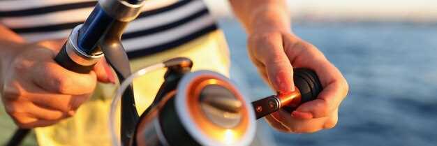
Equipment checklist: Βεβαιωθείτε ότι η πυξίδα είναι εξοπλισμένη και εγκατεστημένη με σωστή στήριξη, ελέγξτε τα καλώδια ή την καλωδίωση εάν είναι μέρος ενός μεγαλύτερου συστήματος. διατηρήστε μια τροφοδοτούμενη μπαταρία ως εφεδρεία, ώστε το όργανο να παραμείνει λειτουργικό όταν διακοπεί η κύρια τροφοδοσία. Εγκαταστήστε μια δεύτερη συσκευή ως γρήγορη εφεδρεία και επισημάνετε την περιοχή εγκατάστασης με μια ειδοποίηση για τις αλλαγές πληρώματος. Ανατρέξτε στις μαρίνες για ειδοποιήσεις σχετικά με μαγνητικές παρεμβολές κοντά στα καλώδια τροφοδοσίας του λιμανιού. Η Bavaria προσφέρει τοπική καθοδήγηση από τις αρχές· χρησιμοποιήστε τα ως μία μοναδική πηγή αλήθειας.
Σχεδιασμός και εξάσκηση: Κατά τη δημιουργία σχεδίων, σημειώστε την περιοχή και τα πιθανά σημεία με μαγνητική παρεμβολή (κοντά σε καλώδια ρεύματος, κινητήρες ή φορτία). Από οικονομικής άποψης, μεταφέρετε μια συμπαγή πλαστικοποιημένη κάρτα πεδίου που να δείχνει την τοπική μαγνητική διακύμανση ανά περιοχή. Οι βαρκάρηδες θα πρέπει να εναλλάσσονται μεταξύ της μαγνητικής διόπτευσης και της αληθινής πορείας στον χάρτη για να αποφύγουν την παρέκκλιση. Η ακόλουθη συνήθεια βελτιώνει την αυτοπεποίθηση, ειδικά τη νύχτα ή στην ομίχλη.
Notice: Παρακολουθήστε τα καλώδια του κινητήρα και τις ηλεκτρικές γραμμές για να αποφύγετε παρεμβολές. διατηρείτε την περιοχή γύρω από την πυξίδα καθαρή από σιδηρομαγνητικά αντικείμενα, αποφύγετε μεταλλικά εργαλεία και κρατήστε τις φορητές συσκευές μακριά από την πυξίδα. διατηρείτε μια κατά προσέγγιση απόσταση σε πόδια από την πηγή που μπορεί να παραμορφώσει τις ενδείξεις. Οι κίνδυνοι πυρκαγιάς κοντά στις γραμμές καυσίμων απαιτούν γρήγορη ανταπόκριση και απομάκρυνση εάν μια ριπή προκαλέσει σπινθήρα. Οι βαρκάρηδες σε μια μαρίνα θα πρέπει να χρησιμοποιούν μια λειτουργία ενός κινητήρα όταν εξαρτώνται από το μαγνητικό πεδίο. εάν δείτε μια απόκλιση, ελέγξτε ξανά με το χάρτη και προσαρμόστε όπως απαιτούν οι αρχές.
Λειτουργία εκτός σύνδεσης παραμένει πρακτική σε μεγάλες διαδρομές· αυτό συνάδει με την ιδιοκτησία και τη συστημική προσέγγιση, ενισχύοντας την ανθεκτικότητα όταν η ισχύς και τα ηλεκτρονικά αποτυγχάνουν. Η τεχνική μπορεί να δοκιμαστεί σε διαφορετικές συνθήκες περιοχής· η ακτή της Βαυαρίας προσφέρει λόφους που αλλάζουν την οπτική επαφή με τα ορόσημα, οπότε βασιστείτε σε αυτά τα σημεία για να επαληθεύσετε τα ρουλεμάν. Διατηρήστε ένα απλό, οικονομικό κιτ που περιλαμβάνει μια εφεδρική μπαταρία, μια πλαστικοποιημένη κάρτα πεδίου με συντομογραφίες και σαφή σχέδια για την εναλλαγή μεταξύ μαγνητικού ρουλεμάν και χαραγμένων πορειών.
Πλοήγηση με Μαγνητική Πυξίδα: Βασικές Πρακτικές για Ασφαλή και Αυτοπεποίθηση Κρουαζιέρα
Να ρυθμίζετε πάντα ένα μαγνητικό ρουμπάρισμα προς την προβλεπόμενη πορεία σας πριν από την αναχώρηση., και έπειτα επιβεβαιώστε το με μια δεύτερη μέθοδο, όπως GPS ή σημεία αναφοράς. Αυτό σας κρατά σε καλό δρόμο σε νερά που κυριαρχούνται από ρεύματα και αλλαγές ανέμου, επιτρέποντάς σας να πλέετε με μεγαλύτερη αυτοπεποίθηση.
Regular learning και following δομημένο class βοηθά στην κατασκευή awareness of διαφορές μεταξύ των ενδείξεων της πυξίδας και της πραγματικής διεύθυνσης. Χρησιμοποιήστε offline practice για την ενίσχυση της μυϊκής μνήμης: περιστρέψτε την πυξίδα, συγκρίνετε με τα δεδομένα του χάρτη και καταγράψτε τις παρατηρήσεις στο ownership σημειώσεις.
Κρατήστε τα φορητά και τα σταθερά όργανα μέσα service: ελέγξτε την θήκη για ρωγμές, αντικαταστήστε τη στεφάνη και βεβαιωθείτε ότι χρέωση είναι επαρκής για συσκευές δημιουργίας αντιγράφων ασφαλείας. Όταν τα ταξίδια περιλαμβάνουν fishing ή προσέγγιση around να περάσετε ξέρες, χρησιμοποιήστε το ρουμπάρισμα για να οδηγήσετε ένα secure τόξου και να ελέγχετε περιοδικά.
Οι βαρκάρηδες πρέπει να κατανοήσουν ότι many παράγοντες επηρεάζουν την ανάγνωση: τοπική διακύμανση, διαφορές μεταξύ χάρτη και οθόνης, και τον αντίκτυπο των μεταλλικών αντικειμένων. Να διατηρείτε πάντα data από πολλαπλά means να έχετε κατά νου και μαζί να αναπτύξετε μια ισχυρή συνήθεια για να παραμείνετε στην πορεία.
Μια πρακτική ρουτίνα: έλεγχος κατεύθυνσης, έπειτα επανέλεγχος μετά από στροφή ή αλλαγή στο νερό, τα ρεύματα ή τον άνεμο· τήρηση ημερολογίου, ανασκόπηση. awareness data μετά από κάθε trip, και include σημειώσεις για το πώς technology και products εκτελέστηκε offline και online.
Pre-Departure Compass Check: Declination, Deviation, and Swing
Set your magnetic compass to the latest declination from the updated chart or источник on deck, then lock the setting. Cross-check with the deviation table to ensure the numbers reflect current waterways, and log the change in a quick table aboard to support your plans and trips. Document the detail of the adjustment to aid crew work during pre-departure checks.
Compute the true heading by applying two corrections to the observed compass heading: deviation (D) from the vessel’s deviation table, and variation (V) from the chart. Use the equation TC = CH + D + V, with signs taken from the sources. Example: CH 090°, D = +2°, V = +5° yields TC 097°. When D or V are negative, adjust accordingly to keep your plotting on the intended type of course.
Perform a swing check while berthed: rotate the wheel through 360 degrees and compare the compass reading with a fixed reference bearing from landmarks or a charted line on the plotter. Note what you observe, expect swing to stay within roughly 0–6° on a typical hull; larger swing indicates residual magnetism or nearby damage. If you detect excess swing, pause, reassess deviation data, and rely on a quick, powered backup such as GPS overlay to confirm the route while you adapt.
If the hull or compass shows damage, or interference from gear is suspected, rely on a gyro compass or GPS-based track as a stand-in. When youre plotting trips through channels, a lake passage, or long waterway legs, keep a stand-on bearing in mind and enable a quick cross-check with the GPS plot to stay carefree and on plan.
Document the updated data in a dedicated table on deck, mark источник as the data source, and share the results with everyone aboard, including the charter crew. This detail keeps your plans aligned, reduces risk during long trips, and enables carefree travel between water channels.
Reading the Compass at the Helm: Navigating with Pitch, Roll, and Spray
Lock the helm and confirm a stable bearing by aligning a magnetic compass with sense4boat data, and use aids such as a gyro or fluxgate to cross-check readings; verify signal quality via hdop readouts, which is more accurate than a single instrument. If the numbers drift beyond ±3 degrees after a 15-second check, then re-center and re-check against the tide.
On deck, shifting seas produce spray that fogs the compass card. Keep your gaze through the binnacle, practicing calm helm corrections, and react quickly to small deviations; blasts from waves can push readings off, so strive to adjust before another span passes. This reduces collisions, a clear advantage in distress situations. Stay mindful of regulations.
Bilge pump readiness matters; ensure lines are clear and checks don’t interfere with cockpit instruments.
Learning updates from a network of owners, Bavaria sail owners, and suppliers of products keep you informed. Sense4boat readings, hdop trends, and numbers flux matter more than a single instrument. Informed care stays steady; you become more capable as conditions change through dives, tide, blasts, and gusts, and the approach can feel carefree yet precise. This significantly sharpens decision making.
| Condition | Action | Σημειώσεις |
|---|---|---|
| Pitch > 5° or roll > 6° | Return to bearing; recenter; cross-check hdop | Cross-check with sense4boat; then lock |
| Spray obscures readout | Recenter; adjust to keep readings aligned | Keep eyes on cards; monitor spots |
| Reading drifts on spots | Record numbers; compare with network updates | Become consistent; updates help |
Correct for Variation and Deviation in Real-Time Bearings
Always validate bearings in real time by cross-checking magnetic readings with GPS positions and known visual cues, including buoys and upstream references to confirm alignment with the intended course.
- Baseline setup: pull local variation from a current chart or offline apps, then set that value in your compass settings and the electronics display, creating a single reference used in quick checks.
- Continuous cross-check: maintain alignment between magnetic bearing and GPS-derived course; compare positions against marina charts and a few fixed marks; when a discrepancy is detected, adjust bearing values immediately and log changes with concise abbreviations.
- Crew responsibilities: assign a quick observer to watch visual cues and buoys; keep the crew informed, involve your electrician when hardware readouts drift, and ensure the log is updated with care.
- Interference and drift: be mindful of blasts from nearby equipment or power lines that can shift readings; recalibrate, verify compass alignment, and test against a known set of courses to restore accuracy.
- Offline resilience: if connectivity or apps go offline, rely on positions, visual cues, and a trusted set of tracks; maintain a small record of bearings, positions, and courses to speed real-time decisions.
- Maintenance discipline: keep electronics well maintained, replace batteries, and review settings regularly; theres a need to verify readings after any calibration, and the crew should review the log after every trip; involve your electrician for a hardware check.
- Reference tools: use marina charts, buoys, and equipment to confirm alignment; with many inputs, accuracy improves; always align your heading with a good visual reference and a backup from apps or GPS.
Cross-Check Bearings with Charts, GPS, and Visible Landmarks
Check bearings against three sources: charts, GPS, visible landmarks before every leg. In practice, run the three-source check to confirm your position within the area, then update as you move. This approach increases accuracy when approaching busy zones such as wakeboarding zones, and when dealing with depths that change with tides.
- Charts and abbreviations: Read the fundamental bearing shown on the chart. Use the chart source; verify scale, grid, declination, and abbreviations in the legend. Note depths in the area and record what you see in your log tables to reference later.
- GPS and sensors: Compare GPS bearing with chart bearing; check sensor status, time, and update rate. If readings diverge beyond a small margin, switch to dead reckoning and relying on landmarks until readings align. Set an alarm if drift persists beyond 2–3 minutes.
- Visible landmarks: Identify at least two fixed features on shore or buoys; take visual bearings to each, compare with chart positions, and verify your location every few minutes. This critical step helps when GPS is degraded or signal is limited.
- Handling discrepancies: If misalignment exceeds a preset threshold, execute a rapid cross-check using what you know about depths and the ship’s wake. Update course gradually to reestablish your path.
- Record keeping: Save information in a dedicated log; include time, location, measured bearings, and notes. Refer to books or class materials, and fill in tables with abbreviations you can glance quickly. This ensures everything is captured.
- Practical practicing: Before class or during drills, run this routine on a known journey route. Practicing increases tolerance to misalignment as you sail near zones and other craft. What you learn here becomes baseline behavior when sailing in unsettled conditions. This practice will increase your accuracy.
Maintaining the Compass: Cleaning, Storage, and Magnetization Prevention
Start with a clean, magnetically neutral base: wipe the compass face with a soft microfiber cloth, rinse with fresh water, and dry thoroughly. Use a mild soap if needed; avoid solvents. Keep the unit above the deck to minimize moisture ingress and prevent water marks on the glass. After cleaning, verify the north reference against a distant mark or marks on a chart, confirming accuracy before heading out on the journey.
Maintain proper storage: when not in use, place the compass in a dry, cool container away from ferrous hardware, high-current cables, and any electronic sensors that could induce stray fields. The goal is to keep the dial balanced; avoid exposure to ferrous metals that can magnetize the dial. Store with the face up to help back bearings and maintain readability.
Magnetization prevention: keep the instrument away from beidou antennas and other magnet sources around the cockpit; a single magnet can cause drift, producing multipath-like errors when plotting routes. If you notice drift, perform a simple calibration against a known north reference. This must be part of your awareness at all times.
Simple checks during plotting: use sense4boat to compare compass output with GPS sensors; taking updates from authorities when away from shore; stay aware of distances and routes to limit collisions. If sensors show a discrepancy, develop understanding that a great deal of external influence can upset readings and adjust accordingly.
Charter crews, especially in bavaria, must stay aware of a routine that keeps the compass reliable. Start each day by checking alignment, and stay prepared with a back-up bearing. The aim is a carefree journey with reliable bearings, while authorities oversee safety and distances to other vessels along busy routes.
Regular checks create awareness of multipath and external interference that sensors may reveal. Building understanding of how external factors affect readings helps you stay able to plot more accurately. A simple, repeatable routine–clean, store, magnetization precautions–keeps distances and routes accurate, making back-up bearings usable when conditions are rough. Stay mindful of authorities and be proactive in maintaining performance on the journey ahead.