

 Bahamas Abacos Yacht Charter and Sailing Vacations">

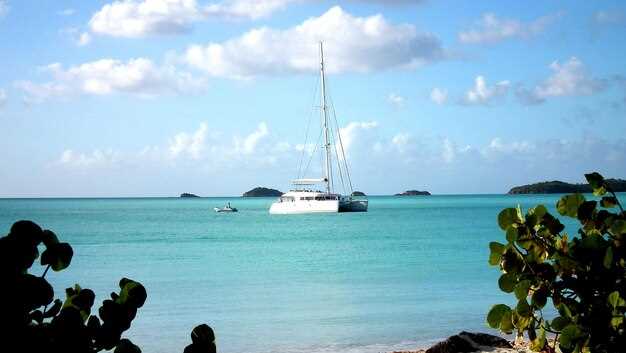
Κλείστε μια ναύλωση γιοτ στις Μπαχάμες Αμπάκος φέτος για να απολαύσετε ένα caribbean ιστιοπλοϊκή εμπειρία με την οικογένεια ή τους φίλους. Ένα πρόγραμμα 7 έως 10 ημερών λειτουργεί καλύτερα, με Σκάφη αναψυχής 3 έως 4 καμπινών που προσφέρουν σε όλους ιδιωτικότητα και άνεση. Ξεκινήστε από το Marsh Harbour, το οποίο κάνει τις αεροπορικές συνδέσεις απλές, και στη συνέχεια εξερευνήστε την Hope Town και το Treasure Cay. η διαδρομή χρησιμοποιεί ήρεμα νερά, χρυσές παραλίες και beautiful ένα τοπίο που κρατά τους ναυτικούς γεμάτους ενέργεια. Ένα καλά υπολογισμένο σχέδιο γεμίζει τις ημέρες με κολύμβηση με αναπνευστήρα, επισκέψεις σε νησιά και βραδιές πάνω σε ένα σκάφος που έχει τις ρίζες του στην κληρονομιά των Μπαχάμων.
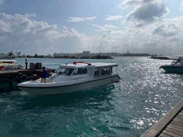
Τακτοποιήστε τις αφίξεις μέσω του Marsh Harbour airport ή Treasure Cay airport, έπειτα οδηγήστε τον σύντομο δρόμο από Πλύμουθ στη βάση σας και επιβιβαστείτε στο γιοτ σας. Αναζητήστε σκάφη με 3-4 καμπίνες, ένα ευρύχωρο σαλόνι και μια ηλιόλουστη εξέδρα· μια καλά εξοπλισμένη κουζίνα διευκολύνει την προμήθεια τροφίμων. Κάτω την επιφάνεια, θα βρείτε καθαρά νερά ιδανικά για κολύμβηση με αναπνευστήρα, ενώ το πλήρωμά σας μπορεί να κανονίσει επισκέψεις σε ιστορικές τοποθεσίες που αντικατοπτρίζουν την κληρονομιά του αρχιπελάγους.
Οι τιμές ναύλωσης στις Άμπακος κυμαίνονται περίπου από 2,500 δολάρια την ημέρα για ένα μικρό σκάφος 2 έως 3 καμπινών προς 6,000 δολάρια την ημέρα για ένα premium καταμαράν 4 καμπινών. Για ένα άνετο σκάφος 3 ή 4 καμπινών, υπολογίστε περίπου 3.500–4.500 δολάρια την ημέρα κατά την υψηλή περίοδο, που μεταφράζεται χονδρικά σε 24.500–31.500 ένα δολάριο για μια εβδομάδα. Ακόμη και Με έναν πιο περιορισμένο προϋπολογισμό, μεγιστοποιείτε την αξία ανά δολάριο με προσεκτική προμήθεια και έναν έξυπνο καπετάνιο.
What να πακετάρετε περιλαμβάνει ελαφριά ρούχα, αντηλιακό ασφαλές για τους κοραλλιογενείς υφάλους, ένα καπέλο με φαρδύ γείσο και ένα waterproof τσάντα για εκδρομές στην ακτή. Προσθέστε ένα μικρή φωτογραφική μηχανή for golden μικρά σφηνάκια και μερικά μπαχάμικα κέρματα για φιλοδωρήματα.
Αφήστε το πλήρωμά σας να σας οδηγήσει σε απάνεμους όρμους, φάρους και παραθαλάσσια εστιατόρια για να γεμίσετε τα βράδια με απαλή μουσική και γεύσεις Μπαχάμας. Η ακτή των Άμπακος προσφέρει beautiful θέα, μια πλούσια κληρονομιά και μια αίσθηση ελευθερίας που αντηχεί στους ναυτικούς που εκτιμούν έναν χαλαρό ρυθμό. Εάν σχεδιάζετε μια μακρύτερη διαμονή, λάβετε υπόψη τις οδικές συνδέσεις μεταξύ του Great Abaco και των εξωτερικών νησιών για να επεκτείνετε τον χρόνο σας και να απολαύσετε ακόμη περισσότερο το χρυσαφένιο φως πάνω από τα τιρκουάζ νερά.
Πρακτικές Συνθήκες Ιστιοπλοΐας και Καιρός στις Μπαχάμες
Προγραμματίστε την επίσκεψή σας στην ξηρή περίοδο, από τον Νοέμβριο έως τον Απρίλιο, για σταθερούς αέρηδες και ήρεμα πρωινά που σας επιτρέπουν να απολαύσετε χρόνο στο κατάστρωμα και στην ακτή.
Οι άνεμοι πνέουν από τα ανατολικά ή βορειοανατολικά, συνήθως 12–20 κόμβοι με περιστασιακές ριπές έως 25 κόμβους. Ένα διερχόμενο ψυχρό μέτωπο μπορεί να φέρει μια σύντομη μετατόπιση προς τα βόρεια ή δυτικά και ισχυρότερες ριπές, επομένως πρέπει να παρακολουθείτε την πρόγνωση και να είστε έτοιμοι να μειώσετε τα πανιά. Όταν ο άνεμος είναι σταθερός, η διατήρηση μιας πορείας μεταξύ άμμου και υφάλων είναι προβλέψιμη και μπορείτε να ταξιδέψετε μεταξύ αγκυροβολίων με αυτοπεποίθηση.
Η κατάσταση της θάλασσας παραμένει άνετη μέσα στην αλυσίδα των Άβακος. Αναμένετε κυματισμό 0,3–1 μέτρου σε προστατευμένες περιοχές και 0,6–1,8 μέτρων στην ανοικτή θάλασσα όταν οι άνεμοι ενισχύονται. Τέτοιες συνθήκες κάνουν την πλεύση με ένα ελαφρύ έως μεσαίου βάρους σχέδιο ιστιοφορίας να αισθάνεται σταθερή και θα ακούγεστε σίγουροι καθώς αλλάζετε μεταξύ νηνεμίας και ενός σύντομου, καθαρού απόνερα πίσω από τα γιοτ σας.
Η θερμοκρασία και η ορατότητα είναι ευνοϊκές για τις περισσότερες δραστηριότητες. Η θερμοκρασία του αέρα κυμαίνεται από τα μέσα της δεκαετίας των 70 έως τις αρχές της δεκαετίας των 90 βαθμών Φαρενάιτ (24–34°C), ενώ η θερμοκρασία του νερού κυμαίνεται από τα μέσα έως τα τέλη της δεκαετίας των 70 (26–29°C). Διαυγή, καραμελένια ηλιοβασιλέματα πάνω από πράσινα νερά δημιουργούν ένα αξέχαστο σκηνικό για τη βραδινή βάρδια και θα διαπιστώσετε ότι οι παραλίες παραμένουν φιλόξενες μετά από μια κουραστική μέρα ιστιοπλοΐας ή καταδύσεων.
Εποχιακά μοτίβα και συμβουλές σχεδιασμού:
- Ξηρή περίοδος (Νοέμβριος–Απρίλιος): αξιόπιστοι αληγείς άνεμοι, πιο ήρεμα πρωινά και εξαιρετικές συνθήκες για ημερήσιες κρουαζιέρες μεταξύ Marsh Harbour, Elbow Cay και επόμενων στάσεων. Είναι μια καλή εποχή για να επισκεφθείτε με παιδιά ή πελάτες που αναζητούν χαλαρή κρουαζιέρα και οικογενειακό χρόνο.
- Εποχή των βροχών (Μάιος–Οκτώβριος): αυξημένη υγρασία και καθημερινές βροχές. Οι απογευματινές μπόρες είναι συνηθισμένες, και η περίοδος των τυφώνων διαρκεί από τον Ιούνιο έως τον Νοέμβριο, γι' αυτό παρακολουθείτε στενά τον τύπο και τις προβλέψεις και έχετε ένα σχέδιο έκτακτης ανάγκης για ραγδαίες αλλαγές.
- Μέτωπα και αλλαγές ανέμου: τα ψυχρά μέτωπα από το βορρά μπορεί να φτάσουν με ισχυρούς, βραχύβιους ανέμους. να τα αντιμετωπίζετε ως σημάδι για να προσαρμόσετε τα σχέδια ιστιοφορίας και να αγκυροβολήσετε σε ένα προστατευμένο μέρος πριν από το σούρουπο.
Πρακτική πλοήγηση και άνεση εν πλω:
- Αγκυροβόλια και διαδρομές: αναζητήστε προστατευμένους όρμους κατά μήκος της νότιας ακτής του Γκρέιτ Αμπάκο και γύρω από το Μαν-Ο-War και τη Γκουάνα για να μειώσετε την έκθεση κατά τη διάρκεια ασταθών περιόδων.
- Εγκατάσταση επί του σκάφους: οι καμπίνες παραμένουν άνετες με καλό αερισμό. μια σχάρα στο κατάστρωμα βοηθά να διατηρούνται τα γεύματα ευέλικτα κατά τη διάρκεια μεταβλητών διαδρομών μεταξύ των στάσεων.
- Παραλίες και καταδύσεις: οι Αμπάκος προσφέρουν πράσινα, καθαρά νερά και εξαιρετικές τοποθεσίες για καταδύσεις· σχεδιάστε μια ημέρα κατάδυσης ή κολύμβησης με αναπνευστήρα όταν το επιτρέπει ο καιρός και η θάλασσα είναι αρκετά ήρεμη για μια χαλαρή είσοδο.
- Επικοινωνίες: φροντίστε να έχετε ένα αξιόπιστο VHF και μια δορυφορική επιλογή για ενημερώσεις. χρησιμοποιήστε τις προβλέψεις και την εκτέλεση μοντέλων για να προγραμματίσετε τις αναχωρήσεις και τις αφίξεις, ειδικά όταν έχετε επισκέπτες στο σκάφος που αναζητούν μια ομαλή ροή στην ημέρα.
- Τοπικές γνώσεις: οι ντόπιοι και οι βαρελοποιοί κατά μήκος των αποβαθρών μπορούν να σας δώσουν τις τρέχουσες συνθήκες, συμβουλές για το ψάρεμα και ασφαλή σημεία πρόσδεσης που ταιριάζουν στο σχέδιό σας και στο όνομα της επόμενης στάσης.
Συμβουλές για ομαλές διακοπές:
- Να έχετε μαζί σας ένα ελαφρύ μπουφάν για νωρίς το πρωί και αργά το βράδυ. ο αέρας μπορεί να είναι πιο δροσερός κοντά σε ανοιχτή θάλασσα, ακόμη και όταν ο ήλιος είναι ψηλά.
- Ετοιμάστε ευέλικτα γεύματα και ένα καλό πλάνο ψησίματος· θα εκτιμήσετε την επιλογή να μαγειρέψετε στο σκάφος ένα ανέμελο απόγευμα, όταν οι μετακινήσεις στην ξηρά είναι περιορισμένες.
- Διατηρήστε μια απλή, επαναλαμβανόμενη ρουτίνα: έλεγχοι συστημάτων πριν την αυγή, έλεγχοι υφάλων στα μέσα του πρωινού και μια επίσκεψη στην ακτή κατά το ηλιοβασίλεμα για να αξιοποιήσετε στο έπακρο τον χρόνο και τα παράθυρα καιρού.
- Να γνωρίζετε τα όριά σας και τα όρια του πληρώματός σας. εάν ο καιρός φαίνεται αβέβαιος, προσαρμόστε ένα συντηρητικό σχέδιο και απολαύστε ένα άνετο μέρος για αγκυροβόλιο ή ένα προστατευμένο λιμάνι.
Είτε είστε ταξιδιώτης για πρώτη φορά είτε έμπειρος καπετάνιος, αυτές οι συνθήκες σάς βοηθούν να βρείτε έναν καλό ρυθμό για τις διακοπές σας στις Μπαχάμες Abacos, με καθαρές θάλασσες, ουρανούς με ρίγες ζαχαρωτών και αξέχαστες παραλίες. Αναζητήστε μια ισορροπία ανάμεσα στις καταδυτικές περιπέτειες, την ήσυχη κρουαζιέρα και τον χρόνο με τους ντόπιους που μπορούν να σας υποδείξουν το καλύτερο μέρος για επίσκεψη, μέρα με τη μέρα.
Βέλτιστες εποχές για ναυλώσεις στις Άμπακος και πώς οι αληγείς άνεμοι διαμορφώνουν τα δρομολόγια
Η καλύτερη περίοδος για να ναυλώσετε στις Άμπακος είναι από τον Νοέμβριο έως τον Απρίλιο, όταν οι βορειοανατολικοί αληγείς άνεμοι παραμένουν σταθεροί στους 15-20 κόμβους και κυριαρχούν οι καθαρές ημέρες. Αυτό το χρονικό διάστημα διατηρεί υψηλή την άνεση των επιβατών, ελαχιστοποιεί τις καθυστερήσεις στα ταξίδια και προσφέρει θερμότερες ημέρες με πιο δροσερές νύχτες που απολαμβάνουν οι ταξιδιώτες. Οι ναυτικοί από τοπικούς συλλόγους συμβουλεύουν ότι η έγκαιρη κράτηση κλειδώνει τις best pricing and ensures a smoother experience around Plymouth. Advice from experienced sailors helps you adjust for winds, currents, and anchorage choices. Travelers will find the abacos archipelago rewarding.
From May through October, warmer air and shifting winds bring more variability. Plan smaller hops between Marsh Harbour, Hope Town, Green Turtle Cay, and Man-O-War Cay, with anchorages in protected channels. Expect weather blocks and squalls, and use the club or press updates to refine your plan. In winter, whale sightings may appear along outer channels, adding a special touch to travel.
Trade winds from the NE guide your course; map a route with waypoints between Marsh Harbour, Elbow Cay, and Green Turtle Cay, then swing south along the channels toward Guana Cay and Cherokee Sound. For smaller bareboat crews, keep legs under 20-30 miles and favor sand beaches and sheltered bays for overnight stops. If conditions were to change, you can adjust to a shorter course and stay over in a calm harbor; a recommended approach for longer trips is to alternate longer hops with short anchorages. This pragmatic planning is common among sailors being cautious about forecast accuracy.
Insurance and equipment checks form the practical backbone of a smooth voyage. Most charters include safety gear, charts, and a cruising guide, making a passenger-ready boat suitable for travel between local cities and travel hubs. Plymouth serves as a convenient stop for shore visits and refueling; plan 4-7 days on a typical itinerary with 2-3 anchorages per leg to maximize comfort and the best winds, while allowing room for flexibility.
Average wind speeds, wave heights, and sea state by month
Plan February charters for steadier trades and calmer seas, ideal for guests who want to sail between crystal coves and sandy spots along the island routes.
| Month | Avg wind (knots) | Wave height (ft) | Sea state |
|---|---|---|---|
| January | 15–20 | 2–4 | 3–4 |
| february | 16–21 | 2–4 | 3–4 |
| Μάρτιος | 14–18 | 2–3 | 3 |
| Απρίλιος | 12–16 | 2–3 | 2–3 |
| May | 10–14 | 2–3 | 2–3 |
| June | 8–12 | 1–2 | 2 |
| July | 7–11 | 1–2 | 2 |
| August | 7–10 | 1–2 | 2 |
| September | 6–9 | 1–2 | 2 |
| October | 9–13 | 1.5–2.5 | 2–3 |
| November | 10–14 | 2–3 | 2–3 |
| December | 12–16 | 2–3 | 2–3 |
This pattern supports a balanced vacation, with most itineraries built around nearby destinations and iconic spots. When you sail, consider a stop at crystal coves and rock shores, with an airport hop to your next destination if needed. Yachts sailed by guests will benefit from predictable winds, while additional days can be added to explore sandy beaches or reef passages. The dollar cost remains stable for well-planned weeks, and a 7–9 day passage delivers a complete circuit of the island and its spots, with a clear price for gear and crew.
Currents, tides, and navigation tips around the Abaco chain
Plan every leg around slack-water windows and check tide tables with your captain before departure. Start in the morning when light trades set up predictable shifts, and aim for daylight arrivals at preferred coastside destinations or docks. Along the Abaco chain, candy-striped daymarks and rock‑recessed channels guide routes; rely on them to align your approach and confirm you stay in safe water around key passes and anchorages.
Expect surface currents to run 1–3 knots in main passes, with stronger bursts up to 4–5 knots when northeast winds push through open gaps. Between cays and along the coast, currents merge with tidal exchange, creating zones of faster flow near channels like Whale Cay and around major bays. With winter winds, keep a margin for sudden gusts and adjust speed early to prevent stern‑quarter lift near shallow reefs.
Tides in the Abaco area present a modest range, typically about 0.3–0.9 meters (1–3 feet), with spring tides briefly peaking higher and neaps easing. Plan crossings to align with the larger tidal swing when crossing narrow channels; dropping the stern enough to expose a shallow rock or sand bar can save time but demands precise helm control and a steady hand at the wheel.
Use marked channels and keep to the safe side of reefs, especially around rock outcrops close to the coast and near passages between islands. If you anchor near Marsh Harbour, Hope Town, or Man‑O‑War Cay, watch for smaller, candy-striped marks that indicate shallow zones and outbound traffic lanes. Maintain a steady rate of travel, avoid rushing past tight passages, and verify your depth twice before turning a tight corner in a crowded bay or near a harbor wall.
For American travelers with cabin‑style charters and family crews, winter conditions bring cooler air and calmer mornings, yet seas can still tighten after a front. Include patience in your schedule and select shorter hops between familiar destinations; the climate allows comfortable sailing days, including long stays at welcoming harbors where you can rest in a soft breeze and enjoy the local hospitality and houses along the coast. Build your knowledge-theory from real experiences, and keep a flexible plan that adapts to wind shifts, water clarity, and the comfort of every passenger aboard.
Weather forecasting tools and reliable data sources for planning
Recommended workflow: check the Bahamas Met Office marine forecast and the NWS/NHC tropical outlook at least 48 hours before departure. Albert, a captain based in Marsh Harbour, looks at official forecasts first and then cross-checks model data for the next 3–5 days. If you want reliable planning, lock in a 3-day window for longer hops and set 24-hour checks for day-of changes, covering the winter and year-round charters.
Core sources and tools include official forecasts, satellite imagery, and buoy observations. Use Bahamas Met Office products for coastal and island forecasts and the NHC for tropical activity. For model data, pull ECMWF and GFS runs (and UKMET if available) and view them in Windy, Meteoblue, or similar visual tools. If you want a quick baseline, these layers give wind, wave height, and pressure, and you can back them up with observations from nearby grounds and buoys.
Key hazards to watch: rising winds, squalls near reefs, rough seas, and sudden changes when fronts sweep through. Set conservative thresholds for day passages: 15–20 knots typical, 20–28 knots for coastal hops in winter, and be ready to reroute if gusts spike. Do not miss a 12-hour update; adjust plans, call the crew, and maintain safe margins between open-water legs and sheltered anchorages.
Data reliability and timing: rely on island observations, offshore grounds, satellite data, and buoy measurements. Forecasts update every 6–12 hours; cross-check the latest 72-hour outlook with the current 24-hour run. If you’re having trouble with a source, back it up with a second system and keep your itinerary flexible.
Itineraries and provisioning: build itineraries with margins, allowing time for weather checks. For passenger comfort and safety, plan shorter hops during unsettled periods and anchor when fronts approach. When you plan groceries, plan roughly a dollar more for delays and keep a supply of shelf-stable items; for those who want to stock liquor, coordinate deliveries at your first port of call. Make a call to marinas ahead of time to confirm berthing and services, having a backup route if storms rise.
Skills and courses: improve weather interpretation with short courses offered by sailing clubs or charter operators; focus on reading winds, fronts, and model outputs. Looking to raise your skills? These courses help you plan more confidently across different times of the year. Albert benefits from practicing with different forecast ensembles and learning to weigh risks against grounds and passenger comfort, while you map itineraries that suit the local climate and the rising seas.
Gear, safety, and packing tailored to Bahamas sailing conditions
Pack a compact, waterproof safety kit and a marine VHF radio with spare batteries for every voyage, plus verify insurance coverage for a bareboat charter and guest medical evacuation options. Have a backup beacon, flares, and a whistle easily accessible, and store them in a dry bag near the companionway so guests can grab them quickly if weather shifts along the coast.
Wear quick-dry layers in green and pastel hues; they stay visible against white decks and coral reefs. Pack UV shirts, a lightweight rain shell, and water shoes for rocky shores. Use dry bags in green or pastel to separate clean clothes from sun-soaked gear. Keep all navigation gear sealed from spray in a 10-liter dry bag or a splashproof pouch. Bring a sturdy anchor with 1:7 scope in moderate seas, plus a compact adjustable anchor buoy and a coast-ready anchor light for nights at anchor near nearby islands.
For navigation, rely on a dedicated chart plotter and paper charts of the Abacos. Keep a printed list of waypoints and safe anchorages, marked with buoy colors, and verify depths before approaching shallows. Carry a backup compass and a spare GPS battery. In case of a squall, have a hand-held VHF as a backup and follow the sound of nearby traffic and beacon signals to avoid shoals. Look for crystal-clear water signs of reefs, and plan routes for easy, direct hops between islands with nearby marinas and restaurants for guests to find a great meal after sunset.
December nights can bring cooler air and light winds. Pack a fleece, long pants, and a compact sleeping bag for cockpit nights. Sunscreen stays necessary, and sunglasses with retention straps plus a brimmed hat cut glare on crystal water. Keep a compact headlamp for deck checks and a well-vented cabin to prevent mildew after rain. Have a well-fitting life jacket for every guest, including a lightweight inflatable option for easy on-deck use.
For fishing and wildlife, carry a simple kit: a 6- to 8-foot rod, 10-20 lb line, a small selection of lures, and a landing net. Follow local rules and bag limits; bonefish flats lie along the coast and nearby channels. Whale sightings happen offshore on certain routes, so keep a respectful distance and use slow, steady retrieves. In nearby towns you can find spare rope, clips, and hardware from coopers and bakers for quick repairs. Some british operators favor compact, durable gear. Ensure gear is rinsed after salt spray when you return to the boat, and brief guests on safe catch-and-release practices.
Pre-sail check: ensure life jackets fit all guests, test strobe lights and horn, verify GPS and VHF have fresh batteries, and confirm insurance terms for the charter. Draw up a simple emergency plan and share with everyone. Record nearby marinas, fuel docks, and weather updates for a few days of sailing; note that December fronts can shift quickly, so keep an eye on the sky and water for color changes that signal depth or reef exposure. With this prep, you can move between islands smoothly and enjoy crystal water and crisp nights with confidence.