

 Exumas Cruising Guide – Our Favorite Bahamas Sailing Destination">
Plan a minimum 7- to 14-day Exumas cruise to maximize blue water sailing, quiet anchorages, and access to the Exuma Cays Land and Sea Park, a national treasure for marine life. Bring a compact lehder bag for shore trips and prepare a practical provisioning list, because many groceries drift between cays and you’ll want to optimize your shopping along the way. The extensive route planning relies on statistical data about winds and currents, so legs stay short and seas calm. Expect deep blue horizons, hidden coves, and a rhythm of days that invites lingering before sunset.
Start in Staniel Cay, then target Thunderball Grotto for snorkeling in crystal water. Short hops between Staniel Cay, Compass Cay, and nearby Big Major Cay cover roughly 12–25 nautical miles in typical trade winds, translating to 2–5 hours at 5–7 knots. At Compass Cay you’ll meet the resident stingrays and can feed them from the stern, a popular moment for families and first-timers. The snorkeling around the reefs here shows vibrant corals, school fish, and curious reef sharks in protected lagoons.
Hidden coves allow quiet swims and safe night anchors; mind the moorings and drift lines. Be mindful of the Exuma Cays Land and Sea Park rules to protect wildlife and allow the reserve to recover. For provisioning, local shacks in George Town and Nassau supply fresh lobster, grouper, and conch; plan ahead to reserve best catch times. Nighttime plans should consider stars overhead and a restful anchor; if the wind shifts, you can paddle to a shallow sandbar where the water glows with bioluminescence. If you hear a distant loon, consider it a playful reminder that this is a peaceful place.
Helpful planning notes: check weather windows 1–2 weeks ahead, and reserve key moorings in peak season. This route has been a favorite of many sailors for decades, with calm bays and friendly harbors that welcome careful cruisers. Bring a spare anchor line and a compact dinghy that handles shallow flats; pack reef-safe sunscreen, a first-aid kit, and a robust VHF. The Exumas are a national treasure for divers and snorkelers, and a smart plan includes a couple of nights near protected anchorages inside the park and a few quieter nights under a sky full of stars.
Practical Exumas Cruising Plan for Sailors
Anchor at Warderick Wells for two nights to set the rhythm, read the currents, and map day trips to the nearby gardens. If youre planning a Bahamas loop, this base reduces risk and helps you manage weather windows while the crew settles in. Expect deep, protected bays and large, easy-to-approach anchorages that welcome cruisers of all levels.
From Warderick Wells, head south to Cambridge Cay for stunning coral gardens and blue water, then swing by Staniel Cay for a quick snorkel near Thunderball Grotto. Plan 20–28 NM legs between stops, with an early departure to catch daily winds from the east. Use close anchorages when weather shifts and pick calmer nights to rest on board.
Provisioning and supplies: stop first at Black Point for fresh produce and a friendly post office vibe, then run to George Town for bulk goods and an additional water fill. In season, Cocoplum and nearby beaches offer a taste of local fruit; note items left on the dock may be available, and grab a few coconuts or a cute souvenir for the crew. For the upcoming legs, keep an extra cooler on deck and stash an additional bag of ice to extend relax time on hot afternoons.
Cruisers network: join the cruisers club on Stocking Island or in George Town; upcoming gatherings cover anchoring ethics and best moorings around shallow bars. If youre sailing with kids or guests, set a simple rule for balls on the beach and a quiet evening at sunset, then share a bella moment when the stars come out. The ohana vibe in this area helps you connect with nearby vessels and plan shared dinners.
Navigation and safety: keep a close watch on depth sounders; many channels require careful timing around shoals. Follow the trail from Warderick Wells toward Cambridge Cay and Staniel Cay to hit the best reef gardens and dive sites, then adjust your route to favor calm nights and close, protected harbors. Use a reliable forecast to lock in a 2–3 day window for the strongest passages, and always carry an extra life jacket for guests and visitors on deck.
Final plan: schedule a 10–14 day loop starting at Warderick Wells, looping to Cambridge Cay, Staniel Cay, Black Point, George Town, Cocoplum, and Stocking Island, then returning to Great Exuma. If you need extra time, add a rest day in the blue expanse near Bella or nearby coves, and keep the pace relaxed to savor the experience. With this structure, you cover golden beaches, large lagoons, and intimate bays while staying organized and prepared for changing conditions.
7–10 Day Route Across Exumas Cays
Hook your plan to a counterclockwise loop: Georgetown → Warderick Wells → Cambridge Cay → Shroud Cay → Staniel Cay → Compass Cay → back to Georgetown, a route that minimizes crowds and leverages the southeast trades for a smooth, predictable ride. The following itinerary fits 7–10 days, with an option to add Little Farmer’s Cay and Black Point if you want an extra leg. Bring electronic charts and a backup map, and post quick crew updates to track progress through the following legs.
Day 1–2: Depart George Town or Stocking Island and sail to Warderick Wells Cay. Choose the park moorings or anchor in a shallow spot along the north side for excellent protection. Explore the trails up to Lookout Point and through the vegetation-dominated interior, then spend the evening watching the stars over calm water. This first hop is typically 2–4 hours at a steady pace, leaving you fresh for the next morning’s passage. Store extra gear in the cockpit lockers to keep the deck clear for the approach to the park’s channels.
Day 3: Head to Cambridge Cay for a spectacular reef experience and a quiet anchorage. The reef heads and drop-offs are prime for a morning snorkel, while the island’s calm surroundings invite a relaxed afternoon on deck. Use the electronic chart to navigate the shallow ribbons near the reef, and plan a short dinghy ride to the famous sandbar if the current allows. The following day’s move is best made after a light breakfast and a quick post about the route to share the day’s plan with cruising friends.
Day 4: Move to Shroud Cay, where mangrove trails and sheltered lagoons invite easy exploration by tender. Anchor in a protected cove and walk the interior paths to spot birds, conch beds, and scattered sea vegetation along the shore. The water here remains clear, making it easy to observe starfish and small fish without crowds. Keep a small stash of stored water and snacks in the galley, and check the satellite connection for essential weather updates before the next leg.
Day 5: Staniel Cay delivers quick access to fuel, fresh provisions, and the famous Compass Cay nurse sharks. Anchor options around Staniel are plentiful, then dinghy in to visit Thunderball Grotto (when conditions are favorable) and the coral gardens off the lee shore. The internet access here is variable, so plan offline maps and download necessary charts before departure. After a busy morning, enjoy a relaxed afternoon on deck and a sunset that makes the boatside glow with color.
Day 6: Move south toward Black Point on Great Exuma to restock a few essentials and enjoy a more authentic Bahamian vibe. The locals’ small shops and fresh bread are a nice change of pace from the park outlets, and the harbor provides a comfortable place to regroup. This stop emphasizes the industry of local fishers and craftspeople, while keeping storage for provisions organized in the cabin lockers. If weather permits, take a short walk along the shoreline to see the starfish in shallow pools and the sparse but charming vegetation along the dune edges.
Day 7–8: Return toward Georgetown along the southeast edge of the Exumas Cays, with flexible legs to match the wind and current. Typical hops are 2–4 hours each, letting you slip into Stocking Island or George Town in time for a final post and crew debrief. If you crave one more highlight, add a stop at Little Farmer’s Cay before finishing, where you can sample local cuisine and reflect on the route’s potential for future cruises. This loop showcases the location’s balance of pristine underwater trails, protected waters, and approachable services for the boating industry.
Anchorages, Moorings, and Day Stops
Anchor at allen’s cay for a serene, protected start; its golden shores invite a brief walk ashore, and the locals are friendly, sharing tips for the next leg of your tropical sailing. That youre ready signals the purpose of your cruising and sets the tone for the island loop.
From allen’s cay, orient toward compass cay for a short hop and a close encounter with nurse sharks along the shallow wave-washed channel; moorings are reliable, the entrance is straightforward, and you can snorkel or simply watch the water. This brief leg keeps your sailing on track and gives you a taste of Exuma calm.
At staniel cay, take a mooring near the Thunderball Grotto area; scyc tips help you pick a reliable spot. Stay for a sunset that paints the tropical water in golden tones, and enjoy a quick walking path to the nearby beach. If a plane passes overhead, use it as a reminder of the real world while you soak in the view.
Next, continue to Warderick Wells or Fowl Cay in the Exuma Cays Land and Sea Park; serene moorings and reef fronts reward you with easy snorkeling. Walking trails lead to viewpoints that show the whole Exumas panorama and connect you with the majors of the cruising circuit.
Close the loop with a final stop at Compass Cay or Little Farmer’s Cay for a meal with locals, then back to Staniel for sunset. The route offers a great balance of snorkeling, walking, and island time, and the whole experience made cruising here worth repeating during longer trips.
Seasonal Weather, Winds, and Planning Windows
Plan a 7–10 day window from late November through March to maximize steady ENE trades, mild daytime heat, and clear nights. Expect winds in the 12–20 knot range, with occasional 25 knot pulses from passing fronts; seas typically 2–4 ft, comfortable for a broad range of sailors on a bareboat charter. Those conditions make the Exumas paradise, with shallow lagoons and safe anchorages that invite long evening swims under the stars. Finish each day anchored in a sheltered cay and wake refreshed, ready to sail again the next morning.
instead of jumping between far-flung stops, craft convenient itineraries that cluster 3–5 anchorages. Start on Great Exuma, then move to Little Exuma, Warderick Wells, and Staniel Cay, finishing where you feel most relaxed. identify the ideal sequence with input from james, the dundas crew, bella, and forbes sisters, so the main route fits your boat size and the bond you want with your crew. If you want longer hops, plan 6–7 anchorages within the window and still finish with a sheltered night. Those anchorages offer massive protection, crystal-clear water, and shades of blue that feel like a postcard.
From June through November, fronts and squalls can shorten hops. Plan with a flexible window and 1–2 backup days, and build itineraries that include 3–4 stops in sheltered coves and harbors. For bareboat crews, pick anchorages near lee shores and avoid open stretches when winds top 25 knots; have a safe harbor list ready and rely on local guides–james, the forbes sisters, and others–to identify alternatives. In any season, the wonders of the Exumas reveal a massive mosaic of reefs, lagoons, and beaches to sail between, perfect for a sailing bond, snorkeling, and the finish of each day in calm shades of paradise.
Provisioning, Fuel, and Local Services
Best to top off fuel in George Town before you depart for the Exumas, then plan a backup stop at Staniel Cay for a quick fill if your leg is long. Use the Georgetown fuel dock for diesel and gasoline, and verify prices at the pump before you arrive. If you drive a dinghy ashore, park near the marina and walk to the shops for provisioning. Check the weather and tides to time crossings, and keep an eye on the sky for sudden squalls.
Provisioning starts in Georgetown: Bahamian markets stock canned staples, fresh greens from local gardens, and daily reef fish caught by islanders. Look for Exuma Market and a handful of stalls where vendors post specials by the dock. Buy from licensed fishers and pack root vegetables, citrus, and bread in a cool locker on deck. If your crew minds a sparse selection, coordinate a provisioning drop with a Bahamian supplier who can deliver to your anchorage.
Local services cluster around George Town: a Bahamian post office, a small bank, and a marine store handle quickest needs for gear and parts. The post handles packages and weather bulletins; the bank accepts cards and cash for fuel and groceries; the marine shop stocks hoses, clamps, and small repairs. For larger fixes, experts on island are happy to advise on parts compatibility and service windows. Post a note on the dock bulletin board for crew tips on ice, fresh produce, and the best shops, and you’ll often get quick replies from fellow cruisers.
When planning an itinerary, choose anchorage options with shelter along creeks offering vegetation and sparse mangroves. A bank of clear water and a shallow sand bank makes a good stop for a relaxed break, while starfish dot the bottom at low tide. The Thunderball Grotto near Staniel Cay is a feature for a snorkeling detour, then continue toward the next stop if conditions allow. Arrived boats can use a short drive to stock up on ice and water, then park the dinghy and stroll to nearby facilities. Mind the tides and weather, and confirm fuel availability before you head out. Look for quiet, protected anchorage spots, and you may glimpse a loon along a distant shore–worth a quick check for wildlife while you’re looking for a calm, Bahamian experience in lush vegetation and gardens.
Navigation Tips: Depths, Hazards, and Wildlife

Always download the latest chart and check tides and wind forecasts before entering normans passages around Normans Cay; depths shift quickly near shoals, especially at creek mouths. Visiting and exploring the Exumas with precise planning keeps you safe and lets you enjoy nature and paradise around you.
- Depths to expect: main channels run roughly 12–20 ft (3.5–6 m); reef flats may drop to 5–6 ft at low tide; in creeks, depths commonly range from 6–10 ft, with deeper pockets mid-channel. Maintain a margin of 1.5–2 times your draft when tracking toward shallow marks.
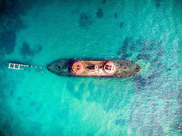
- Hazards to watch: stay in marked channels, as submerged coral heads and ledges lurk just below the surface. Wrecks and abandoned structures show up on some charts; interpret marks carefully. Inlets and creek mouths can switch depth quickly with the tides, so slow down and keep a sharp look around.
- Submerged wells and sudden depth changes: some entrances feature underwater wells or steep drops near channel entrances. Use your depth sounder in bends and tight turns, and verify with the chart whenever you approach a new inlet.
- Currents and tides: currents around creeks shift with time and tide, and spring tides can swing depth by a foot or more in narrow passages. Plan transitions for slack water when possible and respect strong winds that stack against the tide.
- Wildlife near the surrounding waters: dolphins and sea turtles cruise the edges of flats, while rays glide along sand bars. Slow to a glide pass in shallow areas, give wildlife plenty of space, and avoid chasing or sudden maneuvers that could startle them.
Practical steps for planning: use statistics from official sources and reliable websites to compare depths, review time windows for safe passage, and cross-check with your chart. When you visit norman areas and surrounding creeks, log your course and adjust for the latest wind forecast and tide outlook to keep stays smooth and clock time productive for stops along the way.
- Tools you can rely on: chart data, time-based tide tables, wind forecasts, and reputable cruising websites. Cross-check with at least two sources before a long leg.
- Recommended stops as part of itineraries: Staniel Cay, Cambridge Cay, Shroud Cay, Norman’s area, and the creeks near the surrounding flats. Each offers distinctive depths, wildlife encounters, and sheltered anchorages that align with popular time windows.
Itinerary tips: when plotting routes, favor channels with golden shades of shallow water that reflect sun across the sea floor, then migrate toward deeper, well-marked passages. Visiting these areas in favorable winds helps you stay comfortable while exploring the best creeks and protection zones around Norman’s and normans landmarks. Use local charted routes, verify with official websites, and time your calls to landfalls to match the latest conditions.