

 Tipy pro plavbu na mezinárodních vodách – bezpečnost, právo a navigace">

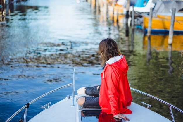
Always file a float plan before leaving international waters to reduce risk and inform a trusted onshore contact. Include vessel name, registration, exact route, estimated times, radio frequencies, and emergency procedures. A full plan kept on board and shared with a member on shore helps staying aligned if signals drop today.
Equip with the latest safety gear: life jackets for everyone, a working VHF radio, an EPIRB, and a 406 MHz beacon. Carry waterproof charts and a tight emergency kit, and verify your anchor setup and propeller health before every offshore leg. Regular checks are useful to keep the crew informed and calm.
Know the convention and flag-state obligations that cover your voyage. Understand basic rules of the road for international waters and how they apply near routes with heavy traffic. If you belong to a member club, use its coverage for weather alerts and rescue coordination, but verify information with official sources today.
Plan your route with official charts and the latest ENC data, and actively avoid frequented lanes during poor conditions. Confirm the forecast from national meteorological services and coastal rescue centers, and keep a full weather briefing on board. Update your plan if visibility or wind speed changes, and share updates with your shore contact to reduce surprises.
Be aware of political developments that can affect rescue coverage or safety in border zones. Monitor advisories, maintain an open line with coast guard authorities, and respect any temporary traffic separation schemes. Staying proactive and informing your crew about changes helps everyone stay safe and avoid unnecessary risk today.
Keep on-board practices safe by limiting speed near anchored vessels and frequented bays, performing prop checks, and recording a full log of events. Use route planning tools, stay informed with official coverage updates, and ensure things on board stay organized for a smooth, disciplined operation.
International Waters Boating Guide
Taking epirbs onboard and filing a float plan before venturing beyond legal limits of coastal waters sets a baseline for safety. This simple action speeds rescue and clarifies your course for responders.
Useful, practical actions cover safety, law, and navigation across nations. Use this guide to plan with confidence, and adjust accordingly as conditions change.
Even when the forecast looks calm, verify notices, restrictions, and regional guidance before departure. Across the world, boaters share practical lessons to improve safety and legal compliance.
- Equipment and readiness: include life jackets for all crew, waterproof charts, a working VHF radio, a handheld backup radio, AIS if available, and epirbs placed for quick access; carry spare batteries and a first-aid kit; tailor kits for small yachts and craft.
- Documentation and legality: legally operate by flag state rules; keep vessel registration, operator licenses, passports when crossing borders, and a crew list. Stay aware about local regulations and note restrictions that vary by country and zone, including exclusive economic zones and safety requirements for on-water activities.
- Navigation and course planning: plot a route with current, wind, and tide data; load up-to-date charts; use AIS and GPS to maintain situational awareness; set a fuel and daylight limit and plan for contingencies.
- Pirate risk and security: check current advisories before long crossings; avoid known hot spots; adjust your course with routing; never sail toward visibly suspicious waters; report incidents to naval or coast guard authorities.
- Vessel operations and crew: assign a driver and a lookout; maintain a strict watch schedule; practice man-overboard drills; keep a life raft and throwable device accessible on-water.
- Emergency planning: epirbs, distress calls on VHF 16, and satellite beacons improve response times; have a clear action plan for flooding, fire, or engine failure; have a backup plan to reach a safe harbor or near-shore assistance.
- After-action and learning: log every voyage, capture notes on restrictions encountered, and share useful findings with companions; include economic considerations such as port costs and mooring fees to plan financially when crossing nations.
Pre-Departure Safety Gear Checklist (PFDs, Flares, EPIRB, Liferaft)
Verify PFDs, Flares, EPIRB, and Liferaft are on board, accessible, and within service dates before you depart.
PFDs: Ensure every passenger has a properly sized, Coast Guard-approved life jacket. Inspect straps, buckles, seams, and reflective tape; replace any item showing wear. Keep at least one spare PFD for each known passenger in a dry, visible location near the companionway. If a buckle or strap shows deterioration, it is indicating replacement.
Flares: Check expiration dates on handheld and parachute flares and discard anything past date or damaged. Store in a sealed, labeled container in a cool, dry spot. Rotate stock so older units are used first and replace spent flares before the next voyage.
EPIRB: Verify registration is valid for the vessel and the device is up to date. Test per the manufacturer’s procedure, ensure the battery is within service life, and confirm the antenna is clear. Mount the unit for rapid activation in an emergency and log the last test date; carry a backup beacon if feasible.
Liferaft: Inspect the inflation system, painter line, sea anchor, and repair kit. Confirm the hydrostatic release unit is connected and free of corrosion; check canopy fabric for tears and confirm accessibility of the launch handle. Ensure the liferaft has been serviced within the manufacturer’s interval and record the service date; schedule annual service before longer coastal passages.
Packing and storage: Assemble gear into a compact safety kit, with each item clearly labeled and stored in its own watertight container. The kit includes a safety log and a quick-reference card for all passengers, helping you plan the boarding sequence. Taking these actions pays off in real time, and you can prep passengers in minutes. Secure all items so they do not interfere with movement, access to the cockpit, or navigation gear, with some items stored over labeled bins for easy sighting.
Documentation and reporting: Maintain a small safety log with the date of checks, any issues, and corrective actions. If you identify known issues or damage, report them to national authorities or coast guards and update your EPIRB registration records as needed. Be aware of restrictions that apply to coastal routes and international water passages, and adjust plans accordingly.
Ocean-wide practice: In global oceans, this kit is useful for protecting passengers and ecosystems. There, conditions can change quickly, so a steady rate of checks helps you catch wear early and reduces risk over the voyage, including during an encounter with distress signals. Taking these steps without delay makes the operation safer for everyone.
AIS and Monitoring: Transmission Requirements and Best Practices
Enable AIS Class A on all eligible international voyages today and verify your MMSI, vessel name, flag, call sign, vessel type, and route before departure. Accurate data improves response times for search-and-rescue and makes you easier to identify by port authorities and nearby traffic.
Designed for reliability, install AIS with a dedicated power supply and a stable GPS input, then run a full self-test. Position the antenna as high as possible with a clear line of sight to open-sky reception, and route cables away from high-EMI gear. Maintain a clean deck layout to prevent multipath signals that can mislead a navigator and potentially indicate equipment faults.
Class A is mandatory for vessels on international voyages under flag authority guidelines; Class B provides visibility for smaller boats and enhances safety in busy lanes and at anchor. Review the requirements of your flag authority and any visa or border rules that might affect your route before planning long passages with mixed traffic.
For monitoring, keep AIS on continuously and compare your own data with nearby targets on the bridge display. Use radar or VHF together with AIS to validate tracks and adjust speed or course early to avoid conflicts. If you observe an approaching vessel that’s indicating risk, reduce speed and alter course in a predictable, rule-compliant manner.
epirbs and SARTs remain essential redundancy. Ensure epirbs are registered with the flag authority and tested according to the manufacturer’s schedule; keep SART within reach and test the distress alarm. Do not rely on AIS alone in distress situations, and practice using both AIS and GMDSS procedures during drills, especially if youre operating near diving operations or boarding teams.
Special considerations apply to operations on adventurous routes: near busy harbors, in fishing grounds, or during load-ins and boarding. Keep alcohol off watch, avoid operating radios during critical maneuvers, and ensure crew understand the priority of AIS visibility in such conditions. Something should always be in place to prevent misinterpretation of data and to avoid false alarms.
Tips: test your setup before departure, validate target data with radar, and maintain a log of AIS events. Youre responsible for keeping your data accurate, up to date, and consistent with the flag authority’s records. comfortable, unmatched situational awareness helps create a smoother experience for your crew and fellow boaters when navigating open routes and coastal waters.
Projevení ochoty a souladu s mezinárodními postupy zlepší zážitek pro vás i ostatní námořníky, sníží hrozby na moři a zefektivní komunikaci s úřady v případě ohlášení přístavu nebo kontroly víz.
| Aspect | Třída A | Třída B | Doporučení pro osvědčené postupy |
|---|---|---|---|
| Dynamická aktualizace dat | 2 sekundy při pohybu; ~3 minuty nečinnosti | ≈30 sekund při pohybu; delší doba v nečinnosti | Udržujte data aktuální; křížová kontrola s radarem |
| Aktualizace statických dat | Každých 6 minut nebo při změně | Každých 6 minut nebo při změně | Ověřte název plavidla, MMSI, vlajku, typ a trasu |
| Požadovaná data | MMSI, název, vlajka, volací znak, typ, trasa | MMSI, jméno, vlajka, typ | Zachovejte konzistenci se záznamy vlajkových úřadů |
| Napájení a zálohování | Vyhrazená dodávka + záloha | Doporučeno vyhrazené napájení | Testování napájení; prevence selhání v jednom bodě |
| Umístění antény | Vysoká, jasná linie viditelnosti | Vysoká, jasná linie viditelnosti | Vyhněte se překážkám; zkontrolujte při nástupu |
| Monitorování integrace | Radar/ECDIS propojené; nepřetržitá služba | Pravidelně monitorujte; integrace aplikace | Zarovnejte cíle AIS s ostatními senzory, abyste snížili hrozbu |
| Nouzové zařízení | EPIRB zaregistrováno; SART připraven | doporučeno EPIRB | Zaregistrujte EPIRB u úřadu; testujte podle plánu |
Rychlý přehled COLREG: Přednost v jízdě, světla a signály
Během několika sekund identifikujte plavidla, která mají přednost, a plavidla, která musí dát přednost, a upravte kurz tak, abyste se vyhnuli kolizi. Pokud situace zůstává nejasná, zpomalte na bezpečnou rychlost a držte se v dostatečné vzdálenosti.
Při křížení cest, uvolněte cestu, pokud je jiná loď na vaší pravoboku; plavidlo s předností v jízdě udržuje kurz a rychlost, aby zachovalo viditelnost a předvídatelnost pro všechny, kdo se v okolí pohybují.
V noci používejte standardní navigační světla: červené na levoboku, zelené na pravoboku a bílé světlo signalizující, že jste v pohybu; pokud kotvíte nebo jste omezeni viditelností, přidejte bílé světlo se všesměrovým vyzařováním; dodržujte publikované vzory a udržujte je čisté a viditelné v oblasti, kde operujete.
Používejte stručné zvukové signály a koordinujte pohyby, pokud hrozí riziko kolize; v mlze nebo snížené viditelnosti snižte rychlost a postupujte se zvýšenou opatrností; mějte s sebou VHF rádio a jako první krok hlaste nouzi nebo potřebu koordinace na kanálu 16.
Mějte svého průvodce s aktuálními předpisy pro zemi, ve které se nacházíte; zkontrolujte publikované pokrytí pravidel pro vodní cesty ve vašem okolí a ujistěte se, že vaše jednání je v souladu s místními pravidly uvedenými ve vašem navigačním průvodci.
Při plavbě po frekventovaných vodních cestách v okolí oblíbených tras plavby dodržujte větší rozestupy a buďte ve střehu před předměty, jako jsou bóje, plavidla a plavci; používejte mapu a polohu k potvrzení kurzu a udržujte předvídatelnou dráhu a vyhýbejte se prudkým změnám.
Pokud narazíte na zraněnou osobu nebo záchrannou operaci, koordinujte se záchranným týmem a nahlaste to úřadům; zajistěte bezpečnost posádky a nabídněte pomoc pouze v případě, že to neohrozí vaši bezpečnost ani bezpečnost ostatních na palubě.
VHF Radiové protokoly a postupy Mayday/Pan-Pan
Okamžitě odvysílejte MAYDAY na kanálu 16, pokud čelíte bezprostřednímu nebezpečí a potřebujete pomoc, poté přepněte na pracovní kanál pro koordinaci záchrany. Uveďte název plavidla, volací znak nebo MMSI, pozici, počet osob na palubě a povahu tísně. Třikrát opakujte MAYDAY a poté poskytněte stručné a praktické podrobnosti pro urychlení reakce.
Formát volání Mayday: MAYDAY, MAYDAY, MAYDAY. Zde Sea Spirit, MMSI 987654321, pozice 37.7749 N, 122.4194 W, kurz 120°, rychlost 3 uzly, 4 na palubě, požár motoru. Jsme v silném počasí a žádáme o okamžitou pomoc. Pokud to slyšíte, potvrďte a předejte informace příslušným službám na blízkých kanálech. Po kontaktu přejděte na pracovní kanál pro koordinaci podle pokynů vedoucího na místě.
Formát volání Pan-Pan: PAN-PAN, PAN-PAN, PAN-PAN. Tady Sea Spirit, MMSI 987654321, pozice 37.7749 N, 122.4194 W, blízko Golden Gate, naléhavé, ale ne život ohrožující. Máme mechanický problém a potřebujeme pomoc. Sledujte kanál 16 a buďte připraveni přepojit na pobřežní stráž nebo záchranné služby na pracovním kanálu. Potvrďte a zaznamenejte podrobnosti pro hlášení.
Disciplína a postupy pro kanály: udržujte kanál 16 volný pro počáteční tísňová volání a přejděte na určený pracovní kanál pro pokračující dialog s respondéry. Použijte DSC na kanálu 70 k odesílání tísňových upozornění, když není možný hlasový hovor, a udržujte nepřetržité sledování kanálu 16 během všech přenosů. Používejte jednoduché počítadlo volání, abyste se vyhnuli duplicitním přenosům a zabránili zahlcení éteru, zejména když odpovídají plavidla v okolí.
Operační připravenost: ověřte si licence a proškolení určeného operátora v oblasti radioprocedur, ujistěte se, že jsou hlášení připravena, a mějte rádio a náhradní baterii zapnuté a na dosah. Naplánujte si mapu kanálů pro každou plavbu s jasným přechodem z kanálu 16 na preferovaný pracovní kanál, jako je 6, 13 nebo regionální ekvivalenty, a slaďte to s místními službami pobřežní stráže.
Bezpečnostní vybavení a chování na palubě: v případě nouze dodržujte jacket a mluvte pomalu a zřetelně. Uveďte svou pozici s pomocí stupňů nebo orientačních bodů, potvrďte s druhou stranou další akci a vyhýbejte se zbytečným řečem, které mohou zastínit kritické detaily. Pokud se podmínky zhorší, začněte předávat informace okolním plavidlům, abyste vytvořili kooperativní reakci.
Hlášení a odpovědnost: po události MAYDAY nebo Pan-Pan hlaste událost příslušnému orgánu a svému poskytovateli služeb a zdokumentujte časy, pozice, zprávy a podniknuté kroky. Toto hlášení podporuje dodržování předpisů Marpol a licenčních požadavků, zmírňuje odpovědnost a pomáhá plánovačům koordinovat záchranné prostředky mezi agenturami. Uveďte počet zúčastněných osob, směr plavidla do bezpečí a veškeré environmentální nebo lékařské aspekty, aby záchranáři mohli přizpůsobit svou reakci.
Plánování a koordinace: v průběhu všech činností na moři vytvořte specializovaného vedoucího komunikace, informujte ostatní členy posádky a udržujte jasný řetězec podávání zpráv. S uceleným plánem se vyhnete zmatkům a zajistíte, že mnoho záchranných prostředků – blízké pobřežní stanice, přístavní služby a záchranné čluny – pomůže včas. V praxi dobře udržovaný plán snižuje zpoždění tím, že potlačuje nedorozumění a udržuje všechny zúčastněné strany na stejné úrovni informovanosti.
Documentation, Flag State Rules, and International Licensing for Your Route
Verify licensing and flag state requirements for every leg of your route at least six weeks before departure. Contact the flag state authorities and the port states you will visit to confirm required certificates, endorsements, and documents. Share them with the captains to keep plans aligned.
Compile a documentation package: vessel registration or proof of ownership; current radio license and MMSI; GMDSS certification; safety equipment testing results; insurance certificate; crew certificates for captains, engineers, and able crew; medical certificates; passenger manifests; and your voyage plans.
Flag State Rules: When you sail under a flag, that state governs your vessel in international waters and during entry at foreign ports. Schedule annual surveys, ensure valid tonnage and safety endorsements, and keep crew licenses current. Some flags require drills and formal record-keeping you must log.
International Licensing: Identify which licenses are recognized across jurisdictions along your route. Secure an appropriate captain’s license and any engineer or radio operator endorsements; obtain endorsements for carrying passengers if you plan to transport them; keep expiry dates visible and renew on time.
Territories and jurisdictions: Your route may touch multiple territories; each may demand different clearances. Before calling at a port, confirm local port entry and clearance procedures; maintain a cross-border log with contact details for authorities in each area; track submission dates for permits. If you want to minimize delays, pre-file forms with the relevant offices.
Practical tips for staying compliant: Maintain digital and physical copies of all documents; store in a shared drive accessible to captains and crew; review licenses annually with a seasoned leader; set reminders six months before expiry; if an injury occurs, notify the local authorities and the flag state to receive guidance; ensure transport plans and on-board procedures cover emergency response. If crew changes require flying, coordinate with authorities to confirm that licenses, medicals, and endorsements remain valid for the trip.
Benefits you gain include smoother check-ins at ports, faster clearance with authorities, enhanced protection for passengers, and better access to insurance coverage when you keep licensing and documentation up to date. Staying compliant supports responsible voyages and respects nearby ecosystems while leaders and captains keep plans on track.