

 How to Create a Float Plan – The Complete Guide for Safe Boating">

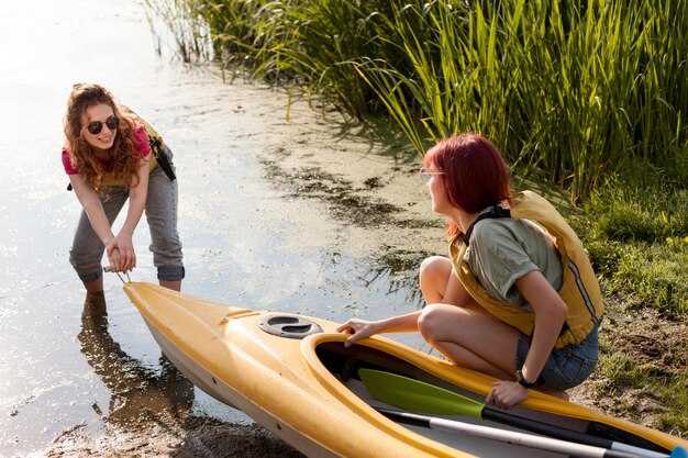
Write a written float plan today and share it with guardians and the operator before you head on-water.
Your plan should cover the on-water route, the estimated return time, and contact methods for contacting the crew if plans shift. Include the boat name and operator, a line of reference points such as a tower or shoreline markers, and, if available, coordinates. If you can, add a demos section to illustrate how the plan works in practice so guardians can see what to expect.
Before departure, contact guardians by call or text to confirm receipt of the plan, and ensure you have a backup contact. Save the plan in a written file above the console and also keep a copy on your device. Define what to do if contact is lost, and set a check-in cadence so your crew knows when to expect updates back from you.
During the trip, keep a portable power source, maintain radio contact with the operator, and be ready to adjust the plan if conditions worsen; update guardians with a quick status, a brief message, or a short call at milestone times. Maintain a clear timeline above the plan to show progress along the route, and if possible share photos or status updates at key points on-water.
Practical Float Plan Setup for Safer Boating
File a float plan before departure that specifies where you head, your intended line of travel, ETA, and planned check-ins; creating a clear, shareable document helps guardians and authorities stay aligned and reduces risk.
Assign guardians among crew or trusted contacts who monitor milestones, confirm arrivals, and trigger alerts if you drift off schedule; their prompt actions build trust and keep operations smooth.
Stock tools for real-time updates: a VHF radio, a satellite messenger, a chart plotter, and a spare battery with sufficient charge; test channels, set the course, and save the plan for quick reference, with sound alerts for missed check-ins.
Document contingencies for certain weather, currents, and daylight; include alternate routes and a line for filing with the coast guard or port authorities; list where to submit the plan and when to update it to keep operations transparent.
For activities like fishing or skiing, log specifics in the plan, including fishing zones and where skiers may cross; indicate what to expect from responders, show expected message times, and how to notify nearby boats if plans change; include a numbercolor marker to help responders identify you on charts.
Set a practical communications schedule: check-in every two hours, or more often in rough seas; specify radio channels and emergency codes, and ensure you can receive a quick reply; keep a copy with guardians and in the cabin, and follow uscg guidance for training or templates to support safe operations.
| Element | Details | Owner | Poznámky |
|---|---|---|---|
| Route & ETA | Coast-to-offshore path; waypoints A→B→C; ETA targets; check-in windows | Captain | Maintain daylight limits |
| Communications | VHF 16, 69; satellite messenger; message templates | Most | Test pre-departure |
| Safety Gear | Life jackets, throwable, flares, radios | Posádka | Battery checks |
| Filing & Records | Float plan filed with authorities; copy kept aboard and with guardians | Captain | Include numbercolor codes |
| Contingencies | Weather shifts, currents, alternate routes | Operations | Update if conditions change |
Define Trip Details: Route, ETA, and Weather Window
Draft a written route and ETA now, save it as a template, and keep it within reach onboard. The plan should describe departure, next waypoint, pace, and a target arrival window so the crew can review at a glance and give feedback.
Plot the route along the coast from your marina to the next marina or to a trusted fishing spot, marking each leg with coordinates, distance (in nautical miles), and expected time. Use a visible line on the chart to connect points and describe the features of each segment, described here, including terrain, current, and potential hazards close to shore.
Set the weather window as a practical range you can rely on: forecast wind under 20 knots, seas under 2 meters, and visibility at least 3 miles. Prefer a window that covers the next watch, with a buffer to handle small changes in wind or swell. Check trusted sources and write down the forecast time, then compare it with your ETA at each waypoint to confirm the setting.
Build in sufficient margin for safety: add a priority fallback leg if conditions shift, and assign crew tasks so they can respond quickly. Give them clear responsibilities onboard, such as monitoring weather, managing lines, and keeping gear ready. If the forecast isnt favorable, you have a backup on deck and in the engine room, and you can hold position near a safe harbor until conditions improve. This approach reduces worry and keeps operations smooth and controlled. This level of planning also enhances the experience aboard.
Document and store the plan in your setting as a written record, for example in the ship’s log and on the onboard tablet. The template should be described with the next steps and the gear required, so the crew has a trusted reference. Share it with them before departure to avoid miscommunication and to speed decisions when speed changes or visibility drops.
After departure, maintain the same practice: review the route and ETA at the coast, confirm the float plan with all hands, and update the template as conditions change. Revisit the plan during the voyage and close the loop when you reach the next waypoint, using the written record to guide decisions and to hold the vessel on a safe heading. This document is the float plan, commonly called a float plan.
Record Vessel and Crew Info: Registration, Licenses, and Safety Gear
First, hold a single, up-to-date log that records registration numbers, license IDs, and safety gear checks, and keep it in a dry pocket near the helm for quick reference before every trip.
Record details: vessel name, hull ID, registration number, issuing authority, issue date, and expiration. Keep both a paper copy and a digital scan saved in a cloud location you trusted. This found reference saves time if you ever need to respond to questions from coast guard or harbor staff.
Licenses: ensure each operator holds a current certificate appropriate to the vessel, with expiry date clearly listed. Create a roster that includes each member name, role, license type, license number, and contact method. If someone didnt have a license for their role, assign a different task or return to shore. Keep these records on board and in the cloud for safety.
Safety gear: every person onboard wears a U.S. Coast Guard–approved life jacket; ensure sufficient life jackets for all passengers and that they fit properly. Keep a throwable flotation device within reach, a whistle or sound device, and a fire extinguisher that is inspected and not past its expiry. Have a first-aid kit, reliable communication devices, a GPS or handheld radio, and spare batteries. Carry a cell phone in a dry pouch as backup to the radio. Keep space free from clutter so you can grab gear quickly.
Checklist before leaving: verify registration numbers match vessel name; confirm licenses are valid; inspect safety gear: PFDs in good condition, throw bag accessible, fire extinguisher within date, signal devices current, VHF radio ready, backup light and battery, and a spare fuse. The point is to have everything visible and portable, and save a quick list of emergency contacts on the device and in the log.
When boating near the coast, especially around fishing boats and kayakers, reduce speed, keep a safe distance, and make planned passes with signaling. Use your VHF or a cell-based communication to confirm intentions. If a nearby vessel or person needs help, respond with a clear action and log the event. Keep the crew member responsible for communications informed and ready to advise course corrections.
Love for boating grows when you prepare and protect everyone on board. Review the record before each trip, update after maintenance or crew changes, and store copies in a cloud that you can access from shore. This habit saves time and helps you stay safe on every outing.
List Emergency Contacts and Reporting Points
Print a standard template of emergency contacts and keep it with your float plan; review and update it every few days of planning.
List authorities and reporting points clearly, including check-in schedules and the location where you report a problem.
For each contact include name, role, daytime and after-hours numbers, their vessel or company, and a cell or satellite device you can use to reach them.
Assign a person on board as the lead for reporting; store their direct contact and a backup contact so you can reach someone during operations.
Keep the information on at least two formats: a printed copy and a digital copy on your devices; both should stay accessible during drift or wind conditions.
Include reporting points along the route and times; the expected check-in windows help responders track progress amidst shifting conditions.
Record the gear and devices on board that you may need for self-rescue or signaling, and note their locations, so a responder can reach the right person quickly.
Verify the numbers regularly, and test your plan with a dry run; wrong numbers or outdated contacts waste time and risk safety.
Keep a live log of updates, including days since the last change and any new authorities or reporting points you add; that keeps everyone aligned.
Uložte zdroj pro každou položku a zaznamenejte, odkud informace pocházejí, pro ověření z vzdálené lokace.
Nastavení navigačních a komunikačních protokolů: VHF/DSC, pozice a signalizace
Mělo by se stanovit hlavní VHF/DSC plán nyní a vycvičit na něm všechny. Každý by měl znát hlavní kanál pro běžné hovory, sekvenci DSC a hlasový postup pro nouzové situace. Uložte laminovaný list u navigačního stanoviště s názvem plavidla, MMSI, seznamem kanálů a jasnými kroky při pádu přes palubu. Používejte zařízení navržená pro redundanci: pevné VHF, přenosné VHF a epirb schovaný v nouzové sadě. Během několika minut od odjezdu ověřte, že posádka na strážích může přepnout na nouzový kanál a proveďte rychlý trénink, když připlujete do přístaviště nebo plujete s přáteli v blízkosti, aby pomoc mohla plavidlo rychle lokalizovat. Mělo by to zahrnovat určité kontroly počasí, povědomí o provozu a kontaktní údaje pro případ nouze.
Polohy a signalizace jsou závislé na vysílání GPS/DSC. Zaznamenejte polohu jako zeměpisnou šířku/délku nebo síťovku, zahrňte čas a přeneste pomocí DSC, kdykoli je to možné. Kapitán by měl zajistit, aby se v záznamu uvádělo, kdo z posádky je na stráži, který kanál je v provozu a které zařízení bylo použito k lokalizaci plavidla. Sdílejte zprávy o poloze v pravidelných intervalech (každých 5–10 minut při plavbě; častěji v drsných mořích) a označte jakékoli odchylky v kurzu nebo rychlosti. Pokud je odeslán nouzový signál, zajistěte, aby zařízení odeslalo poplach všem blízkým plavidlům a pobřežní stráži prostřednictvím DSC, epirb, pokud VHF selže, a vizuální signál, pokud to povolí viditelnost.
Signální postupy kladou důraz na srozumitelnost. Používejte vizuální signály, jako jsou vlajkové signály nebo světla, jako doplněk rádiových hovorů, zejména v rušných zálivových cestách nebo přeplněných marinách. Pokud se blížíte k jiné plachetnici nebo sousednímu člunu, potvrďte porozumění krátkou rádiovou výměnou a uznejte odpověď vizuálním potvrzením. Pokud ztratíte kontakt, zopakujte volání na jiném kanálu a zvažte zvukovou výstrahu pro posádku. Ať už plujete sólo nebo s posádkou, stručná, opakovatelná signální rutina udrží všechny v souladu a sníží zpoždění.
Závěrečné kontroly po plánování: jméno, volací znak a MMSI na každé obrazovce, zajistěte, aby byl epirb dosah ruky a otestován, a ověřte, že jsou všechna zařízení nabitá. Plán by měl pokrýt, kdo volá, kdo zaznamenává a kdo sleduje rizika. Při přechodech v zálivu nebo dlouhých pobřežních úsecích se ujistěte, že kapitán a členové posádky vědí, kdy dorazit do dalšího bodu cesty nebo přístavu. Uložte si rychlou referenční cedulku poblíž kormidelního zařízení a náhradní jednotku do tašky. Toto proaktivní nastavení umožňuje přátelům, sousedům a posádce zůstat informováni, zlepšuje dobu odezvy a udržuje bezpečnostní plány bez mezer.
Sdílejte, spravujte a aktualizujte svůj plán: Kam podat a jak jej změnit
Před odjezdem zašlete plán plavby do portálu USCG a sdílejte kopie s vaším pobřežním kontaktním partnerem, aby všichni byli v souladu. Pokud je to možné, zařiďte také u státní plavební autority. Použijte stejný kanál pro změnu, zrušení nebo přidání podrobností během rybaření, plachtění a plavby. Jakmile jsou plány finální, zašlete konečnou zprávu všem zúčastněným, abyste potvrdili trasu a očekávání.
- Kam odeslat
- Odeslat přes portál USCG; také zkopírovat státní plavební úřad a marinou nebo plavební klub, který používáte.
- Poskytněte kopii pobřežnímu kontaktovi, který dokáže rychle reagovat, pokud úřady požádají o aktualizace.
- Zachovat přístup pro každého uvedeného v plánu, aby mohly být reakce rychlé.
- What to include
- Zahrňte: název plavidla, volací znak, velikost (délka a šířka), barvu trupu (modrá, pokud se vztahuje) a údaje o motoru (výrobce, model, výkon).
- Plánovaná trasa: výchozí bod, cíl, následující zastávky a odhadované časy příjezdu v klíčových bodech.
- Počet cestujících a role na palubě (kapitán, navigátor, pozorovatel, posádka a jakékoli hosté).
- Ochranné pomůcky a vybavení: záchranné vesty, VHF, rakety, EPIRB, hasicí přístroj, lékárnička.
- Plánované aktivity: rybaření, plachtění, táhání nebo demonstrace postupů při pádu přes palubu.
- Orientace podle: věže, majáku nebo pobřežních prvků; zaznamenejte nalezené nebo alternativní orientační body.
- Zálohy: počasí, proudy, zácpy v přístavu a jakékoli úvahy o pojištění nebo námořním krytí.
- Stav připravenosti: potvrdit, že je všichni seznámeni, výstroj zajištěna a cestující připraveni k odletu.
- Informace o pojištění: pojištěnec, číslo pojistky a rozsah krytí pro plánovanou oblast.
- Zvažte faktory: počasí na palubě, příliv, provoz a potenciální zpoždění při informování o přepisování plánu.
- Zahrňte poznámku pro reagující: závěrečný plán, kontaktní osoba na palubě a předpokládané časy příletu.
- Pak zajistěte plán k nalezení lodi, pokud by unášela nebo neočekávaně změnila směr; vždy je tu záložní řešení.
- Jak měnit
- Aktualizujte ihned při jakékoli změně trasy, předpokládaného času příjezdu (ETA), posádky nebo destinace.
- Předkládejte změny stejným kanálem, který jste použili k odeslání plánu; do zprávy zahrňte slovo “změna” a uveďte původní plán, pokud je to možné.
- Pokud se něco změní, je naléhavé aktualizovat soubor a informovat vašeho pobřežního kontaktu a úřady.
- Pokud je plán zrušen nebo se zpozdíte, zašlete finální zprávu k uzavření souboru a vyhněte se tak zmatkům u zasahujících osob.
- Požádejte o potvrzení nebo potvrzení aktualizace a mějte jej připraveno k odpovědi na dotazy USCG, pojišťovny nebo vašeho pobřežního kontaktního zástupce.
Udržujte všechny připravené k rychlé reakci a zajistěte, aby vaše posádka rozuměla nejnovějším změnám. Dodržováním těchto kroků si udržíte klid v mysli ohledně lodní výstroje, pasažérů i pojišťovatelů a všichni budou vědět, jak najít nejnovější verzi vašeho plánu během klidných moří nebo uprostřed rušného dne na modré vodě.