

 Must-Have Sailboat Navigation Equipment – Essential Gear for Safer Voyages">

ابدأ بمجموعة ملحقات مدمجة ومتعددة الميزات تتضمن بوصلة موثوقة وإضاءة ساطعة وخيار شحن يمكن الاعتماد عليه. تحافظ هذه التجهيزات على تركيزك حادًّا عند الفجر وبعد غروب الشمس، مع بوصلة في برج وغطاء مصابيح سطح تقلل من الوهج على الخرائط. وبالنظر إلى المستقبل، ضع خطة احتياطية بسيطة في الحسبان تحسبًا للطقس العاصف.
ابحث عن علامة واضحة للرؤية: ضوء سطح السفينة بقوة 300-600 لومن، ومصابيح ملاحة حمراء/خضراء، وبوق إشارة صغير. ستقدر هذا الهامش الإضافي عندما تهب العواصف الرعدية وينخفض مدى الرؤية.
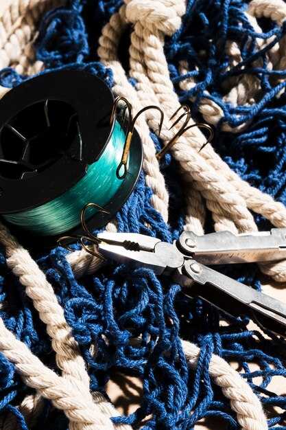
للاتصالات والإشارة، استخدم جهاز VHF صغير الحجم مع DSC وبوقًا محمولًا. احتفظ بلافتة صغيرة لتحديد موقعك على الخرائط، وقم بتخزين بطاريات احتياطية في كيس مانع لتسرب الماء. سيقلل هذا من التخمين عندما يكون البحر هائجًا.
ترتيبات الشحن مهمة: قم بإقران بنك طاقة USB-C بسعة 10,000 مللي أمبير في الساعة مع لوحة شمسية قابلة للطي بقدرة 6 وات أو 10 وات توضع على سطح السفينة. عادة ما تحافظ هذه المجموعة على تشغيل مخطط الخرائط وجهاز استقبال GPS طوال فترة المراقبة. قم بتركيب الجهاز على قضيب الإمساك بشريط مطاطي لمنع الاحتكاك.
في النهج التقني، احتفظ ببوصلة مغناطيسية احتياطية وجهاز لوحي أو هاتف متين ومقاوم للماء مع خرائط غير متصلة بالإنترنت. اضبط الشاشات الرقمية على وحدات القياس المترية للحصول على قراءة متسقة، وقم بحماية الأجهزة من الرذاذ باستخدام غطاء سيليكون.
يأتي الاستمتاع على سطح السفينة من خلال التوزيع الذكي: مناطق صغيرة وواضحة المعالم لمعدات الدفة والطاقة والإشارة. انقل هذه العدة بين الدفة والمقصورة أثناء الإبحار، حتى تتمكن من الوصول إلى ما تحتاجه في المياه الهائجة مع الحفاظ على الهدوء. عند التخطيط لرحلة، أضف بطارية احتياطية وجهاز إرسال محمول إلى قائمة التعبئة.
اختبر شهريًا: تحقق من انحراف البوصلة، وتأكد من أن الإضاءة تعمل على كل من الطاقة الرئيسية والاحتياطية، وتحقق من منافذ الشحن بحثًا عن التآكل. يأتي مع قائمة تحقق بسيطة - قم بالتشغيل، واختبر الإشارة، وتأكد من الرؤية، وأعد الشحن بعد المرور.
معدات ضرورية للملاحة على متن القوارب الشراعية لرحلات بحرية أكثر أمانًا وحاملان للأكواب
ابدأ بمجموعة ملاحة كاملة لا غنى عنها: راسمة خرائط مدمجة بالكامل ومقاومة للماء مع نظام تحديد المواقع العالمي (GPS) ونظام التعرف الآلي (AIS) وجهاز VHF، بالإضافة إلى التوافق مع تطبيقاتك. حاز هذا الإعداد العملي على جوائز للموثوقية ويوفر مخططات يمكنك قراءتها بسهولة في وهج الشمس، سواء على الأسطح أو أثناء الإبحار، بما في ذلك الطرق الساحلية إلى الجزر.
Install حاملان للمشروبات على طاولة قمرة القيادة، مع وعاء للأكواب ومغناطيسات تثبت بإحكام في البحار الهائجة. استخدم مبردات كاملة الحجم يمكن الوصول إليها من الدفة للرحلات الطويلة، وتأكد من أن الحوامل مقاومة للعوامل الجوية ومناسبة للاستخدام في التنقل بين الجزر. تعمل هذه الميزة على تقليل الانسكابات وحماية الأصدقاء على الدفة.
قابل للارتداء تقنية السلامة: جهاز GPS مُثبّت على المعصم وهاتف مُثبَّت في وعاء بسيط سريع التحرير على لوحة العدادات. قم بالإقران مع تطبيقات على مستوى السفينة تقوم بمزامنة موقعك والطقس والطرق، واحتفظ بخطاف صغير على الحاجز لكابلات الشحن. تضيف هذه المجموعة حماية واستخدامًا عمليًا للأصدقاء على متن السفينة.
اختر شيئًا فريدًا،, suitable نظام يناسب موقعك وتصميم سطح السفينة: نظام الطيار الآلي، ورادار مدمج إضافي، وتركيب يحافظ على ترتيب الكابلات. استخدم شاشات عرض ذات تباين أعلى حتى تتمكن من قراءة الرسوم البيانية بسهولة، حتى في الرذاذ. احتفظ بقطع الغيار في وعاء مقاوم للماء، واتبع دليل تركيب تقني بلغة بسيطة لإجراء فحوصات سريعة. هذا الإعداد المُعد بالكامل يعزز سلامة طاقمك وأصدقائك.
معدات الملاحة الأساسية لرحلات بحرية أكثر أمانًا
تركيب جهاز GPS/راسمة خرائط متعدد الوظائف مع نظام AIS مدمج ورادار وطيار آلي ليكون المحور المركزي؛ فهو يوفر حركة مرور في الوقت الفعلي وتخطيطًا للطرق ووعيًا منقذًا للحياة للرحلات البحرية ويدعم القوارب ذات البدنين والأحادية على حد سواء. هذا العمل هو الفائز للرحلات الطويلة ويساعد الطاقم على البقاء واثقًا في كل نقطة على طول الطريق.
المعدات الأساسية والإعداد العملي:
- نظام تحديد المواقع العالمي (GPS)/راسمة الخرائط مع نظام التعريف الآلي (AIS) والرادار: وعي ظرفي بعيد المدى، وتنبيهات حركة المرور، وتجنب الاصطدام في البحر؛ اختر شاشات فائقة السطوع مع مصادر بيانات مزدوجة وتحديثات تستند إلى الوقت كل بضع دقائق، وتحقق من القراءات بالرجوع إلى بوصلة مغناطيسية.
- جهاز VHF مزود بخاصية DSC وقنوات الطقس: ضروري للمكالمات بين السفن وتحديثات الطقس؛ قم بتركيبه في متناول يد القبطان واختبر مكالمات DSC شهريًا.
- بوصلة مغناطيسية وحساس اتجاه: تستخدم كنسخة احتياطية لنظام تحديد المواقع العالمي (GPS)؛ قم بتركيب بوصلة بوابة التدفق معايرة على حاجز صلب بعيدًا عن مصادر الحديد للحصول على اتجاه دقيق من نقطة إلى نقطة.
- جهاز قياس العمق وجهاز قياس السرعة: لمراقبة العمق بالقرب من الخطوط الساحلية وعمق المياه في الممرات الضحلة، وتتبع سرعات الهيكل لتحسين زوايا الأشرعة؛ والتحقق من القراءات في بداية كل نوبة مراقبة.
- الرادار: يوفر بيانات الطقس وحركة المرور في ظروف الرؤية المنخفضة؛ يتم تركيبه عالياً فوق قمرة القيادة، وبرمجة إعدادات مسبقة لأحوال البحر المختلفة وإعدادات النطاق.
- جهاز إرسال واستقبال نظام التعريف الآلي (AIS): شاهد وتَراءَى؛ يجب أن يعمل في وضعي الاستقبال والإرسال؛ حافظ على تحديث رقم تعريف الخدمة البحرية المتنقلة (MMSI) واختبره بانتظام.
- نظام الطيار الآلي / التوجيه: يقلل من عبء عمل الدفة في الرحلات البحرية الطويلة؛ قم بإقرانه ببيانات الرياح والتيارات لتوجيه أفضل مسار بأقل قدر من المدخلات؛ قم بتعيين حدود الانعطاف التلقائي الآمن واختبره في المياه الهادئة.
- جهاز قياس الرياح: يحدد اتجاه وسرعة الرياح الحقيقية؛ يزود جهاز رسم الخرائط بالبيانات لتوجيه فعال وتعديلات خطة الإبحار؛ يستخدم جهاز استشعار من الجيل الجديد لتحديثات أسرع.
- الاتصالات عبر الأقمار الصناعية: اختر مزودًا يتمتع بتغطية عالمية؛ بالنسبة للبحارة في أوروبا وخارجها، تأكد من توفر خدمات بيانات وصوت موثوقة عندما يكون نطاق VHF خارج الخدمة.
- الراديو الطارئ لتحديد المواقع (EPIRB) وجهاز الإرسال والاستقبال الراداري للبحث والإنقاذ (SART): أجهزة منقذة للحياة؛ توضع بالقرب من المخارج التي يمكن الوصول إليها ويتم اختبارها شهريًا؛ استبدل البطاريات حسب الحاجة واحتفظ بمنارة استغاثة احتياطية على متن السفينة.
- قوة واحتياطية: بنك بطاريات يتم شحنه بواسطة مولد التيار المتردد ومجموعة ألواح شمسية؛ يشمل مفتاح تحويل تلقائي ووحدة تحكم شحن قوية؛ مراقبة الفولتية ودرجة الحرارة في قمرة القيادة ومحطة الملاحة؛ استهداف احتياطي لمدة يومين على الأقل من الإلكترونيات الأساسية.
- الملابس ومعدات الطاقم: صوف لفحوصات الفجر والسطح المعرض للرياح؛ حافظ على طبقات دافئة في متناول اليد للحفاظ على التركيز أثناء المناوبات الطويلة.
- نصائح التركيب: وجّه الكابلات بشكل أنيق، واستخدم موصلات مقاومة للماء، وقم بتسمية كل سلك؛ ووفر عزلًا للاهتزاز للإلكترونيات الحساسة وثبّت الشاشات على مستوى العين لتوفير بيئة عمل مناسبة.
- مواصفات القوارب ذات البدنين: الأخذ في الاعتبار الهيكلين المزدوجين والعرض الأكبر؛ ضع الرادار فوق المقصورة لتجنب التظليل على السطح والحفاظ على تغطية نظام التعرف الآلي (AIS) قوية حول كلا الهيكلين.
تشمل المواقع التي يجب إعطاء الأولوية لتركيب المعدات فيها: رأس الصاري ومنطقة دفة القيادة في قمرة القيادة ومحطة الملاحة والعارضة الخلفية بالقرب من غرفة المحرك؛ قم بتحديدها على مخطط واحد لتقليل طول الكابلات والتداخل.
التحقق من الجدول الزمني: إجراء الفحوصات خمس مرات في كل رحلة أو موسم؛ والتحقق من تثبيت نظام تحديد المواقع العالمي (GPS)، ومدى الرادار، وحركة المرور بنظام التعريف الآلي (AIS)، ونطاق جهاز الاتصال اللاسلكي عالي التردد (VHF)، وحالة البطارية قبل كل نوبة مراقبة؛ والاحتفاظ بسجل لأي أعطال لتصحيحها خلال التوقف التالي في الميناء.
اختبر شهريًا جميع معدات إنقاذ الأرواح ومعدات الاتصالات وسجل النتائج.
دمج نظام تحديد المواقع العالمي (GPS) ومخطط تحديد المواقع: اختيار شاشات عرض موثوقة
اختر جهاز تحديد المواقع والرسم البياني (plotter) بشاشة عرض قابلة للقراءة في ضوء النهار (7-9 بوصات)، ونظام GPS مدمج مع نظام WAAS، وهيكل NMEA 2000 قوي. هذا must-have تعمل الإعدادات على إبقاء الخرائط ونقاط الطريق والمسارات متوافقة عبر الأجهزة وتسمح بالاتصالات المباشرة بهوائي GPS لتحديد المواقع بثبات في البحار الهائجة. يجب أن تستوفي المعايير البحرية لمقاومة الماء والتسامح مع التداخل الكهرومغناطيسي (EMI)، مما يضمن الرؤية في الرذاذ والإضاءة المنخفضة. فضّل النماذج التي تتميز بإعادة رسم سريعة وعناصر تحكم بديهية، حتى تتمكن من تعديل المسارات بسرعة، وتتبع منارات AIS، وإبقاء الطاقم في حالة حركة نحو ممر آمن. من الممكن تشغيل كل من الخرائط الملاحية وتراكبات الرادار على شاشة واحدة لتحقيق الوعي الظرفي.
تشمل الخيارات الشائعة Garmin و Raymarine و Furuno و Simrad و B&G؛ تقدم هذه العلامات التجارية أجهزة تخطيط الخرائط مقاس 7-9 بوصات مع خرائط أساسية مُحمَّلة مسبقًا ومخططات متجهة وتكامل AIS/المنارات. ابحث عن إمكانية القراءة في ضوء النهار (استهدف 1000+ شمعة/متر مربع)، وإعادة رسم سريعة وتحديثات خرائط موثوقة. تقدم جميع الخيارات الشائعة تقريبًا إدخالًا باللمس أو هجينًا؛ ضع في اعتبارك kinds نوع التثبيت الذي تفضله - المثبت بشكل مسطح أو اللوحي أو الحاضن - وتأكد من أن الواجهة تدعم كلاً من التحكم باللمس والتحكم المادي للاستخدام السريع في البحار الهائجة. إذا كنت تقيّم القيمة، فقم بإجراء عرض تجريبي جنبًا إلى جنب ولاحظ المدة التي يستغرقها تبديل الرسوم البيانية؛ فهذا يوفر ساعات لاحقًا.
إدارة الطاقة مهمة: اختر شاشات تعمل بجهد 12 فولت مع خيارات لإمداد مخصص أو ناقل مشترك. ابحث عن سحب منخفض في وضع الخمول والقدرة على التشغيل من مولد تيار متردد أو بطارية مخصصة. خطط لـ spend بضع دقائق لتوصيل تغذية مباشرة منصهرة من نظام الطاقة بالقارب إلى جهاز تخطيط مسار السفينة وحافلة NMEA 2000. تفقد أطراف الحلقة بحثًا عن التآكل وقم بتأمين التأريض. احتفظ بالإمدادات الاحتياطية مثل الصمامات والكابلات الكهربائية الاحتياطية ووحدات الذاكرة الاحتياطية في متناول اليد. تجنب الكابلات التي تمتد إلى قاع السفينة؛ حافظ على مسارات قصيرة ومحمية، واحرص على إبقاء الوحدة بعيدًا عن العوادم؛ قم بالتركيب على ارتفاع كافٍ لتجنب الحرارة ورذاذ التهوية، مع إمكانية الوصول إليها للصيانة. تأكد أيضًا من وجود اتصالات بيانات مفتوحة بالرادار والطيار الآلي لزيادة التوافق.
موثوقية البيانات والتكرار: اضبط الشاشة على سحب المخططات والتراكبات الجوية وبيانات المد والجزر ومنارات نظام التعرف الآلي (AIS) من مصادر متعددة. يقلل هذا من فرص وجود فجوات في البيانات. توفر شاشات Nereide تصنيفات IP متينة، مما يساعد في قمرات القيادة الرطبة؛ ضع في اعتبارك استخدامها إذا كنت بحاجة إلى حل مضغوط ومغلق. هذا تذكير: الإسهاب مهم.
راديو VHF DSC: اتصالات واضحة واستعداد للإنقاذ
تشغيل الطاقة and keep the unit powered by the vessel’s 12-volt system before departure, enable DSC watch, and keep channel 16 for voice while configuring the DSC function to monitor calls on channel 70.
Store the MMSI, vessel name, and call sign in the contents so the provider can identify you quickly during an incident. If available, enable GPS-linked DSC to send your position automatically; this is specifically helpful when time matters and you need a precise signal for rescue crews.
Most models support functions for distress (Mayday), safety calls, routine calls, and group calls. These uses cover direct calling between اليخوت, fleets, and coast stations; when DSC fails, use the equivalent voice channel to reach a nearby station, and you’ll still have a useful fallback.
Position the antennae as high as possible and away from heavy machinery to maximize reception. Route cables with shielded coax, check for water intrusion, and install a mounting that provides protection from salt spray. A poor installation reduces range, almost the same amount as the gains you expect from good placement.
In practice, during fishing near an island or along busy coasts, you can use group calls to coordinate with other vessels; the signal travels best when you maintain direction from the shore to the vessel. Keep the antennae oriented for optimum reception from a distant station and keep the channel 16 monitor active for voice backup.
Keep a simple diagnostic cookie in the log to confirm the unit identity, test results, and the time of the last check. Do a monthly radio check with a remote or coastal provider, and review the contents of memory to ensure the most critical numbers are current. For remote runs, ensure a spare battery is available and charged, to guarantee at least one backup power source.
Radar, AIS, and Collision Avoidance: Reading Signals for Safe Navigation
Set radar range to 3 NM in harbor, 6 NM on busy channels, and 12 NM when crossing open ocean; connect AIS to a dedicated app on your smartphone to log targets and compare directly with radar echoes; maintain a dedicated lookout. This direct workflow improves detection of smaller yachts and gives you extra time to react.
A radar with a high refresh rate and a diameter of 30–60 cm performs best on اليخوت; install it high on a hard deck or in a dedicated compartment to minimize spray and vibration. Keep the radar dome clear of fleece, towels, and other fabrics that could block signals. Enable a multi-sensor overlay to merge AIS identities with radar echoes; use tecnologie that fuse GPS, compass, and autopilots for a cohesive display. Expect contacts at 5–8 NM in calm seas and 2–4 NM in rain or fog; check for electric interference from winch motors and move antennas away from windlass or battery compartments.
Read AIS data to identify vessel type, speed, and heading. Use CPA and TCPA thresholds to decide when to act: alert on CPA above 0.25 NM and TCPA under 8 minutes, then verify with radar bearing. In dense traffic near a harbor entrance, treat similar vessels as potential risks within 2–3 miles and pre-plan a safe turning arc. If a contact appears in the same location across several sweeps, verify visually and physically confirm the bearing by sighting fixed landmarks if conditions allow, then coordinate with the other vessel using direct VHF or digital messaging.
When risk appears, execute a three-step plan: slow down, adjust course by a few degrees to increase TCPA, and maintain a steady course with autopilots while you communicate with the crew. Channel your kahuna-level calm to lead the operation across all locations. If signal is lost, switch to manual steering and rely on an independent display on your smartphone as a backup. Keep extra gear ready–arrestor line, winch, and a spare battery–and return to checklists after the maneuver. Training drills on a quiet day, with towels handy to dry gear and a fleece layer for night watches, build readiness for high-ocean conditions.
Practical tips for yachts: practice cross-checks between radar, AIS, and GPS at least once a week; maintain dedicated settings for night and fog; check the diameter and mounting alignment during seasonal maintenance; create a simple routine to compare signals from similar targets and confirm their angles and distances. This disciplined routine improves safety and keeps you prepared for unpredictable turns in big seas.
Backups and Redundancy: Compass, Paper Charts, and Sextant Skills
Recommendation: Always maintain a properly stored backup navigation kit including a magnetic compass with a spare ring, a dedicated dry box, a full set of paper charts, and regular sextant practice. A saying among sailors is that two backups beat one failure, and this approach has proven reliable for years across sailboats of various sizes. Have this ready for times when electronics fail or when you face heavy weather, so you can keep steering and plotting with confidence.
Compass backups: Install the primary binnacle compass and place a second magnetic compass in a dry, fleece-lined pouch. Installation should be secure and within easy reach, without blocking sightlines or the wheel. Use both to check bearings against known waterway features at regular intervals, and note results in a log. When available, compare the spare’s readings with GPS-derived bearings to confirm accuracy, thereby sharpening your situational awareness. The ring dial on the compass helps readability in rough seas and dim light.
Paper charts: Sailboats benefit from waterproof, tear-resistant charts for the waterways you sail. The table includes chart numbers, scales, and edition dates; always carry a second copy in a protected chart case or in a fleece-lined pocket for humidity defense. Update data after new dredging, harbor changes, or chart corrections, and rotate copies so the oldest are used least. Store charts in a space that stays dry and clearly labeled; bring tide tables and current data for your routes, including coastal approaches and open-water legs. This redundancy lets you navigate calmly if the electronic path goes dark.
Sextant skills: Practice sun fixes and star sightings to maintain a viable line of position. Learn altitude measurement, apply index corrections, and use a chronometer as a time reference when GPS is unavailable. Regular drills keep you comfortable with the process and allow you to plot a fix quickly on a chart, often in minutes. Those skills hold value for years, and they deliver a dependable fallback when technology falters, thereby preserving safety and progress on long passages. This discipline lets you maintain a clear navigator’s mindset even when radios fade or screens go blank.
Storage, care, and planning: Keep a compact, buoyancy-friendly kit near the helm, with a fleece lining to protect optics and reduce noise in rough seas. The installation should be straightforward, fit in available space, and allow quick access during maneuvers. Theres a simple rule: test, use, and refresh on a set cadence across years and times. This approach links hands-on skills with tecnologie and cross-checks between charts and compasses to keep your navigation robust.
| Item | Primary role | Redundancy level | Storage location | Maintenance cadence |
|---|---|---|---|---|
| Magnetic compass (primary) | Directional reference | Basic backup | Binnacle or cockpit dry box | Check bearings weekly; calibrate annually |
| Magnetic compass (spare) | Backup reference | Dual backup | Dry pouch, easily accessible | Inspect monthly; rotate with primary |
| Paper charts | Reference navigation | Redundant editions | Waterproof case and fleece pocket | Update after changes; replace every few years |
| Chart tide/current tables | Plan routes | Supplemental | Chart case pocket | Review before each voyage |
| Sextant | Celestial navigation backup | Skills-based | Pouch in cockpit locker | Weekly practice; lens and mechanism check quarterly |
| Chronometer (time reference) | Time anchor for sight fixes | Critical | Protected case | Calibration annually |
Drink Holders: Two Secure Mounts, Spill Prevention, and Easy Access
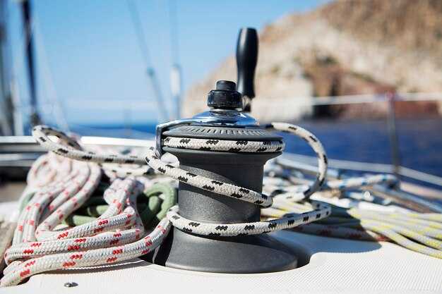
Install two secure mounts on the cockpit coaming, one within reach of the helm and one on the opposite side, using marine-grade stainless steel brackets with locking clamps to prevent loosening in heavy seas. This two-mount setup keeps cups stable when the boat heels and speeds along, so you stay hydrated without chasing contents across the deck.
Each holder features a raised splash lip, a silicone gasket, and an anti-slip liner to keep the contents steady, with a snap-on lid or flip-cap for extra spill prevention during open-boat conditions or gusts. Position the rims slightly above the deck to intercept spray and prevent liquids from traveling toward the line management area.
For easy access, place mounts so you can enter and operate the cups with one hand; the inserts accommodate 2.5–3.5 inch diameter cups and allow a clear read of the fill level. If you run a bluetooth-enabled boat, pair a sensor kit to track whether a cup is present and its temperature, aiding knowing and time management during watches. The open cockpit layout keeps access fast, and a nearby ventilator helps maintain cabin air without blowing spills onto electronics.
To boost safety, use cups with buoyancy or add buoyant inserts so a topple leaves the contents afloat rather than lost. This buoyancy helps during rescue drills and real rescue scenarios, and reduces the risk of spills onto fuel lines during heavy weather. Labeling the setup with a small rescueme cue can speed teammate response in drills and during an actual incident.
In choosing gear, check the requirements for compatibility, durability, and mounting security. The two-mount arrangement should sit about 40–60 cm apart, with mounts fixed into solid backing rather than a soft core. Stick to marine-grade materials, keep away from fuel sources, and ensure the system aligns with your boat’s management approach and buoyancy goals–this third-generation option is a winner for many marine layouts and fulfills those practical requirements.