

 Greece Sailing Guide 2025 – Best Routes, Ports & Tips for Sailors">

greece يستضيف أرخبيلاً كثيفًا حيث تقلل خطة جيدة التنظيم وقت العبور وتزيد من المراسي الآمنة. ابدأ بـ باروس، ثم ناكسوس، ثم ميكونوس، تليها ميلوس، مع الحفاظ على القفزات بين 12 و 25 ميلاً بحريًا في الأيام الصافية. الهدف هو إعداد مضغوط يتجنب الممرات الطويلة في فترات ما بعد الظهر العاصفة مع توفير مياه نقية تمامًا ومأوى يمكن الاعتماد عليه.
عادةً ما تصل إمدادات الطاقة في الموانئ إلى 16 أمبير؛ وتوفر الحمامات مياهًا ساخنة في معظم الموانئ بعد الساعة 07:00؛ ولا تعتمد على موثوقية طوال العام - احمل بطارية محمولة ومصابيح احتياطية. تحدث بعض الانقطاعات في ساعات الذروة، لذا خطط مسبقًا. يقلل فحص الراديو على قناة VHF 16 قبل الدخول من سوء التواصل بالقرب من مناطق العبور الضيقة. يشمل ملخص الخيارات على الشاطئ الحانات التي يسهل الوصول منها إلى الأسماك الطازجة وبعض الكوكتيلات، بالإضافة إلى عدد قليل من الأماكن التي تبيع المشروبات غير الكحولية التي تناسب الأطفال.
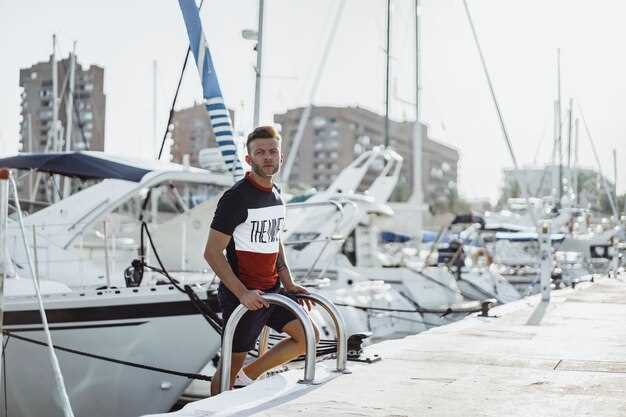
يصبح الفرق بين سباق سريع ورحلة آمنة ومدروسة واضحًا بعد بضعة رحلات حول الرؤوس الصغيرة؛ فباستخدام قارب آلي، يمكنك تضييق الجدول الزمني خلال ساعات القيلولة، بينما يتيح الطاقم الأكبر قفزات أطول. تحافظ الخطة المدمجة على الإيقاع ثابتًا، وتقلل من دورات الإرساء، وتحسن جودة الإقامة في المراسي ذات الطاقة الموثوقة. عند اختيار طاقم، فإن شركة محلية لديها معرفة محلية قوية تقلل من عمليات التموين وتقلل المخاطر في الموانئ المزدحمة.
تتجمع الخيارات المثالية حول قاعدتين ملاحيتين حيث تتماشى الحمامات والمنتجات الطازجة والحانات مع إيقاع يمكن التنبؤ به. إذا كنت ترغب في الجمع بين الاسترخاء والاستكشاف، فاحجز مساحة الرصيف مسبقًا خلال موسم الذروة؛ واستهدف تأمين الإقامات قبل عام للموانئ الأكثر شعبية، وخاصة في عطلات نهاية الأسبوع. في اليونان، تشجع المبادئ التوجيهية الحكومية الرسو المستدام؛ اتبع الدوائر المحددة وحافظ على ضبط المحركات للحفاظ على جودة الهواء والأمسيات الهادئة، مع الحفاظ على توليد الطاقة على متن سفينتك.
ملخص: تشير الملاحظات العملية إلى اختيار شركة تقدم مسارات مرنة بسعر ثابت، حتى تعرف التكلفة مقدمًا؛ واحرص على إحضار مولد احتياطي أو بنك طاقة؛ وخزّن المياه للرحلات الطويلة؛ وابْقَ بالقرب من الخلجان المحمية واحمل جهاز VHF محمولًا؛ يجب أن تتكيف الخطة مع توقعات الطقس وأنماط الملتيمي؛ يشهد العام رياحًا أكثر استقرارًا من مايو حتى سبتمبر، ولا تنسَ أن العواصف يمكن أن تظهر في بداية الموسم.
عمليًا، يُتيح هذا النهج قضاء المزيد من الوقت في بحار ذات سماء زرقاء صافية، مع أمسيات هادئة في صالات المارينا حيث يمكنك طلب الكوكتيلات ومشاهدة غروب الشمس فوق المياه النقية الصافية؛ خطط للحجز مبكرًا، وقارن بين العديد من شركات التأجير، واحتفظ بفترة إقامة مرنة لاستيعاب الأحوال الجوية.
طرق يونانية عملية، موانئ ونصائح على متن السفن لعام 2025
ابدأ برحلة قصيرة محمية كاستراحة عملية: من باروس إلى ناكسوس في جزر سيكلاديز خلال فترات رياح أخف، ثم أعد التقييم لاحقًا برحلات أطول.
خطط لدائرة ذات مرحلتين: الأولى التجمع حول باروس وناكسوس وسيروس وكوفونيسيا للإبحار السهل؛ ثم الدفع لاحقًا نحو ميلوس وفوليجاندروس وسانتوريني عندما تهدأ البحار. أطوال الأرجل النموذجية: 8-12 ميلًا بحريًا بين باروس وناكسوس؛ 6-15 ميلًا بحريًا نحو كوفونيسي؛ 18-28 ميلًا بحريًا إلى أمورجوس. فضل الخلجان والموانئ المحمية مع مراسي متاحة موثوقة لتجنب التأخير. يقلل هذا النهج من التعرض للرياح المتقطعة والمراسي المزدحمة، وهذا واقع عندما يحل الموسم الأكثر ازدحامًا، وقد كان هذا صحيحًا مع تدفق السفن والعبارات عبر القنوات.
اللوجستيات على متن القارب: حافظ على ملء الخزانات وخطط لإمدادات الوقود والمياه؛ وخصص وقتًا للملء قبل الرحلات الطويلة؛ وتأكد من توفر طاقة الشاطئ في الموانئ الرئيسية؛ الأحمال الأخف تحسن المناولة وكفاءة الوقود؛ إن الرسو في الخلجان المحمية ذات القيعان الرملية أو الموحلة أكثر أمانًا، لذا تدرب على الأسلوب المناسب وراقب الشعاب المرجانية. بالنسبة للطواقم المستأجرة للقوارب العارية، تأكد من الكفاءة في الرسو والحبال وقرارات الطقس؛ تضيف خيارات التأجير مساعدة عندما تشتد الرياح وتزداد الظروف صعوبة.
التسعير والاختيارات: يحمل التأجير الشامل في ذروة الأشهر علاوة سعرية، إلا أن الفرق مقابل التأجير بدون توفير قد يكون ضئيلاً إذا أخذت في الاعتبار الطاقم والتأمين والتموين. تظل الميزة الأهم هي المعدات الموثوقة والقوارب متعددة الاستخدامات والدعم على الشاطئ. في الأقواس البركانية على طول الشريط الساحلي للبلاد حول ميلوس وسانتوريني، توقع أسعارًا أعلى وحركة مرور أثقل؛ في المقابل، توفر الجزر السيكلادية الداخلية حشودًا أخف ومرابط محمية أكثر وتوافرًا أوسع. نصائح الإرساء: اختر المراسي المحمية من الرياح والأمواج، واستخدم صمامًا ثانيًا في الزوايا المكشوفة، وتحقق دائمًا من الخزانات وعمق المحيط قبل الإعداد. بهذه الطريقة تبقى آمناً وأخف وزناً ومستعداً للمرحلة التالية.
غرب بيلوبونيز: الطرق الرئيسية والمسافات وأفضل مراسي القوارب
ابدأ في بيلوس، وأمِّن مرسى لليلة الأولى في مرسى بيلوس، وتزوَّد بالمؤن من مطعم محلي، وانطلق مع نظاراتك الشمسية استعدادًا لساعات النهار الطويلة. تحافظ هذه الامتدادات على راحة السفن، والساحل مرصع بالخلجان، والشواطئ الجنوبية للبلاد في متناول اليد.
- بايلوس ← ميثوني
- المسافة: 12-15 ميلًا بحريًا
- المدة النموذجية: 2.5-4 ساعات بسرعة 4-5 عقدة
- خيارات الرسو والدخول: عوامات مرفأ ميثوني، بالإضافة إلى رصيف بلدي صغير؛ الرسو في الخليج الجنوبي المحمي إذا كانت العوامات ممتلئة.
- المرافق: مياه، خزانات وقود أساسية، متاجر أدوات بحرية، وعدد قليل من المطاعم الصغيرة المتوفرة على الرصيف.
- أبرز المعالم: بقايا أثرية حول القلعة، وأسوار من العصر الفينيسي، ومدخل هادئ مع مسطحات رملية ضحلة بالقرب من المدخل
- ملاحظات: خطط للدخول بحلول أواخر الصباح لزيادة ضوء النهار مقابل مد وجزر أواخر الظهيرة؛ اللوائح واضحة ومباشرة ولكن تحقق من رسوم الإرساء المحلية
- ميثوني ← كوروني
- المسافة: 6-9 ميل بحري
- المدة النموذجية: 1.5-2.5 ساعة
- مراسي وخيارات الدخول: يوفر مرفأ كوروني مراسي عائمة ورصيفًا محميًا؛ مراسٍ بديلة على طول الخليج الداخلي.
- المرافق: العديد من الحانات الصغيرة ومحلات السوبر ماركت الصغيرة وعدد قليل من المترجمين لتلبية الاحتياجات البرية.
- أبرز الملامح: شاطئ رملي طويل قريب وقلعة على قمة جرف توفر إطلالات بانورامية
- ملاحظات: هذه الاختلافات في عمق الميناء واتجاه الرياح تجعل هذه المرحلة شائعة بين العائلات والرحلات البحرية الطويلة على حد سواء
- كوروني ← فينيكوندا
- المسافة: 7-9 ميل بحري
- المدة النموذجية: 1.5-2.0 ساعة
- مراسي وخيارات الدخول: يوفر ميناء فينيكوندا الصغير عوامات وخيارات الرصيف؛ قم بالإرساء بالقرب من الخلجان المواجهة للشرق إذا كانت العوامات نادرة.
- المرافق: صف من المطاعم الساحلية، وبائعي الأسماك الطازجة، ومتجر أدوات بحرية صغير.
- أبرز الملامح: ساحل منقط بخلجان مثالية للسباحة في منتصف النهار؛ ملاحظات أثرية قريبة في المنطقة الأوسع.
- ملاحظات: التخطيط في ضوء النهار اللطيف؛ كن على علم بالبقع الضحلة بالقرب من المدخل
- فينيكوندا ← كَلاماتا (مدخل شبه الجزيرة)
- المسافة: 30–32 ميلًا بحريًا
- المدة النموذجية: 6-7 ساعات بسرعة 5 عقدة؛ رحلات أقصر ممكنة مع رياح مواتية
- مراسي وخيارات الدخول: مارينا كالاماتا (كبيرة ومجهزة تجهيزًا جيدًا)؛ مراسٍ بديلة بالقرب من رأس أُقرة.
- المرافق: خدمات مارينا متكاملة، وخزانات وقود، وورش إصلاح، ومطاعم متعددة، وقائمة فرعية صغيرة من خدمات مكتب المارينا للتصاريح
- أبرز الملامح: أطول مرحلة في اليوم تتميز بمسطحات مائية هادئة في الصباح؛ مواقع أثرية بارزة في المناطق النائية وجو عطلات نابض بالحياة في الصيف
- ملاحظات: استخدم ضوء النهار لدخول كالاماتا؛ توافر الوقود في المرسى يساعد إذا كان مستوى الوقود في الخزانات منخفضًا.
تشمل الاعتبارات العملية لهذه المحطات اللوائح البحرية، وخيارات الرسو الآمنة، وخطة واضحة لكل محطة يومية. يكون الخط الساحلي هنا أكثر انبساطًا مما هو عليه في خطوط العرض الشمالية، مما يؤدي غالبًا إلى صباح أكثر هدوءًا وهبات تختلف بين الصباحات المطلة على البحر وبعد الظهيرة الدافئة والمنعشة. كن على دراية بالقواعد المحلية بشأن الرسو، وتحقق مع مديري الموانئ لمعرفة أي قيود موسمية قد تنطبق على هذه المراسي.
نصائح تشغيلية لقفزات سلسة

- اصطحب معك دائمًا نظارات شمسية وسترة خفيفة وخريطة مدمجة للمطاعم؛ يمكن لعدد قليل من المترجمين الناطقين باللغة الإنجليزية في الموانئ المساعدة في إنجاز المعاملات الورقية.
- اصطحاب جهاز لاسلكي محمول VHF، ومجموعة مشاعل عاملة، وقائمة محدثة بأرقام الاتصال الخاصة بسلطات الميناء.
- ادخل الموانئ ببطء واستخدم قنوات الاقتراب الضحلة؛ تتطلب هذه الاختلافات في العمق قيادة حذرة.
- ينبغي فحص خزانات الوقود والمياه قبل كل مرحلة؛ وتوفر معظم المحطات خدمات إعادة التعبئة أو الوصول إلى المياه في الرصيف.
- قد تتسبب الإجازة الشاطئية خلال العطلات في ازدحام؛ خطط لزيارة المواقع الأثرية في أوقات أكثر هدوءًا
تُظهر خطط المسارات على مر السنين أن هذا التسلسل لا يزال شائعًا بين الأطقم التي أبحرت في هذه المناطق لعقود، حيث تفضل العديد من الأطقم بيلوس كنقطة انطلاق طبيعية وكالاماتا كنهاية قوية. يظل الساحل ودودًا للرحلات البحرية من جميع مستويات الخبرة، مع لوائح واضحة وإجراءات ميناء مباشرة. بالنسبة لأولئك الذين يريدون وتيرة أخف، استبدلوا القفزات القصيرة على طول كوروني أو فينيكوندا لمزيد من الوقت في الشمس ووقت أقل في العبور. يؤكد هذا النهج على خط سير متوازن، مما يزيد من ضوء النهار ويقلل من فترات التوقف الطويلة دون رصيف آمن.
سانتوريني إلى كريت: الملاحة الساحلية وخيارات المرسى
Plan as a two‑leg itinerary: from Santorini head southeast to a sheltered break near Amorgos or Anafi for a night, then complete the transit to a Crete marina such as Heraklion or Agios Nikolaos. This choice keeps the skippered crew wise, preserves stamina, and reduces risk when wind from the east blows in September.
Leg distances and time estimates: Santorini to Amorgos ~60–70 nm; Amorgos to Heraklion ~130–150 nm, depending on waypoint. At 6–7 knots the first leg runs 9–12 hours, the second 22–26 hours, so a two‑day schedule with a sheltered spot if seas are unsettled works well.
Anchorage options along the coast include sheltered bays near Elounda and Agios Nikolaos on Crete’s northeast side, plus a few sandy coves west of Ierapetra. Drop anchor on sand or mud with 3:1 to 5:1 scope in calm to moderate wind, increase if gusts rise. Position to face the prevailing swell, avoid posidonia meadows to preserve habitat above the seabed. If a mooring buoy exists, prefer it to an anchor whenever possible; moni may be cited locally for a small monastery complex, so verify signage before settling in.
Regulatory notes emphasize licensing and legislation in protected zones: check necessary permissions before entry, and confirm any port clearance or marina license needs. Call ahead to verify berth availability; in some spots a permit from coastal authorities is above minimal compliance. This reduces risk of fines and ensures a smooth port call in the east region.
Seasonal context for September: diurnal wind swings are common, with easterly blows in the morning that may freshen in the afternoon. Choose a daylight transit window when possible, keeping tempo steady so arrival at a sheltered anchorage or marina is practical. This approach provides a homeward‑oriented rhythm while maintaining safety during a month of variable conditions.
Detour example: as an equivalent option, a skipper may break the transit with a brief stop at aegina as a western waypoint, then continue toward Crete; spots near moni or similar shoreline features can host a short layover if a weather break occurs. Always confirm the necessary licenses and comply with local legislation protecting habitats such as posidonia.
Operational notes and practicalities: use latest charts at 1:50,000 scale for coastal detail, maintain VHF with a backup handheld, and carry a spare fuel can. Brief the crew in advance, log transit times, and keep a home‑base contact handy. When anchoring, favor sand or mud bottoms, tidy fenders, and monitor depth to avoid rock hazards in each bay; this keeps the passage efficient, aligns with regional norms, and preserves the marine environment.
Ionian Sea Loop: Distances, Weather Windows & Anchorages
Plan the circuit in late spring or early autumn to catch light to moderate winds and stable seas; this keeps crew comfortable and reduces fatigue. An authentic experience unfolds when you combine clear shorelines with Byzantine-era ruins, ancient churches, and small, characterful harbours beyond the busy channels. Since posidonia beds and other seagrass communities frame many anchorages, choose spots that allow good holding without disturbing meadows.
- Lefkada Town to Corfu Town – 60–70 NM; 12–14 h at 5 knots
- Corfu Town to Paxos (Gaios or Loggos) – 25–30 NM; 5–6 h
- Paxos to Ithaca (Kioni or Vathi) – 15–25 NM; 3–5 h
- Ithaca to Kefalonia (Fiskardo area or Argostoli approach) – 20–25 NM; 4–5 h
- Kefalonia to Zakynthos – 60–70 NM; 12–14 h
- Zakynthos to Lefkada (Nidri or Vlikho Bay) – 70–85 NM; 12–15 h
Weather windows and planning notes: ideal months are late May through early July and late August through early October. Winds commonly shift from NW to W at 8–18 knots in the core season, with gusts to 25–30 knots possible during passing systems. Sea state remains comfortable in sheltered bays, but expect short chop in the open passages. Night passages are workable when the forecast shows light land breezes, but always have fenders ready and maintain a lighter, nimble approach for quick adjustments. For bareboat crews, plan anchorages with good holding, especially near posidonia-dense bottoms, and prefer deeper, well-protected corners of the main harbours if conditions require shelter.
Anchorages and harbour recommendations by leg (practical picks to avoid crowds):
- Corfu Town area: Gouvia Municipal Harbour for a reliable shelter with formal mooring options; Paleokastritsa offers a dramatic cove for a quiet night, but verify depth and weed beds first.
- Gouvia/Corfu east coast: anchorages inside the bay require careful approach; use a light crew, keep to mid-channel depths, and set the anchor beyond seagrass zones.
- Paxos: Gaios Bay and Loggos Bay are classic anchorages with clear hold, small coves, and local taverna options; Lakka is another tight, scenic option with good protection in NW winds.
- Ithaca: Kioni and Vathy provide reliable shelter, with nearby small harbours to tie up if the crew wants to rest onboard; note the arrow-shaped coves along the eastern shore can funnel swell in W winds.
- Kefalonia: Fiskardo offers a picturesque northern harbour with муниципal facilities nearby; Argostoli Bay gives a broad anchorage near town without crowded moorings; check seabed for posidonia before anchoring in the nearshore zones.
- Zakynthos: Gerakas and Vasilikos bays provide protected anchorages with good anchor holds in sand; Porto Zoro and Zakynthos Town can serve as longer stopovers when conditions suit.
- Nidri/Vlikho Bay (Lefkada): both anchorages offer calmer evenings after crossing the central gulf; municipal harbours nearby provide fuel and groceries if needed, with routine police checks typical of busy resort zones.
Practical tips to execute clean loop logistics: keep a main watch for weather changes, bring sunglasses for glare in the white spray, and ensure fenders are ready for multiple vessel types–small or large–on short notice. Since crew rests are essential, schedule regular stops to stretch and refresh, and use calmer anchorages to recharge before the next transit.
Cyclades Island Hopping: Wind Patterns, Typical Ports & Safe Anchorages
Begin from Aegina, then arc clockwise via Kythnos, Serifos, Sifnos, Milos, Paros, Naxos, Santorini, Folegandros, returning to the Attica coast. This long, easy sequence minimizes crowded harbours and keeps you close to coastal anchorages with good holding.
Wind patterns in this arc shift seasonally: Meltemi arrives as a northerly to northeasterly flow in late spring through autumn, typically 15–25 knots with gusts up to 30–35. Mornings are calmer, afternoons can build; in caldera-facing coves near Santorini shelter is notable, whilst coastlines elsewhere respond to sea state and barometric pressure. Prepare a flexible approach, they require calmer seas at dawn, and youve got ample opportunities to sail comfortably; youre able to adjust your plan toward aegina departure if squalls appear, a safe practice when you plan to stay long at anchorages along the coastline.
Anchorages and approach: Anchorages along the coastlines offer seagrass holds and good bottom texture, ideal for long rests. Aegina Souvala Bay or Agia Marina present appropriate options near kallithea, with greek-flagged vessels usually nearby for support. Kythnos Kolona Bay, Serifos Livadi Bay, Sifnos Vathi, Milos Adamas or Pollonia, Paros Naoussa or Piso Livadi, Naxos Agia Anna or Agios Prokopios, Santorini Ammoudi Bay or Vlychada, and Folegandros Karavostasi provide easy access while staying within sheltered zones. If you ve extension to Rhodes, prepare for a longer approach; such a route demands careful handling and evidence of current weather guidance, but adds diversity to island exploration, with coastline scenery that showcases caldera views along the way and coral reefs suitable for snorkelling.
Guidance and evidence from veteran skippers aligns with these options: choose anchorages on the inside of bays where seagrass beds offer dependable holding, stay well clear of crowded marinas during peak months, and plan stays around caldera-adjacent shores where long, smooth passages are easier to manage. The island chain offers beauty that rewards patient, steady sailors who value coastline access, snorkelling opportunities, caldera panoramas, and a sense of exploration that feels truly authentic. Whilst you explore, keep an eye on weather forecasts and adjust as needed; this approach supports a safe, enjoyable voyage, with all the elements needed to enjoy the journey and the quiet anchorages that reveal the true character of each island.
| Island | Ideal Anchorage | Wind Window | الملاحظات |
|---|---|---|---|
| Aegina | Souvala Bay | 10–20 kn (calmer mornings) | Close to kallithea; good holding; easy access by greek-flagged craft |
| Kythnos | Kolona Bay | 12–22 kn | Quiet, protective orientation |
| Serifos | Livadi Bay | 12–18 kn | Nice coastline, suitable for snorkelling |
| Sifnos | Vathi Bay | 15–25 kn | Charming backdrop, moderate crowds outside peak |
| Milos | Adamas Bay | 10–20 kn | Caldera glimpses nearby, seagrass holds good |
| Paros | Naoussa Bay | 12–22 kn | Popular in season, choose outer mooring if crowded |
| Naxos | Agia Anna / Agios Prokopios | 12–20 kn | Long coastline, attractive snorkelling nearby |
| Santorini | Ammoudi Bay | 15–25 kn | Caldera backdrop, shelter important during peak winds |
| Folegandros | Karavostasi Bay | 10–18 kn | Quiet, scenic, good holding, slow pace |
| Rhodes | Lindos Bay (extension) | 18–28 kn | Long-range option; ensure requirements and guidance align with extended hops |
Dodecanese Highlights: Seasonal Winds, Route Suggestions & Harbor Picks
Start Rhodes, then Symi and Kalymnos, with a likely stop at Patmos; this loop suits a beginner sailor to understand wind windows and sea-state. Evidence from recent seasons shows sheltered bays delivering relief from heat and smoother days; paros serves as a practical provisioning stop, offering cheaper seafood and a relaxed tempo before entering the archipelago. Monk seals are occasionally spotted along rocky coves, a detail that many love when track winds and weather align.
Seasonal winds steer the core plan. In late spring through high-season, the usual northerly meltemi keeps seas lively in open water, often 15–25 knots; entry into harbors remains manageable when you hug lee shores. In protected coves around Kalymnos, Patmos and Nisyros, seas relax, and caldera viewpoints near Nisyros offer dramatic scenery that pairs well with sunbathing on deck. Compared with croatia’s crowded routes, this corridor preserves calm anchorages.
Route options keep a sensible order, with short hops first, while maximizing calm anchorages. Option A: Rhodes (Mandraki) → Symi → Kalymnos (Pothia) → Patmos (Skala) → Leros (Lakki) → Kos (Kos Town) → return to Rhodes. Option B: add paros as a prelude to provisioning, then push to Kos and work south along the arc to Karpathos and Pigadia before looping back. Track wind and weather daily to adjust pacing; entry into each harbor is straightforward when you plan early.
Harbor picks for a relaxed cruise: Mandraki (Rhodes) offers charming service and easy entry; Kos Town provides robust marinas with good provisioning; Pothia (Kalymnos) is efficient for refuel and seafood dinners; Gialos (Symi) combines pastel houses and sunny shorelines; Skala (Patmos) and Lakki (Leros) are quiet, with natural anchorages and gentle winds; Pigadia (Karpathos) suits longer hops with pricing in shoulder-season; Megisti (Kastellorizo) stands out for its crystal-clear sea and small-boat relief after busy days. Monk-like hospitality is a noted touch in harbor tavernas.
Natural rhythm favors shelter, clear provisioning, and sunbathing between hops. In high-season, popularity peaks and pricing rises, yet many coves still offer calmer options than mainland resorts; almost all harbors deliver reliable service and a vibrant seafood scene that many love. This arc appeals to a beginner seeking a relaxed boating pace, clear evidence of seasonal winds, and a love of island charm that grows with every stop.