


To enhance your understanding of sailing, familiarize yourself with these 50 key phrases. They provide clarity in communication and contribute to a safer experience at sea.
Understanding the difference between terms like مِيزَّان و backstay is crucial for effectively managing the sails and rigging. Each term holds significance; for example, knowing bearing allows sailors to navigate more confidently, identifying their position relative to obstacles and currents.
As you delve into the intricacies of sailing, you might have wondered about the role of a stopper or how to quickly secure a line. The knowledge of such words helps prevent potential issues like sinking or losing control. Strong communication on board can stop confusion in otherwise challenging situations.
When out on the water, positioning yourself correctly is key. An alternative route may be necessary if strong currents are present. By mastering these terms, you empower yourself while ashore or at sea, ensuring a smooth and enjoyable experience.
Understanding Key Nautical Terms Starting with ‘L’
Learn these crucial terms beginning with ‘L’ to enhance your maritime vocabulary:
- Leeway: The sideways drift of a vessel caused by wind and current. To minimize leeway, adjust the sails and angle relative to the wind.
- Length Overall (LOA): The total length of a watercraft from the bow to the stern, measured in metres. This measurement is vital for docking and mooring.
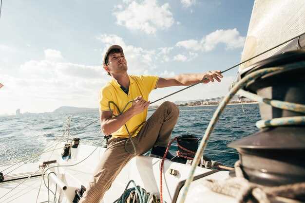
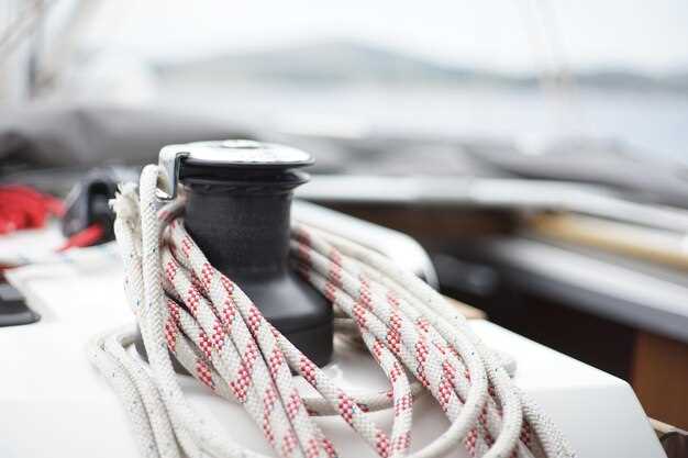
- Line: A term used to describe any rope, except for the anchor line. Always ensure lines are fastened securely to avoid accidents.
- Launch: To set a boat afloat or to begin a journey. Make sure the launch area is clear and check the watercraft for flotation devices before proceeding.
- Latitude: A geographical coordinate that specifies the north-south position on the Earth’s surface. Use latitude as a reference point for navigating.
- List: The tilt of a vessel to one side. A list can occur due to uneven loading or water accumulation; it’s crucial to correct it promptly.
- الموقع: The specific position of a vessel. Maintain awareness of your location to ensure safe passage and proper navigation through channels.
- Lookout: A person designated to watch for navigational hazards, other vessels, and changes in weather. Always have a lookout on board during busy sailing times.
These terms are integral for effective communication and safety while onboard. Understanding and using them correctly can enhance your sailing experience significantly.
What Does ‘Luff’ Mean in Sailing?
‘Luff’ refers to the act of bringing the sail closer to the wind, causing it to “flap” instead of catching the breeze properly. This maneuver can occur when trim adjustments are made to manage the sail’s angle to maximize propulsion.
When a sail luffs, it loses efficiency and can become less secure, impacting the vessel’s speed and maneuverability. Properly adjusting sails is crucial for getting the best performance, especially in challenging weather conditions like a storm.
In sailing, understanding how the luff affects your spinnaker is important. A clean, well-trimmed spinnaker helps maintain a steady flow of air around it, while a luffing sail may indicate you’re pointing too close to the wind.
It’s essential to comply with optimal sail configurations to prevent getting adrift in deep waters. A well-rigged bowline can keep the sail in position, reducing the chances of accidental luffing.
Regular cleaning and maintenance of sails, including checking for zinc or other materials on the cover, can ensure longevity and performance. Wooden boats often have specialized areas where luffing might apply differently due to their unique design and characteristics.
Understanding the relationship between luffing and sail angles allows sailors to fine-tune their approach while chartering, ensuring they navigate the waters effectively and safely.
How to Use ‘Leeward’ in Navigational Contexts
When determining your position on the water, the term ‘leeward’ is crucial. It designates the direction away from the wind, providing essential information for safe maneuvering. Keep your vessel oriented with the headsail trimmed properly, as this reduces the risk of capsizing in strong winds.
Use floating markers, such as buoys, to help identify leeward areas. These objects serve as reliable references for locating safe anchorage, especially in conditions where visibility may be compromised. Their positions often indicate the leeward side of navigational hazards.
In navigation, reducing error in your bearings is vital. When determining leeward direction, correctly figure the wind’s position relative to your boat. This aids in adjusting cordage and sail configurations to increase stability.
Remember that currents can affect your location in leeward areas. Being driven off course by external forces means you need to frequently check your bearings against fixed objects or portable navigational aids.
In summary, understanding the concept of leeward helps you make informed decisions while on the water, ensuring a safer and more controlled experience. Minimize risk with careful planning and attention to your surroundings in this context.
The Importance of ‘Latitude’ in Chart Reading
Understanding latitude plays a critical role in successful chart reading. Hatches that expose the helmsman to open air can also be the vantage point for observing landmarks along the shore, aiding in precise navigation.
Latitude determines the position of watercraft in relation to the equator and helps in identifying navigable paths. It allows crew members to communicate effectively about the ship’s location, especially in rough waters where obstacles and reefs may cause unexpected challenges.
When plotting a course, it is vital to have accurate latitude readings. Fathom calculations, which measure water depth, become more meaningful when layered with latitude data, providing a complete view of the marine environment. This knowledge helps in avoiding areas that lack adequate depth and safe structure.
Pulling into a moor or anchoring will often rely on understanding where you are in terms of latitude. Choosing a green area near the coastline can be beneficial for swift departures. With accurate readings, crews can fill sails more confidently, enhancing speed while avoiding potential hazards.
In practice, remembering the concept of the chine–where the hull meets the waterline–can assist in understanding how latitude affects your vessel’s behavior on the water. The angle of approach may require adjustments based on the latitude, especially when coming close to islands or shorelines.
Replacement of navigational tools requires precise latitude coordination, as it impacts the overall journey’s success. With every recalibration, crew members must rely on consistent latitude readings to maintain accuracy in their charting endeavors.
تحديد ‘شريان الحياة’ ودوره في السلامة
حبل الأمان هو هيكل حيوي على متن السفينة، يوفر نظام دعم سلامة يمكن أن ينقذ الأرواح. يتم تثبيته بإحكام على جوانب القارب، مما يخلق حاجزًا يساعد في منع الأفراد من السقوط في البحر في الظروف الصعبة.
عادةً ما تكون هذه الخطوط مصنوعة من مواد متينة يمكنها تحمل الرياح القوية وتآكل البحر. يشكل شكل خط الحياة خطًا مستمرًا حول محيط سطح السفينة، مما يضيف طبقة إضافية من الأمان عند الإبحار في المياه الصعبة.
من الأهمية بمكان فحص حبال النجاة بانتظام للتأكد من خلوها من أي تلف قد يضر بسلامتها. تأكد من أن جميع الملحقات مُحكمة وأنه لا توجد أطراف مهترئة أو نقاط ضعف. بالإضافة إلى ذلك، يجب أن تكون حبال النجاة متوافقة مع معدات السلامة الأخرى مثل الأحزمة ومصممة للعمل جنبًا إلى جنب مع سلالم الأمان والمغارف، مما يساعد في جهود الإنقاذ إذا جرف شخص ما.
بالإضافة إلى ذلك، ضع في اعتبارك موضع الفتحات ونقاط الوصول. يمكن لخطوط الحياة الموضوعة بشكل صحيح أن تدعم الحركة الآمنة حول الجزء الداخلي من السفينة مع تقليل خطر السقوط في البحر. إن معرفة كيفية عمل هذه الخطوط مع الهيكل العام للقارب تعزز الثقة الملاحية.
أخيرًا، يجب فهم أن حبال النجاة تزيد من سلامة كل من الطاقم والركاب. إنها أكثر من مجرد حبال؛ إنها عنصر أساسي في الأمن البحري وتلعب دورًا محوريًا في أي رحلة.
التعرف على ‘خيط الرصاص’ لقياس العمق
لقياس عمق المياه بدقة، استخدم حبلاً رصاصيًا، مزودًا بوزن في نهايته، يُسمى “الرصاص”. أولاً، أسقطه من جانب القارب، مع السماح له بالغطس. تأكد من أن الحبل طويل بما يكفي للوصول إلى القاع. أثناء نزوله، راقب أي مقاومة أو توقفات مفاجئة؛ يشير هذا إلى أنه قد وصل إلى السطح فوق الهياكل المغمورة.
استخدم العلامات على طول الخيط، غالبًا ما تكون متباعدة بأطوال محددة، لقياس العمق. انتبه جيدًا للتغيرات في العمق عند الاقتراب من الرصيف، حيث يمكن أن يكون القاع غير مستوٍ. تحقق من نسيج القاع؛ المواد المختلفة، مثل الطين أو الرمل، تؤثر على كيفية تحرك الخيط.
يُعد اختيار الملحقات المناسبة أمرًا أساسيًا. ضع في اعتبارك تركيب الأنودات لمنع التآكل إذا كان الخط معرضًا لمياه مالحة. إذا بدا العمق محدودًا، فتحقق منه مقابل الخرائط تحسبًا للمستنقعات أو مخاطر الغرق المحتملة في المستقبل. تواصل دائمًا مع القبطان لضمان الإرساء السليم وتجنب الانقلاب.
استخدم مصطلحات مثل “خط القيادة” باستمرار لتعزيز فهم أفضل بين أفراد الطاقم. يساعد تتبع هذه القياسات في تخطيط المسارات، خاصة عند استخدام الأشرعة الأكبر حجمًا مثل السبنر، والتي تتطلب مساحة أكبر وملاحة دقيقة حول العوائق. تضمن اليد الثابتة، جنبًا إلى جنب مع الرجوع المنتظم إلى خط القيادة، السلامة عند الوصول إلى المياه العميقة.
تدرب على استخدام حبل الغطس بانتظام. إن الإلمام بطوله وعلاماته سيعزز مهارتك في تقييم العمق، والتعرف على الوقت المناسب للاقتراب من المناطق الضحلة يمكن أن يمنع وقوع الحوادث. اجعله جزءًا لا يتجزأ من روتينك أثناء وجودك في الماء.